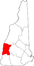
Springfield, New Hampshire | |
---|---|
Coordinates: 43°29′43″N72°02′03″W / 43.49528°N 72.03417°W | |
Country | United States |
State | New Hampshire |
County | Sullivan |
Incorporated | 1794 |
Villages |
|
Government | |
• Board of Selectmen |
|
Area | |
• Total | 44.5 sq mi (115.3 km2) |
• Land | 43.6 sq mi (113.0 km2) |
• Water | 0.9 sq mi (2.3 km2) 1.99% |
Elevation | 1,440 ft (438 m) |
Population (2020) | |
• Total | 1,259 |
• Density | 29/sq mi (11.1/km2) |
Time zone | UTC-5 (Eastern) |
• Summer (DST) | UTC-4 (Eastern) |
ZIP codes | |
Area code | 603 |
FIPS code | 33-72740 |
GNIS feature ID | 0873723 |
Website | www |
Springfield is a town in Sullivan County, New Hampshire, United States. The population was 1,259 at the 2020 census. [2] Gile State Forest is located within the town.
First settled by Europeans in 1769 and named "Protectworth", the town adopted the name "Springfield" when it was incorporated in 1794. [3] [4] Prior to county division in 1827, Springfield was in Cheshire County.
Springfield occupies the northeast corner of Sullivan County. According to the United States Census Bureau, the town has a total area of 44.5 square miles (115.3 km2), of which 43.6 square miles (113.0 km2) are land and 0.89 square miles (2.3 km2) are water, comprising 1.99% of the town. The northwest part of town, including the town center, is drained by Bog Brook and its tributaries, leading west to Stocker Brook in Grantham and part of the Sugar River watershed leading west to the Connecticut River. The southeast part of the town, including Baptist Pond and Star Lake, drains south to Lake Sunapee, the headwaters of the Sugar River. The northeast part of town is drained by Kimpton Brook and tributaries of Walker Brook, part of the Blackwater River watershed leading to the Contoocook River and eventually the Merrimack, while the far northeast corner of town is drained by tributaries of Smith Brook, which leads northeast to the Smith River, then the Pemigewasset River, and finally the Merrimack.
The highest point in Springfield is the summit of Melvin Hill in the northeast part of town, at 2,303 feet (702 m) above sea level.
Census | Pop. | Note | %± |
---|---|---|---|
1790 | 210 | — | |
1800 | 570 | 171.4% | |
1810 | 614 | 7.7% | |
1820 | 967 | 57.5% | |
1830 | 1,202 | 24.3% | |
1840 | 1,252 | 4.2% | |
1850 | 1,270 | 1.4% | |
1860 | 1,021 | −19.6% | |
1870 | 781 | −23.5% | |
1880 | 732 | −6.3% | |
1890 | 540 | −26.2% | |
1900 | 439 | −18.7% | |
1910 | 422 | −3.9% | |
1920 | 349 | −17.3% | |
1930 | 270 | −22.6% | |
1940 | 364 | 34.8% | |
1950 | 324 | −11.0% | |
1960 | 283 | −12.7% | |
1970 | 310 | 9.5% | |
1980 | 532 | 71.6% | |
1990 | 788 | 48.1% | |
2000 | 945 | 19.9% | |
2010 | 1,311 | 38.7% | |
2020 | 1,259 | −4.0% | |
U.S. Decennial Census [5] |
At the 2000 census there were 945 people, 386 households, and 286 families in the town. The population density was 21.8 people per square mile (8.4/km2). There were 534 housing units at an average density of 12.3 per square mile (4.8/km2). The racial makeup of the town was 98.84% White, 0.32% Native American, 0.21% Asian, 0.21% from other races, and 0.42% from two or more races. Hispanic or Latino of any race were 0.74%. [6]
Of the 386 households 30.1% had children under the age of 18 living with them, 65.3% were married couples living together, 6.2% had a female householder with no husband present, and 25.9% were non-families. 19.9% of households were one person and 6.7% were one person aged 65 or older. The average household size was 2.45 and the average family size was 2.80.
The age distribution was 23.5% under the age of 18, 4.2% from 18 to 24, 31.1% from 25 to 44, 28.8% from 45 to 64, and 12.4% 65 or older. The median age was 40 years. For every 100 females, there were 97.3 males. For every 100 females age 18 and over, there were 96.5 males.
The median household income was $44,659 and the median family income was $58,068. Males had a median income of $33,958 versus $25,223 for females. The per capita income for the town was $23,263. About 3.5% of families and 5.1% of the population were below the poverty line, including 2.4% of those under age 18 and 7.9% of those age 65 or over.
The town is served by the provider Consolidated Communications. They provide options for both Fiber-optic and DSL, the latter being phased out in preference for the former. The new plans for fiber range in speeds from 50 megabit to 1 gigabit, and while DSL is still available, it is much slower and less reliable (although slightly cheaper) then the fiber options. [7]
In the part of Springfield that is in the community of Eastman, there is also the internet provider Comcast which provides a high of about 300 Mb/s down and 15 Mb/s up.
Benton is a town in Grafton County, New Hampshire, United States. The population was 374 at the 2020 census. Located in the White Mountains, Benton is largely surrounded by the White Mountain National Forest. The town is crossed by the Appalachian Trail.
Ellsworth is a town in Grafton County, New Hampshire, United States. The population was 93 at the 2020 census.
Orange is a town in Grafton County, New Hampshire, United States. The population was 277 at the 2020 census, down from 331 at the 2010 census.
Piermont is a town in Grafton County, New Hampshire, United States. The population was 769 at the 2020 census. It is home to Camp Walt Whitman and Kingswood Camp for Boys.
Allenstown is a town in Merrimack County, New Hampshire, United States. The population was 4,707 at the 2020 census, up from 4,322 at the 2010 census. Allenstown includes a portion of the village of Suncook. Just over one-half of the town's area is covered by Bear Brook State Park.
Andover is a town in Merrimack County, New Hampshire, United States. The population was 2,406 at the 2020 census. Andover includes the villages of Cilleyville, Potter Place, East Andover, and West Andover, in addition to the town center. The town is home to Ragged Mountain State Forest and Proctor Academy, a private coeducational preparatory school.
Chichester is a town in Merrimack County, New Hampshire, United States. The population was 2,665 at the 2020 census.
Danbury is a town in Merrimack County, New Hampshire, United States. The population was 1,250 at the 2020 census.
Dunbarton is a town in Merrimack County, New Hampshire, United States. The population was 3,005 at the 2020 census, up from 2,758 at the 2010 census.
Epsom is a town in Merrimack County, New Hampshire, United States. The population was 4,834 at the 2020 census.
Hill is a town in Merrimack County, New Hampshire, United States. The population was 1,017 at the 2020 census. It is home to William Thomas State Forest.
New London is a town in Merrimack County, New Hampshire, United States. The population was 4,400 at the 2020 census. The town is the home of Colby–Sawyer College, site of the Gordon Research Conferences since 1947.
Newbury is a town in Merrimack County, New Hampshire, United States. The population was 2,172 at the 2020 census.
Sutton is a town in Merrimack County, New Hampshire, United States. The population was 1,978 at the 2020 census. Sutton includes the villages of Sutton Mills, North Sutton, South Sutton and East Sutton. North Sutton is home to Wadleigh State Park on Kezar Lake.
Warner is a town in Merrimack County, New Hampshire, United States. The population was 2,937 at the 2020 census. The town is home to Magdalen College of the Liberal Arts, Rollins State Park and Mount Kearsarge State Forest.
Wilmot is a town in Merrimack County, New Hampshire, United States. The population was 1,407 at the 2020 census. The town includes the communities of Wilmot, Wilmot Flat, and North Wilmot.
East Kingston is a town in Rockingham County, New Hampshire, United States. The population was 2,441 at the 2020 census.
Sandown is a town in Rockingham County, New Hampshire, United States. The population was 6,548 at the 2020 census, up from 5,986 at the 2010 census.
Goshen is a town in Sullivan County, New Hampshire, United States. The population was 796 at the 2020 census.
Sunapee is a town in Sullivan County, New Hampshire, United States. The population was 3,342 at the 2020 census. The town is home to part of Lake Sunapee and includes the village of Georges Mills.