Wilmot, New Hampshire

Last updated

Wilmot, New Hampshire
WilmotNH CongregationalChurch.jpg
Wilmot Baptist Church, in Wilmot Flat
Wilmot Town Seal.png
Merrimack County New Hampshire incorporated and unincorporated areas Wilmot highlighted.svg
Location in Merrimack County and the state of New Hampshire.
Coordinates: 43°27′03″N71°54′48″W / 43.45083°N 71.91333°W / 43.45083; -71.91333
Country United States
State New Hampshire
County Merrimack
Incorporated 1807
Villages
  • Wilmot
  • Wilmot Flat
  • North Wilmot
Government
   Board of Selectmen
Area
[1]
  Total29.6 sq mi (76.7 km2)
  Land29.4 sq mi (76.2 km2)
  Water0.2 sq mi (0.5 km2)  0.70%
Elevation
873 ft (266 m)
Population
 (2020) [2]
  Total1,407
  Density48/sq mi (18.5/km2)
Time zone UTC-5 (Eastern)
  Summer (DST) UTC-4 (Eastern)
ZIP code
03287
Area code 603
FIPS code 33-84900
GNIS feature ID0873755
Website www.wilmotnh.org

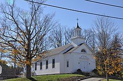
Wilmot is a town in Merrimack County, New Hampshire, United States. The population was 1,407 at the 2020 census. [2] The town includes the communities of Wilmot, Wilmot Flat, and North Wilmot.

Contents

History

Incorporated in 1807 from part of New London, the Kearsarge gore, and a small piece of New Chester (later renamed Hill), the town took its name from Dr. James Wilmot, an English clergyman who had spoken out against England's treatment of the American colonies. Dr. Wilmot was rector at Barton-on-the-Heath in Warwickshire, England. [3]

Geography

Wilmot is in northwestern Merrimack County, in the Dartmouth–Lake Sunapee Region of New Hampshire. According to the United States Census Bureau, the town has a total area of 29.6 square miles (76.7 km2), of which 29.4 square miles (76.2 km2) are land and 0.2 square miles (0.5 km2), or 0.70%, are water. Wilmot is drained by Cascade Brook (two branches), Kimpton Brook, and Frazier Brook, all of which flow to the Blackwater River in neighboring Andover. The entire town is part of the Merrimack River watershed. Wilmot is dotted with several large ponds, including Eagle, Butterfield, Piper, White, Tannery, and Chase ponds. The Sunapee–Ragged–Kearsarge (SRK) Greenway traverses the town, crossing Bog Mountain in the northern part of town and climbing Mount Kearsarge in the south.

The village of Wilmot is near the center of the town, along New Hampshire Route 4A. Wilmot Flat is a village in the southern part of the town, served by New Hampshire Route 11. North Wilmot is a rural community centered on the junction of North Wilmot Road and Breezy Hill Road, north of White Pond.

Mount Kearsarge, elevation 2,931 feet (893 m) above sea level, on the southern border, is the highest point in town and in Merrimack County. Winslow State Park, at the northern foot of the mountain, provides access by two hiking trails to the summit. The state park and the Winslow Trail are named after Captain John Winslow, the commander of the USS Kearsarge, which in June 1864 sank the CSS Alabama in the English Channel in a famous Civil War sea battle.

The town is the home of Camps Kenwood and Evergreen on Eagle Pond.

Adjacent municipalities

Demographics

Historical population
CensusPop.Note
1810 298
1820 670124.8%
1830 83424.5%
1840 1,21245.3%
1850 1,2725.0%
1860 1,195−6.1%
1870 1,072−10.3%
1880 1,0800.7%
1890 840−22.2%
1900 653−22.3%
1910 614−6.0%
1920 536−12.7%
1930 495−7.6%
1940 466−5.9%
1950 370−20.6%
1960 3915.7%
1970 51632.0%
1980 72540.5%
1990 93529.0%
2000 1,14422.4%
2010 1,35818.7%
2020 1,4073.6%
U.S. Decennial Census [2] [4]
Winslow House c. 1900 Winslow House, Mount Kearsarge.jpg
Winslow House c.1900

As of the census [5] of 2000, there were 1,144 people, 459 households, and 329 families residing in the town. The population density was 38.7 inhabitants per square mile (14.9/km2). There were 530 housing units at an average density of 17.9 per square mile (6.9/km2). The racial makeup of the town was 98.25% White, 0.09% African American, 0.09% Native American, 0.61% Asian, 0.09% Pacific Islander, and 0.87% from two or more races. Hispanic or Latino of any race were 0.26% of the population.

There were 459 households, out of which 34.2% had children under the age of 18 living with them, 60.6% were married couples living together, 7.4% had a female householder with no husband present, and 28.3% were non-families. 22.4% of all households were made up of individuals, and 7.4% had someone living alone who was 65 years of age or older. The average household size was 2.49 and the average family size was 2.93.

Blackwater River c. 1910 Blackwater River, Wilmot Flat, NH.jpg
Blackwater River c.1910

In the town, the population was spread out, with 26.0% under the age of 18, 4.4% from 18 to 24, 27.0% from 25 to 44, 29.5% from 45 to 64, and 13.1% who were 65 years of age or older. The median age was 42 years. For every 100 females, there were 93.6 males. For every 100 females age 18 and over, there were 93.4 males.

The median income for a household in the town was $49,605, and the median income for a family was $57,143. Males had a median income of $37,857 versus $30,278 for females. The per capita income for the town was $25,629. About 1.8% of families and 4.4% of the population were below the poverty line, including 5.8% of those under age 18 and 1.4% of those age 65 or over.

Notable people

Related Research Articles

<span class="mw-page-title-main">Sullivan County, New Hampshire</span> County in New Hampshire, United States

Sullivan County is a county in the U.S. state of New Hampshire. As of the 2020 census, the population was 43,063, making it the second-least populous county in New Hampshire. Its county seat is Newport.

<span class="mw-page-title-main">Merrimack County, New Hampshire</span> County in New Hampshire, United States

Merrimack County is a county in the U.S. state of New Hampshire. As of the 2020 Census, the population was 153,808, making it the third most populous county in New Hampshire. Its county seat is Concord, the state capital. The county was organized in 1823 from parts of Hillsborough and Rockingham counties, and is named for the Merrimack River. Merrimack County comprises the Concord, NH Micropolitan Statistical Area, which in turn constitutes a portion of the Boston–Worcester–Providence, MA–RI–NH–CT Combined Statistical Area. In 2010, the center of population of New Hampshire was located in Merrimack County, in the town of Pembroke.

<span class="mw-page-title-main">Nelson, New Hampshire</span> Town in New Hampshire, United States

Nelson is a town in Cheshire County, New Hampshire, United States. The population was 629 at the 2020 census, down from 729 at the 2010 census. Nelson includes the village of Munsonville.

<span class="mw-page-title-main">Bridgewater, New Hampshire</span> Town in New Hampshire, United States

Bridgewater is a town in Grafton County, New Hampshire, United States. The population was 1,160 at the 2020 census.

<span class="mw-page-title-main">New Ipswich, New Hampshire</span> Town in New Hampshire, United States

New Ipswich is a town in Hillsborough County, New Hampshire, United States. The population was 5,204 at the 2020 census. New Ipswich, situated on the Massachusetts border, includes the villages of Bank, Davis, Gibson Four Corners, Highbridge, New Ipswich Center, Smithville, and Wilder, though these village designations no longer hold the importance they did in the past. The Wapack Trail passes through the community.

<span class="mw-page-title-main">Andover, New Hampshire</span> Town in New Hampshire, United States

Andover is a town in Merrimack County, New Hampshire, United States. The population was 2,406 at the 2020 census. Andover includes the villages of Cilleyville, Potter Place, East Andover, and West Andover, in addition to the town center. The town is home to Ragged Mountain State Forest and Proctor Academy, a private coeducational preparatory school.

<span class="mw-page-title-main">Canterbury, New Hampshire</span> Town in New Hampshire, United States

Canterbury is a town in Merrimack County, New Hampshire, United States. The population was 2,389 at the 2020 census. The Canterbury Shaker Village is in the eastern part of the town.

<span class="mw-page-title-main">Danbury, New Hampshire</span> Town in New Hampshire, United States

Danbury is a town in Merrimack County, New Hampshire, United States. The population was 1,250 at the 2020 census.

<span class="mw-page-title-main">Franklin, New Hampshire</span> City in New Hampshire, United States

Franklin is a city in Merrimack County, New Hampshire, United States. At the 2020 census, the population was 8,741, the lowest figure of New Hampshire's 13 cities. Franklin includes the village of West Franklin.

<span class="mw-page-title-main">Hill, New Hampshire</span> Town in New Hampshire, United States

Hill is a town in Merrimack County, New Hampshire, United States. The population was 1,017 at the 2020 census. It is home to William Thomas State Forest.

<span class="mw-page-title-main">New London, New Hampshire</span> Town in New Hampshire, United States

New London is a town in Merrimack County, New Hampshire, United States. The population was 4,400 at the 2020 census. The town is the home of Colby–Sawyer College, site of the Gordon Research Conferences since 1947.

<span class="mw-page-title-main">Newbury, New Hampshire</span> Town in New Hampshire, United States

Newbury is a town in Merrimack County, New Hampshire, United States. The population was 2,172 at the 2020 census. Newbury is home to part of Lake Sunapee, including Mount Sunapee State Park Beach. Mount Sunapee Resort, a ski area in Mount Sunapee State Park, is in the west. The town includes the villages of Newbury, Blodgett Landing and South Newbury.

<span class="mw-page-title-main">Salisbury, New Hampshire</span> Town in New Hampshire, United States

Salisbury is a town in Merrimack County, New Hampshire, United States. The population was 1,422 at the 2020 census.

<span class="mw-page-title-main">Sutton, New Hampshire</span> Town in New Hampshire, United States

Sutton is a town in Merrimack County, New Hampshire, United States. The population was 1,978 at the 2020 census. Sutton includes the villages of Sutton Mills, North Sutton, South Sutton and East Sutton. North Sutton is home to Wadleigh State Park on Kezar Lake.

<span class="mw-page-title-main">Warner, New Hampshire</span> Town in New Hampshire, United States

Warner is a town in Merrimack County, New Hampshire, United States. The population was 2,937 at the 2020 census. The town is home to Magdalen College of the Liberal Arts, Rollins State Park and Mount Kearsarge State Forest.

<span class="mw-page-title-main">Hampstead, New Hampshire</span> Place in New Hampshire, United States

Hampstead is a town in Rockingham County, New Hampshire, United States. The population was 8,998 at the 2020 census. Hampstead, which includes the village of East Hampstead, is home to a portion of the Rockingham Recreational Trail.

<span class="mw-page-title-main">Sandown, New Hampshire</span> Town in New Hampshire, United States

Sandown is a town in Rockingham County, New Hampshire, United States. The population was 6,548 at the 2020 census, up from 5,986 at the 2010 census.

<span class="mw-page-title-main">Goshen, New Hampshire</span> Place in New Hampshire, United States

Goshen is a town in Sullivan County, New Hampshire, United States. The population was 796 at the 2020 census.

<span class="mw-page-title-main">Springfield, New Hampshire</span> Place in New Hampshire, United States

Springfield is a town in Sullivan County, New Hampshire, United States. The population was 1,259 at the 2020 census. Gile State Forest is located within the town.

<span class="mw-page-title-main">Sunapee, New Hampshire</span> Place in New Hampshire, United States

Sunapee is a town in Sullivan County, New Hampshire, United States. The population was 3,342 at the 2020 census. The town is home to part of Lake Sunapee and includes the village of Georges Mills.

References

  1. "2021 U.S. Gazetteer Files – New Hampshire". United States Census Bureau. Retrieved December 16, 2021.
  2. 1 2 3 "Wilmot town, Merrimack County, New Hampshire: 2020 DEC Redistricting Data (PL 94-171)". U.S. Census Bureau. Retrieved December 16, 2021.
  3. "Wilmot NH - Community Profile | Economic & Labor Market Information Bureau | NH Employment Security". www.nhes.nh.gov. Retrieved January 19, 2016.
  4. "Census of Population and Housing". Census.gov. Retrieved June 4, 2016.
  5. "U.S. Census website". United States Census Bureau . Retrieved January 31, 2008.