Bradford, New Hampshire

Last updated

Bradford, New Hampshire
BradfordNH TownHall.jpg
Bradford Town Hall
Bradford Town Seal.png
Merrimack County New Hampshire incorporated and unincorporated areas Bradford highlighted.svg
Location in Merrimack County and the state of New Hampshire.
Coordinates: 43°16′12″N71°57′36″W / 43.27000°N 71.96000°W / 43.27000; -71.96000
Country United States
State New Hampshire
County Merrimack
Incorporated 1787
Villages
Government
   Board of Selectmen
  • Marlene Freyler, Chair
  • Mel Pfeifle
  • Beth Downs
  Town AdministratorKaren Hambleton
Area
[1]
  Total35.9 sq mi (93.1 km2)
  Land35.3 sq mi (91.3 km2)
  Water0.7 sq mi (1.8 km2)  1.92%
Elevation
686 ft (209 m)
Population
 (2020) [2]
  Total1,662
  Density47/sq mi (18.2/km2)
Time zone UTC-5 (Eastern)
  Summer (DST) UTC-4 (Eastern)
ZIP code
03221
Area code 603
FIPS code 33-06980
GNIS feature ID0873549
Website www.bradfordnh.org

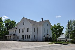
Bradford is a town in Merrimack County, New Hampshire, United States. The population was 1,662 at the 2020 census. [2] The main village of the town, where 372 people resided at the 2020 census, is defined as the Bradford census-designated place (CDP), and is located in the northeast part of the town, west of the junction of New Hampshire routes 103 and 114. The town also includes the village of Bradford Center.

Contents

History

Depot Square in 1913 Depot Square, Bradford, NH.jpg
Depot Square in 1913

Granted by Governor Benning Wentworth in 1765 [3] to John Pierce and George Jaffrey of Portsmouth, it was settled in 1771 by Deacon William Presbury and family. [4] Three years later other settlers arrived, several of them from Bradford, Massachusetts, after which the town was named "New Bradford". Later, it was called "Bradfordton", but upon incorporation by the General Court on September 27, 1787, it was officially named Bradford. [5]

Parts of the town are hilly, but the largest portion is in a valley with varied soil. Streams provided water power for watermills. By 1859, when Bradford's population reached 1,341, industries included one woolen mill, one sash, blind and door factory, one wheelwright shop, two sawmills, one gristmill, one tannery, and one clothing mill. [5] In 1850, the Concord & Claremont Railroad opened from Concord to Bradford, which would remain its terminus until the line was extended to Claremont in 1871–1872. [6]

Geography

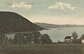
According to the United States Census Bureau, the town has a total area of 35.9 square miles (93.1 km2), of which 35.3 square miles (91.3 km2) are land and 0.69 square miles (1.8 km2) are water, comprising 1.92% of the town. [1] The village of Bradford is located near the northern border of the town, at the intersection of routes 103 and 114, just north of the Warner River and adjacent to the outlet of Todd Lake. The largest water body in the town is Lake Massasecum, near the town's eastern border. The Warner River and its tributaries drain the northern and central parts of town, while the southern part is drained by tributaries of the Contoocook River. Bradford lies fully within the Merrimack River watershed. [7]

The highest point in Bradford is an unnamed 2,096-foot (639 m) summit overlooking Ayers Pond on the town's western border. Knights Hill (1,910 ft or 580 m) and Rowes Hill (1,950 ft or 590 m) constitute a large, hilly mass occupying the southern portion of town.

Demographics

Historical population
CensusPop.Note
1790 217
1800 740241.0%
1810 1,03439.7%
1820 1,31827.5%
1830 1,285−2.5%
1840 1,3313.6%
1850 1,3410.8%
1860 1,180−12.0%
1870 1,081−8.4%
1880 950−12.1%
1890 810−14.7%
1900 805−0.6%
1910 695−13.7%
1920 580−16.5%
1930 5871.2%
1940 66112.6%
1950 606−8.3%
1960 508−16.2%
1970 67933.7%
1980 1,11564.2%
1990 1,40526.0%
2000 1,4543.5%
2010 1,65013.5%
2020 1,6620.7%
U.S. Decennial Census [2] [8]

As of the census of 2010, there were 1,650 people, 667 households, and 471 families residing in the town. There were 917 housing units, of which 250, or 27.3%, were vacant. 203 of the vacant units were for seasonal or recreational uses. The racial makeup of the town was 97.5% white, 0.1% African American, 0.4% Native American, 0.2% Asian, 0.1% Native Hawaiian or Pacific Islander, 0.2% some other race, and 1.6% from two or more races. 1.3% of the population were Hispanic or Latino of any race. [9]

Of the 667 households, 29.1% had children under the age of 18 living with them, 57.7% were headed by married couples living together, 7.8% had a female householder with no husband present, and 29.4% were non-families. 21.1% of all households were made up of individuals, and 7.1% were someone living alone who was 65 years of age or older. The average household size was 2.47, and the average family size was 2.86. [9]

In the town, 20.7% of the population were under the age of 18, 6.3% were from 18 to 24, 20.9% from 25 to 44, 38.9% from 45 to 64, and 13.2% were 65 years of age or older. The median age was 46.3 years. For every 100 females, there were 100.7 males. For every 100 females age 18 and over, there were 100.6 males. [9]

For the period 2011–2015, the estimated median annual income for a household was $59,783, and the median income for a family was $68,750. Male full-time workers had a median income of $55,119 versus $40,000 for females. The per capita income for the town was $28,152. 7.1% of the population and 4.8% of families were below the poverty line. 7.8% of the population under the age of 18 and 8.5% of those 65 or older were living in poverty. [10]

Sites of interest

Notable people

Related Research Articles

<span class="mw-page-title-main">Merrimack County, New Hampshire</span> County in New Hampshire, United States

Merrimack County is a county in the U.S. state of New Hampshire. As of the 2020 Census, the population was 153,808, making it the third-most populous county in New Hampshire. Its county seat is Concord, the state capital. The county was organized in 1823 from parts of Hillsborough and Rockingham counties, and is named for the Merrimack River. Merrimack County comprises the Concord, NH Micropolitan Statistical Area, which in turn constitutes a portion of the Boston–Worcester–Providence, MA–RI–NH–CT Combined Statistical Area. In 2010, the center of population of New Hampshire was located in Merrimack County, in the town of Pembroke.

<span class="mw-page-title-main">Piermont, New Hampshire</span> Town in New Hampshire, United States

Piermont is a town in Grafton County, New Hampshire, United States. The population was 769 at the 2020 census. It is home to Camp Walt Whitman and Kingswood Camp for Boys.

<span class="mw-page-title-main">Allenstown, New Hampshire</span> Town in New Hampshire, United States

Allenstown is a town in Merrimack County, New Hampshire, United States. The population was 4,707 at the 2020 census, up from 4,322 at the 2010 census. Allenstown includes a portion of the village of Suncook. Just over one-half of the town's area is covered by Bear Brook State Park.

<span class="mw-page-title-main">Andover, New Hampshire</span> Town in New Hampshire, United States

Andover is a town in Merrimack County, New Hampshire, United States. The population was 2,406 at the 2020 census. Andover includes the villages of Cilleyville, Potter Place, East Andover, and West Andover, in addition to the town center. The town is home to Ragged Mountain State Forest and Proctor Academy, a private coeducational preparatory school.

<span class="mw-page-title-main">Boscawen, New Hampshire</span> Town in New Hampshire, United States

Boscawen is a town in Merrimack County, New Hampshire, United States. The population was 3,998 at the 2020 census.

<span class="mw-page-title-main">Contoocook, New Hampshire</span> Census-designated place in New Hampshire, United States

Contoocook is a village and census-designated place (CDP) within the town of Hopkinton in Merrimack County, New Hampshire, United States. The population was 1,427 at the 2020 census. Contoocook is well known for its growth of small businesses, preservation of historical landmarks, community involvement and recreational activities within the village.

<span class="mw-page-title-main">Franklin, New Hampshire</span> City in New Hampshire, United States

Franklin is a city in Merrimack County, New Hampshire, United States. At the 2020 census, the population was 8,741, the least of New Hampshire's 13 cities. Franklin includes the village of West Franklin.

<span class="mw-page-title-main">Hopkinton, New Hampshire</span> Town in New Hampshire, United States

Hopkinton is a town in Merrimack County, New Hampshire, United States. The population was 5,914 at the 2020 census. The town has three distinct communities: Hopkinton village, mainly a residential area in the center of the town; Contoocook, the town's business hub, located in the north; and West Hopkinton, within the more agricultural portion of the town. The town is home to the Hopkinton State Fair, adjacent to Contoocook village, and to the historic Contoocook Railroad Depot and the Contoocook Railroad Bridge, the oldest covered railroad bridge in the United States.

<span class="mw-page-title-main">New London, New Hampshire</span> Town in New Hampshire, United States

New London is a town in Merrimack County, New Hampshire, United States. The population was 4,400 at the 2020 census. The town is the home of Colby–Sawyer College, site of the Gordon Research Conferences since 1947.

<span class="mw-page-title-main">Newbury, New Hampshire</span> Town in New Hampshire, United States

Newbury is a town in Merrimack County, New Hampshire, United States. The population was 2,172 at the 2020 census. Newbury is home to part of Lake Sunapee, including Mount Sunapee State Park Beach. Mount Sunapee Resort, a ski area in Mount Sunapee State Park, is in the west. The town includes the villages of Newbury, Blodgett Landing and South Newbury.

<span class="mw-page-title-main">Suncook, New Hampshire</span> Census-designated place in New Hampshire, United States

Suncook is a census-designated place (CDP) in Merrimack County, New Hampshire, United States. The population was 5,501 at the 2020 census. Approximately two-thirds of Suncook is located in the town of Pembroke, with the remainder in Allenstown.

<span class="mw-page-title-main">Sutton, New Hampshire</span> Town in New Hampshire, United States

Sutton is a town in Merrimack County, New Hampshire, United States. The population was 1,978 at the 2020 census. Sutton includes the villages of Sutton Mills, North Sutton, South Sutton and East Sutton. North Sutton is home to Wadleigh State Park on Kezar Lake.

<span class="mw-page-title-main">Warner, New Hampshire</span> Town in New Hampshire, United States

Warner is a town in Merrimack County, New Hampshire, United States. The population was 2,937 at the 2020 census. The town is home to Magdalen College of the Liberal Arts, Rollins State Park and Mount Kearsarge State Forest.

<span class="mw-page-title-main">Webster, New Hampshire</span> Town in New Hampshire, United States

Webster is a town in Merrimack County, New Hampshire, United States. The population was 1,913 at the 2020 census.

<span class="mw-page-title-main">Henniker (CDP), New Hampshire</span> Census-designated place in New Hampshire, United States

Henniker is a census-designated place (CDP) and the main village in the town of Henniker in Merrimack County, New Hampshire, United States. The population of the CDP was 3,166 at the 2020 census, out of 6,185 in the entire town. The CDP is the home to New England College.

<span class="mw-page-title-main">Henniker, New Hampshire</span> Town in New Hampshire, United States

Henniker is a town in Merrimack County, New Hampshire, United States. As of the 2020 census, the reported total population of the town was 6,185, although the figure, 27.9% greater than the 2010 population, has been questioned by local officials. Henniker is home to New England College and Pats Peak Ski Area. Henniker is a college town and resort area, featuring both skiing and white-water kayaking.

<span class="mw-page-title-main">Hillsborough, New Hampshire</span> Town in New Hampshire, United States

Hillsborough, frequently spelled Hillsboro, is a town in Hillsborough County, New Hampshire, United States. The population was 5,939 at the 2020 census. The town is home to Fox State Forest and part of Low State Forest.

<span class="mw-page-title-main">Bradford (CDP), New Hampshire</span> Census-designated place in New Hampshire, United States

Bradford is a census-designated place (CDP) and the main village in the town of Bradford in Merrimack County, New Hampshire, United States. The population of the CDP was 372 at the 2020 census, out of 1,662 in the entire town.

<span class="mw-page-title-main">New London (CDP), New Hampshire</span> Census-designated place in New Hampshire, United States

New London is a census-designated place (CDP) and the primary village in the town of New London in Merrimack County, New Hampshire, United States. The population of the CDP was 1,266 at the 2020 census, out of 4,400 in the entire town. The CDP includes the campus of Colby–Sawyer College.

<span class="mw-page-title-main">Warner (CDP), New Hampshire</span> Census-designated place in New Hampshire, United States

Warner is a census-designated place (CDP) and the main village in the town of Warner in Merrimack County, New Hampshire, United States. The population of the CDP was 453 at the 2020 census, out of 2,937 in the entire town.

References

  1. 1 2 "2021 U.S. Gazetteer Files – New Hampshire". United States Census Bureau. Retrieved December 13, 2021.
  2. 1 2 3 "Bradford town, Merrimack County, New Hampshire: 2020 DEC Redistricting Data (PL 94-171)". U.S. Census Bureau. Retrieved December 13, 2021.
  3. Hayward's New England Gazetteer of 1839
  4. Nathaniel Bouton, Documents and Records Relating to Towns in New Hampshire; Concord, New Hampshire 1875
  5. 1 2 Austin J. Coolidge & John B. Mansfield, A History and Description of New England; Boston, Massachusetts 1859
  6. Nashua City Station Railroad History -- The Concord & Claremont Railroad
  7. Foster, Debra H.; Batorfalvy, Tatianna N.; Medalie, Laura (1995). Water Use in New Hampshire: An Activities Guide for Teachers. U.S. Department of the Interior and U.S. Geological Survey.
  8. "Census of Population and Housing". Census.gov. Retrieved June 4, 2016.
  9. 1 2 3 "Profile of General Population and Housing Characteristics: 2010 Census Summary File 1 (DP-1): Bradford town, Merrimack County, New Hampshire". American Factfinder. U.S. Census Bureau. Archived from the original on February 13, 2020. Retrieved November 2, 2017.
  10. "Selected Economic Characteristics: 2011-2015 American Community Survey 5-Year Estimates (DP03): Bradford town, Merrimack County, New Hampshire". American Factfinder. U.S. Census Bureau. Archived from the original on February 13, 2020. Retrieved November 2, 2017.
  11. "Lake Todd Village District: Home".
  12. "Inside the Secret Sale of Ghislaine Maxwell's Swanky New Hampshire Hideout". Daily Beast. July 2, 2020. Retrieved July 2, 2020.
  13. LaCrosse, Mike (July 2, 2020). "Ghislaine Maxwell Arrested at 'Gorgeous Property' in Bradford, NH". CBS Boston. Retrieved July 3, 2020.
  14. Graham, Ruth (July 2, 2020). "Epstein Associate Ghislaine Maxwell Was Hiding in a Million-Dollar House in a Tiny New Hampshire Town". Slate. Retrieved July 3, 2020.