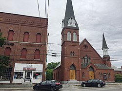
Pittsfield (CDP), New Hampshire

Last updated

Pittsfield, New Hampshire
Pittsfield NH CDP.jpg
Union Block and First Congregational Church, Bridge Street
USA New Hampshire location map.svg
Red pog.svg
Pittsfield
Usa edcp location map.svg
Red pog.svg
Pittsfield
Coordinates: 43°18′21″N71°19′27″W / 43.30583°N 71.32417°W / 43.30583; -71.32417
Country United States
State New Hampshire
County Merrimack
Town Pittsfield
Area
[1]
  Total1.68 sq mi (4.36 km2)
  Land1.68 sq mi (4.36 km2)
  Water0.00 sq mi (0.00 km2)
Elevation
496 ft (151 m)
Population
 (2020)
  Total1,570
  Density933.41/sq mi (360.42/km2)
Time zone UTC-5 (Eastern (EST))
  Summer (DST) UTC-4 (EDT)
ZIP code
03263
Area code 603
FIPS code 33-61860
GNIS feature ID2378088

Pittsfield is a census-designated place (CDP) and the main village in the town of Pittsfield in Merrimack County, New Hampshire, United States. The population of the CDP was 1,570 at the 2020 census, [2] out of 4,075 in the entire town.

Contents

Geography

The CDP occupies the central-western part of the town of Pittsfield, on both sides of the Suncook River. It is bordered to the southwest by the town of Chichester; to the northwest by New Hampshire Route 28; to the northeast by River Road, the Suncook River, and part of Bow Street; and to the southeast by Winant Road, the outlet of Whites Pond, and the Suncook River. [3]

Route 28 bypasses the center of the village to its northwest, leading southwest 6 miles (10 km) to the Epsom traffic circle and northeast 13 miles (21 km) to Alton. New Hampshire Route 107 passes through the center of Pittsfield as Catamount Road and Carroll Street, leading southeast 8 miles (13 km) to Northwood Narrows and northwest 11 miles (18 km) to Gilmanton.

According to the U.S. Census Bureau, the Pittsfield CDP has a total area of 1.7 square miles (4.4 km2), all of it recorded as land. [2] The Suncook River, which flows through the center of the community, is part of the Merrimack River watershed.

Demographics

Historical population
CensusPop.Note
1950 1,342
1960 1,4074.8%
1970 1,66218.1%
1980 1,584−4.7%
1990 1,7178.4%
2000 1,669−2.8%
2010 1,576−5.6%
2020 1,570−0.4%
U.S. Decennial Census [4]

As of the census of 2010, there were 1,576 people, 639 households, and 383 families residing in the CDP. There were 750 housing units, of which 111, or 14.8%, were vacant. The racial makeup of the CDP was 96.6% white, 0.3% African American, 0.3% Native American, 0.6% Asian, 0.0% Pacific Islander, 0.1% some other race, and 2.2% from two or more races. 3.2% of the population were Hispanic or Latino of any race. [5]

Of the 639 households in the CDP, 33.3% had children under the age of 18 living with them, 39.4% were headed by married couples living together, 15.0% had a female householder with no husband present, and 40.1% were non-families. 31.3% of all households were made up of individuals, and 9.4% were someone living alone who was 65 years of age or older. The average household size was 2.47, and the average family size was 3.07. [5]

26.0% of residents in the CDP were under the age of 18, 9.9% were from age 18 to 24, 27.1% were from 25 to 44, 25.4% were from 45 to 64, and 11.6% were 65 years of age or older. The median age was 34.9 years. For every 100 females, there were 95.3 males. For every 100 females age 18 and over, there were 93.5 males. [5]

For the period 2011-15, the estimated median annual income for a household was $27,798, and the median income for a family was $29,063. The per capita income for the CDP was $18,094. 23.1% of the population and 25.0% of families were below the poverty line, along with 22.7% of people under the age of 18 and 6.3% of people 65 or older. [6]

Related Research Articles

<span class="mw-page-title-main">Merrimack County, New Hampshire</span> County in New Hampshire, United States

Merrimack County is a county in the U.S. state of New Hampshire. As of the 2020 Census, the population was 153,808, making it the third most populous county in New Hampshire. Its county seat is Concord, the state capital. The county was organized in 1823 from parts of Hillsborough and Rockingham counties, and is named for the Merrimack River. Merrimack County comprises the Concord, NH Micropolitan Statistical Area, which in turn constitutes a portion of the Boston–Worcester–Providence, MA–RI–NH–CT Combined Statistical Area. In 2010, the center of population of New Hampshire was located in Merrimack County, in the town of Pembroke.

<span class="mw-page-title-main">East Merrimack, New Hampshire</span> Census-designated place in New Hampshire, United States

East Merrimack is a census-designated place (CDP) in the town of Merrimack, Hillsborough County, New Hampshire, United States. There is no village center named "East Merrimack"; rather, the CDP refers to the region of the town of Merrimack lying east of the F. E. Everett Turnpike, overlapping portions of the villages of Reeds Ferry, Thornton's Ferry, and the center of Merrimack. The population was 5,176 at the 2020 census, up from 4,197 at the 2010 census.

<span class="mw-page-title-main">Allenstown, New Hampshire</span> Town in New Hampshire, United States

Allenstown is a town in Merrimack County, New Hampshire, United States. The population was 4,707 at the 2020 census, up from 4,322 at the 2010 census. Allenstown includes a portion of the village of Suncook. Just over one-half of the town's area is covered by Bear Brook State Park.

<span class="mw-page-title-main">Chichester, New Hampshire</span> Town in New Hampshire, United States

Chichester is a town in Merrimack County, New Hampshire, United States. The population was 2,665 at the 2020 census.

<span class="mw-page-title-main">Contoocook, New Hampshire</span> Census-designated place in New Hampshire, United States

Contoocook is a village and census-designated place (CDP) within the town of Hopkinton in Merrimack County, New Hampshire, United States. The population was 1,427 at the 2020 census. Contoocook is well known for its growth of small businesses, preservation of historical landmarks, community involvement and recreational activities within the village.

<span class="mw-page-title-main">Epsom, New Hampshire</span> Town in New Hampshire, United States

Epsom is a town in Merrimack County, New Hampshire, United States. The population was 4,834 at the 2020 census.

<span class="mw-page-title-main">South Hooksett, New Hampshire</span> Census-designated place in New Hampshire, United States

South Hooksett is a census-designated place (CDP) within the town of Hooksett in Merrimack County, New Hampshire, United States. The population was 5,888 at the 2020 census. It is a suburban area adjacent to the city of Manchester, New Hampshire's largest city, and includes a mix of housing developments and large retail stores.

<span class="mw-page-title-main">Suncook, New Hampshire</span> Census-designated place in New Hampshire, United States

Suncook is a census-designated place (CDP) in Merrimack County, New Hampshire, United States. The population was 5,501 at the 2020 census. Approximately two-thirds of Suncook is located in the town of Pembroke, with the remainder in Allenstown.

<span class="mw-page-title-main">Tilton Northfield, New Hampshire</span> Census-designated place in New Hampshire, United States

Tilton Northfield is a census-designated place (CDP) representing two adjacent villages in the towns of Tilton in Belknap County and Northfield in Merrimack County in the U.S. state of New Hampshire. The CDP encompasses the town centers of both Tilton and Northfield, located on either side of the Winnipesaukee River. The population was 3,324 at the 2020 census.

<span class="mw-page-title-main">Hudson (CDP), New Hampshire</span> Census-designated place in New Hampshire, United States

Hudson is a census-designated place (CDP) and the urban center of the town of Hudson in Hillsborough County, New Hampshire, United States. The population of the CDP was 7,534 at the 2020 census, out of 25,394 in the entire town.

<span class="mw-page-title-main">Henniker (CDP), New Hampshire</span> Census-designated place in New Hampshire, United States

Henniker is a census-designated place (CDP) and the main village in the town of Henniker in Merrimack County, New Hampshire, United States. The population of the CDP was 3,166 at the 2020 census, out of 6,185 in the entire town. The CDP is the home to New England College.

<span class="mw-page-title-main">Hooksett (CDP), New Hampshire</span> Census-designated place in New Hampshire, United States

Hooksett is a census-designated place (CDP) in the town of Hooksett in Merrimack County, New Hampshire, United States. The CDP includes the historic central village of Hooksett as well as suburban and rural land surrounding it. The population of the CDP was 5,283 at the 2020 census, out of 14,871 in the entire town.

<span class="mw-page-title-main">Hooksett, New Hampshire</span> Town in New Hampshire, United States

Hooksett is a town in Merrimack County, New Hampshire, United States. The population was 14,871 at the 2020 census, up from 13,451 at the 2010 census. The town is located between Manchester, the state's largest city, and Concord, the state capital. A prominent landmark is Robie's Country Store, a National Historic Landmark and a frequent stop for presidential candidates during the New Hampshire primary.

<span class="mw-page-title-main">Pittsfield, New Hampshire</span> Town in New Hampshire, United States

Pittsfield is a town in Merrimack County, New Hampshire, United States. The population was 4,075 at the 2020 census.

<span class="mw-page-title-main">Derry (CDP), New Hampshire</span> Census-designated place in New Hampshire, United States

Derry is a census-designated place (CDP) in the town of Derry in Rockingham County, New Hampshire, United States. The CDP comprises the urban center of the town, as well as the village of East Derry and connected suburban areas. The population of the CDP was 22,879 at the 2020 census, out of 34,317 in the entire town.

<span class="mw-page-title-main">Londonderry (CDP), New Hampshire</span> Census-designated place in New Hampshire, United States

Londonderry is a census-designated place (CDP) within the town of Londonderry in Rockingham County, New Hampshire, United States. The population of the CDP was 11,645 at the 2020 census, out of 25,826 in the entire town.

<span class="mw-page-title-main">Bradford (CDP), New Hampshire</span> Census-designated place in New Hampshire, United States

Bradford is a census-designated place (CDP) and the main village in the town of Bradford in Merrimack County, New Hampshire, United States. The population of the CDP was 372 at the 2020 census, out of 1,662 in the entire town.

<span class="mw-page-title-main">Loudon (CDP), New Hampshire</span> Census-designated place in New Hampshire, United States

Loudon is a census-designated place (CDP) and the main village in the town of Loudon in Merrimack County, New Hampshire, United States. The population of the CDP was 711 at the 2020 census, out of 5,576 in the entire town.

<span class="mw-page-title-main">New London (CDP), New Hampshire</span> Census-designated place in New Hampshire, United States

New London is a census-designated place (CDP) and the primary village in the town of New London in Merrimack County, New Hampshire, United States. The population of the CDP was 1,266 at the 2020 census, out of 4,400 in the entire town. The CDP includes the campus of Colby–Sawyer College.

<span class="mw-page-title-main">Warner (CDP), New Hampshire</span> Census-designated place in New Hampshire, United States

Warner is a census-designated place (CDP) and the main village in the town of Warner in Merrimack County, New Hampshire, United States. The population of the CDP was 453 at the 2020 census, out of 2,937 in the entire town.

References

  1. "ArcGIS REST Services Directory". United States Census Bureau. Retrieved September 20, 2022.
  2. 1 2 "2021 U.S. Gazetteer Files – New Hampshire". United States Census Bureau. Retrieved December 17, 2021.
  3. "TIGERweb: Pittsfield CDP, New Hampshire". Geography Division, U.S. Census Bureau. Retrieved January 26, 2021.
  4. "Decennial Census Official Publications". Census.gov. Retrieved March 4, 2024.
  5. 1 2 3 "Profile of General Population and Housing Characteristics: 2010 Census Summary File 1 (DP-1): Pittsfield CDP, New Hampshire". U.S. Census Bureau, American Factfinder. Archived from the original on February 13, 2020. Retrieved September 28, 2017.
  6. "Selected Economic Characteristics: 2011-2015 American Community Survey 5-Year Estimates (DP03): Pittsfield CDP, New Hampshire". U.S. Census Bureau, American Factfinder. Archived from the original on February 13, 2020. Retrieved September 28, 2017.