Danbury is a town in Merrimack County, New Hampshire, United States. The population was 1,250 at the 2020 census.

New London is a town in Merrimack County, New Hampshire, United States. The population was 4,400 at the 2020 census. The town is the home of Colby–Sawyer College, site of the Gordon Research Conferences since 1947.
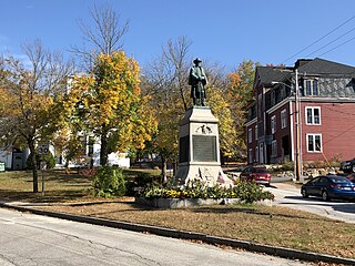
Warner is a town in Merrimack County, New Hampshire, United States. The population was 2,937 at the 2020 census. The town is home to Magdalen College of the Liberal Arts, Rollins State Park and Mount Kearsarge State Forest.

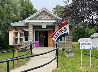
Wilmot is a town in Merrimack County, New Hampshire, United States. The population was 1,407 at the 2020 census. The town includes the communities of Wilmot, Wilmot Flat, and North Wilmot.

Mount Monadnock, or Grand Monadnock, is a mountain in the town of Jaffrey, New Hampshire. It is the most prominent mountain peak in southern New Hampshire and is the highest point in Cheshire County. It lies 38 miles (61 km) southwest of Concord and 62 miles (100 km) northwest of Boston. At 3,165 feet (965 m), Mount Monadnock is nearly 1,000 feet (305 m) higher than any other mountain peak within 30 miles (48 km) and rises 2,000 feet (610 m) above the surrounding landscape. Monadnock's bare, isolated, and rocky summit provides expansive views. It is known for being featured in the writings of Ralph Waldo Emerson and Henry David Thoreau.

Mount Jefferson State Natural Area is a 1,188-acre (4.81 km2) North Carolina state park in Ashe County, North Carolina in the United States. Located near Jefferson, North Carolina, it includes the peak of Mount Jefferson, named for Thomas Jefferson and his father Peter, who owned land nearby and surveyed the North Carolina-Virginia border in 1749. In 1974, Mount Jefferson State Natural Area was designated as a National Natural Landmark by the National Park Service.

The Dartmouth–Lake Sunapee area of the U.S. state of New Hampshire lies in the west-central portion of the state, along the Connecticut River Valley. It includes all of Sullivan County, and parts of Merrimack County and Grafton County. The region shares its name with Dartmouth College, a prestigious Ivy League institution, and Lake Sunapee, a popular tourist destination. Interstate 89 forms the main freeway connecting the region to other parts of New Hampshire, as well as to nearby Vermont. Lebanon, Hanover, and Claremont are the three most populous communities in the region.

Franconia Notch State Park is a public recreation area and nature preserve that straddles eight miles (13 km) of Interstate 93 as it passes through Franconia Notch, a mountain pass between the Kinsman Range and Franconia Range in the White Mountains of northern New Hampshire, United States. The northern part of the park, including Cannon Mountain and Echo and Profile lakes, is in the town of Franconia, and the southern part, including Lonesome Lake and the Flume, is in Lincoln. Attractions in the state park include the Flume Gorge and visitor center, the Old Man of the Mountain historical site, fishing in Echo Lake and Profile Lake, and miles of hiking, biking and ski trails.

Rollins State Park is a public recreation area on the southern slope of Mount Kearsarge in Warner, New Hampshire. The state park is at the entrance to an auto road that ascends to within 0.5 miles (0.8 km) of the summit. Picnic facilities are available, and hiking trails leave from the high point of the auto road to the summit. The park is named for Frank W. Rollins, who served as governor of New Hampshire from 1899 to 1901.

Mount Kearsarge is a mountain located in Wilmot, New Hampshire, and Warner, New Hampshire. Two state parks are located at the northern and southern bases of the mountain—Winslow State Park and Rollins State Park, respectively—and the entire mountain is within Kearsarge Mountain State Forest. On a very clear day, skyscrapers in the city of Boston 80 miles (130 km) away are visible from the fire tower on the summit. The summit has remained bare since a 1796 forest fire.

The Metacomet-Monadnock Trail is a 114-mile-long (183 km) hiking trail that traverses the Metacomet Ridge of the Pioneer Valley region of Massachusetts and the central uplands of Massachusetts and southern New Hampshire. Although less than 70 miles (110 km) from Boston and other large population centers, the trail is considered remarkably rural and scenic and includes many areas of unique ecologic, historic, and geologic interest. Notable features include waterfalls, dramatic cliff faces, exposed mountain summits, woodlands, swamps, lakes, river floodplain, farmland, significant historic sites, and the summits of Mount Monadnock, Mount Tom and Mount Holyoke. The Metacomet-Monadnock Trail is maintained largely through the efforts of the Western Massachusetts Chapter of the Appalachian Mountain Club (AMC). Much of the trail is a portion of the New England National Scenic Trail.

Mount Sunapee is a 5-mile-long (8.0 km) mountain ridge in the towns of Newbury and Goshen in western New Hampshire, United States. Its highest peak, at the north end of the mountain, is 2,726 feet (831 m) above sea level. The mountain has three secondary peaks, White Ledges at 2,716 ft (828 m); North Peak at 2,280 ft (695 m); and South Peak at 2,608 ft (795 m). The north end of the mountain, including the summit, is within Mount Sunapee State Park, which encompasses 3.85 square miles (10.0 km2) and is home to the popular Mount Sunapee Resort. The mountain extends south to Pillsbury State Park in the towns of Goshen and Washington.

Ragged Mountain is a low mountain with numerous knobby summits in the towns of Danbury and Andover in central New Hampshire. It is home to the Ragged Mountain ski resort.

Kearsarge North is a mountain located about 4 miles (6 km) northeast of North Conway, Carroll County, New Hampshire, United States. The U.S. Board on Geographic Names accepted the name "Pequawket Mountain" in 1915 but it was renamed Kearsarge North in 1957. The Pequawket are a subdivision of the Abenaki people who formerly lived in the area. It is sometimes referred to as Mount Kearsarge, a name officially assigned to a mountain in Merrimack County.
Pillsbury State Park is a state park located mainly in Washington and partially in Goshen, New Hampshire, in the United States. It is home to the headwaters of the Ashuelot River. It contains one of the more rustic campgrounds in the state park system, with no electricity and limited running water. There are 40 campsites, most of which are reservable. Eleven of the sites are at "remote" locations, most of which are accessible by canoe. Hiking trails connect to the 51-mile-long (82 km) Monadnock-Sunapee Greenway trail.

The Monadnock-Sunapee Greenway (MSG) is a 50-mile (80 km) hiking trail that traverses the highlands of southern New Hampshire from Mount Monadnock in Jaffrey to Mount Sunapee in Newbury. Located approximately 27 miles (43 km) from the city of Concord, New Hampshire, the trail traverses a rural, heavily glaciated and metamorphic upland studded with lakes, heath barrens, the rocky summits of several monadnocks, and dense woodland of the northern hardwood forest type. The trail is maintained primarily through the efforts of the Monadnock-Sunapee Greenway Trail Club.

Cardigan Mountain State Park is a 5,655-acre (2,288 ha) public recreation area in Orange, New Hampshire. The state park is free to use, open year-round, and offers a hiking trail up to the 3,121-foot treeless granite summit of Mount Cardigan plus places to picnic.
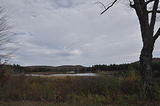
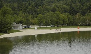
Wadleigh State Park is a public recreation area located on the south shore of 170-acre (69 ha) Kezar Lake in Sutton, New Hampshire. The state park has a bathhouse and playing fields and offers opportunities for swimming, picnicking, fishing, and boating.

Echo Lake State Park is a public recreation area in North Conway, New Hampshire, that features 15.7-acre (6.4 ha) Echo Lake and two rock ledges with scenic views, Cathedral Ledge and White Horse Ledge. Activities include swimming, hiking, non-motorized boating, picnicking and fishing. There is a one-mile trail around the lake.
Mount Sunapee State Park is a public recreation area in Newbury, New Hampshire. The state park's nearly 3,000 acres (1,200 ha) include most of Mount Sunapee and a beach area on Lake Sunapee. Park activities include swimming, hiking, camping, skiing, fishing, picnicking, and non-motorized boating. The park's ski area is operated as Mount Sunapee Resort under the management of Vail Resorts Inc.

