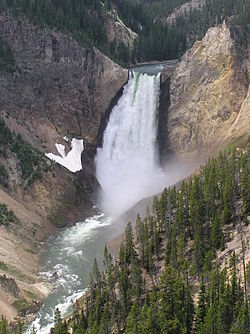
Protected areas of the United States

Last updated
Grand Canyon of Yellowstone YellowstonefallJUN05.JPG
Grand Canyon of Yellowstone
John Muir (1838-1914), one of the main inspirations for the U.S. national park system.
"Why should man value himself as more than a small part of the one great unit of creation ?" - John Muir. John Muir.jpg
John Muir (1838-1914), one of the main inspirations for the U.S. national park system.
"Why should man value himself as more than a small part of the one great unit of creation ?" - John Muir.

The protected areas of the United States are managed by an array of different federal, state, tribal and local level authorities and receive widely varying levels of protection. Some areas are managed as wilderness, while others are operated with acceptable commercial exploitation. As of 2022, the 42,826 protected areas covered 1,235,486 km2 (477,024 sq mi), or 13 percent of the land area of the United States. [2] This is also one-tenth of the protected land area of the world.[ citation needed ] The U.S. also had a total of 871 National Marine Protected Areas, covering an additional 1,240,000 sq mi (3,200,000 km2), or 26 percent of the total marine area of the United States. [3]

Contents

Federal-level protected areas

Federal protected areas include lands and waters owned outright ("Fee ownerships"), as well as areas that are secured by easements, leases, etc. In addition to ownership-defined areas, there are numerous overlaying policy designations that apply management protections and use conditions on all or some of individual protected areas (e.g., Wilderness Areas, National Monuments, etc.).

As of 2007, according to the United Nations Environment Programme, the U.S. had a total of 6,770 terrestrial nationally designated (federal) protected areas. Federal level protected areas are managed by a variety of agencies, most of which are a part of the National Park Service, a bureau of the United States Department of the Interior. They are often considered the crown jewels of the protected areas. Other areas are managed by the United States Forest Service, the Bureau of Land Management and the United States Fish and Wildlife Service. The United States Army Corps of Engineers is claimed to provide 30 percent of the recreational opportunities on federal lands, mainly through lakes and waterways that they manage.

The highest levels of protection, as described by the International Union for Conservation of Nature (IUCN), are Level I (Strict Nature Reserves & Wilderness Areas) and Level II (National Parks). The United States maintains 12 percent of the Level I and II lands in the world. These lands had a total area of 210,000 sq mi (540,000 km2).[ citation needed ]

Because U.S. federal protected areas include both ownership based names, and names related to overlaying policy designations, the naming system for U.S. protected areas results in some types being used by more than one agency. For instance, both the National Park Service and the U.S. Forest Service manage areas designated National Preserves and National Recreation Areas. The National Park Service, the U.S. Forest Service, and the Bureau of Land Management manage areas called national monuments. National Wilderness Areas are designated within other protected areas, managed by various agencies and sometimes wilderness areas span areas managed by multiple agencies. Those relying on U.S. protected areas data are advised to learn more about all of these conventions by reviewing the extensive PAD-US Help system.

There are existing federal designations of historic or landmark status that may support preservation via tax incentives, but that do not necessarily convey any protection, including a listing on the National Register of Historic Places or a designation as a National Historic Landmark. States and local zoning bodies may or may not choose to protect these. The state of Colorado, for example, is very clear that it does not set any limits on owners of NRHP properties. [4]

Federal protected area designations [1]

International protected area designations

State-level protected areas

Every state has a system of state parks as well as many other types of protected areas (forests, reserves, refuges, recreation areas, etc.). State parks vary widely from urban parks to very large parks that are on a par with national parks. Some state parks, like Adirondack Park, are similar to the national parks of England and Wales, with numerous towns inside the borders of the park. About half the area of the park, some 3,000,000 acres (1,200,000 ha), is state-owned and preserved as "forever wild" by the Forest Preserve of New York. Wood-Tikchik State Park in Alaska is the largest state park by the amount of contiguous protected land; it is larger than many U.S. National Parks, with some 1,600,000 acres (650,000 ha), making it larger than the state of Delaware. Many states also operate game and recreation areas.

Local-level protected areas

U.S. counties, cities and towns, metropolitan authorities, regional park systems, recreation districts and other units manage a wide variety of local public parks and other protected areas. Some of these are little more than picnic areas or playgrounds; however, others are extensive nature reserves. South Mountain Park in Phoenix, Arizona, for example, is called the largest city park in the United States; it spans 25 sq mi (65 km2) and contains 58 mi (93 km) of trails.

List of protected areas by region

See also

Related Research Articles

<span class="mw-page-title-main">United States Forest Service</span> Agency of the U.S. Department of Agriculture

The United States Forest Service (USFS) is an agency within the U.S. Department of Agriculture that administers the nation's 154 national forests and 20 national grasslands covering 193 million acres (780,000 km2) of land. The major divisions of the agency are the Chief's Office, National Forest System, State and Private Forestry, Business Operations, as well as Research and Development. The agency manages about 25% of federal lands and is the sole major national land management agency not part of the U.S. Department of the Interior.

<span class="mw-page-title-main">National forest (United States)</span> Classification of federal lands in the United States

In the United States, national forest is a classification of protected and managed federal lands that are largely forest and woodland areas. They are owned collectively by the American people through the federal government and managed by the United States Forest Service, a division of the United States Department of Agriculture. The U.S. Forest Service is also a forestry research organization which provides financial assistance to state and local forestry industry. There are 154 national forests in the United States.

<span class="mw-page-title-main">National Wildlife Refuge</span> United States protected area designation

National Wildlife RefugeSystem (NWRS) is a system of protected areas of the United States managed by the United States Fish and Wildlife Service (FWS), an agency within the Department of the Interior. The National Wildlife Refuge System is the system of public lands and waters set aside to conserve America's fish, wildlife, and plants. Since President Theodore Roosevelt designated Florida's Pelican Island National Wildlife Refuge as the first wildlife refuge in 1903, the system has grown to over 568 national wildlife refuges and 38 wetland management districts encompassing about 856,000,000 acres (3,464,109 km2).

<span class="mw-page-title-main">National Wild and Scenic Rivers System</span> Conservation effort of certain rivers in the United States and its territories

The National Wild and Scenic Rivers System was created by the Wild and Scenic Rivers Actof 1968, enacted by the U.S. Congress to preserve certain rivers with outstanding natural, cultural, and recreational values in a free-flowing condition for the enjoyment of present and future generations.

In all modern states, a portion of land is held by central or local governments. This is called public land, state land, or Crown land. The system of tenure of public land, and the terminology used, varies between countries. The following examples illustrate some of the range.

<span class="mw-page-title-main">Wilderness</span> Undisturbed natural environment

Wilderness or wildlands are natural environments on Earth that have not been significantly modified by human activity, or any nonurbanized land not under extensive agricultural cultivation. The term has traditionally referred to terrestrial environments, though growing attention is being placed on marine wilderness. Recent maps of wilderness suggest it covers roughly one-quarter of Earth's terrestrial surface, but is being rapidly degraded by human activity. Even less wilderness remains in the ocean, with only 13.2% free from intense human activity.

<span class="mw-page-title-main">Alaska National Interest Lands Conservation Act</span> United States federal law providing protection to certain areas in Alaska

The Alaska National Interest Lands Conservation Act (ANILCA) is a United States federal law signed by President Jimmy Carter on December 2, 1980. ANILCA provided varying degrees of special protection to over 157,000,000 acres (64,000,000 ha) of land, including national parks, national wildlife refuges, national monuments, wild and scenic rivers, recreational areas, national forests, and conservation areas. It was, and remains to date, the single largest expansion of protected lands in history and more than doubled the size of the National Park System.

The protected areas of Michigan come in an array of different types and levels of protection. Michigan has five units of the National Park Service system. There are 14 federal wilderness areas; the majority of these are also tribal-designated wildernesses. It has one of the largest state forest systems as well having four national forests. The state maintains a large state park system and there are also regional parks, and county, township and city parks. Still other parks on land and in the Great Lakes are maintained by other governmental bodies. Private protected areas also exist in the state, mainly lands owned by land conservancies.

<span class="mw-page-title-main">Wilderness Act</span> American federal law

The Wilderness Act of 1964 was written by Howard Zahniser of The Wilderness Society. It created the legal definition of wilderness in the United States, and protected 9.1 million acres (37,000 km²) of federal land. The result of a long effort to protect federal wilderness and to create a formal mechanism for designating wilderness, the Wilderness Act was signed into law by President Lyndon B. Johnson on September 3, 1964 after over sixty drafts and eight years of work.

<span class="mw-page-title-main">National Wilderness Preservation System</span> Protection of wilderness areas in the U.S.

The National Wilderness Preservation System (NWPS) of the United States protects federally managed wilderness areas designated for preservation in their natural condition. Activity on formally designated wilderness areas is coordinated by the National Wilderness Preservation System. Wilderness areas are managed by four federal land management agencies: the National Park Service, the U.S. Forest Service, the U.S. Fish and Wildlife Service, and the Bureau of Land Management.

The Heritage Conservation and Recreation Service (HCRS) was an agency within the United States Department of the Interior which subsumed its functions from the National Park Service and Bureau of Outdoor Recreation. It was created under the Carter administration by order of the Secretary of the Interior on January 25, 1978. HCRS, a non-land managing agency, was responsible for assuring the identification, protection, and beneficial use of important cultural, natural, and recreational American resources. HCRS offered grant assistance, technical information and guidance to those in the public and private sectors involved in conservation or recreation projects. Under the Reagan administration the HCRS was abolished by Secretarial Order 3060 on February 19, 1981, and absorbed into the National Park Service.

<span class="mw-page-title-main">National Conservation Lands</span> Group of federally-managed protected areas in the United States

National Conservation Lands, formally known as the National Landscape Conservation System, is a 35-million-acre (140,000 km2) collection of lands in 873 federally recognized areas considered to be the crown jewels of the American West. These lands represent 10% of the 258 million acres (1,040,000 km2) managed by the Bureau of Land Management (BLM). The BLM is the largest federal public land manager and is responsible for over 40% of all the federal public land in the nation. The other major federal public land managers include the US Forest Service (USFS), National Park Service (NPS), and the US Fish and Wildlife Service (USFWS).

<span class="mw-page-title-main">Santa Rosa and San Jacinto Mountains National Monument</span> Protected area in California

The Santa Rosa and San Jacinto Mountains National Monument is a National Monument in southern California. It includes portions of the Santa Rosa and San Jacinto mountain ranges, the northernmost ones of the Peninsular Ranges system. The national monument covers portions of Riverside County, west of the Coachella Valley, approximately 100 miles (160 km) southeast of downtown Los Angeles.

<span class="mw-page-title-main">The Wilderness Society (United States)</span> American non-profit land conservation organization

The Wilderness Society is an American non-profit land conservation organization that is dedicated to protecting natural areas and federal public lands in the United States. They advocate for the designation of federal wilderness areas and other protective designations, such as for national monuments. They support balanced uses of public lands, and advocate for federal politicians to enact various land conservation and balanced land use proposals. The Wilderness Society also engages in a number of ancillary activities, including education and outreach, and hosts one of the most valuable collections of Ansel Adams photographs at their headquarters in Washington, D.C.

<span class="mw-page-title-main">Protected areas of California</span> Protected environmental areas of California, US

According to the California Protected Areas Database (CPAD), in the state of California, United States, there are over 14,000 inventoried protected areas administered by public agencies and non-profits. In addition, there are private conservation areas and other easements. They include almost one-third of California's scenic coastline, including coastal wetlands, estuaries, beaches, and dune systems. The California State Parks system alone has 270 units and covers 1.3 million acres (5,300 km2), with over 280 miles (450 km) of coastline, 625 miles (1,006 km) of lake and river frontage, nearly 18,000 campsites, and 3,000 miles (5,000 km) of hiking, biking, and equestrian trails.

<span class="mw-page-title-main">Protected areas of Georgia (U.S. state)</span>

The protected areas of Georgia cover almost one million acres (4,000 km2) of the state. These areas are managed by different federal and state level authorities and receive varying levels of protection. Some areas are managed as wilderness while others are operated with acceptable commercial exploitation. On the Federal level, Georgia contains 1 Biosphere Reserve, 15 National Park Service Managed Sites, 1 National Forest and 8 Wildlife Refuges. Georgia is home to 63 state parks, 48 of which are state parks and 15 that are National Historic Sites, and many state wildlife preserves, under the supervision of the Georgia Department of Parks and Recreation, a division of the Georgia Department of Natural Resources.

<span class="mw-page-title-main">Omnibus Public Land Management Act of 2009</span>

The Omnibus Public Land Management Act of 2009 is a land management law passed in the 111th United States Congress and signed into law by President Barack Obama on March 30, 2009. The bill designates millions of acres in the US as protected and establishes a National Landscape Conservation System. It includes funding for programs, studies and other activities by the Department of the Interior and the Department of Agriculture, and in some cases bars further geothermal leasing, oil and gas leasing, and new mining patents on certain stretches of protected land.

<span class="mw-page-title-main">Protected areas of North Carolina</span> North Carolina protected areas

The protected areas of North Carolina cover roughly 3.8 million acres, making up 11% of the total land in the state. 86.5% of this protected land is publicly owned and is managed by different federal and state level authorities and receive varying levels of protection. Some areas are managed as wilderness while others are operated with acceptable commercial exploitation. The remainder of the land is privately owned, but willingly entered into conservation easement management agreements, or are owned by various nonprofit conservation groups such as the National Audubon Society and The Nature Conservancy. North Carolina contains 1 National Park, and various other federally owned protected land including 2 National Seashores, 5 National Forests, 12 Wildlife Refuges, and the southern half of the Blue Ridge Parkway. North Carolina has an extensive state park system of 42 open units, 35 of which are state parks, 4 that are recreation areas, and 3 staffed state natural areas, along with other designated units managed by the North Carolina Department of Natural and Cultural Resources.

References

  1. 1 2 Carley, Rachel (2001). Wilderness A To Z. An Essential Guide to the Great Outdoors. New York - London - Toronto - Sydney - Singapore: Simon & Schuster. ISBN   0-7432-0057-8.
  2. "United States of America". Protected Planet. World Database on Protected Areas. 2022. Retrieved 2022-08-05.
  3. "National Marine Protected Areas Center". marineprotectedareas.noaa.gov. Retrieved 2023-08-27.
  4. "National & State Register Program". OAHP. Colorado Historical Society. 2009. Archived from the original on 2008-09-07. Retrieved 2009-04-13.