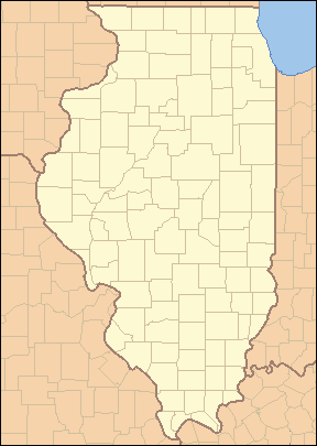
| Name | County | Area (acres) | Area (km2) | Established | Bodies of water | Image | Remarks |
|---|
| Anderson Lake State Fish & Wildlife Area | Fulton | 2,247 | 9.09 | 1947 | Anderson Lake | | |
| Baldwin Lake State Fish & Wildlife Area | Randolph | 2,018 | 8.17 | ? | Baldwin Lake | | |
| Banner Marsh State Fish and Wildlife Area | Fulton | 4,363 | 17.66 | 1980s [5] | Illinois River | | |
| Cape Bend State Fish and Wildlife Area | Alexander | 1,380 | 5.6 | ? | | | |
| Carlyle Lake State Fish and Wildlife Area | Fayette | 37,000 | 150 | 1966 | Carlyle Lake | | |
| Coffeen Lake State Fish and Wildlife Area | Montgomery | 297 | 1.20 | 1966 | Coffeen Lake, Shoal Creek | | |
| Crawford County State Fish and Wildlife Area | Crawford | 1,129 | 4.57 | ? | Huston Creek | | |
| Des Plaines Fish and Wildlife Area | Will | 5,000 | 20 | 1948 | Kankakee River, Milliken Lake | | |
| Devils Island Wildlife Management Area | Alexander, Union | 2,741 | 11.09 | ? | Mississippi River, Picayune Chute | | |
| Double T State Fish and Wildlife Area | Fulton | 1,961 | 7.94 | 2001 | Double T Lake | | |
| Edward R. Madigan State Fish and Wildlife Area | Logan | 974 | 3.94 | 1971 | Salt Creek | | |
| Green River State Wildlife Area | Lee | 2,565 | 10.38 | 1940 | Green River | | |
| Hamilton County State Fish and Wildlife Area | Hamilton | 1,683 | 6.81 | 1962 | Dolan Lake | | |
| Heidecke Lake State Fish & Wildlife Area | Grundy | 1,300 | 5.3 | ? | Heidecke Lake | | |
| Horseshoe Lake State Fish & Wildlife Area | Alexander | 10,200 | 41 | ? | Horseshoe Lake | | |
| Iroquois County State Wildlife Area | Iroquois | 2,480 | 10.0 | 1944 | None | | Occupies the edge of the former Glacial Lake Watseka. |
| Jim Edgar Panther Creek State Fish and Wildlife Area | Cass | 16,550 | 67.0 | June 1993 | Gridley Lake, Prairie Lake, Drake Lake | | |
| Kaskaskia River State Fish & Wildlife Area | St. Clair, Monroe, Randolph | 20,000 | 81 | ? | Kaskaskia River, Baldwin Lake | | |
| Kinkaid Lake State Fish and Wildlife Area | Jackson | 11,750 | 47.6 | 1968 | Kinkaid Lake, Johnson Creek, Reed Creek | | |
| Kishwaukee River State Fish and Wildlife Area | DeKalb | 570 | 2.3 | 2002 | Kishwaukee River | | |
| LaSalle Lake State Fish & Wildlife Area | LaSalle | 2,058 | 8.33 | ? | LaSalle Lake | | |
| Mackinaw River State Fish and Wildlife Area | Tazewell | 1,448 | 5.86 | 1970 | Mackinaw River | | |
| Marshall State Fish & Wildlife Area | Marshall | 6,000 | 24 | 1925 | Illinois River | | |
| Mautino State Fish and Wildlife Area | Bureau | 911 | 3.69 | ? | 15 lakes | | |
| Mazonia/Braidwood State Fish and Wildlife Area | Grundy | 1,017 | 4.12 | 1981 | Braidwood Lake | | |
| Mermet Lake State Fish and Wildlife Area | Massac | 2,630 | 10.6 | 1949 | Mermet Lake | | |
| Middle Fork State Fish and Wildlife Area | Vermilion | 2,700 | 11 | 1986 | Middle Fork | | |
| Mississippi River State Fish and Wildlife Area | Jersey, Calhoun | 24,386 | 98.69 | ? | Stump Lake, Fuller Lake | | |
| Newton Lake State Fish and Wildlife Area | Jasper | 1,775 | 7.18 | 1979 | Newton Lake, Sand Creek, Laws Creek | | |
| Peabody River State Fish and Wildlife Area | Randolph | 2,200 | 8.9 | ? | 20 lakes | | |
| Pekin Lake State Fish and Wildlife Area | Tazewell | 1,181 | 4.78 | ? | Pekin Lake, Worley Lake | | |
| Powerton Lake State Fish and Wildlife Area | Tazewell | 1,426 | 5.77 | September 18, 1984 [6] [7] [8] | Powerton Lake | | |
| Ray Norbut State Fish and Wildlife Area | Pike | 1,140 | 4.6 | 1970 | Illinois River | | |
| Rend Lake State Fish and Wildlife Area | Franklin, Jefferson | 38,900 | 157 | ? | Rend Lake | | |
| Rice Lake State Fish and Wildlife Area | Fulton | 5,660 | 22.9 | 1945 | Rice Lake | | |
| Saline County State Fish and Wildlife Area | Saline | 1,270 | 5.1 | 1959 | Glen O. Jones Lake | | |
| Sam Dale Lake State Fish and Wildlife Area | Wayne | 1,302 | 5.27 | 1959 | Sam Dale Lake | | |
| Sam Parr State Fish and Wildlife Area | Jasper | 1,180 | 4.8 | 1960 | | | |
| Sanganois State Fish and Wildlife Area | Cass, Schuyler, Mason | 10,360 | 41.9 | 1948 | | | |
| Shelbyville State Fish and Wildlife Area | Moultrie | 6,200 | 25 | ? | Kaskaskia River, West Okaw River | | |
| Silver Springs State Fish & Wildlife Area | Kendall | 1,350 | 5.5 | 1969 | Fox River, Loon Lake, Beaver Lake, Silver Springs | | |
| Snakeden Hollow State Fish and Wildlife Area | Knox | 2,500 | 10 | 1987 | Snakeden Hollow Lake | | |
| Spring Lake Fish and Wildlife Area | Tazewell | 2,032 | 8.22 | 1950 | Spring Lake | | |
| Ten Mile Creek State Fish & Wildlife Area | Hamilton, Jefferson | 6,000 | 24 | 1988 | Ten Mile Creek | | |
| Turkey Bluffs State Fish and Wildlife Area | Randolph | 2,264 | 9.16 | ? | | | |
| Union County State Fish and Wildlife Area | Union | 6,202 | 25.10 | 1940s | | | |
| Woodford State Fish and Wildlife Area | Woodford | 2,900 | 12 | | Illinois River, Upper Peoria Lake | | |