Effingham was first settled in 1814, and was known from then until 1859 as Broughton.[3] In 1859, it became the county seat with buildings relocated from nearby (now deserted) Ewington.[4] The community was named after General E. Effingham, a local surveyor.[5]
In the late 1880s, local citizens founded Austin College, which lasted for several decades, and ultimately was purchased to become the Illinois College of Photography, also known as Bissel College. That school closed due to the Great Depression in the 1930s.[6]
On April 4, 1949, St. Anthony's Hospital caught fire and burned to the ground, killing 74 people.[7] As a result, fire codes nationwide were improved. Due to extensive media coverage, including a Life magazine cover story,[7] donations for rebuilding the hospital came from all 48 states and several foreign countries.
Effingham was a sundown town;[8] daytime segregation was enforced until at least the mid-1960s.[9]
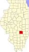
Geography
According to the 2022 census gazetteer files, Effingham has a total area of 10.56 square miles (27.35km2), of which 10.49 square miles (27.17km2) (or 99.34%) is land and 0.07 square miles (0.18km2) (or 0.66%) is water.[10]
As of the 2020 census[13] there were 12,252 people, 5,205 households, and 3,029 families residing in the city. The population density was 1,160.78 inhabitants per square mile (448.18/km2). There were 5,862 housing units at an average density of 555.38 per square mile (214.43/km2). The racial makeup of the city was 91.00% White, 0.85% African American, 0.25% Native American, 1.31% Asian, 0.02% Pacific Islander, 1.80% from other races, and 4.77% from two or more races. Hispanic or Latino of any race were 4.60% of the population.
There were 5,205 households, out of which 27.9% had children under the age of 18 living with them, 41.77% were married couples living together, 11.82% had a female householder with no husband present, and 41.81% were non-families. 33.26% of all households were made up of individuals, and 16.64% had someone living alone who was 65 years of age or older. The average household size was 2.91 and the average family size was 2.29.
The city's age distribution consisted of 22.9% under the age of 18, 8.0% from 18 to 24, 26.4% from 25 to 44, 23.6% from 45 to 64, and 19.2% who were 65 years of age or older. The median age was 37.1 years. For every 100 females, there were 87.1 males. For every 100 females age 18 and over, there were 82.3 males.
The median income for a household in the city was $52,551, and the median income for a family was $69,405. Males had a median income of $37,288 versus $26,182 for females. The per capita income for the city was $31,029. About 10.8% of families and 16.9% of the population were below the poverty line, including 29.8% of those under age 18 and 9.0% of those age 65 or over.
The former Illinois Central line was taken over by Canadian National in 1999,[15]:10 and the former Pennsylvania Railroad was taken over by Conrail, in turn this line is now operated by CSX.
Amtrak, the national passenger rail system, provides service to Effingham under the daily City of New Orleans route to New Orleans and Chicago, and the Saluki and Illini to Chicago and Carbondale. Until October 1, 1979, the station also served Amtrak's former National Limited line between Kansas City and New York City.
Education
Effingham has several schools, both public and private. The private schools are both religiously affiliated and include Saint Anthony and Sacred Heart. Saint Anthony Grade School (SAGS) serves grades preschool (age 3+) to eighth grade. SAGS has the Bullpup as its mascot. Sacred Heart Grade School (SHS) serves preschool (age 3+) to eighth grade. SHS's mascot is the Shamrock. The public schools include the Early Learning Center, South Side Elementary, Central Grade School, Effingham Junior High School (EJHS), and Effingham High School. The Early Learning Center serves preschool and kindergarten age children. South Side Elementary serves first and second graders. Aspire is a school for students who are likely to drop out or those who get expelled. Central Grade School serves third through fifth grade students. Central Grade school's mascot is the Mustang. EJHS serves junior high students in grades six to eight. EJHS's mascot is the Mustang.
Effingham High School (EHS) is the public high school.[16] The new EHS building opened in the fall of 1998, and has a current enrollment of 849.[17] The former EHS building, built in 1939 as a WPA project and expanded in 1965, is currently the junior high, serving grades 6–8. The old junior high, Central School, is now a grade school serving grades 3–5. EHS athletics were originally known as the Warriors but the name was changed after Ada Kepley, a city resident, referred to Effingham as the "Heart of America" in a campaign to attract visitors to the city. The name stuck, with references in the city government and the downtown movie theater named the Heart Theater. EHS athletics are now known as the Flaming Hearts.
Effingham is also home to St. Anthony High School, a private Roman Catholic High School. SAHS athletics are known as the Bulldogs.
Cross at Interstate 57 and 70
Monument
The Cross at the Crossroads, a 198-foot (60m) steel cross erected by the Cross Foundation is located in Effingham and was inaugurated in 2001. The cross is made out of over 180 tons of steel and cost over $1 million.[18] The Cross Foundation claims that the cross is the largest in the United States, standing at 198 feet (60m) with a span of 113 feet (34m).[19]
Comedians and authors have poked fun at the "Effing" portion of the name Effingham and its use in North American and UK slang as a minced oath for the word "fuck".[23] For example, radio comedians Bob and Tom produced a segment on their national radio show referencing Effingham.[24]Ben Folds's album Way to Normal uses a similar play on words in a track that was inspired by driving past Effingham, although the song refers to the city as "Effington".[25]
↑ Loewen, James W. (July 9, 2006). "Honda's All-American Sundown Town". History News Network. The George Washington University. Archived from the original on August 21, 2017. Retrieved August 20, 2017.
↑ "Effingham High School". Effingham Community Schools. Archived from the original on September 10, 2024. Retrieved December 29, 2012.
↑ "Effingham High School". Illinois Report Card. Illinois State Board of Education. Archived from the original on April 10, 2015. Retrieved April 5, 2015.
This page is based on this Wikipedia article Text is available under the CC BY-SA 4.0 license; additional terms may apply. Images, videos and audio are available under their respective licenses.