Carlinville, Illinois | |
---|---|
Coordinates: 39°16′36″N89°51′56″W / 39.27667°N 89.86556°W [1] | |
Country | United States |
State | Illinois |
County | Macoupin |
Townships | Carlinville Brushy Mound |
Founded | 1865 |
Government | |
• Mayor | Sarah Oswald |
Area | |
• Total | 3.37 sq mi (8.72 km2) |
• Land | 3.37 sq mi (8.72 km2) |
Elevation | 617 ft (188 m) |
Population | |
• Total | 5,710 |
• Density | 1,694.86/sq mi (654.48/km2) |
Time zone | UTC-6 (CST) |
• Summer (DST) | UTC-5 (CDT) |
ZIP code | 62626 |
Area code | 217 |
FIPS code | 17-11202 |
GNIS feature ID | 2393743 [1] |
Wikimedia Commons | Carlinville, Illinois |
Website | www |
Carlinville is a city in and the county seat of Macoupin County, Illinois, United States. [4] As of the 2020 census, the population was 5,710.
It is the home of Blackburn College, a small college affiliated with the Presbyterian church. The city is the former home of Prairie Farms Dairy.
Carlinville is named for Thomas Carlin, [5] seventh governor of Illinois, who as a member of the state legislature was instrumental in creating Macoupin County.
Carlinville has long been a site of Illinois history, and played host to many presidential hopefuls via campaign stops at a time in American history when railway routes produced many visits by politicians. Perhaps the largest and most important hallmark of Carlinville's history is its courthouse, the largest built outside of New York City at the time of its erection. Built in 1870 and designed by famous state capitol building architect Elijah E. Myers, the construction of Carlinville's courthouse produced its candidacy for the location of the state capitol.[ citation needed ] Locally, it is known as "The Million Dollar Courthouse" due to its cost overruns at the time it was built.
In the early 1900s Carlinville became the site of a great many Sears Catalog Homes. An entire neighborhood was constructed of the homes and was funded, in 1918, by Standard Oil of Indiana for its mineworkers in Carlinville, at a cost of approximately one million dollars. In gratitude, Sears, Roebuck named one of its house models the "Carlin". Today 149 of the original 156 homes still exist, the largest single repository of Sears Catalog Homes in the United States. [6]
One notable resident of Carlinville was American entomologist Charles Robertson, who carried out what is still the single most intensive study of flower-visiting insects of a single locality (Carlinville), culminating in a 221-page book published in 1928 under the title Flowers and Insects. From among the specimens he collected in the process of doing this study, he named over 100 new species of bees and wasps. Scientists in 1970–1972 did a similar survey, and found that most of the bees noted by Robertson were still present. This is presumably due to the existence of bee habitat in hedgerows, on slopes, and in other non-agricultural land in the survey area. [7]
Other notable Carlinvillians include nature writer and novelist Mary Hunter Austin, once called "the most intelligent woman in America" by H.G. Wells, [8] distinguished military personnel, politicians, and others.
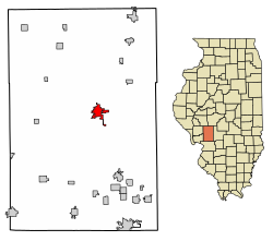
Carlinville is in central Macoupin County. Illinois Routes 4 and 108 pass through the city center, joining as East 1st South Street through the city's east side. Route 4 leads north-northeast 40 miles (64 km) to Springfield, the state capital, and south 21 miles (34 km) to Staunton, while Route 108 leads east 13 miles (21 km) to Interstate 55 and west 29 miles (47 km) to Carrollton.
According to the U.S. Census Bureau, Carlinville has a total area of 3.37 square miles (8.7 km2), all land. [2] Briar Creek passes through the east side of the city, joining Macoupin Creek just south of the city limits. Macoupin Creek is a west-flowing tributary of the Illinois River.
Climate data for Carlinville, Illinois, 1991–2020 normals, extremes 1893–2022 | |||||||||||||
---|---|---|---|---|---|---|---|---|---|---|---|---|---|
Month | Jan | Feb | Mar | Apr | May | Jun | Jul | Aug | Sep | Oct | Nov | Dec | Year |
Record high °F (°C) | 74 (23) | 82 (28) | 91 (33) | 92 (33) | 99 (37) | 106 (41) | 113 (45) | 110 (43) | 105 (41) | 95 (35) | 84 (29) | 74 (23) | 113 (45) |
Mean daily maximum °F (°C) | 36.1 (2.3) | 41.3 (5.2) | 52.1 (11.2) | 65.1 (18.4) | 74.1 (23.4) | 82.9 (28.3) | 86.2 (30.1) | 85.0 (29.4) | 79.2 (26.2) | 67.0 (19.4) | 52.9 (11.6) | 40.9 (4.9) | 63.6 (17.5) |
Daily mean °F (°C) | 27.7 (−2.4) | 32.2 (0.1) | 42.1 (5.6) | 54.0 (12.2) | 63.8 (17.7) | 72.8 (22.7) | 76.1 (24.5) | 74.3 (23.5) | 67.1 (19.5) | 55.4 (13.0) | 43.0 (6.1) | 32.8 (0.4) | 53.4 (11.9) |
Mean daily minimum °F (°C) | 19.2 (−7.1) | 23.0 (−5.0) | 32.2 (0.1) | 42.9 (6.1) | 53.5 (11.9) | 62.6 (17.0) | 66.0 (18.9) | 63.6 (17.6) | 55.1 (12.8) | 43.9 (6.6) | 33.2 (0.7) | 24.6 (−4.1) | 43.3 (6.3) |
Record low °F (°C) | −22 (−30) | −23 (−31) | −12 (−24) | 16 (−9) | 26 (−3) | 37 (3) | 44 (7) | 38 (3) | 25 (−4) | 14 (−10) | −4 (−20) | −20 (−29) | −23 (−31) |
Average precipitation inches (mm) | 2.28 (58) | 2.09 (53) | 2.90 (74) | 4.67 (119) | 4.27 (108) | 4.64 (118) | 3.44 (87) | 3.24 (82) | 3.32 (84) | 3.31 (84) | 3.53 (90) | 2.32 (59) | 40.01 (1,016) |
Average snowfall inches (cm) | 5.8 (15) | 4.7 (12) | 2.3 (5.8) | 0.0 (0.0) | 0.0 (0.0) | 0.0 (0.0) | 0.0 (0.0) | 0.0 (0.0) | 0.0 (0.0) | 0.0 (0.0) | 0.9 (2.3) | 2.8 (7.1) | 16.5 (42.2) |
Average precipitation days (≥ 0.01 in) | 8.5 | 7.1 | 9.0 | 11.4 | 11.3 | 9.4 | 8.1 | 7.3 | 8.1 | 8.9 | 8.0 | 7.8 | 104.9 |
Average snowy days (≥ 0.1 in) | 3.4 | 1.7 | 1.2 | 0.0 | 0.0 | 0.0 | 0.0 | 0.0 | 0.0 | 0.0 | 0.5 | 1.4 | 8.2 |
Source 1: NOAA [9] | |||||||||||||
Source 2: National Weather Service [10] |
Census | Pop. | Note | %± |
---|---|---|---|
1880 | 3,117 | — | |
1890 | 3,293 | 5.6% | |
1900 | 3,502 | 6.3% | |
1910 | 3,616 | 3.3% | |
1920 | 5,212 | 44.1% | |
1930 | 4,144 | −20.5% | |
1940 | 4,965 | 19.8% | |
1950 | 5,116 | 3.0% | |
1960 | 5,440 | 6.3% | |
1970 | 5,675 | 4.3% | |
1980 | 5,439 | −4.2% | |
1990 | 5,416 | −0.4% | |
2000 | 5,685 | 5.0% | |
2010 | 5,917 | 4.1% | |
2020 | 5,710 | −3.5% | |
U.S. Decennial Census [11] |
As of the census [12] of 2000, there were 5,685 people, 2,125 households, and 1,393 families residing in the city. The population density was 2,390 inhabitants per square mile (920/km2). There were 2,289 housing units at an average density of 962.3 per square mile (371.5/km2). The racial makeup of the city was 97.01% White, 1.50% African American, 0.25% Native American, 0.26% Asian, 0.02% Pacific Islander, 0.23% from other races, and 0.74% from two or more races. Hispanic or Latino of any race were 0.76% of the population.
There were 2,125 households, of which 31.1% had children under the age of 18 living with them, 50.3% were married couples living together, 11.3% had a female householder with no husband present, and 34.4% were non-families. 30.1% of all households were made up of individuals, and 15.9% had someone living alone who was 65 years of age or older. The average household size was 2.38 and the average family size was 2.96.
In the city, the population was spread out, with 23.4% under the age of 18, 12.8% from 18 to 24, 25.1% from 25 to 44, 19.4% from 45 to 64, and 19.4% who were 65 years of age or older. The median age was 37 years. For every 100 females, there were 89.7 males. For every 100 females age 18 and over, there were 84.1 males.
The median income for a household in the city was $34,259, and the median income for a family was $39,693. Males had a median income of $35,137 versus $21,286 for females. The per capita income for the city was $16,663. About 9.0% of families and 12.5% of the population were below the poverty line, including 15.3% of those under age 18 and 14.6% of those age 65 or over.
Illinois Route 4 passes north to south through Carlinville. Interstate 55 passes 12 miles (19 km) east of the city. Illinois Route 108 passes through Carlinville connecting Interstate 55 to the east with Kampsville to the west, where it crosses the Illinois River on a free, state-operated ferry.
The Carlinville Amtrak station is served directly by five daily trains, offering easy access south to St. Louis and north to Springfield and Chicago. One train is the Texas Eagle which connects Chicago to Texas and features sleeping cars, a dining car and a lounge.
Freight rail service is provided by the Union Pacific Railroad, formerly the Gulf, Mobile and Ohio, the Illinois Central Gulf, the Chicago, Missouri and Western, and the Southern Pacific Chicago - St. Louis Railways. The main line of the GM&O passed through Carlinville.
The Illinois Terminal Railroad, an electric interurban to St. Louis from Springfield that once provided both freight and passenger service, passed down the middle of Carlinville's West Street. It was still operating freight trains on West Street to a nearby grain elevator into the 1970s. Its trestle crossing Goat Hollow south of Carlinville burned severing the line, which was then abandoned. A small portion of the line is used by Monterey Coal Co. mine to connect with the former Chicago and North Western Transportation Company L & M District, serving coal-fired power plants.
Macoupin County is a county located in the U.S. state of Illinois. According to the 2020 census, it had a population of 44,967. The county seat is Carlinville.
Brighton is a village located mostly in Macoupin County and partially in Jersey County, Illinois, United States. As of the 2020 census, the village had a population of 2,221. The village's current mayor is Matthew P. Kasten.
Benld is a city in Macoupin County, Illinois, United States. The population was 1,464 at the 2020 census, down from 1,556 in 2010. It is located in the Metro-East portion of the Greater St. Louis metropolitan area.
Bunker Hill is a city in Macoupin County, Illinois, United States. The population was 1,630 at the 2020 census, down from 1,774 in 2010.
Chesterfield is a village in Macoupin County, Illinois, United States. The population was 170 at the 2020 census.
Dorchester is a village in Macoupin County, Illinois, United States. The population was 133 at the 2020 census.
East Gillespie is a village in Macoupin County, Illinois, United States. As of the 2020 census, the village had a population of 269.
Gillespie is a city in Macoupin County, Illinois, United States, and part of the Metro East region of the St. Louis metropolitan area. The population was 3,168 at the 2020 census.
Girard is a city in Macoupin County, Illinois, United States. The population was 1,785 at the 2020 census, down from 2,103 in 2010.
Hettick is a village in Macoupin County, Illinois, United States. The population was 149 at the 2020 census, down from 181 in 2010.
Medora is a village in Macoupin County, Illinois, United States. The population was 379 at the 2020 census, down from 419 in 2010.
Modesto is a village in Macoupin County, Illinois, United States. The population was 182 at the 2020 census, down from 252 in 2000.
Mount Olive is a city in Macoupin County, Illinois, United States. The population was 2,015 at the 2020 census. The city is part of the Metro East region within the St. Louis metropolitan area.
Nilwood is an incorporated town in Macoupin County, Illinois, United States. The population was 201 at the 2020 census, down from 284 in 2000.
Palmyra is a village in Macoupin County, Illinois, United States. The population was 605 at the 2020 census, down from 698 in 2010.
Shipman is a village in Macoupin County, Illinois, United States. The population was 511 at the 2020 census, down from 624 in 2010.
Standard City is a village in Macoupin County, Illinois, United States. The population was 135 at the 2020 census.
Staunton is the second largest city in Macoupin County, Illinois, United States. As of the 2020 census, the population was 5,054.
Virden is a city in Macoupin and Sangamon counties in the U.S. state of Illinois. The population was 3,231 at the 2020 census.
Wilsonville is a village in Macoupin County, Illinois, United States. The population was 536 at the 2020 census.