List of counties in Illinois

Last updated

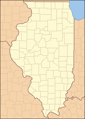
Counties of Illinois
Location State of Illinois
Number102
Populations3,569 (Hardin) – 5,087,072 (Cook)
Areas172 square miles (450 km2) (Putnam) – 1,186 square miles (3,070 km2) (McLean)
Government
Subdivisions

There are 102 counties in Illinois. The most populous of these is Cook County, the second-most populous county in the United States and the home of Chicago, while the least populous is Hardin County. The largest by land area is McLean County, while the smallest is Putnam County. Illinois's FIPS state code is 17 and its postal abbreviation is IL.

Contents

What is now Illinois was claimed as part of Illinois County, Virginia, between 1778 and 1782. Modern-day county formation dates to 1790 when the area was part of the Northwest Territory; two counties—St. Clair and Knox—were created at that time. Knox would later become a county in Indiana and is unrelated to the current Knox County in Illinois, while St. Clair would become the oldest county in Illinois. 15 counties had been created by the time Illinois achieved statehood in 1818. The last county, Ford County, was created in 1859. Cook County, established in 1831 and named for the early Illinois Attorney General Daniel Pope Cook, contained the absolute majority of the state's population in the first half of the 20th century and retains more than 40% of it as of the 2020 Census .

Most counties in Illinois were named after early American leaders, especially of the American Revolutionary War, as well as soldiers from the Battle of Tippecanoe and the War of 1812. Some are named after natural features or counties in other states. Some are named for early Illinois leaders. Two counties are named for Native American tribes, and one bears the name of a plant used as a food source by Native Americans. While it does have a Lincoln city, Illinois does not have a county named after its favorite son, Abraham Lincoln; it does, however, have a Douglas County (founded 1859) named after his political rival Stephen A. Douglas. It also has Calhoun County (founded 1825), named after John C. Calhoun, outspoken for his pro-slavery and pro-southern views in the years preceding the American Civil War. Several of the counties are named after Southerners, reflecting the fact that Illinois was for a short time part of Virginia, and settled in its early years by many Southerners. No counties are named after heroes of the Civil War, mainly because the counties were all named before that war. The state does have a Lee County (founded 1839) named after Henry Lee III, the father of Robert E. Lee, who at one time served in Illinois. Illinois also has two counties named after the same person, New York governor DeWitt Clinton (DeWitt County, and Clinton County).

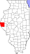
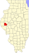
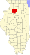
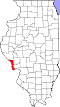
Information on the FIPS county code, county seat, year of establishment, origin, etymology, population, area and map of each county is included in the table below.

Counties

Note: the links in the FIPS County Code column are to the United States Census Bureau page for that county.

County
FIPS code [1] County seat [2] Est. [2] OriginEtymology [3] [4] Population [5] Area [2] Map
AdamsCounty 001 Quincy 1825Pike County John Quincy Adams (1767–1848), sixth President of the United States 64,441855 sq mi
(2,214 km2)
Map of Illinois highlighting Adams County.svg
AlexanderCounty 003 Cairo 1819Union County William M. Alexander, settler and state representative in the Illinois General Assembly 4,695236 sq mi
(611 km2)
Map of Illinois highlighting Alexander County.svg
BondCounty 005 Greenville 1817Crawford County, Edwards County, and Madison County Shadrach Bond (1773–1832), first Governor of Illinois 16,450380 sq mi
(984 km2)
Map of Illinois highlighting Bond County.svg
BooneCounty 007 Belvidere 1837Winnebago County Daniel Boone (1734–1820), trailblazer of the Wilderness Road in Kentucky53,202280 sq mi
(725 km2)
Map of Illinois highlighting Boone County.svg
BrownCounty 009 Mount Sterling 1839Schuyler County Jacob Brown (1775–1828), successful War of 1812 army officer responsible for Great Lakes defenses6,294305 sq mi
(790 km2)
Map of Illinois highlighting Brown County.svg
BureauCounty 011 Princeton 1837Putnam CountyPierre de Bureo, Frenchman, North American fur trader 32,729869 sq mi
(2,251 km2)
Map of Illinois highlighting Bureau County.svg
CalhounCounty 013 Hardin 1825Pike County John C. Calhoun (1782–1850), South Carolina senator and seventh Vice President of the United States 4,317253 sq mi
(655 km2)
Map of Illinois highlighting Calhoun County.svg
CarrollCounty 015 Mount Carroll 1839Jo Daviess Charles Carroll of Carrollton (1737–1832), signed the Declaration of Independence on behalf of Maryland 15,526445 sq mi
(1,153 km2)
Map of Illinois highlighting Carroll County.svg
CassCounty 017 Virginia 1837Morgan County Lewis Cass (1782–1866), second governor of Michigan Territory, fourteenth United States Secretary of War 12,596375 sq mi
(971 km2)
Map of Illinois highlighting Cass County.svg
ChampaignCounty 019 Urbana 1833Vermilion County Champaign County, Ohio, which took its name from the French for "open level country"205,644996 sq mi
(2,580 km2)
Map of Illinois highlighting Champaign County.svg
ChristianCounty 021 Taylorville 1839Sangamon County Christian County, Kentucky, which was named after William Christian 33,228709 sq mi
(1,836 km2)
Map of Illinois highlighting Christian County.svg
ClarkCounty 023 Marshall 1819Crawford County George Rogers Clark (1752–1818), highest-ranking officer in the Northwest Territory during the American Revolution 15,088501 sq mi
(1,298 km2)
Map of Illinois highlighting Clark County.svg
ClayCounty 025 Louisville 1824Wayne, Lawrence, Fayette, and Crawford County Henry Clay (1777–1852), Kentucky legislator who negotiated the Missouri Compromise 12,999468 sq mi
(1,212 km2)
Map of Illinois highlighting Clay County.svg
ClintonCounty 027 Carlyle 1824Washington, Bond, and Fayette County DeWitt Clinton (1769–1828), Governor of New York, responsible for the construction of the Erie Canal 36,785474 sq mi
(1,228 km2)
Map of Illinois highlighting Clinton County.svg
ColesCounty 029 Charleston 1830Clark and Edgar County Edward Coles (1786–1868), second Governor of Illinois, responsible for the abolition of slavery in Illinois46,060508 sq mi
(1,316 km2)
Map of Illinois highlighting Coles County.svg
CookCounty 031 Chicago 1831Putnam County Daniel Pope Cook (1794–1827), politician and first Attorney General of Illinois 5,087,072944 sq mi
(2,445 km2)
Map of Illinois highlighting Cook County.svg
CrawfordCounty 033 Robinson 1816Edwards County William H. Crawford (1772–1834), ninth United States Secretary of War, seventh Secretary of the Treasury 18,300443 sq mi
(1,147 km2)
Map of Illinois highlighting Crawford County.svg
CumberlandCounty 035 Toledo 1843Coles CountyDisputed: Cumberland Road, which entered the county; Cumberland, Maryland; or Cumberland River in Kentucky10,261345 sq mi
(894 km2)
Map of Illinois highlighting Cumberland County.svg
DeKalbCounty 037 Sycamore 1837Kane County Johann de Kalb (1721–1780), German officer in the Continental Army who fought alongside Gilbert du Motier, marquis de Lafayette 100,288631 sq mi
(1,634 km2)
Map of Illinois highlighting DeKalb County.svg
DeWittCounty 039 Clinton 1839Macon and McLean County DeWitt Clinton (1769–1828), Governor of New York, responsible for the construction of the Erie Canal 15,365397 sq mi
(1,028 km2)
Map of Illinois highlighting DeWitt County.svg
DouglasCounty 041 Tuscola 1859Coles County Stephen A. Douglas (1813–1861), prominent Illinois Democrat who engaged in debates with Abraham Lincoln 19,629416 sq mi
(1,077 km2)
Map of Illinois highlighting Douglas County.svg
DuPageCounty 043 Wheaton 1839Cook County DuPage River 921,213327 sq mi
(847 km2)
Map of Illinois highlighting DuPage County.svg
EdgarCounty 045 Paris 1823Clark County John Edgar (c. 1750–1832), Illinois delegate to the Northwest Territory legislature; at the time, wealthiest man in Illinois16,334623 sq mi
(1,614 km2)
Map of Illinois highlighting Edgar County.svg
EdwardsCounty 047 Albion 1814Gallatin County and Madison County Ninian Edwards (1775–1833), third Governor of the State of Illinois and only governor of the Illinois Territory 5,968222 sq mi
(575 km2)
Map of Illinois highlighting Edwards County.svg
EffinghamCounty 049 Effingham 1831Fayette and Crawford County Thomas Howard, 3rd Earl of Effingham, military officer who resigned from the British Army to avoid fighting the American colonies34,331478 sq mi
(1,238 km2)
Map of Illinois highlighting Effingham County.svg
FayetteCounty 051 Vandalia 1821Bond, Wayne, Clark, Jefferson, and Crawford County Gilbert du Motier, marquis de Lafayette (1757–1834), French military officer who was a key factor in the American and French Revolutions.21,164716 sq mi
(1,854 km2)
Map of Illinois highlighting Fayette County.svg
FordCounty 053 Paxton 1859Vermilion County Thomas Ford (1800–1850), eighth Governor of Illinois; served during the Illinois Mormon War 13,250485 sq mi
(1,256 km2)
Map of Illinois highlighting Ford County.svg
FranklinCounty 055 Benton 1818White County and Gallatin County Benjamin Franklin (1706–1790), prolific writer, inventor, and politician; key factor in the American Revolution 37,138408 sq mi
(1,057 km2)
Map of Illinois highlighting Franklin County.svg
FultonCounty 057 Lewistown 1823Pike County Robert Fulton (1765–1815), inventor of the steamboat 32,541865 sq mi
(2,240 km2)
Map of Illinois highlighting Fulton County.svg
GallatinCounty 059 Shawneetown 1812Randolph County Albert Gallatin (1761–1849), fourth and longest-serving United States Secretary of the Treasury 4,670322 sq mi
(834 km2)
Map of Illinois highlighting Gallatin County.svg
GreeneCounty 061 Carrollton 1821Madison County Nathanael Greene (1742–1786), major general in the Continental Army 11,543543 sq mi
(1,406 km2)
Map of Illinois highlighting Greene County.svg
GrundyCounty 063 Morris 1841LaSalle County Felix Grundy (1777–1840), Tennessean senator who served as the thirteenth United States Attorney General 53,578418 sq mi
(1,083 km2)
Map of Illinois highlighting Grundy County.svg
HamiltonCounty 065 McLeansboro 1821White County Alexander Hamilton (1755–1804), first United States Secretary of the Treasury 7,911434 sq mi
(1,124 km2)
Map of Illinois highlighting Hamilton County.svg
HancockCounty 067 Carthage 1825Adams County John Hancock (1737–1793), first governor of the Massachusetts colony and president of the Second Continental Congress 17,186793 sq mi
(2,054 km2)
Map of Illinois highlighting Hancock County.svg
HardinCounty 069 Elizabethtown 1839Pope County Hardin County, Kentucky, which was named after John Hardin 3,569177 sq mi
(458 km2)
Map of Illinois highlighting Hardin County.svg
HendersonCounty 071 Oquawka 1841Warren County Henderson County, Kentucky, which was named after Richard Henderson 6,088378 sq mi
(979 km2)
Map of Illinois highlighting Henderson County.svg
HenryCounty 073 Cambridge 1825Fulton County Patrick Henry (1736–1799), American Revolutionary War figure; first and sixth Governor of Virginia 48,448822 sq mi
(2,129 km2)
Map of Illinois highlighting Henry County.svg
IroquoisCounty 075 Watseka 1833Vermilion County Iroquois Native Americans26,1361,117 sq mi
(2,893 km2)
Map of Illinois highlighting Iroquois County.svg
JacksonCounty 077 Murphysboro 1816Randolph County and Johnson County Andrew Jackson (1767–1845), seventh President of the United States, United States Senator from Tennessee, and general in the War of 1812 52,141584 sq mi
(1,513 km2)
Map of Illinois highlighting Jackson County.svg
JasperCounty 079 Newton 1831Clay and Crawford CountySgt. William Jasper (c. 1750–1779), American Revolutionary War soldier popularized by Parson Weems 9,144494 sq mi
(1,279 km2)
Map of Illinois highlighting Jasper County.svg
JeffersonCounty 081 Mount Vernon 1819Edwards and White County Thomas Jefferson (1743–1826), third President of the United States, second Vice President of the United States, Governor of Virginia, and one of the foremost Founding Fathers of the United States 36,320571 sq mi
(1,479 km2)
Map of Illinois highlighting Jefferson County.svg
JerseyCounty 083 Jerseyville 1839Greene CountyState of New Jersey, from which many early settlers hailed21,091369 sq mi
(956 km2)
Map of Illinois highlighting Jersey County.svg
Jo DaviessCounty 085 Galena 1827Henry, Mercer, and Putnam County Joseph Hamilton Daveiss (1774–1811), commander of the Indiana Dragoons at the Battle of Tippecanoe 21,756600 sq mi
(1,554 km2)
Map of Illinois highlighting Jo Daviess County.svg
JohnsonCounty 087 Vienna 1812Randolph County Richard Mentor Johnson (c. 1780–1850), ninth Vice President of the United States and United States Senator from Kentucky 13,326343 sq mi
(888 km2)
Map of Illinois highlighting Johnson County.svg
KaneCounty 089 Geneva 1836LaSalle County Elias Kane (1794–1835), United States Senator from Illinois 514,982519 sq mi
(1,344 km2)
Map of Illinois highlighting Kane County.svg
KankakeeCounty 091 Kankakee 1853Iroquois and Will County Kankakee River 105,940676 sq mi
(1,751 km2)
Map of Illinois highlighting Kankakee County.svg
KendallCounty 093 Yorkville 1841LaSalle and Kane County Amos Kendall (1789–1869), United States Postmaster General under Presidents Andrew Jackson and Martin Van Buren 139,976320 sq mi
(829 km2)
Map of Illinois highlighting Kendall County.svg
KnoxCounty 095 Galesburg 1825Fulton CountyGen. Henry Knox (1750–1806), American Revolutionary War general and first United States Secretary of War 48,411716 sq mi
(1,854 km2)
Map of Illinois highlighting Knox County.svg
LakeCounty 097 Waukegan 1839McHenry County Lake Michigan 708,760443 sq mi
(1,147 km2)
Map of Illinois highlighting Lake County.svg
LaSalleCounty 099 Ottawa 1831Putnam and Tazewell County Sieur de la Salle (1643–1687), French explorer of the Great Lakes 108,3091,135 sq mi
(2,940 km2)
Map of Illinois highlighting LaSalle County.svg
LawrenceCounty 101 Lawrenceville 1821Crawford and Edwards CountyCapt. James Lawrence (1781–1813), commander of the USS Chesapeake in the War of 1812. Famous for his command "Don't give up the ship!"14,813372 sq mi
(963 km2)
Map of Illinois highlighting Lawrence County.svg
LeeCounty 103 Dixon 1839Ogle County"Light Horse" Henry Lee III (1756–1818), American Revolutionary War officer and ninth Governor of Virginia 33,654724 sq mi
(1,875 km2)
Map of Illinois highlighting Lee County.svg
LivingstonCounty 105 Pontiac 1837LaSalle and McLean County Edward Livingston (1764–1836), prominent jurist, Congressman from New York and Louisiana, and U.S. Secretary of State from 1831-3335,3201,043 sq mi
(2,701 km2)
Map of Illinois highlighting Livingston County.svg
LoganCounty 107 Lincoln 1839Sangamon CountyJohn Logan, country doctor and early settler, and the father of John A. Logan 27,590618 sq mi
(1,601 km2)
Map of Illinois highlighting Logan County.svg
MaconCounty 115 Decatur 1829Shelby County Nathaniel Macon (1758–1837), sixth Speaker of the United States House of Representatives and United States Senator from North Carolina 100,591580 sq mi
(1,502 km2)
Map of Illinois highlighting Macon County.svg
MacoupinCounty 117 Carlinville 1829Greene CountyNative American word macoupin, meaning "American lotus"44,018862 sq mi
(2,233 km2)
Map of Illinois highlighting Macoupin County.svg
MadisonCounty 119 Edwardsville 1812St. Clair County and Randolph County James Madison (1751–1836), fourth President of the United States and principal author of the Constitution of the United States 262,752716 sq mi
(1,854 km2)
Map of Illinois highlighting Madison County.svg
MarionCounty 121 Salem 1823Fayette and Jefferson County Francis Marion (c. 1732–1795), general in the American Revolutionary War known as "The Swamp Fox"36,673572 sq mi
(1,481 km2)
Map of Illinois highlighting Marion County.svg
MarshallCounty 123 Lacon 1839Putnam CountyJohn Marshall (1755–1835), fourth and longest-serving Chief Justice of the United States, wrote opinion in Marbury v. Madison establishing the principle of judicial review 11,683386 sq mi
(1,000 km2)
Map of Illinois highlighting Marshall County.svg
MasonCounty 125 Havana 1841Tazewell and Menard CountyNamed after Mason County, Kentucky, itself named after George Mason 12,523539 sq mi
(1,396 km2)
Map of Illinois highlighting Mason County.svg
MassacCounty 127 Metropolis 1843Pope and Johnson County Fort Massac, a colonial-era fort on the Ohio River 13,661237 sq mi
(614 km2)
Map of Illinois highlighting Massac County.svg
McDonoughCounty 109 Macomb 1826Schuyler CountyCommodore Thomas Macdonough (1783–1825), commander of American naval forces at the Battle of Plattsburgh 26,839589 sq mi
(1,526 km2)
Map of Illinois highlighting McDonough County.svg
McHenryCounty 111 Woodstock 1836Cook and LaSalle CountyMajor William McHenry (c. 1771–1835), officer during several campaigns against Native Americans and was a member of the Illinois legislature312,800603 sq mi
(1,562 km2)
Map of Illinois highlighting McHenry County.svg
McLeanCounty 113 Bloomington 1830Tazewell County John McLean (1791–1830), United States Representative and United States Senator from Illinois (the latter from 1824–25 and 1829–30)170,4411,183 sq mi
(3,064 km2)
Map of Illinois highlighting McLean County.svg
MenardCounty 129 Petersburg 1839Sangamon County Pierre Menard (1766–1844), prominent early settler and first Lieutenant Governor of Illinois 11,954314 sq mi
(813 km2)
Map of Illinois highlighting Menard County.svg
MercerCounty 131 Aledo 1825Schuyler County Hugh Mercer (1726–1777), British officer in the Seven Years' War and general in the Continental Army during the American Revolutionary War 15,487561 sq mi
(1,453 km2)
Map of Illinois highlighting Mercer County.svg
MonroeCounty 133 Waterloo 1816Randolph County and St. Clair County James Monroe (1758–1831), seventh United States Secretary of State, eighth United States Secretary of War, Governor of Virginia, and fifth President of the United States 34,957385 sq mi
(997 km2)
Map of Illinois highlighting Monroe County.svg
MontgomeryCounty 135 Hillsboro 1821Bond and Madison CountyGen. Richard Montgomery (1738–1775), brigadier-general in the Continental Army who led the unsuccessful invasion of Canada 27,663703 sq mi
(1,821 km2)
Map of Illinois highlighting Montgomery County.svg
MorganCounty 137 Jacksonville 1823Sangamon CountyGen. Daniel Morgan (1736–1802), successful tactician in the American Revolutionary War and later United States Representative from Virginia 32,140568 sq mi
(1,471 km2)
Map of Illinois highlighting Morgan County.svg
MoultrieCounty 139 Sullivan 1843Shelby and Macon CountyGen. William Moultrie (1730–1805), American Revolutionary War general and Governor of South Carolina 14,342335 sq mi
(868 km2)
Map of Illinois highlighting Moultrie County.svg
OgleCounty 141 Oregon 1836Jo Daviess Joseph Ogle (1737–1821), early settler in southwest Illinois, who helped found the first Methodist church in Illinois51,265758 sq mi
(1,963 km2)
Map of Illinois highlighting Ogle County.svg
PeoriaCounty 143 Peoria 1825Fulton CountyThe Peoria Native American tribe177,513618 sq mi
(1,601 km2)
Map of Illinois highlighting Peoria County.svg
PerryCounty 145 Pinckneyville 1827Randolph and Jackson CountyCmdre. Oliver Hazard Perry (1785–1819), American naval officer who led the victorious American forces at the Battle of Lake Erie 20,503441 sq mi
(1,142 km2)
Map of Illinois highlighting Perry County.svg
PiattCounty 147 Monticello 1841DeWitt and Macon CountyJames A. Piatt, the patriarch of a prominent settler family in the early history of the county16,714439 sq mi
(1,137 km2)
Map of Illinois highlighting Piatt County.svg
PikeCounty 149 Pittsfield 1821Madison, Bond, and Clark County Zebulon Pike (1779–1813), early explorer of the American Southwest, namesake of Pikes Peak 14,342831 sq mi
(2,152 km2)
Map of Illinois highlighting Pike County.svg
PopeCounty 151 Golconda 1816Gallatin and Johnson County Nathaniel Pope (1784–1850), early Delegate from Illinois Territory to Congress and judge on the United States District Court for the District of Illinois 3,707368 sq mi
(953 km2)
Map of Illinois highlighting Pope County.svg
PulaskiCounty 153 Mound City 1843Alexander and Johnson CountyGen. Casimir Pulaski (1745–1779), Polish American general of cavalry in the American Revolutionary War 4,911199 sq mi
(515 km2)
Map of Illinois highlighting Pulaski County.svg
PutnamCounty 155 Hennepin 1825Fulton CountyGen. Israel Putnam (1718–1790), commander of American forces at the Battle of Bunker Hill 5,561160 sq mi
(414 km2)
Map of Illinois highlighting Putnam County.svg
RandolphCounty 157 Chester 1795St. Clair County Edmund Randolph (1753–1813), first Attorney General of the United States, and briefly United States Secretary of State 29,815575 sq mi
(1,489 km2)
Map of Illinois highlighting Randolph County.svg
RichlandCounty 159 Olney 1841Clay and Lawrence County Richland County, Ohio, itself named for its rich soil 15,488360 sq mi
(932 km2)
Map of Illinois highlighting Richland County.svg
Rock IslandCounty 161 Rock Island 1831Jo Daviess County Rock Island 141,236427 sq mi
(1,106 km2)
Map of Illinois highlighting Rock Island County.svg
SalineCounty 165 Harrisburg 1847Gallatin CountyThe Saline River and salt springs in the county22,873379 sq mi
(982 km2)
Map of Illinois highlighting Saline County.svg
SangamonCounty 167 Springfield 1821Madison and Bond County Sangamon River 193,491868 sq mi
(2,248 km2)
Map of Illinois highlighting Sangamon County.svg
SchuylerCounty 169 Rushville 1825Pike and Fulton CountyGen. Philip Schuyler (1733–1804), American Revolutionary War general and United States Senator from New York 6,733437 sq mi
(1,132 km2)
Map of Illinois highlighting Schuyler County.svg
ScottCounty 171 Winchester 1839Morgan County Scott County, Kentucky, itself named after Charles Scott 4,710250 sq mi
(647 km2)
Map of Illinois highlighting Scott County.svg
ShelbyCounty 173 Shelbyville 1827Fayette County Isaac Shelby (1750–1826), soldier in the American Revolutionary War and War of 1812; first and fifth Governor of Kentucky 20,568758 sq mi
(1,963 km2)
Map of Illinois highlighting Shelby County.svg
St. ClairCounty 163 Belleville 1790original two counties Arthur St. Clair (1737–1818), major general in the American Revolutionary War and first Governor of the Northwest Territory 251,018657 sq mi
(1,702 km2)
Map of Illinois highlighting St. Clair County.svg
StarkCounty 175 Toulon 1839Knox and Putnam CountyGen. John Stark (1728–1822), general in the American Revolutionary War, called the "Hero of Bennington"5,218288 sq mi
(746 km2)
Map of Illinois highlighting Stark County.svg
StephensonCounty 177 Freeport 1837Jo Daviess and Winnebago County Benjamin Stephenson (1769–1822), representative of Illinois Territory in the United States Congress from 1814 to 181643,105564 sq mi
(1,461 km2)
Map of Illinois highlighting Stephenson County.svg
TazewellCounty 179 Pekin 1827Sangamon County Littleton Waller Tazewell (1774–1860), United States Senator from (and later governor of) Virginia 129,541646 sq mi
(1,673 km2)
Map of Illinois highlighting Tazewell County.svg
UnionCounty 181 Jonesboro 1818Johnson CountyThe union of the United States 16,667413 sq mi
(1,070 km2)
Map of Illinois highlighting Union County.svg
VermilionCounty 183 Danville 1826Edgar CountyThe Vermilion River 71,652898 sq mi
(2,326 km2)
Map of Illinois highlighting Vermilion County.svg
WabashCounty 185 Mount Carmel 1824Edwards CountyThe Wabash River 10,942223 sq mi
(578 km2)
Map of Illinois highlighting Wabash County.svg
WarrenCounty 187 Monmouth 1825Schuyler County Joseph Warren (1741–1775), played a role in American Patriot movements, a prominent early fatality in the American Revolutionary War 16,185542 sq mi
(1,404 km2)
Map of Illinois highlighting Warren County.svg
WashingtonCounty 189 Nashville 1818St. Clair County George Washington (1732–1799), commander-in-chief of American forces in the American Revolutionary War and first President of the United States 13,536562 sq mi
(1,456 km2)
Map of Illinois highlighting Washington County.svg
WayneCounty 191 Fairfield 1819Edwards CountyGen. "Mad" Anthony Wayne (1745–1796), major general in the United States Army in the American Revolutionary War and the Northwest Indian War 15,761713 sq mi
(1,847 km2)
Map of Illinois highlighting Wayne County.svg
WhiteCounty 193 Carmi 1815Gallatin County Isaac White (1776–1811), resident of Illinois who enlisted in the Indiana militia and was killed at the Battle of Tippecanoe 13,401494 sq mi
(1,279 km2)
Map of Illinois highlighting White County.svg
WhitesideCounty 195 Morrison 1836Jo Daviess and Henry County Samuel Whiteside (1783–1868), state legislator and militia leader54,498684 sq mi
(1,772 km2)
Map of Illinois highlighting Whiteside County.svg
WillCounty 197 Joliet 1836Cook and Iroquois County Conrad Will (1779–1835), [6] physician, local businessman and longtime member of the state legislature700,728835 sq mi
(2,163 km2)
Map of Illinois highlighting Will County.svg
WilliamsonCounty 199 Marion 1839Franklin County Williamson County, Tennessee, which was named for Hugh Williamson 66,706420 sq mi
(1,088 km2)
Map of Illinois highlighting Williamson County.svg
WinnebagoCounty 201 Rockford 1836Jo Daviess County Winnebago Native Americans280,922513 sq mi
(1,329 km2)
Map of Illinois highlighting Winnebago County.svg
WoodfordCounty 203 Eureka 1841Tazewell and McLean County Woodford County, Kentucky, which was named for William Woodford 38,285527 sq mi
(1,365 km2)
Map of Illinois highlighting Woodford County.svg

Defunct counties

See also

Notes

  1. "U.S. Census Bureau 2019 FIPS Codes". census.gov. Retrieved January 8, 2021.
  2. 1 2 3 "County Explorer". National Association of Counties . Retrieved January 8, 2021.
  3. "Illinois County Biographies". Genealogy Trails.com. Genealogy Trails. 2000. Retrieved September 21, 2008.
  4. "The Origin of Illinois County Names". Genealogy Trails.com. Genealogy Trails. 2000. Retrieved September 21, 2008.
  5. "U.S. Census Bureau QuickFacts: Illinois" . Retrieved April 19, 2024.
  6. Matile, Roger (June 22, 2006). "Reflections: Was Dr. Conrad Will really worth his salt?". Ledger-Sentinel. Retrieved October 11, 2011.

Related Research Articles

<span class="mw-page-title-main">DeWitt County, Illinois</span> County in Illinois, United States

DeWitt County is a county located in the U.S. state of Illinois. As of the 2020 census, the population was 15,516. Its county seat is Clinton. The county was formed on March 1, 1839, from Macon and McLean counties. The county was named in honor of the seventh Governor of New York State, DeWitt Clinton.

<span class="mw-page-title-main">County (United States)</span> Subdivision used by most states in the United States

In the United States, a county or county equivalent is an administrative or political subdivision of a U.S. state or other territories of the United States which consists of a geographic area with specific boundaries and usually some level of governmental authority. The term "county" is used in 48 states, while Louisiana and Alaska have functionally equivalent subdivisions called parishes and boroughs, respectively. The specific governmental powers of counties vary widely between the states, with many providing some level of services to civil townships, municipalities, and unincorporated areas. Certain municipalities are in multiple counties; New York City is uniquely partitioned into five counties, referred to at the city government level as boroughs. Some municipalities have been consolidated with their county government to form consolidated city-counties, or have been legally separated from counties altogether to form independent cities. Conversely, those counties in Connecticut, Rhode Island, eight of Massachusetts's 14 counties, and Alaska's Unorganized Borough have no government power, existing only as geographic distinctions.

<span class="mw-page-title-main">Knox County, Indiana</span> County in Indiana, United States

Knox County is a county in the U.S. state of Indiana in the United States. The oldest county in Indiana, it was one of two original counties created in the Northwest Territory in 1790, alongside St. Clair County, Illinois. Knox County was gradually reduced in size as subsequent counties were established. It was established in its present configuration when Daviess County was partitioned off. At the 2020 United States Census, the county population was 36,282. The county seat is Vincennes.

<span class="mw-page-title-main">St. Clair County, Illinois</span> County in Illinois, United States

St. Clair County is the ninth most populous county in Illinois. Located directly east of St. Louis, the county is part of the Metro East region of the Greater St. Louis metropolitan area in southern Illinois. As of the 2020 United States census, St. Clair County had a population of 257,400, making it the third most populous county in Illinois outside the Chicago metropolitan area. Belleville is the county’s seat and largest city.

<span class="mw-page-title-main">Knox County, Illinois</span> County in Illinois, United States

Knox County is a county in the U.S. state of Illinois. According to the 2020 census, it had a population of 49,967. Its county seat is Galesburg.

<span class="mw-page-title-main">Calhoun County, Illinois</span> County in Illinois, United States

Calhoun County is a county in the U.S. state of Illinois. As of the 2020 census, the population was 4,437, making it Illinois’ third-least populous county. Its county seat and biggest community is Hardin, with a population of 801. Its smallest incorporated community is Hamburg, with a population of 99. Calhoun County is at the tip of the peninsula formed by the courses of the Mississippi and Illinois rivers above their confluence and is almost completely surrounded by water. Calhoun County is sparsely populated; it has just five municipalities, all of them villages.

<span class="mw-page-title-main">50th Illinois General Assembly</span> Illinois state legislature

The 50th Illinois General Assembly met from 1917 to 1919. John G. Oglesby of Decatur was the Lieutenant Governor of Illinois and thus ex officio President of the Senate. Adam C. Cliffe of Sycamore was President pro tempore of the Senate. David Shanahan of Chicago was the Speaker of the House of Representatives.

<span class="mw-page-title-main">54th Illinois General Assembly</span> Illinois state legislature

The 54th Illinois General Assembly met from 1925 to 1927. Fred E. Sterling of Rockford was the Lieutenant Governor of Illinois and thus ex officio President of the Senate. Richard J. Barr of Joliet was President pro tempore of the Senate. Robert Scholes of Peoria was the Speaker of the House of Representatives.

<span class="mw-page-title-main">48th Illinois General Assembly</span> Illinois state legislature

The 48th Illinois General Assembly met from 1913 to 1915. Barratt O'Hara of Chicago was the Lieutenant Governor of Illinois and thus ex officio President of the Senate. Walter I. Manny was President pro tempore of the Senate. William B. McKinley of Chicago was the Speaker of the House of Representatives.

<span class="mw-page-title-main">60th Illinois General Assembly</span> Illinois state legislature

The 60th Illinois General Assembly met from 1937 to 1939. John H. Stelle was the Lieutenant Governor of Illinois and thus ex officio President of the Senate. George M. Maypole of Chicago was President pro tempore of the Senate. Louie E. Lewis was the Speaker of the House of Representatives.

References