Vermilion County is named after the Vermilion River, which passes through the county and empties into the Wabash River in Indiana near Cayuga; the river was so named because of the color of the earth along its route.[4][5]
The area which became Vermilion County was under the flag of France from 1682 to 1763, as part of New France.
It was taken over by Great Britain for fifteen years after the French and Indian War; it then became part of the colonies after the Revolutionary War when the area was ceded to Virginia, titled "the Illinois County of Virginia". Later it was part of the Indiana Territory, then the Illinois Territory, and finally the state of Illinois.[6] The county was created on January 18, 1826, from a portion of Edgar County. There was an unorganized territory to the north and west which was attached to the county; Champaign and Iroquois counties were formed from part of this territory in 1833. The remainder was used to create Ford County in 1859, the last Illinois county to be formed.
The county's saline springs were a strong attraction to early explorers; they were mentioned as early as 1801. Joseph Barron, an interpreter fluent in several Native American languages, stated in an affidavit that he was present at the "Vermilion Salines" that year. The production required 100 gallons of water for one bushel of salt and proved to be profitable from the first run (1822–1829), when salt became less expensive and the venture was no longer economical.[7]
The area's first settlement was made in 1819 near these saline springs, by the Treat, Beckwith, and Whitcomb. James Butler, from Ohio, followed in 1820 and settled in the Catlin area; within a few years, the settlement grew to encompass several families and became known as "Butler's Point". In the southern part of the county, Henry Johnson built a cabin west of present-day Georgetown; this area was known as "Johnson's Point". The southern portion of the county was soon filled with small settlements. Most settlers in Vermilion County came from Kentucky, East Tennessee, Virginia, and Western North Carolina, and those settlers left the South as they were opposed to slavery.[8]
Some of the early settlers were of the Religious Society of Friends, or Quakers. They founded the settlement of Vermilion Grove in the south part of the county, one of the county's first settlements and the site of the county's second public school.
The county has strong ties to Abraham Lincoln, who practiced law in Danville from 1841 to 1859 with Ward Hill Lamon; Lamon later served as Lincoln's bodyguard. Lincoln spoke in Danville during his 1858 campaign for a seat in the US Senate. Lincoln gave the speech in his stocking feet from the balcony of Dr. William Fithian, a prominent local physician. The Fithian home is now listed on the National Register of Historic Places and serves as the Vermilion County Museum;[9] visitors can see Lincoln memorabilia including a bed in which Lincoln slept.[10]
The various stages in the evolution of Vermilion County are shown below.[11]
Vermilion County from the time of its creation to 1831, including a large tract of unorganized territory temporarily attached to it.
Vermilion between 1831 and 1833
The county between 1833 and 1836, after creation of Champaign and Iroquois Counties
Vermilion County between 1836 and 1837
Vermilion County between 1837 and 1853
Vermilion County after 1853, when the unorganized territory was reduced to its current size.
In 1859, the additional territory was split off as Ford County, reducing Vermilion to its current borders.
Geography
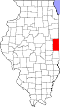
Map of Vermilion County
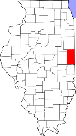
Vermilion County is located along the eastern border of Illinois; its northern border is about 95 miles (153km) south of Chicago.
Vermilion County in Illinois and Vermillion County in Indiana are two of twenty-two counties or parishes in the United States with the same name to border each other across state lines.[12] According to the 2010 census, the county has a total area of 901.28 square miles (2,334.3km2), of which 898.37 square miles (2,326.8km2) (or 99.68%) is land and 2.91 square miles (7.5km2) (or 0.32%) is water.[13] The land in Vermilion County consists mostly of various forms of silt loam.[14]Lake Vermilion, a man-made 1,000-acre (400ha) reservoir, is the county's largest body of water, located northwest of Danville. It provides the city's culinary water, and also provides recreation opportunities.
Several towns were established in the county which no longer survive. In some cases, the coming of the railroads helped to define the best locations for settlements, and as a result some existing towns were abandoned. When Lake Vermilion was created, the town of Denmark was flooded and now lies at the bottom of the reservoir.
As of the 2020 census, the county had a population of 74,188. The median age was 41.7 years. 22.9% of residents were under the age of 18 and 20.2% of residents were 65 years of age or older. For every 100 females there were 99.3 males, and for every 100 females age 18 and over there were 97.7 males age 18 and over.[23][24]
60.5% of residents lived in urban areas, while 39.5% lived in rural areas.[25]
There were 30,568 households in the county, of which 28.3% had children under the age of 18 living in them. Of all households, 41.2% were married-couple households, 20.2% were households with a male householder and no spouse or partner present, and 30.7% were households with a female householder and no spouse or partner present. About 32.1% of all households were made up of individuals and 14.8% had someone living alone who was 65 years of age or older.[23]
There were 34,407 housing units, of which 11.2% were vacant. Among occupied housing units, 67.8% were owner-occupied and 32.2% were renter-occupied. The homeowner vacancy rate was 2.3% and the rental vacancy rate was 10.8%.[23]
Racial and ethnic composition
Vermilion County, Illinois – Racial and ethnic composition Note: the US Census treats Hispanic/Latino as an ethnic category. This table excludes Latinos from the racial categories and assigns them to a separate category. Hispanics/Latinos may be of any race.
As of the 2010 United States census, there were 81,625people, 32,655households, and 21,392families residing in the county.[35] The population density was 90.9 inhabitants per square mile (35.1/km2). There were 36,318 housing units at an average density of 40.4 per square mile (15.6/km2).[13] The racial makeup of the county was 82.5% white, 13.0% black or African American, 0.7% Asian, 0.2% American Indian, 1.5% from other races, and 2.2% from two or more races. Those of Hispanic or Latino origin made up 4.2% of the population. In terms of ancestry, 21.2% self-identified as American, 18.9% as German, 10.1% as Irish, and 9.1% as English.[36]
Of the 32,655households, 31.4% had children under the age of 18 living with them, 45.7% were married couples living together, 14.7% had a female householder with no husband present, 34.5% were non-families, and 29.8% of all households were made up of individuals. The average household size was 2.41 and the average family size was 2.96. The median age was 39.8 years.
The median income for a household in the county was $39,456 and the median income for a family was $49,429. Males had a median income of $40,107 versus $30,104 for females. The per capita income for the county was $20,218. About 14.6% of families and 18.7% of the population were below the poverty line, including 30.0% of those under age 18 and 9.1% of those age 65 or over.[37]
Vermilion County is in the humid continental climate region of the United States along with most of Illinois. Its Köppen climate classification is Dfa,[39] meaning that it is cold, has no dry season, and has a hot summer.[40] In recent years, average temperatures in Danville have ranged from a low of 17°F (−8°C) in January to a high of 86°F (30°C) in July, although a record low of −26°F (−32°C) was recorded in January1994 and a record high of 112°F (44°C) was recorded in July1936. Average monthly precipitation ranged from 1.99 inches (51mm) inches in February to 4.70 inches (119mm) inches in June.[38]
Interstate 74 enters Vermilion County from the west on its way from Champaign–Urbana, and passes just to the north of the towns of Fithian, Muncie and Oakwood before passing through the south edge of the Kickapoo State Park, the north edge of Tilton and the south edge of Danville. Continuing east, it leaves the county and the state on its way to Indianapolis.[41]
US Route 136, which runs across five states, passes into Vermilion County from the west on its way from Rantoul. It passes east through the towns of Armstrong, Potomac and Henning; it reaches Illinois Route 1 south of Rossville and then shares that highway's route as it passes south through Danville. At the south edge of Danville it reaches Main Street and resumes its eastward heading, leaving the east edge of Danville and passing out of the county and state on its way to Covington, Indiana.[42]
US Route 150 enters the county from Champaign–Urbana to the west, running just to the south of Interstate 74 and passing through the towns of Fithian, Muncie and Oakwood. Just west of Danville it crosses to the north side of Interstate74 as that highway veers to the southeast. In downtown Danville, it meets Illinois Route1 and U.S. Route136, and follows Route1 to the south and continues through the towns of Belgium, Westville, Georgetown and Ridge Farm before entering Edgar County further to the south.[43]
Illinois Route 1 runs from the north to the south through the county, passing through Hoopeston, Rossville, Danville, Belgium, Westville, Georgetown and Ridge Farm.[44]
Illinois Route 9 runs from west to east near the north edge of the county and passes through Rankin and Hoopeston; upon reaching the Indiana border
Illinois Route 49 is a north–south highway near the western edge of the county. It passes south through Rankin where it intersects Route9; further south it passes near Armstrong where U.S. Route136 briefly shares its route. Crossing Interstate74, it shares the route of U.S. Route150, running west for about 2 miles (3.2km) and leaving the county before continuing south in Champaign County.[46]
Illinois Route 119 is a short 8-mile (13km) east–west road that connects the intersection of Illinois Route1 and U.S. Route136 with Indiana State Road 28 at the state line.[47]
Four railroad lines pass through or into the county, all intersecting in the Danville area; this results in many different railroad crossings throughout the city:
Norfolk Southern Railway line – enters the county from Decatur to the southwest and passes through Danville on its way to Lafayette, Indiana to the northeast
Kankakee, Beaverville and Southern Railroad line – north–south line through the county, to the east of the CSX line, a few miles from the state border, beginning in northern Iroquois County and running south through Danville, then veering east.[48]
For 2014, Vermilion County had a workforce of 35,643 people; 32,584 were employed and 3,059 (8.6%) were unemployed.[50]
Education
There are 12 school districts in the county that provide primary and secondary education.[51]
There are a total of 10 full K-12 school districts which have any amount of territory in the county, even if the schools and/or administration buildings are in other counties:[52]
Each township has a supervisor. The township board consists of the supervisor and four members elected at large from the township.[55]
The Vermilion County Board is controlled by Republicans. Larry Baughn (R) of Hoopeston serves as chairman. The Vermilion County Circuit Court is led by Judge Thomas O’Shaugnessy.[citation needed]
Politics
United States presidential election results for Vermilion County, Illinois[56]
↑Illinois law allows settlements to incorporate as either cities or villages; when incorporated, cities must have a population of at least 2,500, and villages must have a population of at least 500. "Illinois Municipal Code: Municipalities". Archived from the original on October 22, 2012. Retrieved October 17, 2010.
↑"Illinois Railroad Map"(PDF). Illinois Department of Transportation. January 2006. Archived(PDF) from the original on May 25, 2011. Retrieved October 17, 2010.
Stapp, Katherine; W. I. Bowman (1968). History Under Our Feet: The Story of Vermilion County IL. Danville, Illinois: Interstate Printers and Publishers, Inc.
This page is based on this Wikipedia article Text is available under the CC BY-SA 4.0 license; additional terms may apply. Images, videos and audio are available under their respective licenses.