Georgetown, Illinois

Last updated

Georgetown, Illinois
City
Georgetown Illinois.png
Vermilion County Illinois Incorporated and Unincorporated areas Georgetown Highlighted.svg
Location of Georgetown in Vermilion County, Illinois.
Location map of Vermilion County, Illinois.svg
Red pog.svg
Georgetown, Illinois
Georgetown's location in Vermilion County
Coordinates: 39°58′39″N87°38′07″W / 39.97750°N 87.63528°W / 39.97750; -87.63528 [1]
Country United States
State Illinois
County Vermilion County
Township Georgetown Township
Founded1826
Area
[2]
  Total1.62 sq mi (4.19 km2)
  Land1.62 sq mi (4.19 km2)
  Water0.00 sq mi (0.00 km2)  0%
Elevation
[1]
653 ft (199 m)
Population
 (2020)
  Total3,143
  Density1,944.93/sq mi (750.98/km2)
Time zone UTC-6 (CST)
  Summer (DST) UTC-5 (CDT)
ZIP code
61846
Area code 217
FIPS code 17-28963
GNIS ID2394882 [1]
Website https://georgetownil.net/

Georgetown is a city in Vermilion County, Illinois, United States. As of the 2020 census, the city population was 3,143. It is part of the Danville, Illinois Metropolitan Statistical Area.

Contents

History

Downtown Georgetown, 2007 Georgetown Illinois downtown intersection.png
Downtown Georgetown, 2007

Georgetown was established in 1826 and was platted by James Haworth with the length of a grapevine, although the first home was established in 1820 by Henry Johnson. The town may have been named after George Beckwith, since Danville had been named after Dan Beckwith; another possibility is that it was named after James Haworth's son George. [3] The first post office was established in 1828. [4]

The Paris and Danville Railroad was built in 1871, and the "Interurban" started carrying passengers between Georgetown and Danville sometime after 1900. [3]

Geography

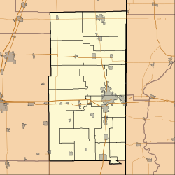
Georgetown is located on Illinois Route 1 / U.S. Route 150 about 13 miles (21 km) south of the county seat of Danville. According to the 2010 census, Georgetown has a total area of 0.14 square miles (0.36 km2), all land. [5]

Demographics

Historical population
CensusPop.Note
1880 741
1890 662−10.7%
1900 98849.2%
1910 2,307133.5%
1920 3,06132.7%
1930 3,40711.3%
1940 3,235−5.0%
1950 3,2941.8%
1960 3,5447.6%
1970 3,98412.4%
1980 4,2205.9%
1990 3,678−12.8%
2000 3,628−1.4%
2010 3,474−4.2%
2020 3,143−9.5%
U.S. Decennial Census

As of the census [6] of 2000, there were 3,628 people, 1,470 households, and 1,004 families residing in the city. The population density was 2,250.6 inhabitants per square mile (869.0/km2). There were 1,564 housing units at an average density of 970.2 per square mile (374.6/km2). The racial makeup of the city was 95.53% White, 2.73% African American, 0.28% Native American, 0.06% Asian, 0.25% from other races, and 1.16% from two or more races. Hispanic or Latino of any race were 1.19% of the population.

There were 1,470 households, out of which 34.4% had children under the age of 18 living with them, 49.9% were married couples living together, 14.2% had a female householder with no husband present, and 31.7% were non-families. 28.6% of all households were made up of individuals, and 16.2% had someone living alone who was 65 years of age or older. The average household size was 2.47 and the average family size was 3.00.

In the city, the population was spread out, with 27.9% under the age of 18, 8.2% from 18 to 24, 26.7% from 25 to 44, 21.1% from 45 to 64, and 16.0% who were 65 years of age or older. The median age was 36 years. For every 100 females, there were 90.1 males. For every 100 females age 18 and over, there were 83.1 males.

The median income for a household in the city was $33,852, and the median income for a family was $37,310. Males had a median income of $32,974 versus $22,581 for females. The per capita income for the city was $14,275. About 8.8% of families and 13.9% of the population were below the poverty line, including 21.6% of those under age 18 and 7.2% of those age 65 or over.

Education

Transportation

Danville Mass Transit provides bus service on Route 9 connecting Georgetown to downtown Danville and other destinations. [7]

Related Research Articles

<span class="mw-page-title-main">Vermilion County, Illinois</span> County in Illinois, United States

Vermilion County is a county in the eastern part of the U.S. state of Illinois, between the Indiana border and Champaign County. It was established in 1826 and was the 45th of Illinois' 102 counties. According to the 2020 United States census, it had a population of 74,188. It contains 21 incorporated settlements; the county seat and largest city is Danville.

<span class="mw-page-title-main">Allerton, Illinois</span> Village in Illinois, United States

Allerton is a village in Sidell Township, Vermilion County, Illinois, United States. A small portion of the village extends into Champaign County. The population was 262 at the 2020 census.

<span class="mw-page-title-main">Vermilion, Illinois</span> Village in Illinois, United States

Vermilion is a village in Stratton and Elbridge Township townships, Edgar County, Illinois, United States. The population was 203 at the 2020 census.

<span class="mw-page-title-main">Alvin, Illinois</span> Village in Illinois, United States

Alvin is a village in South Ross Township, Vermilion County, Illinois, United States. It is part of the Danville, Illinois Metropolitan Statistical Area. The population was 316 at the 2000 census. The U.S. Post Office uses the name Alvin, however the village is also known by the alternate spelling Alvan.

<span class="mw-page-title-main">Belgium, Illinois</span> Village in Illinois, United States

Belgium is a village in Vermilion County, Illinois, United States. It is part of the Danville, Illinois Metropolitan Statistical Area. The population was 404 at the 2010 census.

<span class="mw-page-title-main">Bismarck, Illinois</span> Village in Illinois, United States

Bismarck is a village in Newell Township, Vermilion County, Illinois, United States. It is part of the Danville, Illinois Metropolitan Statistical Area. The population was 582 at the 2020 census.

<span class="mw-page-title-main">Catlin, Illinois</span> Village in Illinois, United States

Catlin is a village in Vermilion County, Illinois, United States. It is part of the Danville, Illinois Metropolitan Statistical Area. The population was 2,040 at the 2010 census, and 1,952 in 2018. Catlin is the hometown of Illinois State Representative Chad Hays, who represents the 104th Representative District of Illinois.

<span class="mw-page-title-main">Fairmount, Illinois</span> Village in Illinois, United States

Fairmount is a village in Vance Township, Vermilion County, Illinois, United States. It is part of the Danville, Illinois Metropolitan Statistical Area. The population was 642 at the 2010 census.

<span class="mw-page-title-main">Fithian, Illinois</span> Village in Illinois, United States

Fithian is a village in Oakwood Township, Vermilion County, Illinois, United States. It is part of the Danville, Illinois Metropolitan Statistical Area. The population was 485 at the 2010 census.

<span class="mw-page-title-main">Henning, Illinois</span> Village in Illinois, United States

Henning is a village in South Ross Township, Vermilion County, Illinois, United States. It is part of the Danville, Illinois Metropolitan Statistical Area. The population was 241 at the 2000 census.

<span class="mw-page-title-main">Indianola, Illinois</span> Village in Illinois, United States

Indianola is a village in Carroll Township, Vermilion County, Illinois, United States. It is part of the Danville, Illinois Metropolitan Statistical Area. The population was 207 at the 2000 census.

<span class="mw-page-title-main">Muncie, Illinois</span> Village in Illinois, United States

Muncie is a village in Oakwood Township, Vermilion County, Illinois, United States. It is part of the Danville, Illinois Metropolitan Statistical Area. The population was 155 at the 2000 census.

<span class="mw-page-title-main">Oakwood, Illinois</span> Village in Illinois, United States

Oakwood is a village in Oakwood Township, Vermilion County, Illinois, United States. It is part of the Danville, Illinois Metropolitan Statistical Area. The population was 1,595 at the 2010 census, and 1,507 in 2018.

<span class="mw-page-title-main">Potomac, Illinois</span> Village in Illinois, United States

Potomac is a village in Vermilion County, Illinois, United States. It is part of the Danville, Illinois Metropolitan Statistical Area. The population was 750 at the 2010 census.

<span class="mw-page-title-main">Rankin, Illinois</span> Village in Illinois, United States

Rankin is a village in Butler Township, Vermilion County, Illinois, United States. It is part of the Danville, Illinois Metropolitan Statistical Area. The population was 561 at the 2010 census.

<span class="mw-page-title-main">Ridge Farm, Illinois</span> Village in Illinois, United States

Ridge Farm is a village in Elwood Township, Vermilion County, Illinois, United States. It is part of the Danville, Illinois Metropolitan Statistical Area. The population was 940 at the 2020 census.

<span class="mw-page-title-main">Rossville, Illinois</span> Village in Illinois, United States

Rossville is a village in Ross Township, Vermilion County, Illinois, United States. As of the 2020 census, the city population was 1,221. It is part of the Danville, Illinois Metropolitan Statistical Area.

<span class="mw-page-title-main">Sidell, Illinois</span> Village in Illinois, United States

Sidell is a village in Sidell Township, Vermilion County, Illinois, United States. It is part of the Danville, Illinois Metropolitan Statistical Area. The population was 617 at the 2010 census.

<span class="mw-page-title-main">Tilton, Illinois</span> Village in Illinois, United States

Tilton is a village in Danville Township, Vermilion County, Illinois, United States. It is part of the Danville, Illinois Metropolitan Statistical Area. The population was 2,976 at the 2000 census, down to 2,724 in 2010 and down to 2,660 in 2020.

<span class="mw-page-title-main">Westville, Illinois</span> Village in Illinois, United States

Westville is a village in Georgetown Township, Vermilion County, Illinois, United States. It is part of the Danville, Illinois Metropolitan Statistical Area. The population was 3,202 at the 2010 census, and 2,990 in 2018.

References

  1. 1 2 3 U.S. Geological Survey Geographic Names Information System: Georgetown, Illinois
  2. "2020 U.S. Gazetteer Files". United States Census Bureau. Retrieved March 15, 2022.
  3. 1 2 Stapp, Katherine; W. I. Bowman (1968). History Under Our Feet: The Story of Vermilion County, Illinois. Danville, Illinois: Interstate Printers and Publishers, Inc. pp. 22–24.
  4. Jones, Lottie E. (1911). History of Vermilion County, Illinois (volume 1). Chicago, Illinois: Pioneer Publishing Company. p. 95.
  5. "G001 - Geographic Identifiers - 2010 Census Summary File 1". United States Census Bureau. Archived from the original on February 13, 2020. Retrieved December 27, 2015.
  6. "U.S. Census website". United States Census Bureau . Retrieved January 31, 2008.
  7. "System Map" . Retrieved January 28, 2024.