Batestown, Illinois

Last updated

Batestown
USA Illinois location map.svg
Red pog.svg
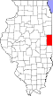
Batestown
Location of Batestown within Illinois
Usa edcp location map.svg
Red pog.svg
Batestown
Batestown (the United States)
Coordinates: 40°07′12″N87°41′47″W / 40.12000°N 87.69639°W / 40.12000; -87.69639
CountryUnited States
StateIllinois
County Vermilion
Township Danville
Elevation
650 ft (200 m)
Time zone UTC-6 (CST)
  Summer (DST) UTC-5 (CDT)
Area code 217

Batestown is an unincorporated community in Danville Township, Vermilion County, Illinois. It is west of Danville, Illinois. [1]

Contents

History

Batestown was a suburb of Danville in the early 20th century. [2] As of 1906, it had a black Baptist church led by the Reverend Dabney Jones. [2] As of 1911, United Doctors operated the Decatur Institute in Batestown. [3]

Lulu O'Dell ran a tavern in Batestown with her son in the 1940s. [4]

Geography

Batestown is located at 40°07′12″N87°41′47″W / 40.12000°N 87.69639°W / 40.12000; -87.69639 .

See also

References

  1. Meadows, Jim (February 27, 2023). "Marron seeks state funding for Savoy, Rantoul & Danville infrastructure projects". IPM Newsroom. Retrieved April 13, 2025.
  2. 1 2 "For the Batestown Church". The Champaign Daily Gazette. September 26, 1906. Retrieved April 13, 2025 via Newspapers.com.
  3. "Batestown Woman Followed Relatives". Herald and Review. Decatur, Illinois. May 25, 1911. Retrieved April 13, 2025 via Newspapers.com.
  4. "Man Kille When Auto Hits Train". The Tuscola Journal. April 16, 1942. Retrieved April 13, 2025 via Newspapers.com.