Cheneyville, Illinois

Last updated
Cheneyville
Cheneyville Illinois grain elevator.png
Grain elevator in Cheneyville
Map of Illinois highlighting Vermilion County.svg
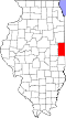
Vermilion County's location in Illinois
Location map of Vermilion County, Illinois.svg
Red pog.svg
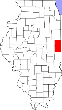
Cheneyville
Cheneyville's location in Vermilion County
Coordinates: 40°28′09″N87°35′05″W / 40.46917°N 87.58472°W / 40.46917; -87.58472 Coordinates: 40°28′09″N87°35′05″W / 40.46917°N 87.58472°W / 40.46917; -87.58472
Country Flag of the United States.svg  United States
State Flag of Illinois.svg  Illinois
County Vermilion County
Township Grant Township
Established1871
Elevation
725 ft (221 m)
ZIP code
60942
Area code(s) 217
GNIS feature ID0406006 [1]

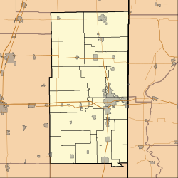
Cheneyville is an unincorporated community in Grant Township, Vermilion County, Illinois.

Grant Township, Vermilion County, Illinois Township in Illinois, United States

Grant Township is a township in Vermilion County, Illinois, USA. As of the 2010 census, its population was 6,028 and it contained 2,817 housing units.

Vermilion County, Illinois County in the United States

Vermilion County is a county in the eastern part of the U.S. state of Illinois, between the Indiana border and Champaign County. It was established in 1826 and was the 45th of Illinois' 102 counties. According to the 2010 United States Census, it had a population of 81,625, a decrease of 2.7% in 2000. It contains 21 incorporated settlements; the county seat and largest city is Danville.

Illinois State of the United States of America

Illinois is a state in the Midwestern and Great Lakes region of the United States. It has the fifth largest gross domestic product (GDP), the sixth largest population, and the 25th largest land area of all U.S. states. Illinois has been noted as a microcosm of the entire United States. With Chicago in northeastern Illinois, small industrial cities and immense agricultural productivity in the north and center of the state, and natural resources such as coal, timber, and petroleum in the south, Illinois has a diverse economic base, and is a major transportation hub. Chicagoland, Chicago's metropolitan area, encompasses over 65% of the state's population. The Port of Chicago connects the state to international ports via two main routes: from the Great Lakes, via the Saint Lawrence Seaway, to the Atlantic Ocean and from the Great Lakes to the Mississippi River, via the Illinois Waterway to the Illinois River. The Mississippi River, the Ohio River, and the Wabash River form parts of the boundaries of Illinois. For decades, Chicago's O'Hare International Airport has been ranked as one of the world's busiest airports. Illinois has long had a reputation as a bellwether both in social and cultural terms and, through the 1980s, in politics.

Contents

History

Cheneyville was founded in 1871 and platted in 1880. It was named for J. H. Cheney, the vice-president of the Lake Erie and Western Railroad. A telephone system was installed in 1888 and soon had to be expanded due to rising demand. [2]

Lake Erie and Western Railroad

The Lake Erie and Western Railroad was a railroad that operated in Ohio, Indiana and Illinois. The Lake Erie and Western Depot Historic District at Kokomo, Indiana was listed on the National Register of Historic Places in 2008.

Geography

Cheneyville is located at 40°28′9″N87°35′5″W / 40.46917°N 87.58472°W / 40.46917; -87.58472 (40.4692031, -87.5847437), about four miles east of the village of Hoopeston and less than two miles south of the northern border of the county. The Kankakee, Beaverville and Southern Railroad passes through town and Illinois Route 9 runs about half a mile to the south.

Hoopeston, Illinois City in Illinois, United States

Hoopeston is a city in Grant Township, Vermilion County, Illinois, United States. As of the 2010 census, the city population was 5,351.

Kankakee, Beaverville and Southern Railroad

The Kankakee, Beaverville and Southern Railroad Company is a Class III railroad serving agricultural communities in east-central Illinois and west-central Indiana.

Illinois Route 9 (IL 9) is a 218.31-mile-long (351.34 km) cross-state, east–west rural state highway in the central part of the U.S. state of Illinois. It travels from Niota at the Fort Madison Toll Bridge, that crosses the Mississippi River into Iowa, eastward across central Illinois to State Road 26 (SR 26) at the Indiana state line.

Cheneyville church Church in Cheneyville, Illinois.png
Cheneyville church

Related Research Articles

Iroquois County, Illinois County in the United States

Iroquois County is a county located in the northeast part of the U.S. state of Illinois. According to the 2010 census, it has a population of 29,718. It is the only county in the United States to be named Iroquois, after the American Indian people. The county seat is Watseka. The county is located along the border with Indiana.

Allerton, Illinois Village in Illinois, United States

Allerton is a village in Sidell Township, Vermilion County, Illinois, United States. A small portion of the village extends into Champaign County. The population was 291 at the 2010 census.

Alvin, Illinois Village in Illinois, United States

Alvin is a village in South Ross Township, Vermilion County, Illinois, United States. It is part of the Danville, Illinois Metropolitan Statistical Area. The population was 316 at the 2000 census. The U.S. Post Office uses the name Alvin, however the village is also known by the alternate spelling Alvan.

Bismarck, Illinois Village in Illinois, United States

Bismarck is a village in Newell Township, Vermilion County, Illinois, United States. It is part of the Danville, Illinois Metropolitan Statistical Area. The population was 542 at the 2000 census.

Fairmount, Illinois Village in Illinois, United States

Fairmount is a village in Vance Township, Vermilion County, Illinois, United States. It is part of the Danville, Illinois Metropolitan Statistical Area. The population was 640 at the 2000 census.

Fithian, Illinois Village in Illinois, United States

Fithian is a village in Oakwood Township, Vermilion County, Illinois, United States. It is part of the Danville, Illinois Metropolitan Statistical Area. The population was 506 at the 2000 census.

Rankin, Illinois Village in Illinois, United States

Rankin is a village in Butler Township, Vermilion County, Illinois, United States. It is part of the Danville, Illinois Metropolitan Statistical Area. The population was 617 at the 2000 census.

Rossville, Illinois Village in Illinois, United States

Rossville is a village in Ross Township, Vermilion County, Illinois, United States. As of the 2010 census, the city population was 1,331. It is part of the Danville, Illinois Metropolitan Statistical Area.

The Little Vermilion River is a 59.6-mile-long (95.9 km) tributary of the Wabash River. The Little Vermilion rises in southern Vermilion County, Illinois, flowing eastward past Georgetown, Illinois, into Vermillion County, Indiana, where it joins the Wabash near Newport.

Sidney Township, Champaign County, Illinois Township in Illinois, United States

Sidney Township is a township in Champaign County, Illinois, USA. As of the 2010 census, its population was 1,733 and it contained 715 housing units.

South Homer Township, Champaign County, Illinois Township in Illinois, United States

South Homer Township is a township in Champaign County, Illinois, USA. As of the 2010 census, its population was 1,601 and it contained 681 housing units.

Claytonville, Illinois Unincorporated community in Illinois, United States

Claytonville is an unincorporated community in Iroquois County, Illinois, United States.

Manns Chapel church in Vermilion County, Illinois

Mann's Chapel is a pioneer church in Vermilion County, Illinois that was built in 1857. It is located just east of Illinois Route 1 a few miles south of the village of Rossville.

Hillery, Illinois Unincorporated community in Illinois, United States

Hillery is an unincorporated community in Danville Township, Vermilion County, Illinois, United States.

East Lynn, Illinois Unincorporated community in Illinois, United States

East Lynn is an unincorporated community in Butler Township, Vermilion County, Illinois.

Goodwine, Illinois Unincorporated community in Illinois, United States

Goodwine is an unincorporated community in southern Iroquois County, Illinois, United States.

Kramm, California Unincorporated community in California, United States

Kramm is an unincorporated community in Butte County, California. It lies 3.25 miles (5.2 km) north-northwest of Oroville on the Western Pacific Railroad, at an elevation of 417 feet.

Lorraine, California Former settlement in California, United States

Lorraine is a former settlement in Butte County, California., it is now inundated by the Thermalito Afterbay reservoir. It lay at an elevation of 138 feet. Lorraine still appeared on maps as of 1952. It was located 5 miles (8.0 km) north-northeast of Biggs on the Sacramento Northern Railroad.

References

  1. "Cheneyville". Geographic Names Information System . United States Geological Survey . Retrieved 2010-10-17.
  2. Stapp, Katherine; W. I. Bowman (1968). History Under Our Feet: The Story of Vermilion County, Illinois. Danville, Illinois: Interstate Printers and Publishers, Inc. p. 45.