Jamesburg, Illinois

Last updated
Jamesburg
Unincorporated community
Map of Illinois highlighting Vermilion County.svg
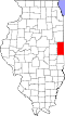
Vermilion County's location in Illinois
Location map of Vermilion County, Illinois.svg
Red pog.svg
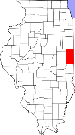
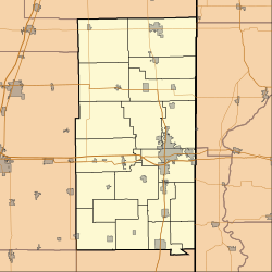
Jamesburg
Jamesburg's location in Vermilion County
Coordinates: 40°15′44″N87°44′56″W / 40.26222°N 87.74889°W / 40.26222; -87.74889 Coordinates: 40°15′44″N87°44′56″W / 40.26222°N 87.74889°W / 40.26222; -87.74889
Country Flag of the United States.svg  United States
State Flag of Illinois.svg  Illinois
County Vermilion County
Township Blount Township
Elevation 682 ft (208 m)
ZIP code 61865
GNIS feature ID 0411031 [1]

Jamesburg is an unincorporated community in Blount Township, Vermilion County, Illinois, United States.

Blount Township, Vermilion County, Illinois Township in Illinois, United States

Blount Township is a township in Vermilion County, Illinois, USA. As of the 2010 census, its population was 3,428 and it contained 1,475 housing units.

Vermilion County, Illinois County in the United States

Vermilion County is a county in the eastern part of the U.S. state of Illinois, between the Indiana border and Champaign County. It was established in 1826 and was the 45th of Illinois' 102 counties. According to the 2010 United States Census, it had a population of 81,625, a decrease of 2.7% in 2000. It contains 21 incorporated settlements; the county seat and largest city is Danville.

Illinois State of the United States of America

Illinois is a state in the Midwestern and Great Lakes region of the United States. It has the fifth largest gross domestic product (GDP), the sixth largest population, and the 25th largest land area of all U.S. states. Illinois is often noted as a microcosm of the entire United States. With Chicago in northeastern Illinois, small industrial cities and immense agricultural productivity in the north and center of the state, and natural resources such as coal, timber, and petroleum in the south, Illinois has a diverse economic base, and is a major transportation hub. Chicagoland, Chicago's metropolitan area, encompasses over 65% of the state's population. The Port of Chicago connects the state to international ports via two main routes: from the Great Lakes, via the Saint Lawrence Seaway, to the Atlantic Ocean and from the Great Lakes to the Mississippi River, via the Illinois Waterway to the Illinois River. The Mississippi River, the Ohio River, and the Wabash River form parts of the boundaries of Illinois. For decades, Chicago's O'Hare International Airport has been ranked as one of the world's busiest airports. Illinois has long had a reputation as a bellwether both in social and cultural terms and, through the 1980s, in politics.

Geography

Jamesburg is located at 40°15′44″N87°44′56″W / 40.26222°N 87.74889°W / 40.26222; -87.74889 at an elevation of 682 feet.

Related Research Articles

Winslow West, Arizona CDP in Arizona, United States

Winslow West is a census-designated place (CDP) in Coconino and Navajo counties in the U.S. state of Arizona. The population was 438 at the 2010 census. The entire community is off-reservation trust land belonging to the Hopi tribe. It lies just west of the city of Winslow, and more than 50 km (31 mi) south of the main Hopi reservation.

Beacon Square, Florida CDP in Florida, United States

Beacon Square is a census-designated place (CDP) in Pasco County, Florida, United States. The population was 7,263 at the 2000 census.

Mayfield, Kansas City in Kansas, United States

Mayfield is a city in Sumner County, Kansas, United States. As of the 2010 census, the city population was 113, which is the same as the previous 2000 census.

Harbor Hills, New York Hamlet and census-designated place in New York, United States

Harbor Hills is a hamlet and census-designated place (CDP) and a part of Great Neck in Nassau County, New York, United States. The population was 575 at the 2010 census.

Daugherty Township, Beaver County, Pennsylvania Township in Pennsylvania, United States

Daugherty Township is a township in Beaver County, Pennsylvania, United States. The population was 3,187 at the 2010 census.

Amatignak Island island in the United States of America

Amatignak Island is a member of the Delarof Islands, in Alaska's Aleutian archipelago. The southernmost point of Alaska is on this island, as well as the westernmost longitude of Alaska, the United States, and North America.

MillBay is a small village on Islandmagee in County Antrim, Northern Ireland. It sits by the tiny Carnspindle Bay, within the townland of Carnspindle. It is in the Larne Borough Council area. In the 2011 Census it had a population of 103 people. .

Bagdad is an unincorporated community in northeastern Shelby County, Kentucky, United States. It was founded at what is currently the intersection of Kentucky Routes 12 and 395.

Casa de Oro, California human settlement in California, United States of America

Casa de Oro is a neighborhood in east San Diego County, California, United States. The community, twelve miles east of San Diego, is divided between the unincorporated town of Spring Valley and an unincorporated part of La Mesa. The United States Census Bureau has also divided the neighborhood between two census-designated places (CDPs), Spring Valley CDP and Casa de Oro-Mount Helix CDP. Casa de Oro's main thoroughfare is Campo Road.

Kilderry is located in County Kerry, Ireland, on the N70 National secondary road between Milltown and Killorglin (4.8).

Lancaster, Huntington County, Indiana Unincorporated community in Indiana, United States

Lancaster is an unincorporated community in Lancaster Township, Huntington County, Indiana.

Protochori village in Greece

Protochori is a community of the city of Kozani in northern Greece. Located south of the city centre, it has a population of 830 (2011).

The Navajo meridian, established in 1869, is one of the two principal meridians for Arizona, the other being the Gila and Salt River meridian. Its initial point was stated as latitude 35° 45' north, longitude 108° 32' 45" west from Greenwich, but has been revised as 35°44′56″N108°31′59″W The Navajo meridian and baseline were used to set townships and ranges in a special survey for the original Navajo Reservation, and was set at the eastern boundary of that reservation. The Arizona lands surveyed using the Navajo meridian and baseline were ranges six west to ten west and townships one north to fourteen north, and included Canyon de Chelly National Monument.

Zovashen, Kotayk Place in Kotayk, Armenia

Zovashen is a village in the Kotayk Province of Armenia.

Sturgeon Creek is located in Midland County. It has its origin in Section 22 of Hope Township, and makes its way southwesterly and southeasterly through Lincoln Township and Larkin Township and into the western side of the city of Midland, emptying into the Tittabawassee River.

Tibitha is an unincorporated community in Northumberland County, in the U.S. state of Virginia.

Jameson Point South Shetland Islands, Antarctica

Jameson Point is a small headland 6.3 km (3.9 mi) north of Cape Garry on the west side of Low Island, in the South Shetland Islands of Antarctica. It was roughly charted by the French Antarctic Expedition, 1908–10. The point was photographed from the air by the Falkland Islands and Dependencies Aerial Survey Expedition, 1955–57, and more accurately delineated from these photos by the Falkland Islands Dependencies Survey in 1959. The name "Jameson Island" was applied to Low Island by James Weddell in 1820–23, and Jameson Point has been approved for this point to preserve Weddell's name on Low Island.

St. Francis of Assisi Church (Manhattan) church in New York City

The Church of St. Francis of Assisi is a parish church under the authority of the Roman Catholic Archdiocese of New York, and is located at 135–139 West 31st Street, Manhattan, New York City. The parish is staffed by the Order of Friars Minor.

Mesa Union School District

Mesa Union Elementary School District is a public school district based in Ventura County, California, United States located on State Route 118. Many Mesa students attend Rio Mesa High School of the Oxnard Union High School District after completing 8th grade.

References

  1. "Jamesburg". Geographic Names Information System . United States Geological Survey . Retrieved 2010-10-17.