Catlin Township, Vermilion County, Illinois

Last updated

Catlin Township
Map highlighting Catlin Township, Vermilion County, Illinois.svg
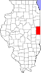
Location in Vermilion County
Coordinates: 40°03′38″N87°43′28″W / 40.06056°N 87.72444°W / 40.06056; -87.72444
Country United States
State Illinois
County Vermilion
Created1858
Area
  Total
50.07 sq mi (129.7 km2)
  Land49.79 sq mi (129.0 km2)
  Water0.28 sq mi (0.73 km2)  0.56%
Elevation
673 ft (205 m)
Population
 (2010)
  Estimate 
(2016) [1]
3,199
  Density66.3/sq mi (25.6/km2)
Time zone UTC-6 (CST)
  Summer (DST) UTC-5 (CDT)
ZIP codes
61817, 61832, 61834, 61841, 61846, 61858, 61883
Area code 217
FIPS code 17-183-11787

Catlin Township is a township in Vermilion County, Illinois, United States. As of the 2010 census, its population was 3,300 and it contained 1,342 housing units. [2]

Contents

History

Catlin Township was created in 1858.

Geography

According to the 2010 census, the township has a total area of 50.07 square miles (129.7 km2), of which 49.79 square miles (129.0 km2) (or 99.44%) is land and 0.28 square miles (0.73 km2) (or 0.56%) is water. [2]

Demographics

Historical population
CensusPop.Note
2016 (est.)3,199 [1]
U.S. Decennial Census [3]

Cities and towns

Extinct towns

Adjacent townships

Cemeteries

The township contains fourteen cemeteries: Allhands, Cox, Dougherty, God's Acre, Hickman, Jones Grove, Kight's, Mount Vernon, New Atherton, Oak Ridge, Pate, Songer, Spicer Family Plot and Wright Family.

Major highways

Airports and landing strips

Lakes

School districts

Political districts

References

  1. 1 2 "Population and Housing Unit Estimates" . Retrieved June 9, 2017.
  2. 1 2 "Population, Housing Units, Area, and Density: 2010 - County -- County Subdivision and Place -- 2010 Census Summary File 1". United States Census. Archived from the original on February 12, 2020. Retrieved May 28, 2013.
  3. "Census of Population and Housing". Census.gov. Retrieved June 4, 2016.