Jamaica, Illinois

Last updated

Jamaica
USA Illinois location map.svg
Red pog.svg
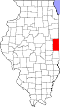
Jamaica
Location of Jamaica within Illinois
Usa edcp location map.svg
Red pog.svg
Jamaica
Jamaica (the United States)
Coordinates: 39°59′28″N87°48′24″W / 39.99111°N 87.80667°W / 39.99111; -87.80667
CountryUnited States
StateIllinois
County Vermilion
Township Jamaica
Elevation
[1]
676 ft (206 m)
Time zone UTC-6 (CST)
  Summer (DST) UTC-5 (CDT)
Area code 217

Jamaica is an unincorporated community in Jamaica Township, Vermilion County, Illinois.

Contents

History

Like so many other small towns in the late 19th century, Jamaica developed because of the railroads. When the C&EI railroad came through the township, Jamaica thrived. However, when the Fairmount quarries closed, the town began to dwindle. It is now a small unincorporated area. School consolidation led to the new school being built near the town to replace the older Fairmount, Indianola, and Sidell high schools, and it was called Jamaica High School. [2]

Geography

Jamaica is located at 39°59′28″N87°48′24″W / 39.99111°N 87.80667°W / 39.99111; -87.80667 ( 39.9911467, -87.8066939).

References

  1. "USGS detail on Jamaica" . Retrieved October 10, 2007.
  2. Stapp, Katherine; W. I. Bowman (1968). History Under Our Feet: The Story of Vermilion County, Illinois. Danville, Illinois: Interstate Printers and Publishers, Inc. p. 22.