A settlement was founded in 1872 about a mile south of present-day Alvan, along the Chicago and Eastern Illinois Railroad, and was called Gilbert in honor of the founder, Alvan Gilbert. In 1875, the new Havana, Rantoul and Eastern Railroad (which became the Illinois Central Railroad) crossed the C&EI north of Gilbert, and the town of Alvan was founded at the intersection. Tradition says that the town's name became Alvin (with an "i" instead of an "a") because the post office misspelled it and refused to correct the error.[4]
On March 16, 1942, a tornado struck Alvan and caused much destruction, killing six people. A marker in the town commemorates the tragic event and reads as follows:
Alvin Tornado Monday, March 16, 1942 11:40 AM Killed Billy Smith - Henry O'Farrell Ruth Viles - George Johnson Odessa Scott - Goldie Hoover Donated by Mel Schriefer 2004 A.E. Hoskins
1942 tornado marker
Geography
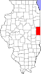
Alvan is located on County Road 3 approximately 3.6 miles north of Bismarck and 12 miles north of Danville. The North Fork of the Vermilion River flows past the west side of the community.[5]
According to the 2010 census, Alvin has a total area of 0.79 square miles (2.05km2), all land.[6]
As of the census[8] of 2000, there were 316 people, 106 households, and 85 families residing in the village. The population density was 397.2 inhabitants per square mile (153.4/km2). There were 115 housing units at an average density of 144.6 per square mile (55.8/km2). The racial makeup of the village was 97.78% White, 1.58% Native American, 0.32% Asian, and 0.32% from two or more races. Hispanic or Latino of any race were 0.63% of the population.
There were 106 households, out of which 49.1% had children under the age of 18 living with them, 59.4% were married couples living together, 14.2% had a female householder with no husband present, and 19.8% were non-families. 19.8% of all households were made up of individuals, and 8.5% had someone living alone who was 65 years of age or older. The average household size was 2.98 and the average family size was 3.35.
In the village, the population was spread out, with 34.5% under the age of 18, 7.6% from 18 to 24, 29.7% from 25 to 44, 19.6% from 45 to 64, and 8.5% who were 65 years of age or older. The median age was 30 years. For every 100 females, there were 92.7 males. For every 100 females age 18 and over, there were 89.9 males.
The median income for a household in the village was $36,000, and the median income for a family was $38,333. Males had a median income of $30,278 versus $18,194 for females. The per capita income for the village was $13,773. About 7.0% of families and 8.2% of the population were below the poverty line, including 8.2% of those under age 18 and 31.6% of those age 65 or over.
↑Stapp, Katherine; W. I. Bowman (1968). History Under Our Feet: The Story of Vermilion County, Illinois. Danville, Illinois: Interstate Printers and Publishers, Inc. p.48.
This page is based on this Wikipedia article Text is available under the CC BY-SA 4.0 license; additional terms may apply. Images, videos and audio are available under their respective licenses.