Peru, Illinois

Last updated

Peru
U.S. Six through "Peru" PA150802.jpg
4th Street Looking East in Downtown Peru
Flag of Peru, Illinois.png
Seal of Peru, Illinois.png
LaSalle County Illinois Incorporated and Unincorporated areas Peru Highlighted.svg
Location of Peru in LaSalle County, Illinois.
Illinois in United States (US48).svg
Location of Illinois in the United States
Coordinates: 41°20′25″N89°07′03″W / 41.34028°N 89.11750°W / 41.34028; -89.11750 [1]
CountryUnited States
StateIllinois
County Bureau, LaSalle
Townships Peru, Dimmick, Hall
Government
  MayorKen Kolowski
Area
[2]
  Total10.12 sq mi (26.21 km2)
  Land9.99 sq mi (25.86 km2)
  Water0.13 sq mi (0.35 km2)
Elevation
[1]
640 ft (200 m)
Population
 (2020)
  Total9,896
  Density977.87/sq mi (377.57/km2)
Time zone UTC−6 (CST)
  Summer (DST) UTC−5 (CDT)
ZIP Code(s)
61354
Area code 815
FIPS code 17-59234
GNIS feature ID2396189 [1]
Website City of Peru official website

Peru is a city in LaSalle and Bureau counties, Illinois, United States. The population was 9,896 at the 2020 census, down from 10,295 at the 2010 census. It is part of the Ottawa, IL Micropolitan Statistical Area. Peru and its twin city, LaSalle, make up the core of Illinois Valley.

Contents

History

The city's first settler was John Hays, who arrived in 1830. The city was organized as a borough in 1838, incorporated as a village February 25, 1845, [3] and incorporated as a city on March 13, 1851. The original plat was between West Street, 4th Street, and East Street (now Pine Street).

River City (1831–1933)

Peru, circa 1900 Peru, Illinois (circa 1900).jpg
Peru, circa 1900

Since the first steamboat Traveler reached Peru in 1831, the city had high hopes of being the western terminus for the Illinois & Michigan Canal. LaSalle won that designation, but Peru became a busy steamboat port at the head of navigation on the Illinois River. Captain McCormick was involved in the Five Day Line, making record fast trips between Peru and St. Louis, Missouri. Senator Gilson reported to land surveyor, Grenville Dodge, that the town would soon outstrip Chicago due to its favorable location along the river and railroads. [4]

Water Street was a thin ribbon pressed between the bluff and the river, leading to the growth eastward of a large industrial district. Developed along the river and the canal, it was served by the Rock Island Railroad and Chicago Burlington and Quincy. These important transportation routes, along with coal mining in at least four mines lasting from 1857 until 1949, [5] [6] were the basis for Peru's rise to an industrial center. Many entrepreneurs grew into prominent businessmen and advanced the interests of Peru and the region. Prominent companies from that time included Maze Lumber, Maze Nails, Peru Plow and Wheel Works, Huse and Loomis Ice Co, Brunner Foundry, [7] Star Union Brewery, Hebel Brewery, Illinois Zinc (Peru and LaSalle were sometimes referred to as "Zinc City") and many others. Peru's citizens were intent on improving their town, so far as constructing a plank road, northwest of town, a toll road meant to reach Dixon, Illinois. [4]

Peru's story became a story of two levels. The story of Water Street and the bottoms, and the town growing above the bluff. Peru tried hard to link the two. For example, the Peru Horse and Dummy Railroad was driven to dissolution by the city's impossible mandate that it create a loop from Water Street to the upper bluff.

Clock City (1884–1980)

Westclox Building Westclox Peru front 2007.jpg
Westclox Building

In 1884, Stahlberg started the United Clock Company in Peru. Shortly afterward, it went bankrupt and was reorganized with the help of Frederick William Matthiessen as the Western Clock Company. By 1905 it had grown into a national company, producing over 1 million alarm clocks per year. In 1909, they trademarked "Westclox". In 1917 they became a model for workers' benefits, one of the early companies to pay life insurance and have a safety committee. Later on, they limited the work week, constructed a company park with a tennis court and horseshoe courts, developed workers' housing, and established a school for watchmakers with provision for scholarships. In 1935 it was the safest company in the nation, with 11 million hours without a lost time accident. [4]

During World War II the company made mechanical fuses for the government and had more than 600 of its employees enter the armed forces. At its height it manufactured nearly 2 million clocks and watches annually and employed over 4,000 persons. It closed the Peru factory in 1980; the loss of jobs caused a rapid decline in population in LaSalle and Peru.

Today the old Westclox Administration Building is now the headquarter for the Carus Corporation and the rest of the Westclox complex is being redeveloped into a commercial center. The building is also home to the Westclox Museum. [8] The building caught fire on July 14, 2023.
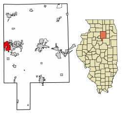
Geography

Historical photo of the bluffs of the Illinois River Valley in Peru, Illinois. Water Street in Peru, Illinois.jpg
Historical photo of the bluffs of the Illinois River Valley in Peru, Illinois.

As of 2021, Peru has a total area of 10.12 square miles (26.21 km2), of which 9.986 square miles (25.86 km2) (or 98.68%) is land and 0.134 square miles (0.35 km2) (or 1.32%) is water. [2]

Located on the Illinois River, Peru lies 3 miles (4.8 km) west of the intersection of two major interstate highways: Interstate 39 and Interstate 80. The city is also the western terminus of the historic Illinois and Michigan Canal. Before the Illinois Waterway was constructed, the Illinois River was navigable only up to Peru. Starved Rock State Park, a regional tourist attraction, is located 5 miles (8.0 km) south-east of the community. Peru has a twin city on its eastern edge, LaSalle.

Climate

Climate data for Peru, Illinois (1991–2020 normals, extremes 1901–present)
MonthJanFebMarAprMayJunJulAugSepOctNovDecYear
Record high °F (°C)68
(20)
72
(22)
84
(29)
94
(34)
105
(41)
107
(42)
113
(45)
106
(41)
103
(39)
93
(34)
82
(28)
70
(21)
113
(45)
Mean daily maximum °F (°C)30.0
(−1.1)
34.5
(1.4)
47.5
(8.6)
60.9
(16.1)
72.5
(22.5)
81.3
(27.4)
84.0
(28.9)
82.2
(27.9)
76.9
(24.9)
63.9
(17.7)
48.4
(9.1)
35.5
(1.9)
59.8
(15.4)
Daily mean °F (°C)22.0
(−5.6)
26.0
(−3.3)
37.4
(3.0)
49.3
(9.6)
60.9
(16.1)
70.3
(21.3)
73.4
(23.0)
71.5
(21.9)
64.8
(18.2)
52.5
(11.4)
39.2
(4.0)
27.7
(−2.4)
49.6
(9.8)
Mean daily minimum °F (°C)14.0
(−10.0)
17.6
(−8.0)
27.3
(−2.6)
37.7
(3.2)
49.2
(9.6)
59.4
(15.2)
62.8
(17.1)
60.8
(16.0)
52.6
(11.4)
41.1
(5.1)
30.0
(−1.1)
19.9
(−6.7)
39.4
(4.1)
Record low °F (°C)−26
(−32)
−24
(−31)
−11
(−24)
13
(−11)
25
(−4)
37
(3)
42
(6)
37
(3)
25
(−4)
14
(−10)
−5
(−21)
−21
(−29)
−26
(−32)
Average precipitation inches (mm)1.81
(46)
1.77
(45)
2.28
(58)
3.77
(96)
4.49
(114)
4.62
(117)
3.89
(99)
3.70
(94)
3.41
(87)
3.50
(89)
2.71
(69)
2.10
(53)
38.05
(966)
Average snowfall inches (cm)8.6
(22)
5.5
(14)
4.0
(10)
0.6
(1.5)
0.0
(0.0)
0.0
(0.0)
0.0
(0.0)
0.0
(0.0)
0.0
(0.0)
0.2
(0.51)
0.9
(2.3)
8.7
(22)
28.5
(72)
Average precipitation days (≥ 0.01 in)9.97.810.812.412.810.89.49.57.89.510.010.2120.9
Average snowy days (≥ 0.1 in)6.34.72.40.40.00.00.00.00.00.01.15.420.3
Source: NOAA [9] [10]

Demographics

Historical population
CensusPop.Note
1850 1,279
1860 3,139145.4%
1870 3,65016.3%
1880 4,63226.9%
1890 5,55019.8%
1900 6,86323.7%
1910 7,98416.3%
1920 8,86911.1%
1930 9,1212.8%
1940 8,983−1.5%
1950 8,653−3.7%
1960 10,46020.9%
1970 11,77212.5%
1980 10,873−7.6%
1990 9,302−14.4%
2000 9,8205.6%
2010 10,2954.8%
2020 9,896−3.9%
Decennial US Census

As of the 2020 census [11] there were 9,896 people, 4,482 households, and 2,760 families residing in the city. The population density was 977.87 inhabitants per square mile (377.56/km2). There were 4,825 housing units at an average density of 476.78 per square mile (184.09/km2). The racial makeup of the city was 86.86% White, 1.31% African American, 0.21% Native American, 1.75% Asian, 0.03% Pacific Islander, 2.68% from other races, and 7.15% from two or more races. Hispanic or Latino of any race were 9.43% of the population.

There were 4,482 households, out of which 25.6% had children under the age of 18 living with them, 47.81% were married couples living together, 10.95% had a female householder with no husband present, and 38.42% were non-families. 34.65% of all households were made up of individuals, and 17.00% had someone living alone who was 65 years of age or older. The average household size was 2.64 and the average family size was 2.12.

The city's age distribution consisted of 19.5% under the age of 18, 6.2% from 18 to 24, 21.1% from 25 to 44, 27.2% from 45 to 64, and 26.1% who were 65 years of age or older. The median age was 49.2 years. For every 100 females, there were 84.4 males. For every 100 females age 18 and over, there were 84.6 males.

The median income for a household in the city was $52,635, and the median income for a family was $73,477. Males had a median income of $50,645 versus $24,706 for females. The per capita income for the city was $34,268. About 6.3% of families and 11.3% of the population were below the poverty line, including 22.9% of those under age 18 and 3.2% of those age 65 or over.

Economy

St. Margaret's Health Peru (formerly Illinois Valley Community Hospital) West Street in Peru, Illinois.jpg
St. Margaret's Health Peru (formerly Illinois Valley Community Hospital)

There are a number of business districts in Peru. The largest is at the intersection of I-80 and IL-251. Then there are three smaller districts along the US-6 Corridor, including Peru's downtown. The largest employers in Peru are the Peru Mall, the Illinois Valley Community Hospital, Walmart, James Hardie, Officemax, the American Nickeloid, Liberty Village, Double D Express, Heritage Manor Nursing Home, Eakas, Target, and Horizon Industries. [12]

Peru is the home of at least three very old companies. It is the national headquarters of American Nickeloid, started in 1898, and the W.H. Maze Co, dealing in lumber and nails, which started the year the Illinois and Michigan Canal opened in 1848. Maze Nails is one of America's last remaining nail makers. Peru is home to the offices of Carus Chemical Company, started in 1915, today one of the largest manufacturers of potassium permanganate in the world. [13]

In 2021, the DuPage Pistol Shrimp baseball team relocated from Lisle, Illinois to Peru, becoming the Illinois Valley Pistol Shrimp. The Pistol Shrimp are a member of the collegiate Prospect League.[ citation needed ]

Education

Schools serving Peru include: [14]

Elementary schools

High schools

Transportation

The city operates Illinois Valley Regional Airport. [15]

Notable people

Related Research Articles

<span class="mw-page-title-main">Scott County, Iowa</span> County in Iowa, United States

Scott County is a county located in the U.S. state of Iowa. As of the 2020 census, the population was 174,669, making it the third-most populous county in Iowa. The county seat is Davenport.

<span class="mw-page-title-main">LaSalle County, Illinois</span> County in Illinois, United States

LaSalle County is located within the Fox Valley and Illinois River Valley regions of the U.S. state of Illinois. As of the 2020 Census, it had a population of 109,658. Its county seat and largest city is Ottawa. LaSalle County is part of the Ottawa, IL Micropolitan Statistical Area of Northern Illinois.

<span class="mw-page-title-main">Cherry, Illinois</span> Village in Illinois, United States

Cherry is a village in Bureau County, Illinois, United States. The population was 435 at the 2020 census. It is part of the Ottawa Micropolitan Statistical Area. It is located northwest of LaSalle-Peru, just a few miles north of Interstate 80, and is about 75 miles (121 km) east of the Quad Cities.

<span class="mw-page-title-main">Spring Valley, Illinois</span> City in Illinois, United States

Spring Valley is a city situated on the Illinois River in Bureau County, Illinois, United States. The population was 5,582 at the 2020 census, up from 5,558 in 2010. It is part of the Ottawa Micropolitan Statistical Area.

<span class="mw-page-title-main">Lemont, Illinois</span> Village in Illinois, United States

Lemont is a village located in Cook, DuPage, and Will counties in the U.S. state of Illinois, and is a south-west suburb of Chicago. The population was 17,629 as of the 2020 census. The village is situated on a hillside along the south banks of the Des Plaines River. It overlooks Waterfall Glen's Midwestern Bluff Savanna on the opposite side. Lemont is home to Argonne National Laboratory and other heavy industrial sites, and has a substantial European immigrant population.

<span class="mw-page-title-main">Summit, Illinois</span> Village in Illinois, United States

Summit is a village in Cook County, Illinois, United States. The population was 11,161 at the 2020 census. The name Summit, in use since 1836, refers to the highest point on the Chicago Portage between the northeast-flowing Chicago River and the southwest-flowing Des Plaines River located just north of the village.

<span class="mw-page-title-main">Seneca, Illinois</span> Village in Illinois, United States

Seneca is a village in LaSalle and Grundy counties in the U.S. state of Illinois. The population was 2,353 at the 2020 census, down from 2,371 at the 2010 census.

<span class="mw-page-title-main">Millington, Illinois</span> Village in Illinois, United States

Millington is a village in Kendall and LaSalle counties in the U.S. state of Illinois. The population was 617 at the 2020 census, down from 665 at the 2010 census.

<span class="mw-page-title-main">LaSalle, Illinois</span> City in Illinois, United States

LaSalle or La Salle is a city in LaSalle County, Illinois, United States, located at the intersection of Interstates 39 and 80. It is part of the Ottawa, IL Micropolitan Statistical Area. Originally platted in 1837 over one square mile, the city's boundaries have grown to 12 sq mi (31 km2). City boundaries extend from the Illinois River and Illinois and Michigan Canal to a mile north of Interstate 80 and from the city of Peru on the west to the village of North Utica on the east. Starved Rock State Park is located approximately 5 mi (8 km) to the east. The population was 9,582 as of the 2020 census, down from 9,609 at the 2010 census. LaSalle and its twin city, Peru, make up the core of the Illinois Valley. Due to their combined dominance of the zinc processing industry in the early 1900s, they were collectively nicknamed "Zinc City."

<span class="mw-page-title-main">Marseilles, Illinois</span> City in Illinois, United States

Marseilles is a city in LaSalle County, Illinois, United States. An Illinois River town, the population was 4,845 at the 2020 census, down from 5,094 at the 2010 census. It is part of the Ottawa, IL Micropolitan Statistical Area.

<span class="mw-page-title-main">Mendota, Illinois</span> City in Illinois, United States

Mendota is a city in LaSalle County, Illinois, United States, in the state's north-central region. The population was 7,061 at the 2020 census. It is part of the Ottawa, IL Micropolitan Statistical Area. Mendota is located approximately 85 miles west of Chicago, 70 miles east of Moline and 55 miles south of Rockford. The current mayor is David W. Boelk, an independent elected to a four-year term.

<span class="mw-page-title-main">North Utica, Illinois</span> Village in Illinois, United States

North Utica, often known as Utica, is a village in Utica Township, LaSalle County, Illinois. The population was 1,323 at the 2020 census. It is part of the Ottawa Micropolitan Statistical Area.

<span class="mw-page-title-main">Oglesby, Illinois</span> City in Illinois, United States

Oglesby is a city in LaSalle County, Illinois, United States. The population was 3,712 at the 2020 census, down from 3,791 at the 2010 census. It is part of the Ottawa Micropolitan Statistical Area.

<span class="mw-page-title-main">Ottawa, Illinois</span> City in Illinois, United States

Ottawa is a city in and the county seat of LaSalle County, Illinois, United States. It is located at the confluence of the navigable Fox River and Illinois River, the latter being a conduit for river barges and connects Lake Michigan at Chicago, to the Mississippi River, and North America's 25,000 mile river system. The population estimate was 18,742, as of 2020. It is the principal city of the Ottawa, IL Micropolitan Statistical Area.

<span class="mw-page-title-main">Rutland, Illinois</span> Village in Illinois, United States

Rutland is a village in LaSalle County, Illinois, United States. It is part of the Ottawa Micropolitan Statistical Area. As of the 2020 census, the population was 259, down from 318 at the 2010 census.

<span class="mw-page-title-main">Tonica, Illinois</span> Village in LaSalle County, Illinois

Tonica is a village in LaSalle County, Illinois, United States. The population was 749 at the 2020 census, down from 768 at the 2010 census. It is part of the Ottawa Micropolitan Statistical Area.

<span class="mw-page-title-main">Troy Grove, Illinois</span> Village in Illinois, United States

Troy Grove is a village in LaSalle County, Illinois, United States. The population was 225 at the 2020 census, down from 250 at the 2010 census. It is part of the Ottawa, IL Micropolitan Statistical Area.

<span class="mw-page-title-main">Wenona, Illinois</span> City in Illinois, United States

Wenona is a city in Marshall and LaSalle counties in the U.S. state of Illinois. The population was 974 at the 2020 census.

<span class="mw-page-title-main">Victor Andre Matteson</span> American architect

Victor Andre Matteson was an American architect. His practice was based in Chicago and LaSalle, Illinois.

<span class="mw-page-title-main">Matthiessen and Hegeler Zinc Company</span> Zinc manufacturer

The Mattheissen and Hegeler (M&H) Zinc Company was a zinc manufacturing company headquartered in LaSalle, Illinois. At one time, the family-owned company was the largest zinc manufacturing plant in the United States. The company brought zinc ore from Wisconsin and Missouri to the coal fields of Northern Illinois. The company and its founders had a large influence in the development of LaSalle & Peru, Illinois.

References

  1. 1 2 3 U.S. Geological Survey Geographic Names Information System: Peru, Illinois
  2. 1 2 Bureau, US Census. "Gazetteer Files". Census.gov. Retrieved June 27, 2022.
  3. "Illinois Counties and Incorporated Municipalities". Office of the Illinois Secretary of State-Publications/Forms. Illinois Secretary of State. July 1, 2012. Retrieved November 3, 2021.
  4. 1 2 3 Maze, Nancy (1985). Tales and Pictures of Peru: Peru's 150th Anniversary. Peru, Illinois: Letterkraft Printers Inc.
  5. Archived June 14, 2010, at the Wayback Machine
  6. Archived June 13, 2010, at the Wayback Machine
  7. Details, genealogytrails.com; accessed October 31, 2015.
  8. "About". Westclox Museum. Retrieved February 23, 2022.
  9. "NowData – NOAA Online Weather Data". National Oceanic and Atmospheric Administration. Retrieved July 11, 2021.
  10. "Station: Peru, IL". U.S. Climate Normals 2020: U.S. Monthly Climate Normals (1991-2020). National Oceanic and Atmospheric Administration. Retrieved July 11, 2021.
  11. "Explore Census Data". data.census.gov. Retrieved June 28, 2022.
  12. Employers: Peru, IL, ivaced.org; accessed October 31, 2015.
  13. "Locations". www.caruscorporation.com. Retrieved April 15, 2020.
  14. "Schools". City of Peru, Illinois. Retrieved October 26, 2018.
  15. "Illinois Valley Regional Airport". City of Peru, Illinois. Retrieved February 23, 2022.