Troy Grove, Illinois

Last updated

Troy Grove, Illinois
Homer, Illinois
20110101 06 Troy Grove, Illinois.jpg
Grain elevator in Troy Grove
LaSalle County Illinois Incorporated and Unincorporated areas Troy Grove Highlighted.svg
Location in LaSalle County, Illinois
Illinois in United States (US48).svg
Location of Illinois in the United States
Coordinates: 41°27′57″N89°04′54″W / 41.46583°N 89.08167°W / 41.46583; -89.08167 [1]
CountryUnited States
StateIllinois
County LaSalle
Township Troy Grove
IncorporatedApril 3rd, 1886 [2]
Government
  Village presidentCharles Mammen
Area
[3]
  Total0.69 sq mi (1.78 km2)
  Land0.69 sq mi (1.78 km2)
  Water0.00 sq mi (0.00 km2)
Elevation
[1]
663 ft (202 m)
Population
 (2020)
  Total225
  Density327.51/sq mi (126.48/km2)
Time zone UTC-6 (CST)
  Summer (DST) UTC-5 (CDT)
ZIP Code(s)
61372
Area code(s) Area codes 815 and 779
FIPS code 17-76225
GNIS feature ID2400005 [1]
Wikimedia CommonsTroy Grove, Illinois

Troy Grove is a village in LaSalle County, Illinois, United States. The population was 225 at the 2020 census, down from 250 at the 2010 census. [4] It is part of the Ottawa, IL Micropolitan Statistical Area.

Contents

Troy Grove is notable as the birthplace of Wild Bill Hickok and Kate Austin. It is home to the Wild Bill Hickok Memorial. The town also has another connection to the Wild West, as the last reported wild bison killed in Illinois happened near the town in 1837. [5]

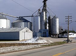
Silica sand, a fine white sand used in making glass, is mined in the vicinity of Troy Grove.

History

Troy Grove C&NW depot ca. 1920 Troy Grove Depot.jpg
Troy Grove C&NW depot ca. 1920

Originally laid out as Homer, Illinois, the village was named by an early settler who emigrated from Homer, New York. [6] As the town of Homer, Illinois already had a Post Office, the community took its name from a nearby grove, which was named for an early settler. [7] A Post Office has been in operation under the name of Troy Grove since 1837.

1939 C&NW Time Table listing the Troy Grove Depot 1939 C&NW Time Table.jpg
1939 C&NW Time Table listing the Troy Grove Depot

In the early 1830s a sawmill was built which facilitated the construction of a new schoolhouse in 1837. The village grew for several years and was home to several shops and businesses. The first store to open was owned by William Alonzo Hickok, father of Wild Bill Hickok. One of the first Presbyterian churches in the county was founded here in 1849 with a congregation of just 8 members. A gristmill was constructed in 1861 [2]

The village was previously served by the Northern Illinois Railroad [2] and the Chicago & Northwestern Railroad. Passenger service was ended in the early 1950s. The railroad is today owned and operated by Union Pacific to haul raw material from the active silica mines. [8]

Geography

Troy Grove is located in northwestern LaSalle County. U.S. Route 52 passes through the north side of the village as North 37th Road; it leads northwest 8 miles (13 km) to Mendota and east 54 miles (87 km) to Joliet. Interstate 39 passes 1.5 miles (2.4 km) east of the village, with access from Exit 66 (US 52). I-39 leads north 62 miles (100 km) to Rockford and south 7 miles (11 km) to Interstate 80 at LaSalle.

According to the 2021 census gazetteer files, Troy Grove has a total area of 0.69 square miles (1.79 km2), all land. [9] The Little Vermilion River, a south-flowing tributary of the Illinois River, passes through the southeast corner of the village.

Demographics

Historical population
CensusPop.Note
1880 168
1890 28368.5%
1900 31611.7%
1910 289−8.5%
1920 261−9.7%
1930 259−0.8%
1940 233−10.0%
1950 25810.7%
1960 2715.0%
1970 2813.7%
1980 2975.7%
1990 259−12.8%
2000 30517.8%
2010 250−18.0%
2020 225−10.0%
U.S. Decennial Census [10]

As of the 2020 census [11] there were 225 people, 80 households, and 55 families residing in the village. The population density was 327.51 inhabitants per square mile (126.45/km2). There were 106 housing units at an average density of 154.29 per square mile (59.57/km2). The racial makeup of the village was 97.78% White, 1.33% from other races, and 0.89% from two or more races. Hispanic or Latino of any race were 4.89% of the population.

There were 80 households, out of which 46.3% had children under the age of 18 living with them, 52.50% were married couples living together, 11.25% had a female householder with no husband present, and 31.25% were non-families. 22.50% of all households were made up of individuals, and 7.50% had someone living alone who was 65 years of age or older. The average household size was 3.05 and the average family size was 2.63.

The village's age distribution consisted of 28.6% under the age of 18, 5.2% from 18 to 24, 25.7% from 25 to 44, 31.4% from 45 to 64, and 9.0% who were 65 years of age or older. The median age was 34.4 years. For every 100 females, there were 96.3 males. For every 100 females age 18 and over, there were 100.0 males.

The median income for a household in the village was $73,333, and the median income for a family was $83,438. Males had a median income of $61,250 versus $30,000 for females. The per capita income for the village was $34,519. About 10.9% of families and 9.6% of the population were below the poverty line, including 12.1% of those under age 18 and 15.8% of those age 65 or over.

Related Research Articles

<span class="mw-page-title-main">LaSalle County, Illinois</span> County in Illinois, United States

LaSalle County is located within the Fox Valley and Illinois River Valley regions of the U.S. state of Illinois. As of the 2020 Census, it had a population of 109,658. Its county seat and largest city is Ottawa. LaSalle County is part of the Ottawa, IL Micropolitan Statistical Area of Northern Illinois.

<span class="mw-page-title-main">Arlington, Illinois</span> Village in Illinois, United States

Arlington is a village in Bureau County, Illinois, United States. The population was 169 at the 2020 census. It is part of the Ottawa Micropolitan Statistical Area, located east of the Quad Cities, north of Peoria and Galesburg, west of LaSalle and Peru, and southwest of Rockford and Chicago.

<span class="mw-page-title-main">Dalzell, Illinois</span> Village in Illinois, United States

Dalzell is a village in Bureau and LaSalle counties in the U.S. state of Illinois. The population was 663 at the 2020 census, down from 717 at the 2010 census. It is part of the Ottawa Micropolitan Statistical Area. Dalzell was founded on November 24, 1903 and certified on February 11, 1904.

<span class="mw-page-title-main">Seatonville, Illinois</span> Village in Illinois, United States

Seatonville is a village in Bureau County, Illinois, United States. The population was 321 at the 2020 census. It is part of the Ottawa Micropolitan Statistical Area.

<span class="mw-page-title-main">Maple Park, Illinois</span> Village in Illinois, United States

Maple Park is a village in DeKalb and Kane counties in the U.S. state of Illinois. The population was 1,433 at the 2020 census, up from 1,310 at the 2010 census. Maple Park was formerly known as Lodi.

<span class="mw-page-title-main">Somonauk, Illinois</span> Village in Illinois, United States

Somonauk is a village in DeKalb and LaSalle Counties in the U.S. state of Illinois. The population was 1,786 at the 2020 Census, down from 1,893 at the 2010 Census.

<span class="mw-page-title-main">Lisbon, Illinois</span> Village in Illinois, United States

Lisbon is a village in Kendall County, Illinois, United States. The population was 271 at the 2020 census.

<span class="mw-page-title-main">Millington, Illinois</span> Village in Illinois, United States

Millington is a village in Kendall and LaSalle counties in the U.S. state of Illinois. The population was 617 at the 2020 census, down from 665 at the 2010 census.

<span class="mw-page-title-main">LaSalle, Illinois</span> City in Illinois, United States

LaSalle or La Salle is a city in LaSalle County, Illinois, United States, located at the intersection of Interstates 39 and 80. It is part of the Ottawa, IL Micropolitan Statistical Area. Originally platted in 1837 over one square mile, the city's boundaries have grown to 12 sq mi (31 km2). City boundaries extend from the Illinois River and Illinois and Michigan Canal to a mile north of Interstate 80 and from the city of Peru on the west to the village of North Utica on the east. Starved Rock State Park is located approximately 5 mi (8 km) to the east. The population was 9,582 as of the 2020 census, down from 9,609 at the 2010 census. LaSalle and its twin city, Peru, make up the core of the Illinois Valley. Due to their combined dominance of the zinc processing industry in the early 1900s, they were collectively nicknamed "Zinc City."

<span class="mw-page-title-main">Leland, Illinois</span> Village in Illinois, United States

Leland is a village in LaSalle County, Illinois, United States. The population was 951 at the 2020 census. It is part of the Ottawa Micropolitan Statistical Area.

<span class="mw-page-title-main">Leonore, Illinois</span> Village in Illinois, United States

Leonore is a village in LaSalle County, Illinois, United States. The population was 121 at the 2020 census. It is part of the Ottawa Micropolitan Statistical Area.

<span class="mw-page-title-main">Lostant, Illinois</span> Village in Illinois, United States

Lostant is a village in LaSalle County, Illinois, United States. The population was 423 at the 2020 census, down from 498 at the 2010 census. It is part of the Ottawa Micropolitan Statistical Area.

<span class="mw-page-title-main">Mendota, Illinois</span> City in Illinois, United States

Mendota is a city in LaSalle County, Illinois, United States, in the state's north-central region. The population was 7,061 at the 2020 census. It is part of the Ottawa, IL Micropolitan Statistical Area. Mendota is located approximately 85 miles west of Chicago, 70 miles east of Moline and 55 miles south of Rockford. The current mayor is David W. Boelk, an independent elected to a four-year term.

<span class="mw-page-title-main">Ransom, Illinois</span> Village in Illinois, United States

Ransom is a village in LaSalle County, Illinois, United States. The population was 308 at the 2020 census, down from 384 at the 2010 census. It is part of the Ottawa Micropolitan Statistical Area. It is part of the subregion known as Streatorland.

<span class="mw-page-title-main">Rutland, Illinois</span> Village in Illinois, United States

Rutland is a village in LaSalle County, Illinois, United States. It is part of the Ottawa Micropolitan Statistical Area. As of the 2020 census, the population was 259, down from 318 at the 2010 census.

<span class="mw-page-title-main">Tonica, Illinois</span> Village in LaSalle County, Illinois

Tonica is a village in LaSalle County, Illinois, United States. The population was 749 at the 2020 census, down from 768 at the 2010 census. It is part of the Ottawa Micropolitan Statistical Area.

<span class="mw-page-title-main">Indian Creek, Illinois</span> Village in Illinois, United States

Indian Creek is a village in Vernon Township, Lake County, Illinois, United States. It is part of the Chicago metropolitan area. Per the 2020 census, the population was 536. Police services are provided by Lake County Sheriff and fire/EMS services by the Countryside Fire Protection District.

<span class="mw-page-title-main">Cornell, Illinois</span> Village in Illinois, United States

Cornell is a village in Livingston County, Illinois, United States. The population was 467 at the 2010 census.

<span class="mw-page-title-main">Marine, Illinois</span> Village in Illinois, United States

Marine is a village in Madison County, Illinois, United States. The population was 912 at the 2020 census.

<span class="mw-page-title-main">Maryville, Illinois</span> Village in Illinois, United States

Maryville is a village in Madison County, Illinois, United States. The population was 8,221 at the 2020 census, up from 7,487 in 2010.

References

  1. 1 2 3 U.S. Geological Survey Geographic Names Information System: Troy Grove, Illinois
  2. 1 2 3 Kett, H.F. (1877). The Past and present of La Salle County, Illinois : containing a history of the county, its cities, towns, &c., a biographical directory of its citizens, war record of its volunteers in the late rebellion, portraits of early settlers and prominent men, general and local statistics, map of La Salle County, history of Illinois, Constitution of the United States, miscellaneous matters, etc, etc. pp. 347–349.
  3. "2020 U.S. Gazetteer Files". United States Census Bureau. Retrieved March 15, 2022.
  4. "Profile of General Population and Housing Characteristics: 2010 Census Summary File 1 (DP-1), Troy Grove village, Illinois". American FactFinder. U.S. Census Bureau. Archived from the original on February 13, 2020. Retrieved January 9, 2020.
  5. "Returning to the Prairie - Bison at Midewin - National Forest Foundation".
  6. "LaSalle County". Jim Forte Postal History. Retrieved March 30, 2015.
  7. Chicago and North Western Railway Company (1908). A History of the Origin of the Place Names Connected with the Chicago & North Western and Chicago, St. Paul, Minneapolis & Omaha Railways. p. 131.
  8. "1939 C&NW Timetable (Troy Grove listed in table 41)" (PDF). October 8, 1939. Retrieved October 11, 2020.
  9. Bureau, US Census. "Gazetteer Files". Census.gov. Retrieved June 29, 2022.
  10. "Census of Population and Housing". Census.gov. Retrieved June 4, 2015.
  11. "Explore Census Data". data.census.gov. Retrieved June 28, 2022.