Mendota is a city in LaSalle County, Illinois, United States, in the state's north-central region. The population was 7,061 at the 2020 census.[4] It is part of the Ottawa, IL Micropolitan Statistical Area. Mendota is located approximately 85 miles west of Chicago, 70 miles east of Moline and 55 miles south of Rockford. The current mayor is David W. Boelk, an independent elected to a four-year term.
In summer of 1853, the Illinois Central Railroad was completed and crossed the existing Chicago and Aurora Railroad. The Chicago, Burlington and Quincy Railroad completed the crossing at the present site of Mendota. By the following year, the population had grown to more than 1,000 and the town was home to saloons, hotels, and various shops. The town was incorporated as a village in 1855 and reincorporated as a town in 1859. By 1860, the town was also home to churches of 5 denominations.[citation needed]
With the availability of the railroads to facilitate export, several manufactures of items ranging from organs to cigars and buttons opened factories in Mendota. By the end of the American Civil War, the population of the town had more than doubled to over 2,000. By winter of 1866, citizens voted on a referendum to secure a city government.[6] Mendota was incorporated into its current city government on April 9, 1867.[6][7]
A library was opened on September 8, 1874, with 1700 books secured by donation. It was acquired by the city government in 1894. The original building was replaced in 1905 by a new Carnegie Library.[2]
A new Union station was opened on February 23, 1888, to replace the Passenger House, which was the original depot that had burned down in 1885. The new building contained a hotel, restaurants, and separate waiting areas for passengers and railroad staff. Because of falling revenue and ridership, much of the station was torn down in 1942. The current Mendota station is the only remaining portion of the original structure.[8]
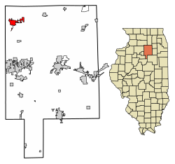
Geography
According to the 2010 census, Mendota has a total area of 5.096 square miles (13.20km2), of which 5 square miles (12.95km2) (or 98.12%) is land and 0.096 square miles (0.25km2) (or 1.88%) is water.[9]
Mendota Creek, a south flowing tributary of the Little Vermilion River, flows through downtown Mendota from its headwaters in the agricultural fields northwest of town. The creek was identified in 2014 as having chronic problems with dissolved oxygen and fecal coliform bacteria concentrations.[10]
As of the 2020 census[12] there were 7,061 people, 2,788 households, and 1,921 families residing in the city. The population density was 1,370.54 inhabitants per square mile (529.17/km2). There were 3,099 housing units at an average density of 601.51 per square mile (232.24/km2). The racial makeup of the city was 73.40% White, 1.40% African American, 1.02% Native American, 0.92% Asian, 0.06% Pacific Islander, 11.94% from other races, and 11.26% from two or more races. Hispanic or Latino of any race were 29.47% of the population.
There were 2,788 households, out of which 35.4% had children under the age of 18 living with them, 48.46% were married couples living together, 15.42% had a female householder with no husband present, and 31.10% were non-families. 26.26% of all households were made up of individuals, and 13.24% had someone living alone who was 65 years of age or older. The average household size was 2.92 and the average family size was 2.42.
The city's age distribution consisted of 23.7% under the age of 18, 10.6% from 18 to 24, 23.1% from 25 to 44, 24.2% from 45 to 64, and 18.6% who were 65 years of age or older. The median age was 39.5 years. For every 100 females, there were 95.7 males. For every 100 females age 18 and over, there were 94.9 males.
The median income for a household in the city was $58,974, and the median income for a family was $65,985. Males had a median income of $43,926 versus $26,643 for females. The per capita income for the city was $30,470. About 5.9% of families and 11.2% of the population were below the poverty line, including 14.9% of those under age 18 and 4.2% of those age 65 or over.
Economy
A number of businesses operate within Mendota including:[13]
Del Monte Foods, a food processing company. The Del Monte plant was slated to close at the end of the 2019 packing season,[14] until a buyer was found later that year. The purchase is set to be completed in spring 2020.[15]
Arts and culture
The Mendota Sweet Corn Festival[16] attracts thousands of visitors each August; it features a parade, carnival, beer garden with live bands, free sweet corn cooked in a vintage steam engine, and other special events. The city closes down several streets in the downtown area to host the annual event which is sponsored by Del Monte Foods. The Mendota Tri-County Fair[17] is held every Labor Day weekend at the Mendota Fairgrounds. The fair hosts a carnival, beer garden, and several other events.
The Breaking the Prairie Museum[22] is a small barn replica showcasing a rotating display with one large item (a vintage tractor or large item of farm husbandry) and several smaller items. Adjacent to the barn is "The Country Chapel", a small church which is owned by the museum. Completed in 2004, it houses a restored pump organ from the 1880s. It is closed to the public, however special tours can be arranged by contacting the Mendota Historical Society Office.[23]
Parks and recreation
The city has two man made lakes, Lake Mendota and Lake Kakusha, used for boating and fishing. Mendota also maintains a community swimming pool as well as several parks including Snyders Grove, a 104-acre (0.42km2) reserve/park.[24]
Education
Mendota has four public schools and one private school. The three public grade schools: Blackstone, Lincoln, and Northbrook are part of Mendota Consolidated Community School District 289; while the Mendota Township High School is district 280. Blackstone School houses kindergarten and first grade, and had an enrollment of 271 students in 2010. Lincoln School houses second through fourth grades, and had a student enrollment of 391 in 2010. Northbrook School is home to the fifth through eighth grades, as well as pre-kindergarten; and had an enrollment of 644 in 2010. The student enrollment of the high school in 2010 was 611 students.[25] A new high school facility was built in 2002 at 2300 Main Street (U.S. Route 52). Holy Cross Roman CatholicParish[26] has a private school which educates students from pre-kindergarten through eighth grade.
Aurora University was originally chartered as Mendota College on the north side of Mendota where the high school was located from 1917 to 2003.[27]
1 2 3 The Past and present of La Salle County, Illinois: containing a history of the county, its cities, towns, &c., a biographical directory of its citizens, war record of its volunteers in the late rebellion, portraits of early settlers and prominent men, general and local statistics, map of La Salle County, history of Illinois, Constitution of the United States, miscellaneous matters, etc, etc. Chicago: H.F. Kett & Co. 1877. pp.314–323.
This page is based on this Wikipedia article Text is available under the CC BY-SA 4.0 license; additional terms may apply. Images, videos and audio are available under their respective licenses.