Mineral, Illinois

Last updated
Village of Mineral
20110723 31 Mineral, Illinois.jpg
Grain elevator in Mineral
Bureau County Illinois Incorporated and Unincorporated areas Mineral Highlighted.svg
Location of Mineral in Bureau County, Illinois.
Illinois in United States (US48).svg
Location of Illinois in the United States
Coordinates: 41°22′55″N89°50′12″W / 41.38194°N 89.83667°W / 41.38194; -89.83667
CountryUnited States
StateIllinois
County Bureau
Township Mineral
Area
[1]
  Total0.553 sq mi (1.43 km2)
  Water0.00 sq mi (0.0 km2)
Population
 (2020)
  Total206
  Density370/sq mi (140/km2)
Time zone UTC-6 (CST)
  Summer (DST) UTC-5 (CDT)
Zip Code
61344
Area code 309
FIPS code 17-49516

Mineral is a village in Bureau County, Illinois, United States. The population was 206 at the 2020 census, down from 237 at the 2010 census. It is part of the Ottawa Micropolitan Statistical Area.

Contents

Geography

Mineral is located at 41°22′55″N89°50′12″W / 41.38194°N 89.83667°W / 41.38194; -89.83667 (41.381921, -89.836576). [2]

According to the 2021 census gazetteer files, Mineral has a total area of 0.55 square miles (1.42 km2), all land. [3]

History

The area in which Mineral is located was first settled in the early 1830s. The land just south of the current village was found to be ripe with coal. Several mines were open until strip mining became a commonly practiced way to retrieve coal from the ground.

The population of the township of Mineral (so named because of its rich coal supply) became populated to the point of where it was officially organized in 1850. As the train tracks were laid north of the coal mining area, so brought the formation of the town of Mineral. The town of Mineral was platted in 1857 and soon developed several small stores and a population of 300 to 350 residents.

A school was erected in 1870, with the town's first graduating high school class being the class of 1894, with three students earning their diplomas. The year 1907 brought the completion of the Hennepin Canal to the north of Mineral. The canal's practical use was outdated by its completion due to the vast developments in the train industry. The Hennepin Canal continues to function as a fishing and boating area.

In 1919, the Mineral School building was destroyed by fire. The school district was organized and determined to rebuild. In 1922, a new two-story brick school building was built on the northwest side of town. This school was built to handle grades 1 - 12 and included a gymnasium complete with a stage and balcony area. During this time, Mineral continued to grow at a steady pace. Though the town's population is said to have never exceeded 350 people, the town was able to support several small businesses, allowing the residents to have all they needed within walking distance of their homes. The creation of U.S. Route 6, which passed through Mineral, was also an asset to the town, bringing in visitors from all over the country.

Mineral enjoyed great successes through the 1930s, 1940s, and 1950s, continuing to support its own school system and several small businesses including, at one time, three gas stations, three restaurant/taverns, an upholstery store, a motel, two grain elevators, two churches, a lumber yard, two grocery stores, a bank, a volunteer fire department, a library, a barbershop, a beauty shop, an ice cream parlor and Mineral High School.

In 1961, the high school was closed due to a lack of sufficient enrollment. The Mineral School District agreed to an annexation effort into the Annawan School District. The Mineral School building continued to serve as a grade school for the Annawan School District until 1974, when its services as a school were ceased for good.

The creation of I-80 north of Mineral was the second devastating blow to the growth of Mineral in the 1960s. All foreign traffic that previously traveled through town by the hundreds of cars a day, now took the quicker, more efficient route of I-80. One by one the businesses closed in this once bustling community.

Today Mineral still supports a grain elevator, a restaurant/tavern, a library, a new post office, a Methodist Church, a volunteer Fire Department, and a trucking business. The old school building has been razed. A new ethanol plant is being built just two miles west of town and is bringing hope for a resurgence in population for the area.
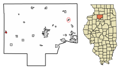
Demographics

Historical population
CensusPop.Note
1880 173
1890 1888.7%
1900 33980.3%
1910 3492.9%
1920 308−11.7%
1930 266−13.6%
1940 30715.4%
1950 274−10.7%
1960 33020.4%
1970 286−13.3%
1980 32513.6%
1990 250−23.1%
2000 2728.8%
2010 237−12.9%
2020 206−13.1%
U.S. Decennial Census [4]

As of the 2020 census [5] there were 206 people, 105 households, and 56 families residing in the village. The population density was 372.51 inhabitants per square mile (143.83/km2). There were 110 housing units at an average density of 198.92 per square mile (76.80/km2). The racial makeup of the village was 89.32% White, 2.91% African American, 0.49% Native American, and 7.28% from two or more races. Hispanic or Latino of any race were 1.94% of the population.

There were 105 households, out of which 22.9% had children under the age of 18 living with them, 33.33% were married couples living together, 8.57% had a female householder with no husband present, and 46.67% were non-families. 45.71% of all households were made up of individuals, and 24.76% had someone living alone who was 65 years of age or older. The average household size was 2.96 and the average family size was 2.09.

The village's age distribution consisted of 21.5% under the age of 18, 10.0% from 18 to 24, 23.7% from 25 to 44, 27.8% from 45 to 64, and 16.9% who were 65 years of age or older. The median age was 41.1 years. For every 100 females, there were 133.0 males. For every 100 females age 18 and over, there were 117.7 males.

The median income for a household in the village was $38,125, and the median income for a family was $59,583. Males had a median income of $36,750 versus $18,125 for females. The per capita income for the village was $22,874. About 12.5% of families and 12.3% of the population were below the poverty line, including 29.8% of those under age 18 and 5.4% of those age 65 or over.

Notable people

Related Research Articles

<span class="mw-page-title-main">Pepeekeo, Hawaii</span> Census-designated place in Hawaii, U.S.

Pepeekeo is a census-designated place (CDP) in Hawaii County, Hawaii, United States. The population was 1,789 at the 2010 census, up from 1,697 at the 2000 census.

<span class="mw-page-title-main">Arlington, Illinois</span> Village in Illinois, United States

Arlington is a village in Bureau County, Illinois, United States. The population was 169 at the 2020 census. It is part of the Ottawa Micropolitan Statistical Area, located east of the Quad Cities, north of Peoria and Galesburg, west of LaSalle and Peru, and southwest of Rockford and Chicago.

<span class="mw-page-title-main">Ladd, Illinois</span> Village in Illinois, United States

Ladd is a village in Bureau County, Illinois, United States. The population was 1,236 at the 2020 census. It is part of the Ottawa Micropolitan Statistical Area. Ladd is most known for Rip's Tavern, and for a Vietnam War tank located in the center of its park.

<span class="mw-page-title-main">Malden, Illinois</span> Village in Illinois, United States

Malden is a village in Bureau County, Illinois, United States. The population was 318 at the 2010 census. It is part of the Ottawa Micropolitan Statistical Area.

<span class="mw-page-title-main">Seatonville, Illinois</span> Village in Illinois, United States

Seatonville is a village in Bureau County, Illinois, United States. The population was 321 at the 2020 census. It is part of the Ottawa Micropolitan Statistical Area.

<span class="mw-page-title-main">Palos Park, Illinois</span> Village in Illinois, United States

Palos Park is a village in southwestern Cook County, Illinois, United States. Per the 2020 census, the population was 4,899.

<span class="mw-page-title-main">Annawan, Illinois</span> Town in Illinois, United States

Annawan is an incorporated town in Henry County, Illinois, United States. The population was 878 at the 2010 census.

<span class="mw-page-title-main">Coal Valley, Illinois</span> Village in Illinois, United States

The village of Coal Valley is located in both Rock Island County and Henry County in the U.S. state of Illinois. The population was 3,743 at the 2010 census, up from 3,606 in 2000. It is mostly residential, housing families who work in or out of the greater Quad Cities Area and is considered a suburb. The students of the Rock Island County part of Coal Valley attend the Moline School District number 40, and in the Henry County portion, Orion Community Unit School District 223

<span class="mw-page-title-main">Buckingham, Illinois</span> Village in Illinois, United States

Buckingham is a village in Kankakee County, Illinois, United States. The population was 300 at the 2010 census, up from 237 at the 2000 census. The village is about 63.7 miles south west of Chicago Illinois. It is included in the Kankakee-Bradley, Illinois Metropolitan Statistical Area.

<span class="mw-page-title-main">Cedar Point, Illinois</span> Village in Illinois, United States

Cedar Point is a village in LaSalle County, Illinois, United States. The population was 266 at the 2020 census, down from 277 at the 2010 census. It is part of the Ottawa Micropolitan Statistical Area. North of town was the Cedar Point Mine, which operated from 1906 to 1924.

<span class="mw-page-title-main">Hennepin, Illinois</span> Place in Illinois, United States

Hennepin is a village located on the Illinois River in Putnam County, Illinois, United States. The population was 757 in 2010, an increase of 50 since the 2000 census. It is the county seat and second largest village in Putnam County.

<span class="mw-page-title-main">Standard, Illinois</span> Place in Illinois, United States

Standard is a village in Putnam County, Illinois, United States. The population was 220 at the 2010 census, down from 256 in 2000. It is part of the Ottawa Micropolitan Statistical Area.

<span class="mw-page-title-main">Milan, Illinois</span> Village in Illinois, United States

Milan is a village in Rock Island County, Illinois, United States. The population was 5,099 at the 2010 census.

<span class="mw-page-title-main">New Berlin, Illinois</span> Village in Illinois, United States

New Berlin is a village in Sangamon County, Illinois, United States. The population was 1,346 at the 2010 census, and 1,327 at a 2018 estimate. It is part of the Springfield Metropolitan Statistical Area. New Berlin is home to CUSD #16, New Berlin High School.

<span class="mw-page-title-main">La Fayette, Illinois</span> Village in Illinois, United States

La Fayette is a village in Stark County, Illinois. It is located south of Kewanee off Route 78 on Route 17|IL-17. The population was 223 at the 2010 census, down from 227 in 2000. It is part of the Peoria, Illinois Metropolitan Statistical Area. Once a prominent strip coal mine and farming village with; a general store, high school(until 1970), hotel, bank, grain elevator, train depot, and many other features and amenities. Once the coal mines shut down and railroad was removed in the early 1980s, it slowly became a low income and high poverty village with many people moving away and it eventually diminished to the hollow shell of what it once was.

<span class="mw-page-title-main">Tampico, Illinois</span> Village in Illinois, United States

Tampico is a village located in Tampico Township, Whiteside County, Illinois, United States next to Rock Falls and Sterling, Illinois. As of the 2010 census the village had a total population of 790, up from 772 at the 2000 census. It is known as the birthplace of Ronald Reagan, the 40th President of the United States.

<span class="mw-page-title-main">Mineral Ridge, Ohio</span> Census-designated place in Ohio, United States

Mineral Ridge is an unincorporated community and census-designated place in southern Trumbull and northern Mahoning counties in the U.S. state of Ohio. The population was 3,951 at the 2020 census. It is a suburb of the Youngstown–Warren metropolitan area. Mineral Ridge was named for valuable coal deposits near the original town site.

<span class="mw-page-title-main">Birnamwood, Wisconsin</span> Village in Wisconsin, United States

Birnamwood is a village in Marathon and Shawano counties in the U.S. state of Wisconsin. It is part of the Wausau, Wisconsin Metropolitan Statistical Area. The population was 818 at the 2010 census. Of this, 802 were in Shawano County, and 16 were in Marathon County. The village is located mostly within the town of Birnamwood in Shawano County; only a small portion extends into the town of Norrie in adjacent Marathon County. Until the 1990s, Birnamwood was home to the world's largest fiberglass badger. U.S. Route 45 runs through the village.

<span class="mw-page-title-main">Hixton, Wisconsin</span> Village in Wisconsin, United States

Hixton is a village in Jackson County, Wisconsin, United States, along the Trempealeau River. The population was 433 at the 2010 census. The village is located within the Town of Hixton.

<span class="mw-page-title-main">Mineral Township, Bureau County, Illinois</span> Township in Illinois, United States

Mineral Township is one of twenty-five townships in Bureau County, Illinois, USA. As of the 2020 census, its population was 477 and it contained 241 housing units.

References

  1. "2020 U.S. Gazetteer Files". United States Census Bureau. Retrieved March 15, 2022.
  2. "US Gazetteer files: 2010, 2000, and 1990". United States Census Bureau. 2011-02-12. Retrieved 2011-04-23.
  3. Bureau, US Census. "Gazetteer Files". Census.gov. Retrieved 2022-06-29.
  4. "Census of Population and Housing". Census.gov. Retrieved June 4, 2015.
  5. "Explore Census Data". data.census.gov. Retrieved 2022-06-28.