La Moille, Illinois | |
---|---|
Coordinates: 41°31′45″N89°16′52″W / 41.52917°N 89.28111°W | |
Country | United States |
State | Illinois |
County | Bureau |
Townships | Lamoille, Clarion |
Area | |
• Total | 1.16 sq mi (3.0 km2) |
• Land | 1.16 sq mi (3.0 km2) |
• Water | 0.00 sq mi (0.0 km2) 0% |
Population (2020) | |
• Total | 679 |
• Density | 590/sq mi (230/km2) |
Time zone | UTC-6 (CST) |
• Summer (DST) | UTC-5 (CDT) |
ZIP Code(s) | 61330 |
Area code | 815 |
FIPS code | 17-41794 |
Wikimedia Commons | La Moille, Illinois |
La Moille is a village in Bureau County, Illinois, United States. The population was 679 at the 2020 census. It is part of the Ottawa Micropolitan Statistical Area.
La Moille was named after the Lamoille River valley, in Vermont. [2]
La Moille was first settled in 1830 by Daniel Dimmick, who went on to found Dimmick, Illinois after the Blackhawk War. The village was originally named Greenfield when platted, but was soon after changed to La Moille. In 1870, an extension of the Chicago, Burlington, and Quincy Railroad began passenger and freight service between Mendota, IL and Fulton, IL. [3]
By 1877, the town was home to a hotel, several churches, more than a dozen stores, a grain elevator, doctors, and a one room schoolhouse. These businesses made up a downtown area of three blocks. The Allen School was built in 1887 to alleviate overcrowding brought on by the increasing population and consolidation of public schools. [4] A fire on May 19, 1916, destroyed much of the northern portion of the downtown area. [5]
La Moille is located at 41°31′45″N89°16′52″W / 41.52917°N 89.28111°W (41.529204, -89.281187). [6]
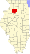
According to the 2021 census gazetteer files, La Moille has a total area of 1.16 square miles (3.00 km2), all land. [1]
The village is at the junction of State Highway 92 and U.S. Route 34, as well as State Highway 89 and U.S. Route 34.
Pike Creek, a tributary to Big Bureau Creek, flows south through the town.
Census | Pop. | Note | %± |
---|---|---|---|
1880 | 488 | — | |
1890 | 516 | 5.7% | |
1900 | 576 | 11.6% | |
1910 | 555 | −3.6% | |
1920 | 547 | −1.4% | |
1930 | 504 | −7.9% | |
1940 | 509 | 1.0% | |
1950 | 505 | −0.8% | |
1960 | 655 | 29.7% | |
1970 | 669 | 2.1% | |
1980 | 734 | 9.7% | |
1990 | 654 | −10.9% | |
2000 | 773 | 18.2% | |
2010 | 726 | −6.1% | |
2020 | 679 | −6.5% | |
U.S. Decennial Census [7] |
As of the 2020 census [8] there were 679 people, 297 households, and 206 families residing in the village. The population density was 587.37 inhabitants per square mile (226.78/km2). There were 313 housing units at an average density of 270.76 per square mile (104.54/km2). The racial makeup of the village was 93.67% White, 0.15% Asian, 0.44% from other races, and 5.74% from two or more races. Hispanic or Latino of any race were 5.89% of the population.
There were 297 households, out of which 32.0% had children under the age of 18 living with them, 61.28% were married couples living together, 5.72% had a female householder with no husband present, and 30.64% were non-families. 24.92% of all households were made up of individuals, and 11.45% had someone living alone who was 65 years of age or older. The average household size was 3.30 and the average family size was 2.70.
The village's age distribution consisted of 23.0% under the age of 18, 13.0% from 18 to 24, 20.2% from 25 to 44, 27% from 45 to 64, and 16.7% who were 65 years of age or older. The median age was 37.3 years. For every 100 females, there were 103.3 males. For every 100 females age 18 and over, there were 115.0 males.
The median income for a household in the village was $60,288, and the median income for a family was $63,125. Males had a median income of $31,726 versus $26,310 for females. The per capita income for the village was $28,568. About 1.5% of families and 3.7% of the population were below the poverty line, including 4.9% of those under age 18 and 8.2% of those age 65 or over.
Clayton is a village in Adams County, Illinois, United States. As of the 2020 census, the total population was 639 people, down from 709 at the 2010 census. It is part of the Quincy, IL–MO Micropolitan Statistical Area.
Cherry is a village in Bureau County, Illinois, United States. The population was 435 at the 2020 census. It is part of the Ottawa Micropolitan Statistical Area. It is located northwest of LaSalle-Peru, just a few miles north of Interstate 80, and is about 75 miles (121 km) east of the Quad Cities.
Ohio is a village in Bureau County, Illinois, United States. The population was 465 at the 2020 census. It is part of the Ottawa Micropolitan Statistical Area.
Wyanet is a village in Bureau County, Illinois, United States. The population was 886 at the 2020 census. It is part of the Ottawa Micropolitan Statistical Area.
Willowbrook is a village in DuPage County, Illinois, United States. Per the 2020 census, the population was 9,236. It is a southwestern suburb of Chicago.
Chebanse is a village in Iroquois and Kankakee counties in the U.S. state of Illinois. The population was 1,044 at the 2020 census. The Kankakee County portion of Chebanse is included in the Kankakee-Bradley, Illinois Metropolitan Statistical Area.
Elburn is a village in Kane County, Illinois, United States. The population was 5,602 as of the 2010 census, up from 2,756 at the 2000 census. It is located at the intersection of Illinois Route 38 and Route 47. Elburn is a town situated 46 miles (74 km) west of the Chicago Loop with frequent commuter rail service from its Metra station at the end of the Union Pacific West Line.
Lostant is a village in LaSalle County, Illinois, United States. The population was 423 at the 2020 census, down from 498 at the 2010 census. It is part of the Ottawa Micropolitan Statistical Area.
Nelson is a village in Lee County, Illinois, United States. The population was 170 at the 2010 census, up from 163 in 2000.
West Brooklyn is a village in Lee County, Illinois, United States. The population was 142 at the 2010 census, down from 174 in 2000.
Scottville is a village in Macoupin County, Illinois, United States. The population was 93 at the 2020 census.
Norwood is a village in Peoria County, Illinois, United States. The population was 478 at the 2010 census. Norwood, just outside Peoria, is part of the Peoria, Illinois Metropolitan Statistical Area.
Cantrall is a village in Sangamon County, Illinois, United States. The population was 139 at the 2000 census. It is part of the Springfield, Illinois Metropolitan Statistical Area.
La Fayette is a village in Stark County, Illinois. It is located south of Kewanee off Route 78 on Route 17|IL-17. The population was 223 at the 2010 census, down from 227 in 2000. It is part of the Peoria, Illinois Metropolitan Statistical Area. Once a prominent strip coal mine and farming village with; a general store, high school(until 1970), hotel, bank, grain elevator, train depot, and many other features and amenities. Once the coal mines shut down and railroad was removed in the early 1980s, it slowly became a low income and high poverty village with many people moving away and it eventually diminished to the hollow shell of what it once was.
Winslow is a village in Stephenson County, Illinois. The population was 338 at the 2010 census, down from 345 in 2000.
Deer Grove is a village in Whiteside County, Illinois, United States. The population was given as 45 in the 2010 census, down from 48 in 2000.
Ingalls Park is a census-designated place and suburb of Joliet in Will County, Illinois, United States. The population was 3,314 at the 2010 census. The town consists of a small neighborhood and a few businesses between Joliet's Pilcher Park and Interstate 80. It is the nearest town to Chicagoland Speedway, which hosted the NASCAR Cup Series from 2001 to 2019.
Durand is a village in Winnebago County, Illinois, United States. It is part of the Rockford, Illinois Metropolitan Statistical Area The population was 1,443 at the 2010 census, up from 1,081 in 2000.
Winnebago is a village in Winnebago County, Illinois. It is part of the Rockford-Winnebago Metropolitan Statistical Area. The population was 3,101 at the 2010 census, up from 2,958 in 2000.
La Moille Township is one of twenty-five townships in Bureau County, Illinois, USA. As of the 2020 census, its population was 1,010 and it contained 475 housing units.