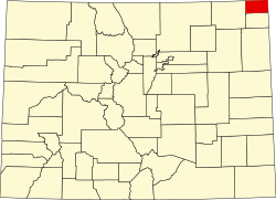
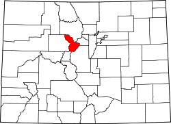
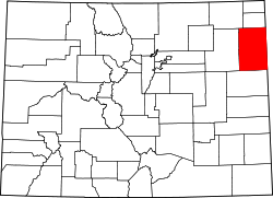
List of counties in Colorado

Last updated

The location of the State of Colorado in the United States of America. Colorado in United States.svg
The location of the State of Colorado in the United States of America.

The U.S. State of Colorado is divided into 64 counties. [1] Two of these, the City and County of Denver, which serves as the state capital, and the City and County of Broomfield, have consolidated city and county governments. In addition to Denver and Broomfield, Pitkin County and Weld County operate as home rule counties with their own county charters. [2] The other 60 counties operate under state regulations per Dillon's Rule. Counties are important units of government in Colorado since there are no civil townships or other minor civil divisions.

Contents

The United States Census Bureau estimates that El Paso County remains the most populous county in Colorado with a population estimate of 752,772, as of July 1, 2024, while Hinsdale County with a population of 747 is now the least populous. [a] Five of the 64 Colorado counties now have more than 500,000 residents, while 12 counties have fewer than 5,000 residents. [a]

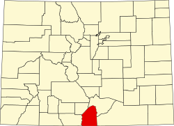
Las Animas County, 4,776 square miles (12,369 km2) in area, is the most extensive county, while the City and County of Broomfield, 34 square miles (87 km2) in area, is the least extensive. The City and County of Denver was the most densely populated Colorado county, with a 2024 population density of 4,918 residents per square mile of land area (1,899/km2), while Hinsdale County was the least densely populated county, with a 2024 population density of 0.67 resident per square mile of land area (0.26/km2).

Mount Elbert, the highest summit of Colorado and the entire Rocky Mountains at an elevation of 14,440 feet (4,401.2 m), is located in Lake County. The lowest point in Colorado is where the Arikaree River flows out of Yuma County and into Kansas, at 3,317 feet (1,011 m) elevation. [b] This point, which is the highest low point of any state, is higher than the highest points of 18 states and the District of Columbia. [4]

History

On November 1, 1861, the new Territory of Colorado created 17 original counties: Arapahoe, Boulder, Clear Creek, Costilla, Douglas, El Paso, Fremont, Gilpin, Guadalupe, Huerfano, Jefferson, Lake, Larimer, Park, Pueblo, Summit, and Weld; plus the Cheyenne Reserve. [5] [6] Six days later, the name of Guadelupe County was changed to Conejos County.

On February 9, 1866, the first new county, Las Animas, was created, followed by Saguache in December of that year. Bent County was created in February 1870, followed by Greenwood the following month. On February 2, 1874, Grand County and Elbert County were formed, and on February 10, La Plata, Hinsdale, and Rio Grande counties were created. Greenwood was absorbed into Bent on February 5. The last county to be created under the Colorado Territory name was San Juan County, created three months before statehood.

By the time Colorado became a state on August 1, 1876, it had only 26 counties. In January 1877, Routt and Ouray were formed, followed by Gunnison and Custer counties in March. In February 1879, Chaffee County was created. From February 8–10, 1879, Lake county was renamed Carbonate County. In 1881, Dolores County and Pitkin County were created. In 1883, Montrose, Mesa, Garfield, Eagle, Delta, and San Miguel counties were formed, leaving the total number of counties at 39. The number rose to 40 in 1885 with the creation of Archuleta County on April 14. Washington County and Logan County were both created in 1887. Between February 19 and April 16 in 1889, Morgan, Yuma, Cheyenne, Otero, Rio Blanco, Phillips, Sedgwick, Kiowa, Kit Carson, Lincoln, Prowers, Baca, and Montezuma counties were formed, bringing the total to 55. By 1900, Mineral County and Teller County had been added. On November 15, 1902, Arapahoe County was split into Adams and South Arapahoe Counties, and Denver was reconstituted as a consolidated city-county from portions of both newly formed counties on December 1, 1902. [7] By 1912, Jackson County, Moffat County, and Crowley County had been created. Alamosa was created in 1913. In 2001, Broomfield was reconstituted as a consolidated city-county from parts of Adams, Boulder, Jefferson and Weld counties, bringing the total to 64 counties.

Colorado counties

Select the OpenStreetMap link at the right to view the location of these 64 counties.

For Colorado counties by statistical area, see the List of statistical areas in Colorado.
For Colorado county seats, see the List of county seats in Colorado.
For Colorado county courthouses, see the List of Colorado county courthouses.
For Colorado county per capita income, see the List of Colorado counties by per capita income
For Colorado county socioeconomics, see the List of Colorado counties by socioeconomic factors.
For Colorado county highest elevation points, see the List of Colorado county high points.
For Colorado municipalities by county, see the List of Colorado municipalities by county.
For Colorado populated places by county, see the List of Colorado populated places by county.
For Colorado county maps, see the State of Colorado Map Viewer.

County population

The 64 Counties of the State of Colorado Ranked by Population

County [1] Population [14] County websiteCoordinates [e]
2024 rank2024 estimates [a] Change 2020 Census Change 2010 Census Change 2000 Census
El Paso County 1752,772+3.06%730,395+17.38%622,263+20.38%516,934 El Paso County
City and County of Denver 2729,019+1.89%715,522+19.22%600,158+8.37%553,805 City and County of Denver
Arapahoe County 3666,918+1.81%655,070+14.52%572,003+17.01%488,829 Arapahoe County
Jefferson County 4578,533−0.75%582,910+9.05%534,543+1.73%525,449 Jefferson County
Adams County 5542,973+4.50%519,572+17.66%441,603+26.87%348,076 Adams County
Douglas County 6393,995+10.06%357,978+25.40%285,465+62.44%175,732 Douglas County
Larimer County 7374,574+4.32%359,066+19.84%299,630+19.14%251,494 Larimer County
Weld County 8369,745+12.39%328,981+30.12%252,825+39.86%180,766 Weld County
Boulder County 9330,262−0.15%330,758+12.29%294,567+9.19%269,784 Boulder County
Pueblo County 10169,866+1.01%168,162+5.72%159,063+12.42%141,490 Pueblo County
Mesa County 11161,260+3.57%155,703+6.12%146,723+25.47%116,939 Mesa County
City and County of Broomfield 1278,323+5.68%74,112+32.61%55,889+42.57%39,202 City and County of Broomfield
Garfield County 1363,167+2.40%61,685+9.39%56,389+28.78%43,786 Garfield County
La Plata County 1456,823+2.13%55,638+8.38%51,334+16.78%43,957 La Plata County
Eagle County 1554,330−2.51%55,731+6.77%52,197+25.40%41,623 Eagle County
Fremont County 1650,093+2.36%48,939+4.52%46,824+1.48%46,140 Fremont County
Montrose County 1744,806+4.98%42,679+3.40%41,276+23.44%33,438 Montrose County
Delta County 1832,215+3.27%31,196+0.79%30,952+11.24%27,824 Delta County
Summit County 1930,882−0.56%31,055+10.93%27,994+18.82%23,560 Summit County
Morgan County 2030,300+4.08%29,111+3.38%28,159+3.63%27,172 Morgan County
Elbert County 2129,382+12.74%26,062+12.89%23,086+16.27%19,855 Elbert County
Montezuma County 2226,841+3.84%25,849+1.23%25,535+7.19%23,822 Montezuma County
Routt County 2325,243+1.67%24,829+5.61%23,509+19.46%19,679 Routt County
Teller County 2424,862+0.62%24,710+5.82%23,350+13.68%20,541 Teller County
Chaffee County 2520,780+6.70%19,476+9.36%17,809+9.59%16,250 Chaffee County
Logan County 2620,755−3.59%21,528−5.20%22,709+10.42%20,566 Logan County
Park County 2718,316+5.32%17,390+7.31%16,206+11.62%14,519 Park County
Otero County 2817,991−3.74%18,690−0.75%18,831−7.29%20,311 Otero County
Gunnison County 2917,310+2.32%16,918+10.40%15,324+9.46%14,000 Gunnison County
Alamosa County 3016,689+1.91%16,376+6.03%15,445+3.21%14,965 Alamosa County
Pitkin County 3116,643−4.12%17,358+1.22%17,148+15.17%14,889 Pitkin County
Grand County 3216,154+2.78%15,717+5.89%14,843+19.38%12,433 Grand County
Las Animas County 3314,518−0.25%14,555−6.14%15,507+1.94%15,212 Las Animas County
Archuleta County 3414,112+5.64%13,359+10.55%12,084+22.13%9,894 Archuleta County
Moffat County 3513,142−1.13%13,292−3.65%13,795+4.68%13,178 Moffat County
Prowers County 3611,957−0.35%11,999−4.40%12,551−13.34%14,483 Prowers County
Rio Grande County 3711,132−3.53%11,539−3.70%11,982−3.57%12,425 Rio Grande County
Yuma County 3810,048+0.60%9,988−0.55%10,043+2.00%9,846 Yuma County
Clear Creek County 399,076−3.42%9,397+3.40%9,088−1.89%9,263 Clear Creek County
San Miguel County 407,819−3.13%8,072+9.69%7,359+11.62%6,593 San Miguel County
Conejos County 417,549+1.18%7,461−9.63%8,256−1.71%8,400 Conejos County
Lake County 427,369−0.90%7,436+1.72%7,310−6.45%7,814 Lake County
Kit Carson County 437,080−0.10%7,087−14.30%8,270+3.21%8,013 Kit Carson County
Huerfano County 446,988+2.46%6,820+1.62%6,711−14.61%7,859 Huerfano County
Saguache County 456,670+4.74%6,368+4.26%6,108+3.46%5,904 Saguache County
Rio Blanco County 466,607+1.19%6,529−2.06%6,666+11.25%5,992 Rio Blanco County
Gilpin County 475,963+2.67%5,808+6.75%5,441+14.64%4,746 Gilpin County
Bent County 485,779+2.28%5,650−13.06%6,499+8.39%5,996 Bent County
Crowley County 495,600−5.44%5,922+1.70%5,823+5.60%5,514 Crowley County
Lincoln County 505,598−1.36%5,675+3.80%5,467−10.22%6,089 Lincoln County
Custer County 515,553+18.05%4,704+10.55%4,255+21.29%3,508 Custer County
Ouray County 525,197+6.63%4,874+9.87%4,436+18.39%3,747 Ouray County
Washington County 534,771−0.95%4,817+0.06%4,814−2.19%4,922 Washington County
Phillips County 544,488−0.93%4,530+1.98%4,442−0.96%4,485 Phillips County
Costilla County 553,686+5.34%3,499−0.71%3,524−3.74%3,661 Costilla County
Baca County 563,367−3.96%3,506−7.44%3,788−16.14%4,517 Baca County
Dolores County 572,467+6.06%2,326+12.69%2,064+11.93%1,844 Dolores County
Sedgwick County 582,257−6.11%2,404+1.05%2,379−13.40%2,747 Sedgwick County
Cheyenne County 591,712−2.06%1,748−4.79%1,836−17.63%2,229 Cheyenne County
Kiowa County 601,392−3.73%1,446+3.43%1,398−13.81%1,622 Kiowa County
Jackson County 611,273−7.69%1,379−1.08%1,394−11.60%1,577 Jackson County
Mineral County 62933+7.86%865+21.49%712−14.32%831 Mineral County
San Juan County 63821+16.45%705+0.86%699+25.27%558 San Juan County
Hinsdale County 64747−5.20%788−6.52%843+6.44%792 Hinsdale County
State of Colorado State5,957,493+3.18%5,773,714+14.80%5,029,196+16.92%4,301,262 State of Colorado

Former counties

The following sortable table lists all the historic counties of the Territory of New Mexico, the Territory of Utah, the Territory of Kansas, and the extralegal Territory of Jefferson [16] that previously existed within the boundaries of the present State of Colorado, as well as the three defunct counties of the Territory of Colorado and the three defunct counties of the State of Colorado. [f]

Counties formerly within the area of the State of Colorado

CountyTerritory or StateDate createdDate supersededHistory
Taos County Territory of New Mexico Originally one of the seven partidos of the Spanish, and later Mexican, province of Santa Fe de Nuevo México. One of the nine original counties created by the Territory of New Mexico in 1852. Excluded from the new Territory of Colorado in 1861.
Great Salt Lake County Territory of Utah Created in 1852. Excluded from the new Territory of Colorado in 1861.
Green River County Territory of Utah Created in 1852, but never organized. Dissolved in 1857, but recreated in 1859. Excluded from the new Territory of Colorado in 1861, and the Territory of Wyoming in 1868. Finally dissolved in 1872.
Iron County Territory of Utah Created in 1852. Excluded from the new Territory of Colorado in 1861.
Sanpete County Territory of Utah Created in 1852. Excluded from the new Territory of Colorado in 1861.
Utah County Territory of Utah Created in 1852. Excluded from the new Territory of Colorado in 1861.
Washington County Territory of Utah Created in 1852. Excluded from the new Territory of Colorado in 1861.
Arapahoe County Territory of Kansas Created in 1855, but never organized. Reverted to unorganized territory when Kansas joined the Union in 1861.
Beaver County Territory of Utah Split from Iron and Millard counties in 1856. Excluded from the new Territory of Colorado in 1861.
Broderick County Territory of Kansas Split from Arapahoe County in 1859, but never organized. Reverted to unorganized territory when Kansas joined the Union in 1861.
El Paso County Territory of Kansas Split from Arapahoe County in 1859, but never organized. Reverted to unorganized territory when Kansas joined the Union in 1861.
Fremont County Territory of Kansas Split from Arapahoe County in 1859, but never organized. Reverted to unorganized territory when Kansas joined the Union in 1861.
Montana County Territory of Kansas Split from Arapahoe County in 1859, but never organized. Reverted to unorganized territory when Kansas joined the Union in 1861.
Oro County Territory of Kansas Split from Arapahoe County in 1859, but never organized. Reverted to unorganized territory when Kansas joined the Union in 1861.
Peketon County Territory of Kansas Created in 1859, but never organized. Reverted to unorganized territory when Kansas joined the Union in 1861.
Arrappahoe County Territory of Jefferson One of the 12 counties created by the extralegal Territory of Jefferson in 1859.
Cheyenne County Territory of Jefferson One of the 12 counties created by the extralegal Territory of Jefferson in 1859.
El Paso County Territory of Jefferson One of the 12 counties created by the extralegal Territory of Jefferson in 1859.
Fountain County Territory of Jefferson One of the 12 counties created by the extralegal Territory of Jefferson in 1859.
Heele County Territory of Jefferson One of the 12 counties created by the extralegal Territory of Jefferson in 1859.
Jackson County Territory of Jefferson One of the 12 counties created by the extralegal Territory of Jefferson in 1859.
Jefferson County Territory of Jefferson One of the 12 counties created by the extralegal Territory of Jefferson in 1859.
Mountain County Territory of Jefferson One of the 12 counties created by the extralegal Territory of Jefferson in 1859.
North County Territory of Jefferson One of the 12 counties created by the extralegal Territory of Jefferson in 1859.
Park County Territory of Jefferson One of the 12 counties created by the extralegal Territory of Jefferson in 1859.
St. Vrain's County Territory of Jefferson One of the 12 counties created by the extralegal Territory of Jefferson in 1859.
Saratoga County Territory of Jefferson One of the 12 counties created by the extralegal Territory of Jefferson in 1859.
Mora County Territory of New Mexico Split from Taos County and San Miguel County in 1860. Excluded from the new Territory of Colorado in 1861.
Guadalupe County Territory of Colorado One of the 17 original counties created by the Territory of Colorado in 1861. The county was renamed Conejos County after only six days.
Greenwood County Territory of Colorado Created from expropriated Cheyenne and Arapaho tribal land and the eastern portion of Huerfano County in 1870. The county was abolished in 1874 and its territory split between Elbert County and Bent County.
Platte County Territory of Colorado Created from the eastern portion of Weld County in 1872. The county was abolished in 1874 after organizers failed to secure voter approval. The territory of the county was returned to Weld County.
Carbonate County State of Colorado Lake County was renamed Carbonate County in 1879. Only two days later, Carbonate County was split into the new Chaffee County and a recreated Lake County.
Uncompahgre County State of Colorado Ouray County was renamed Uncompahgre County for only four days in 1883.
South Arapahoe County State of Colorado One of three counties created from Arapahoe County in 1902. The name was changed back to Arapahoe County after five months.

County high points

Of the 64 Colorado counties, 20 counties extend above 14,000 feet (4,267 m) elevation, 32 counties extend above 13,000 feet (3,962 m), 42 counties extend above 10,000 feet (3,048 m), and all 64 Colorado counties extend above 4,116 feet (1,255 m).

County mean elevation

Of Colorado's 64 counties, 4 counties have a mean elevation [g] above 11,000 feet (3,353 m) elevation, 22 counties have a mean elevation above 10,000 feet (3,048 m), 32 counties have a mean elevation above 9,000 feet (2,743 m), and all 64 counties have a mean elevation above 3,880 feet (1,183 m).

The following 13 Colorado counties have highest mean elevation of any county in the United States, exceeding even the Denali Borough of Alaska.

The 13 highest mean elevation counties in the United States

Rank [h] CountyMean elevation [g] High point [17] Highest elevation [18] [17] [19] Low point [19] Lowest elevation [19] Elevation range [i]
1 Lake County 11,702.5 feet
3,567 m
Mount Elbert 14,440 feet
4,401 m
Arkansas River [j] 8,965 feet
2,733 m
5,475 feet
1,669 m
2 Hinsdale County 11,300 feet
3,444 m
Uncompahgre Peak 14,315 feet
4,363 m
Lake Fork Gunnison River 8,285 feet
2,525 m
6,030 feet
1,838 m
3 Mineral County 11,116 feet
3,388 m
Phoenix Peak13,902 feet
4,237 m
Rio Grande 8,330 feet
2,539 m
5,572 feet
1,698 m
4 San Juan County 11,085 feet
3,379 m
Vermilion Peak 13,900 feet
4,237 m
Animas River 8,270 feet
2,521 m
5,630 feet
1,716 m
5 Summit County 10,935.5 feet
3,333 m
Grays Peak 14,276 feet
4,351 m
Blue River 7,595 feet
2,315 m
6,681 feet
2,036 m
6 Alamosa County 10,928.5 feet
3,331 m
Blanca Peak 14,351 feet
4,374 m
Rio Grande 7,506 feet
2,288 m
6,845 feet
2,086 m
7 Saguache County 10,915 feet
3,327 m
Crestone Peak 14,300 feet
4,359 m
San Luis Creek 7,530 feet
2,295 m
6,770 feet
2,063 m
8 Costilla County 10,865.5 feet
3,312 m
Blanca Peak 14,351 feet
4,374 m
Rio Grande 7,380 feet
2,249 m
6,971 feet
2,125 m
9 Park County 10,705.5 feet
3,263 m
Mount Lincoln 14,293 feet
4,357 m
South Platte River 7,118 feet
2,170 m
7,175 feet
2,187 m
10 Chaffee County 10,661 feet
3,249 m
Mount Harvard 14,427 feet
4,397 m
Arkansas River 6,895 feet
2,102 m
7,532 feet
2,296 m
11 Clear Creek County 10,608 feet
3,233 m
Grays Peak 14,276 feet
4,351 m
Clear Creek 6,940 feet
2,115 m
7,336 feet
2,236 m
12 Rio Grande County 10,402 feet
3,171 m
Bennett Peak 13,209 feet
4,026 m
Rock Creek7,595 feet
2,315 m
5,614 feet
1,711 m
13 Jackson County 10,353 feet
3,156 m
Clark Peak 12,956 feet
3,949 m
North Platte River 7,750 feet
2,362 m
5,206 feet
1,587 m

County firsts

1. Costilla County was the first area within the present State of Colorado to be settled by Europeans in 1851.
2. Taos County, created by the Territory of New Mexico in 1852, was the first organized county to extend into the area of the present State of Colorado.
3. Arapahoe County, created by the Territory of Kansas in 1855, was the first county created exclusively within the area of the present State of Colorado.
4. On November 28, 1859, the extralegal Territory of Jefferson created 12 counties: [16]
The 12 counties of the
Territory of Jefferson
CountyCounty Seat
Arapahoe County Denver City
Cheyenne County
El Paso County Colorado City
Fountain County Pueblo
Heele County La Porte
Jackson County Boulder City
Jefferson County Arapahoe City
Golden City
Mountain County Central City
North County
Park County Tarryall City
St. Vrain's County St. Vrain
Saratoga County Breckinridge
5. On November 1, 1861, the Territory of Colorado created the 17 original Colorado counties:
The 17 original counties of the
Territory of Colorado
CountyFirst County Seat
Arapahoe County Denver City
Boulder County Boulder City
Clear Creek County Idaho
Costilla County San Miguel [k]
Douglas County Frankstown
El Paso County Colorado City
Fremont County Cañon City
Gilpin County Central City
Guadaloupe County Guadaloupe
Huerfano County Autobees Plaza
Jefferson County Golden City
Lake County Oro City
Larimer County La Porte
Park County Tarryall City
Pueblo County Pueblo
Summit County Parkville
Weld County St. Vrain
6. Of the 17 original Colorado counties created in 1861, only Gilpin County and Clear Creek County have retained their original boundaries with only minor survey changes.
7. Guadaloupe County was the first Colorado county to be renamed after only six days in 1861.
8. Las Animas County was the first new Colorado county to be created (in 1866) after the original 17 counties.
9. Greenwood County was the longest lived former Colorado county, existing four years from 1870 to 1874.
10. In 1876, San Juan County became the last county created by the Territory of Colorado, bringing the total number of territorial counties to 26.
11. In 1877, Ouray County became the first county created by the new State of Colorado.
12. Carbonate County was the shortest lived former Colorado county, existing only two days in 1879 before being dissolved.
13. The City and County of Broomfield became the newest Colorado county in 2001, bring the total number of counties to 64.

County distinctions

1. El Paso County (88) and the City and County of Denver (93) and are among the 100 most populous counties of the United States.
2. San Juan County (16), Hinsdale County (25), Mineral County (32), Jackson County (55), Kiowa County (59), and Cheyenne County (80) are among the 100 least populous counties of the United States.
3. Jefferson County borders ten adjacent counties, the most of any Colorado county. [l]
4. Delta County and the City and County of Denver each border only three adjacent counties, the fewest of Colorado counties. [m]
5. Weld County has the most incorporated municipalities of any Colorado county with 31.
6. The following nine Colorado counties have no incorporated municipalities other than their county seat:
CountyCounty Seat
Archuleta County Town of Pagosa Springs
Bent County City of Las Animas
City and County of Broomfield
City and County of Denver
Hinsdale County Town of Lake City
Jackson County Town of Walden
Lake County City of Leadville
Mineral County Town of Creede
San Juan County Town of Silverton
7. Of all 64 Colorado counties, only Conejos County has a county seat that is not an incorporated municipality.
8. The City and County of Denver and the City and County of Broomfield are the only two Colorado counties with enclaves. Arapahoe County, Boulder County, and Jefferson County are the only three Colorado counties with exclaves.
9. Pitkin and Weld are the only home rule counties.

See also

Notes

  1. 1 2 3 United States Census Bureau estimates of county population as of July 1, 2024, [3]
  2. Elevations are adjusted to the North American Vertical Datum of 1988 (NAVD 88).
  3. The ANSI INCITS 31:2009 county code is the five-digit code which uniquely identifies counties and county equivalents in the United States. The three-digit number is unique to each individual county within a state, but to be unique within the entire United States, it must be prefixed by the two-digit ANSI INCITS 31:2009 state code. This means that, for example, while Adams County, Colorado is 001, Belknap County, New Hampshire and Alachua County, Florida are also 001. To uniquely identify Adams County, Colorado, one must use the state code of 08 plus the county code of 001; therefore, the unique nationwide identifier for Adams County, Colorado is 08001. The links in the column INCITS are to the Census Bureau Info page for that county.
  4. The name "Saguache" is pronounced /səˈwæ/ . This name comes from the Ute language noun "sawup" /səˈwʌp/ meaning "sand dunes". The Spanish language version of this name is usually spelled "Saguache", while the English language version is usually spelled "Sawatch".
  5. The centroid geographic coordinates of the county as determined by the United States Census Bureau. [15]
  6. No organized counties of the District of Louisiana, the Territory of Missouri, the extralegal State of Deseret, or the Territory of Nebraska existed within the present boundaries of the State of Colorado.
  7. 1 2 The "mean of extremes" elevation is the arithmetic mean of the highest and lowest elevations.
  8. Rank among United States counties and county-equivalents by mean elevation.
  9. The elevation range is the arithmetic difference between the highest and lowest elevations.
  10. The point where the Arkansas River flows out of Lake County and into Chaffee County, Colorado, is the highest county low point in the United States at 8,965 feet (2,733 m) elevation.
  11. San Miguel was the original seat of Costilla County. In 1863, the Costilla County seat was moved 17 miles (27 km) north to San Luis. It was not until 1869, that surveys revealed that San Miguel, now renamed Costilla, was actually located in the New Mexico Territory.
  12. Jefferson County, Colorado borders Boulder County, the City and County of Broomfield, Adams County, the City and County of Denver, Arapahoe County, Douglas County, Teller County, Park County, Clear Creek County, and Gilpin County, Colorado.
  13. Delta County, Colorado borders Gunnison County, Montrose County, and Mesa County, Colorado. The City and County of Denver, Colorado borders Adams County, Arapahoe County, and Jefferson County, Colorado.

References

  1. 1 2 "Colorado Counties (64 counties)". Colorado Department of Local Affairs. 2025. Retrieved March 21, 2025.
  2. "Colorado County Government Overview" (PDF). National Association of Counties . Retrieved May 31, 2025.
  3. "Annual Estimates of the Resident Population for Counties in Colorado: April 1, 2020 to July 1, 2024 (CO-EST2024-POP-08)". United States Census Bureau, United States Department of Commerce. March 2025. Retrieved June 4, 2025.
  4. "Highest and Lowest Elevations". United States Geological Survey, United States Department of the Interior . Retrieved August 27, 2022.
  5. "Colorado County History". COGenWeb Project. April 29, 2011. Retrieved July 21, 2021.
  6. Stanwyck, Don (2003). "Colorado County Evolution". COGenWeb Project. Archived from the original on February 5, 2007. Retrieved July 21, 2021.
  7. City Council of the City and County of Denver v. Board of Commissioners of Adams County, 77P.858, 861 (1904).
  8. "EPA County FIPS Code Listing". EPA.gov. Archived from the original on December 12, 2012. Retrieved 2008-02-23.
  9. 1 2 National Association of Counties. "NACo – Find a county". Archived from the original on September 27, 2007. Retrieved 2008-04-30.
  10. "Colorado County Seats". State of Colorado, Department of Public Health and Environment. 2007-01-30. Retrieved 2007-01-30.
  11. 1 2 3 "Colorado Government History". State of Colorado, Department of Personnel & Administration, Colorado State Archives. 2001-04-18. Archived from the original on November 30, 2006. Retrieved 2008-09-25.
  12. "Census QuickFacts: Colorado". United States Census Bureau, Population Division. Retrieved March 15, 2025.
  13. Merkl, Dameon (February 26, 2013), "What's in a Colorado name pronunciation?", The Denver Post , retrieved March 7, 2013
  14. "QuickFacts for Colorado". United States Census Bureau . Retrieved June 4, 2025.
  15. "State of Colorado Counties – Current/TAB20 – Data as of January 1, 2020". United States Census Bureau. January 1, 2020. Retrieved September 29, 2022.
  16. 1 2 Provisional Laws and Joint Resolutions of the General Assembly of Jefferson Territory. General Assembly of the Territory of Jefferson. 1859–1860. Retrieved 2011-05-05.
  17. 1 2 "Peak List". Peakbagger.com. Retrieved June 20, 2022.
  18. "Elevation Point Query Service". United States Geological Survey . Retrieved June 20, 2022.
  19. 1 2 3 "National Map Search". United States Geological Survey . Retrieved June 20, 2022.

Further reading

38°59′50″N105°32′52″W / 38.9972°N 105.5478°W / 38.9972; -105.5478 (State of Colorado)