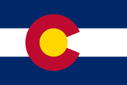
The flag of Colorado

The seal of Colorado

The following outline is provided as an overview of and topical guide to the U.S. state of Colorado:
Contents
- General reference
- Geography of Colorado
- Places in Colorado
- Environment of Colorado
- Regions of Colorado
- Demography of Colorado
- Government and politics of Colorado
- Federal government in Colorado
- State government of Colorado
- Law and order in Colorado
- Local government in Colorado
- Elections and politics in Colorado
- History of Colorado
- History of Colorado, by period
- History of Colorado, by region
- History of Colorado, by subject
- Culture of Colorado
- The arts in Colorado
- Sports in Colorado
- Economy and infrastructure of Colorado
- Education in Colorado
- See also
- References
- External links
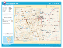
Colorado – 22nd most populous, the eighth most extensive, and the highest in average elevation of the 50 United States. Colorado is one of the western Mountain States. The 30 highest major summits of the Rocky Mountains all rise within Colorado. The Territory of Colorado joined the Union as the 38th state on August 1, 1876.