
Interstate 25 is a major Interstate Highway in the western United States. It is primarily a north–south highway, serving as the main route through New Mexico, Colorado, and Wyoming. I-25 stretches from I-10 at Las Cruces, New Mexico to I-90 in Buffalo, Wyoming. It passes through or near Albuquerque, New Mexico; Pueblo, Colorado; Colorado Springs, Colorado; Denver, Colorado; Fort Collins, Colorado; and Cheyenne, Wyoming. The I-25 corridor is mainly rural, especially in Wyoming, excluding the Albuquerque, Pueblo, Colorado Springs, Denver, and Fort Collins metropolitan areas.

Interstate 76 (I-76) is an east–west Interstate Highway in the Western United States that runs from I-70 in Arvada, Colorado – near Denver – to an interchange with I-80 near Big Springs, Nebraska. The highway measures 187.29 miles (301.41 km) long, all but approximately three miles (4.8 km) of which is in Colorado. Along the route, the highway runs concurrent with US Route 6 (US 6), US 85 in the Denver metropolitan area, and US 34 from Wiggins to Fort Morgan. It has no auxiliary Interstates, but it has two business routes that are located in northeastern Colorado. This route is not connected with the other I-76 that spans from Ohio to New Jersey.
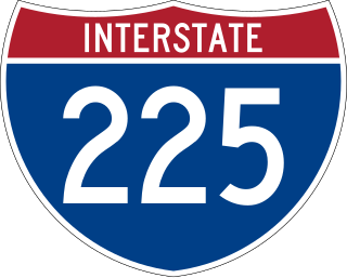
Interstate 225 (I-225) is an auxiliary Interstate Highway in the U.S. state of Colorado. The freeway is a 11.959-mile-long (19.246 km) connector spur route of I-25 that acts as an eastern bypass in the Denver metropolitan area and serves Aurora. It also provides direct access to Denver International Airport for the Denver Tech Center and the southern suburbs of Denver. I-225 is one of the two existing auxiliary Interstate Highways in Colorado and it is the only auxiliary route of I-25, as there are no auxiliary routes for I-25 in New Mexico and Wyoming. The route begins at I-25 in the Denver Tech Center and runs north to I-70 north of Aurora. It interchanges with State Highway 83 (SH 83), SH 30 and I-70 Business/US 40/US 287, known locally as Colfax Avenue. The freeway was first proposed in the 1950s along with the first Interstate Highways within Denver. Construction did not begin until 1964 at the I-70 interchange and proceeded south through Aurora until final completion in early 1976 with the final link to I-25 opening to traffic.

Interstate 270 (I-270) is a seven-mile-long (11 km) auxiliary Interstate Highway located in the northeastern part of the Denver metropolitan area in the US state of Colorado. It overlaps U.S. Highway 36 (US 36) for its entire length and is also a part of the Dwight D. Eisenhower Highway, which spans from I-270 and the Capital Beltway in Bethesda, Maryland, to I-80/US 101 in San Francisco, California. The western terminus of I-270 is at the interchange with I-25 and US 36. It heads eastward to an interchange with I-76, where the mileposts reset because of a previous freeway extension. The freeway heads southeast and comes to meet Vasquez Boulevard, where it enters Commerce City. The road crosses Quebec Street before ending at I-70.
Interstate 270 (I-270) is an auxiliary interstate highway that forms a beltway loop freeway in the Columbus metropolitan area in the US state of Ohio, commonly known locally as The Outerbelt or the Jack Nicklaus Freeway. The zero-milepost is at the junction with I-71 east of Grove City. I-270, along with I-670, provides access to John Glenn Columbus International Airport. The entire length of I-270 is 54.97 miles (88.47 km). It is one of four Interstate loops not to run concurrently with another Interstate freeway, the others being I-295 in Florida, I-485 in North Carolina, and I-610 in Texas.

State Highway 470 is a state highway located in the southwestern portion of the Denver Metro Area. It is also the southwestern portion of the Denver Metro area's beltway. SH 470 begins at US 6 in Golden and heads south interchanging Interstate 70 and then US 285 outside Morrison. After leaving Morrison, it then heads east passing by Littleton and through Highlands Ranch before interchanging Interstate 25 in Lone Tree, where the freeway continues as a tollway and where the state highway designation ends.

U.S. Route 31E (US 31E) is the easternmost of two parallel routes for U.S. Highway 31 from Nashville, Tennessee, to Louisville, Kentucky.

Interstate 70 (I-70) is a transcontinental Interstate Highway in the United States, stretching from Cove Fort, Utah, to Baltimore, Maryland. In Colorado, the highway traverses an east–west route across the center of the state. In western Colorado, the highway connects the metropolitan areas of Grand Junction and Denver via a route through the Rocky Mountains. In eastern Colorado, the highway crosses the Great Plains, connecting Denver with metropolitan areas in Kansas and Missouri. Bicycles and other non-motorized vehicles, normally prohibited on Interstate Highways, are allowed on those stretches of I-70 in the Rockies where no other through route exists.

U.S. Highway 75 (US 75) is a part of the U.S. Highway System that travels from Interstate 345 (I-345) in Dallas, Texas northward to the Canadian border at Noyes, Minnesota. In the state of Texas it runs from I-345 in Dallas and heads north to the Oklahoma state line.

U.S. Route 93 in the state of Arizona is a United States Numbered Highway that begins in Wickenburg and heads north to the Nevada state line at the Mike O'Callaghan–Pat Tillman Memorial Bridge.
In the US state of Colorado, Interstate 25 (I-25) follows the north–south corridor through Colorado Springs and Denver. The highway enters the state from the north near Carr and exits the state near Starkville. The highway also runs through the cities of Fort Collins, Broomfield, Loveland, and Pueblo. The route is concurrent with U.S. Route 87 (US 87) through the entire length of the state. I-25 replaced US 87 and most of US 85 for through traffic.

U.S. Route 40 (US 40) is a part of the U.S. Highway System that travels from Silver Summit, Utah, to Atlantic City, New Jersey. In the U.S. state of Colorado, US 40 is a major east–west route. It crosses the Rocky Mountains, passing over the Continental Divide at Berthoud Pass before descending to the Front Range. It then traverses through the Denver Metro Area, then exits by following Interstate 70 (I-70) and US 287. It is concurrent with US 287 for about 145 miles to Kit Carson. US 40 exits into Kansas east of Arapahoe in Cheyenne. At a length of almost 500 miles, US 40 is the longest numbered route in the state.

Route 185 is a short one-block-long state highway in Jersey City in the U.S. state of New Jersey, between Route 440 and Linden Avenue. Route 185 is a 0.65-mile (1.05 km) freeway in the Greenville neighborhood of Jersey City. It is parallel to Interstate 78 on the eastern side. On Route 440, signs pointing the way to Route 185 imply that the highway runs directly to Liberty State Park. In reality, the freeway ends at Linden Avenue, and travelers must journey one city block west to Caven Point Road, which continues north to Liberty State Park. At Route 185's junction with Route 440, the thru lanes of the Route 440 freeway northbound actually continue north as Route 185, and traffic wishing to continue on Route 440 must actually exit the freeway. Route 185 opened on February 25, 1988, at only 23% of its proposed routing.
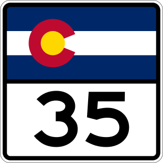
State Highway 35 (SH 35) is an unsigned, 1.317-mile (2.120 km) state highway that runs along Quebec Street located in Denver, Colorado, United States. Its southern end is at Interstate 70 (I‑70) and it runs north until it reaches its northern end at 53rd Place. The route was added to the state highway system in 1972 to provide access to Stapleton International Airport from I-70. After the decommissioning of Stapleton Airport, the highway has been truncated from Martin Luther King Jr. Boulevard to I-70. An expansion was planned but funding was never materialized.

State Highway 58 (SH 58) is a 5.627 mi (9.056 km) state highway in Jefferson County, Colorado. It begins at an at-grade intersection with US 6 and SH 93 in Golden and ends in Wheat Ridge. It is a freeway for its entire length except for its west junction, which is a signal light. The entire route is known as the Golden Freeway.

State Highway 74 (SH 74) is a state highway in the U.S. state of Colorado. Running 18 miles (29 km) from Interstate 70 (I-70) in El Rancho to SH 8 in Morrison, the highway roughly follows a hook-shaped path running northwest–southeast. The section of the route north of the town of Evergreen is known as Evergreen Parkway and is a segment with a four- to six-lane roadway, with the section east of Evergreen mostly two lanes. The other section is known as the Bear Creek Canyon Scenic Mountain Drive, or just Bear Creek Road, and primarily parallels Bear Creek, passing through the towns of Kittredge and Idledale. The route, which is on the outskirts of Denver, passes through several of the city's mountain parks, including Bergen, Dedisse and Red Rocks parks.
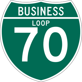
There are 13 active business routes of Interstate 70 in Colorado. Interstate 70 (I-70) spans Colorado in an east–west fashion, holding many business loops and spurs along the way, varying from lengths of 0.22 miles (0.35 km) to 27.47 miles (44.21 km), with a total of 55.51 miles (89.33 km). Four other business routes also used to exist within the state.

State Highway 119 is a 63.7-mile-long (102.5 km) state highway in north central Colorado. It extends in a southwest to northeast direction, from a junction with U.S. Route 6 in Clear Creek Canyon between Golden and Idaho Springs to a junction with Interstate 25 (I-25) east of Longmont. The southwest portion of the road is a scenic mountain drive providing dramatic vistas of the Front Range, while the northeast portion is a busy interurban thoroughfare. The city of Boulder separates these two vastly different sections of SH 119.

State Highway 88 (SH 88) is a state highway located within the Denver Metropolitan Area in the U.S. state of Colorado. Spanning 19.171 miles (30.853 km), the highway travels through the City and County of Denver and Arapahoe County. SH 88 begins at Colfax Avenue in Denver and heads south along Federal Boulevard until it reaches Belleview Avenue, where it continues east until it reaches Interstate 25 in the Denver Tech Center. It then continues along Arapahoe Road until it reaches eastern terminus at SH 83 in Aurora.

U.S. Route 85 (US 85) is a part of the U.S. Highway System that travels from the Mexican border in El Paso, Texas, north to the Canadian border in Fortuna, North Dakota. In the U.S. state of Colorado, US 85 begins at the New Mexico state line south of Starkville and ends at the Wyoming state line south of Cheyenne, Wyoming.


