| Collegiate Peaks | |
|---|---|
| central Sawatch Range | |
 View of the Collegiate Peaks from near the Arkansas River just south of Chalk Creek. | |
| Highest point | |
| Peak | Mount Harvard |
| Elevation | 14,427 ft (4,397 m) |
| Coordinates | 38°55′28″N106°19′15″W / 38.92444°N 106.32083°W |
| Dimensions | |
| Length | 34 mi (55 km)W-E |
| Width | 30 mi (48 km)N-S |
| Area | 587 sq mi (1,520 km2) |
| Geography | |
 | |
| Country | United States |
| State | Colorado |
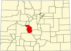
| County | Chaffee and Pitkin |
| Parent range | Sawatch Range, Rocky Mountains |
The Collegiate Peaks (or Collegiate Range [1] ) is a name given to a section of the Sawatch Range of the Rocky Mountains located in central Colorado. Drainages to the east include headwaters of the Arkansas River.
Contents
The Collegiate Peaks include some of the highest mountains in the Rockies. The section is so named because several of the mountains are named for prominent universities.
In the Arapaho language the Collegiate Peaks were called "hiwoxuu hookuhu'ee" or the Elk's Head. [2]