Turner Peak

Last updated

Turner Peak
Turner Peak, Colorado.jpg
Southwest aspect
Highest point
Elevation 13,233 ft (4,033 m) [1] [2]
Prominence 1,157 ft (353 m) [3]
Parent peak Mount Princeton (14,204 ft) [4]
Isolation 3.88 mi (6.24 km) [3]
Coordinates 38°49′11″N106°22′43″W / 38.8198280°N 106.3786886°W / 38.8198280; -106.3786886 [5]
Naming
Etymology William E. Turner
Geography
USA Colorado relief location map.svg
Red triangle with thick white border.svg
Turner Peak
Location in Colorado
Usa edcp relief location map.png
Red triangle with thick white border.svg
Turner Peak
Turner Peak (the United States)
CountryUnited States
State Colorado
County Chaffee County
Protected area Collegiate Peaks Wilderness
Parent range Rocky Mountains
Sawatch Range
Collegiate Peaks
Topo map USGS Tincup
Climbing
Easiest route class 2 hiking [3]

Turner Peak is a 13,233-foot-elevation (4,033-meter) mountain summit in Chaffee County, Colorado, United States.

Contents

Description

Turner Peak is set 0.4 miles (0.64 km) east of the Continental Divide in the Collegiate Peaks which are a subrange of the Sawatch Range. [2] The peak is located 13.3 miles (21.4 km) west of the community of Buena Vista in the Collegiate Peaks Wilderness, on land managed by San Isabel National Forest. Precipitation runoff from the mountain's slopes drains into tributaries of Cottonwood Creek which in turn is a tributary of the Arkansas River. Topographic relief is significant as the summit rises over 2,400 feet (732 m) above the creek's middle fork in 1.2 miles (1.9 km). Chaffee County Road 306 traverses the southern base of this mountain near Cottonwood Pass. The mountain's toponym was officially adopted in 1976 by the United States Board on Geographic Names to remember William E. Turner (?–1976), pioneer resident and historian who once cut timber at the base of this mountain. [5]

Northeast aspect Turner mountain.jpg
Northeast aspect

Climate

According to the Köppen climate classification system, Turner Peak is located in an alpine subarctic climate zone with cold, snowy winters, and cool to warm summers. [6] Due to its altitude, it receives precipitation all year, as snow in winter and as thunderstorms in summer, with a dry period in late spring. Climbers can expect afternoon rain, hail, and lightning from the seasonal monsoon in late July and August.

See also

Related Research Articles

<span class="mw-page-title-main">Sharkstooth Peak</span>

Sharkstooth Peak is a 12,468-foot-elevation (3,800-meter) mountain summit in Montezuma County, Colorado.
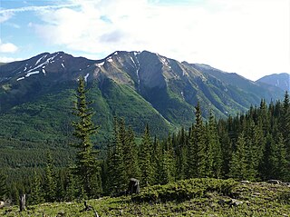
<span class="mw-page-title-main">Ice Mountain (Colorado)</span> Mountain in Colorado, United States

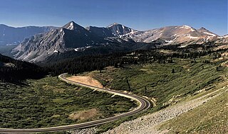
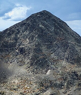
Ice Mountain is a high mountain summit of the Collegiate Peaks in the Sawatch Range of the Rocky Mountains of North America. The 13,958-foot (4,254 m) thirteener is located in the Collegiate Peaks Wilderness, 17.1 miles (27.5 km) west-northwest of the Town of Buena Vista, Colorado, United States, on the Continental Divide separating San Isabel National Forest and Chaffee County from White River National Forest and Pitkin County.

<span class="mw-page-title-main">Carson Peak</span>

Carson Peak is a 10,908-foot-elevation (3,325-meter) mountain summit located in the Sierra Nevada mountain range, in Mono County of northern California, United States. It is situated in the Ansel Adams Wilderness, on land managed by Inyo National Forest. It is approximately 3.5 miles (5.6 km) southwest of the community of June Lake, 2.0 miles (3.2 km) south of Silver Lake, and 2.25 miles (3.62 km) northwest of San Joaquin Mountain, the nearest higher neighbor. The mountain is visible from various locations along the June Lake Loop, and from the nearby June Mountain ski area. The summit offers impressive views of Mount Ritter and Banner Peak. Topographic relief is significant as it rises 3,700 feet above the valley in 1.2 mile. The mountain consists of granite of Lee Vining Canyon. Carson Peak is considered an eastern Sierra classic by backcountry skiers drawn to routes called the "Devils Slide" and "Petes Dream".

<span class="mw-page-title-main">Cutoff Mountain</span> Mountain in the American state of Montana

Cutoff Mountain is a 10,695-foot (3,260-metre) mountain summit located in Park County, Montana.

<span class="mw-page-title-main">Explorer Peak</span> Mountain in Utah, United States

Explorer Peak is a 12,708-foot elevation (3,873 m) mountain summit located in Duchesne County, Utah, United States.

<span class="mw-page-title-main">Yard Peak</span> Mountain in the American state of Utah

Yard Peak is a 12,706-foot elevation (3,873 m) mountain summit located on the common border that Duchesne County shares with Summit County in the U.S. state of Utah.

<span class="mw-page-title-main">Saint Mary Peak</span> Mountain in the state of Montana

Saint Mary Peak is a 9,351-foot elevation (2,850 m) mountain summit located in Ravalli County, Montana.

<span class="mw-page-title-main">Mount White (Colorado)</span> Mountain in the state of Colorado

Mount White is a 13,667-foot (4,166 m) mountain summit in Chaffee County, Colorado, United States.

<span class="mw-page-title-main">Horn Peak</span> Mountain in the state of Colorado

Horn Peak is a 13,450-foot (4,100 m) mountain summit in Custer County, Colorado, United States.

<span class="mw-page-title-main">Broken Hand Peak</span> Mountain in the state of Colorado

Broken Hand Peak is a 13,573-foot (4,137 m) mountain summit on the boundary shared by Custer and Saguache counties, in Colorado, United States.

<span class="mw-page-title-main">The Spider (Colorado)</span>

The Spider is a 12,695-foot (3,869 m) mountain summit in Eagle County, Colorado, United States.

<span class="mw-page-title-main">Highland Peak (Colorado)</span> Mountain in the state of Colorado

Highland Peak is a 12,381-foot (3,774 m) mountain summit in Pitkin County, Colorado, United States.

<span class="mw-page-title-main">Star Mountain (Colorado)</span>

Star Mountain is a 12,941-foot (3,944 m) mountain summit in Lake County, Colorado, United States.

<span class="mw-page-title-main">Cottonwood Peak (Colorado)</span> Mountain peak in the Rockies

Cottonwood Peak is a 13,588-foot (4,142 m) mountain summit on the boundary shared by Custer and Saguache counties, in Colorado, United States.

<span class="mw-page-title-main">Jones Mountain (Chaffee County, Colorado)</span> Mountain in the state of Colorado

Jones Mountain is a 13,218-foot-elevation (4,029-meter) mountain summit in Chaffee County, Colorado, United States.

<span class="mw-page-title-main">Emma Burr Mountain</span> Mountain in the state of Colorado

Emma Burr Mountain is a 13,544-foot-elevation (4,128-meter) mountain summit on the common border shared by Chaffee and Gunnison counties in Colorado, United States.

<span class="mw-page-title-main">Grizzly Peak (Gunnison County, Colorado)</span> Mountain in the state of Colorado

Grizzly Peak is a 13,309-foot-elevation (4,057-meter) mountain summit in Gunnison County, Colorado, United States.

<span class="mw-page-title-main">Notch Mountain</span>

Notch Mountain is a 13,243-foot-elevation (4,036-meter) summit in Eagle County, Colorado, United States.

<span class="mw-page-title-main">Twin Peaks (Ouray County, Colorado)</span> Mountain in Ouray County, Colorado

Twin Peaks is a 10,970-foot-elevation (3,340-meter) double summit mountain located in Ouray County, Colorado, United States.

<span class="mw-page-title-main">Grizzly Peak (Dolores/San Juan Counties, Colorado)</span> Mountain in the state of Colorado

Grizzly Peak is a 13,738-foot-elevation (4,187-meter) mountain summit on the boundary shared by Dolores County and San Juan County, in Colorado, United States.

References

  1. Maryann Gaug (2011), Hiking Colorado, Third Ed., Falcon Guides, ISBN   978-0-7627-5982-8, p. 317.
  2. 1 2 "Turner Peak, Colorado". Peakbagger.com. Retrieved June 3, 2023.
  3. 1 2 3 "Turner Peak - 13,238' CO". listsofjohn.com. Retrieved June 3, 2023.
  4. "Turner Peak, Peakvisor.com" . Retrieved June 3, 2023.
  5. 1 2 "Turner Peak". Geographic Names Information System . United States Geological Survey, United States Department of the Interior . Retrieved June 3, 2023.
  6. Peel, M. C.; Finlayson, B. L.; McMahon, T. A. (2007). "Updated world map of the Köppen−Geiger climate classification". Hydrol. Earth Syst. Sci. 11 (5): 1633. Bibcode:2007HESS...11.1633P. doi:10.5194/hess-11-1633-2007. ISSN   1027-5606. S2CID   9654551.