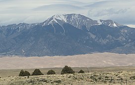
The Sangre de Cristo Range is a mountain range in the Rocky Mountains in southern Colorado in the United States, running north and south along the east side of the Rio Grande Rift. The mountains extend southeast from Poncha Pass for about 75 mi (121 km) through south-central Colorado to La Veta Pass, approximately 20 mi (32 km) west of Walsenburg, and form a high ridge separating the San Luis Valley on the west from the watershed of the Arkansas River on the east. The Sangre de Cristo Range rises over 7,000 ft (2,100 m) above the valleys and plains to the west and northeast.

Great Sand Dunes National Park and Preserve is a national park of the United States that conserves an area of large sand dunes on the eastern edge of the San Luis Valley, and an adjacent national preserve in the Sangre de Cristo Range, in south-central Colorado. The park was originally designated Great Sand Dunes National Monument on March 17, 1932, by President Herbert Hoover. The original boundaries protected an area of 35,528 acres. A boundary change and redesignation as a national park and preserve was authorized on November 22, 2000, and then established on September 24, 2004. The park encompasses 107,342 acres while the preserve protects an additional 41,686 acres for a total of 149,028 acres. The recreational visitor total was 527,546 in 2019.

The Sangre de Cristo Mountains are the southernmost subrange of the Rocky Mountains. They are located in southern Colorado and northern New Mexico in the United States. The mountains run from Poncha Pass in South-Central Colorado, trending southeast and south, ending at Glorieta Pass, southeast of Santa Fe, New Mexico. The mountains contain a number of fourteen thousand foot peaks in the Colorado portion, as well as several peaks in New Mexico which are over thirteen thousand feet.

Blanca Peak is the fourth highest summit of the Rocky Mountains of North America and the U.S. state of Colorado. The ultra-prominent 14,351-foot (4,374 m) peak is the highest summit of the Sierra Blanca Massif, the Sangre de Cristo Range, and the Sangre de Cristo Mountains. The fourteener is located 9.6 miles (15.5 km) north by east of the Town of Blanca, on the drainage divide separating Rio Grande National Forest and Alamosa County from the Sangre de Cristo Land Grant and Costilla County. The summit is the highest point of both counties and the entire drainage basin of the Rio Grande. Below the steep North Face of Blanca Peak two live Glaciers once developed, until extinction sometime after 1903. North & South Blanca Glaciers were located at 37° 35N.,longitude 105° 28W. Blanca Peak is higher than any point in the United States east of its longitude.

Crestone Peak is the seventh-highest summit of the Rocky Mountains of North America and the U.S. state of Colorado. The prominent 14,296.8-foot (4,358 m) fourteener is the highest summit of the Crestones and the second-highest summit in the Sangre de Cristo Range after Blanca Peak. The summit is located in the Sangre de Cristo Wilderness of Rio Grande National Forest, 5.0 miles (8.1 km) east by south of the Town of Crestone in Saguache County, Colorado, United States.

Mount Lindsey is a high mountain summit on the Sierra Blanca Massif in the Sangre de Cristo Range of the Rocky Mountains of North America. The 14,048-foot (4,282 m) fourteener is located in the Sangre de Cristo Land Grant, 10.8 miles (17.4 km) north of the community of Fort Garland in Costilla County, Colorado, United States.
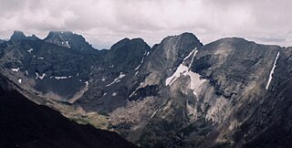
Kit Carson Peak is a high mountain summit of the Crestones in the Sangre de Cristo Range of the Rocky Mountains of North America. Officially designated Kit Carson Mountain, the 14,165.2-foot (4,318 m) fourteener is located 5.2 miles (8.4 km) ESE of the Town of Crestone in Saguache County, Colorado, United States. The name Kit Carson Mountain is used for both the massif with three summits, or to describe the main summit only. The mountain is named in honor of frontiersman Christopher Houston "Kit" Carson. The Crestones are a cluster of high summits in the Sangre de Cristo Range, comprising Crestone Peak, Crestone Needle, Kit Carson Peak, Challenger Point, Humboldt Peak, and Columbia Point. They are usually accessed from common trailheads.

Humboldt Peak is a high mountain summit of the Crestones in the Sangre de Cristo Range of the Rocky Mountains of North America. The 14,070-foot (4,289 m) fourteener is located in the Sangre de Cristo Wilderness of San Isabel National Forest, 11.9 miles (19.2 km) south-southwest of the Town of Westcliffe in Custer County, Colorado, United States.

Challenger Point is a high mountain summit of the Crestones in the Sangre de Cristo Range of the Rocky Mountains of North America. The 14,087-foot (4,294 m) fourteener is located 5.0 miles (8.1 km) east by south of the Town of Crestone in Saguache County, Colorado, United States. The summit is on the northwest shoulder of Kit Carson Mountain, and is a subpeak of the latter. It was renamed in memory of the seven astronauts who died when the Space Shuttle Challenger disintegrated shortly after liftoff on January 28, 1986.
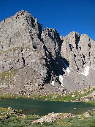
Crestone Needle is a high mountain summit of the Crestones in the Sangre de Cristo Range of the Rocky Mountains of North America. The 14,194.8-foot (4,327 m) fourteener is located 6.9 miles (11.1 km) east-southeast of the Town of Crestone in Saguache County, Colorado, United States. The Crestones are a cluster of high summits in the Sangre de Cristo Range, comprising Crestone Peak, Crestone Needle, Kit Carson Peak, Challenger Point, Humboldt Peak, and Columbia Point. They are usually accessed from common trailheads.

East Spanish Peak is a prominent mountain summit that is the lower of the two Spanish Peaks in the Rocky Mountains of North America. The 12,688-foot (3,867 m) peak is located in the Spanish Peaks Wilderness of San Isabel National Forest, 9.3 miles (14.9 km) southeast by south of the Town of La Veta, Colorado, United States, on the drainage divide between Huerfano and Las Animas counties. The Spanish Peaks are two large igneous stocks which form an eastern outlier of the Culebra Range, a subrange of the Sangre de Cristo Mountains. East Spanish Peak is higher than any point in the United States east of its longitude; it is also the easternmost point in the United States over 12,000 feet (3,700 m), 11,000 feet (3,400 m), and 10,000 feet (3,000 m) feet above sea level.

Columbia Point is a high mountain summit of the Crestones in the Sangre de Cristo Range of the Rocky Mountains of North America. The 13,986-foot (4,263 m) thirteener is located 5.5 miles (8.8 km) east by south of the Town of Crestone in Saguache County, Colorado, United States. The Crestones are a cluster of high summits in the Sangre de Cristo Range, comprising Crestone Peak, Crestone Needle, Kit Carson Peak, Challenger Point, Humboldt Peak, and Columbia Point.

Mount Adams is a high mountain summit of the Crestones in the Sangre de Cristo Range of the Rocky Mountains of North America. The 13,937-foot (4,248 m) thirteener is located in the Sangre de Cristo Wilderness, 5.1 miles (8.2 km) east by north of the Town of Crestone, Colorado, United States, on the drainage divide separating San Isabel National Forest and Custer County from Rio Grande National Forest and Saguache County.

Tijeras Peak is a high mountain summit in the Sangre de Cristo Range of the Rocky Mountains of North America. The 13,610-foot (4,148 m) thirteener is located 9.8 miles (15.8 km) southeast by east of the Town of Crestone in Saguache County, Colorado, United States, in the Sangre de Cristo Wilderness on the boundary between Great Sand Dunes National Preserve and Rio Grande National Forest. Tijeras Peak is the highest summit in Great Sand Dunes National Park and Preserve. Tijeras is Spanish for scissors, and refers to the double-pronged rocky tip of the mountain.
Methodist Mountain is a mountain summit in the northern Sangre de Cristo Range of the Rocky Mountains of North America. The 11,713-foot (3,570 m) peak is located 5.5 miles (8.8 km) south by west of the City of Salida, Colorado, United States, on the drainage divide separating San Isabel National Forest and Chaffee County from Rio Grande National Forest and Saguache County. Methodist Mountain is the northernmost peak of the Sangre de Cristo Mountains, which stretch south through southern Colorado to Santa Fe, New Mexico.
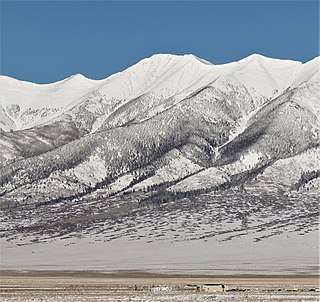
Bushnell Peak is a prominent mountain summit in the Sangre de Cristo Range of the Rocky Mountains of North America. The 13,110-foot (3,996 m) thirteener is located 7.2 miles (11.6 km) north-northeast of the community of Villa Grove, Colorado, United States, on the drainage divide separating Rio Grande National Forest and Saguache County from San Isabel National Forest and Fremont County. Bushnell Peak is the highest point in Fremont County.

Mount Mestas is a mountain summit in the southeastern Sangre de Cristo Range of the Rocky Mountains of North America. The 11,573-foot (3,527 m) peak is located 3.2 miles (5.1 km) southeast of North La Veta Pass in Huerfano County, Colorado, United States. The mountain was known as La Veta Peak until 1949 when it was renamed in honor of PFC Felix B. Mestas Jr. who was killed in action during the Second World War.
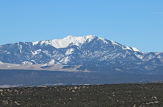
Mount Zwischen is a prominent mountain summit in the Sangre de Cristo Range of the Rocky Mountains of North America. The 12,011-foot (3,661 m) peak is located 32.1 miles (51.6 km) northeast of the City of Alamosa, Colorado, United States, on the drainage divide separating the Great Sand Dunes Wilderness in Great Sand Dunes National Preserve and Huerfano County from the Sangre de Cristo Wilderness in San Isabel National Forest and Saguache County.
California Peak is a high mountain summit in the Sangre de Cristo Range of the Rocky Mountains of North America. The 13,855-foot (4,223 m) thirteener is located on the Sierra Blanca Massif, 12.1 miles (19.5 km) north of the Town of Blanca, Colorado, United States, on the drainage divide separating in Rio Grande National Forest and Alamosa County from San Isabel National Forest and Huerfano County.

Iron Mountain is a prominent mountain summit in the southern Sangre de Cristo Range of the Rocky Mountains of North America. The 11,416-foot (3,480 m) peak is located 3.9 miles (6.2 km) west-northwest of the North La Veta Pass, Colorado, United States, on the drainage divide between Costilla and Huerfano counties.
