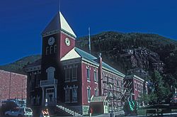
San Miguel County | |
---|---|
Coordinates: 38°01′N108°26′W / 38.01°N 108.43°W | |
Country | United States |
State | Colorado |
Founded | March 2, 1883 |
Named for | San Miguel River |
Seat | Telluride |
Largest town | Telluride |
Area | |
• Total | 1,289 sq mi (3,340 km2) |
• Land | 1,287 sq mi (3,330 km2) |
• Water | 2.0 sq mi (5 km2) 0.2% |
Population | |
• Total | 8,072 |
• Density | 6.3/sq mi (2.4/km2) |
Time zone | UTC−7 (Mountain) |
• Summer (DST) | UTC−6 (MDT) |
Congressional district | 3rd |
Website | www |
San Miguel County is a county located in the U.S. state of Colorado. As of the 2020 census, the population was 8,072. [1] The county seat is Telluride. [2] The county is named for the San Miguel River.
San Miguel County was given the Spanish language name for "Saint Michael" due to the nearby San Miguel River. On February 27, 1883, Ouray County was split to form San Miguel County. Originally the San Miguel County portion was to retain the name Ouray County with the new portion called Uncompahgre County.
Mining operators in the San Juan mountain area of Colorado formed the San Juan District Mining Association (SJDMA) in 1903, as a direct result of a Western Federation of Miners proposal to the Telluride Mining Association for the eight-hour day, which had been approved in a referendum by 72 percent of Colorado voters. [3] The new association consolidated the power of thirty-six mining properties in San Miguel, Ouray, and San Juan counties. [4] The SJDMA refused to consider any reduction in hours or increase in wages, helping to provoke a bitter strike.
In 1875, the Smuggler gold vein was discovered near Telluride. The Smuggler-Union, Tomboy, and Liberty Bell mines combined produced over a hundred tons of gold by 1920, third in the state of Colorado. [5] : 51, 83
According to the U.S. Census Bureau, the county has a total area of 1,289 square miles (3,340 km2), of which 1,287 square miles (3,330 km2) is land and 2.0 square miles (5.2 km2) (0.2%) is water. [6]
Census | Pop. | Note | %± |
---|---|---|---|
1890 | 2,909 | — | |
1900 | 5,379 | 84.9% | |
1910 | 4,700 | −12.6% | |
1920 | 5,281 | 12.4% | |
1930 | 2,184 | −58.6% | |
1940 | 3,664 | 67.8% | |
1950 | 2,693 | −26.5% | |
1960 | 2,944 | 9.3% | |
1970 | 1,949 | −33.8% | |
1980 | 3,192 | 63.8% | |
1990 | 3,653 | 14.4% | |
2000 | 6,594 | 80.5% | |
2010 | 7,359 | 11.6% | |
2020 | 8,072 | 9.7% | |
2023 (est.) | 7,868 | [7] | −2.5% |
U.S. Decennial Census [8] 1790-1960 [9] 1900-1990 [10] 1990-2000 [11] 2010-2020 [12] |
For most of the 20th century, San Miguel County was a national bellwether. It voted for the winner in every presidential election from 1912 to 1984. Since 1988, the county has become one of the most Democratic in Colorado and the nation, largely due to the presence of the Telluride Ski Resort and the influx of liberal-minded voters in the 1960s and 1970s. These trends have made San Miguel similar in vein to other heavily Democratic ski resort counties like Blaine County in Idaho, Teton County in Wyoming, and Pitkin County within Colorado. In the 2000 presidential election, San Miguel County was Green Party candidate Ralph Nader's best countywide performance in the country with 17.2% of the vote.
San Miguel County is situated in Colorado House of Representatives, House District 58. The Current Representative is Marc Catlin, who has represented the county since 2017. [13]
Year | Republican | Democratic | Third party(ies) | |||
---|---|---|---|---|---|---|
No. | % | No. | % | No. | % | |
2024 | 1,154 | 24.02% | 3,529 | 73.46% | 121 | 2.52% |
2020 | 1,136 | 22.07% | 3,924 | 76.24% | 87 | 1.69% |
2016 | 1,033 | 23.86% | 2,975 | 68.72% | 321 | 7.42% |
2012 | 1,154 | 27.11% | 2,992 | 70.30% | 110 | 2.58% |
2008 | 933 | 21.45% | 3,349 | 76.99% | 68 | 1.56% |
2004 | 1,079 | 26.85% | 2,876 | 71.56% | 64 | 1.59% |
2000 | 1,043 | 32.04% | 1,598 | 49.09% | 614 | 18.86% |
1996 | 773 | 28.18% | 1,535 | 55.96% | 435 | 15.86% |
1992 | 628 | 23.58% | 1,380 | 51.82% | 655 | 24.60% |
1988 | 798 | 43.39% | 961 | 52.26% | 80 | 4.35% |
1984 | 833 | 54.77% | 654 | 43.00% | 34 | 2.24% |
1980 | 774 | 42.79% | 651 | 35.99% | 384 | 21.23% |
1976 | 622 | 43.83% | 674 | 47.50% | 123 | 8.67% |
1972 | 583 | 54.95% | 426 | 40.15% | 52 | 4.90% |
1968 | 422 | 53.22% | 311 | 39.22% | 60 | 7.57% |
1964 | 332 | 34.23% | 636 | 65.57% | 2 | 0.21% |
1960 | 525 | 46.09% | 612 | 53.73% | 2 | 0.18% |
1956 | 648 | 57.86% | 469 | 41.88% | 3 | 0.27% |
1952 | 654 | 55.19% | 524 | 44.22% | 7 | 0.59% |
1948 | 451 | 41.80% | 613 | 56.81% | 15 | 1.39% |
1944 | 536 | 45.69% | 630 | 53.71% | 7 | 0.60% |
1940 | 729 | 45.94% | 851 | 53.62% | 7 | 0.44% |
1936 | 433 | 32.12% | 860 | 63.80% | 55 | 4.08% |
1932 | 383 | 29.74% | 862 | 66.93% | 43 | 3.34% |
1928 | 721 | 54.91% | 554 | 42.19% | 38 | 2.89% |
1924 | 677 | 43.62% | 567 | 36.53% | 308 | 19.85% |
1920 | 928 | 54.30% | 688 | 40.26% | 93 | 5.44% |
1916 | 578 | 29.13% | 1,325 | 66.78% | 81 | 4.08% |
1912 | 639 | 30.36% | 1,029 | 48.88% | 437 | 20.76% |
1908 | 882 | 45.30% | 927 | 47.61% | 138 | 7.09% |
1904 | 1,370 | 61.16% | 797 | 35.58% | 73 | 3.26% |
1900 | 717 | 30.39% | 1,604 | 67.99% | 38 | 1.61% |
1896 | 87 | 3.90% | 2,136 | 95.70% | 9 | 0.40% |
1892 | 272 | 23.43% | 0 | 0.00% | 889 | 76.57% |
1888 | 540 | 57.51% | 378 | 40.26% | 21 | 2.24% |
1884 | 433 | 54.19% | 365 | 45.68% | 1 | 0.13% |
Brief Overview
Telluride is the county seat and most populous town of San Miguel County in the southwestern portion of the U.S. state of Colorado. The town is a former silver mining camp on the San Miguel River in the western San Juan Mountains. The first gold mining claim was made in the mountains above Telluride in 1875, and early settlement of what is now Telluride followed. The town was founded in 1878.
San Juan County is a county located in the U.S. state of Colorado. As of the 2020 census, the population was 705, making it the least populous county in Colorado. The county seat and the only incorporated municipality in the county is Silverton. The county name is the Spanish language name for "Saint John", the name Spanish explorers gave to a river and the mountain range in the area. With a mean elevation of 11,240 feet, San Juan County is the highest county in the United States and also has the two highest elevation houses in the United States; the ‘Bonnie Belle’ above Animas Forks at 11,900’ – 11,950’ elevation and an unnamed house above Picayune Gulch at 12,000’ elevation.
Ouray County is a county located in the U.S. state of Colorado. As of the 2020 Census, the population was 4,874. The county seat is Ouray. Because of its rugged mountain topography, Ouray County is also known as the "Switzerland of America".
Montrose County is a county located in the U.S. state of Colorado. As of the 2020 census, the population was 42,679. The county seat is Montrose, for which the county is named.
Montezuma County is a county located in the southwest corner of the U.S. state of Colorado. As of the 2020 census, the population was 25,849. The county seat is Cortez.
Hinsdale County is a county located in the U.S. state of Colorado. As of the 2020 census, the population was 788, making it the second least-populous county in Colorado. With a population density of only 0.71 inhabitants per square mile (0.27/km2), it is also the least-densely populated county in Colorado. The county seat and only incorporated municipality in the county is Lake City. The county is named for George A. Hinsdale, a prominent pioneer and former Lieut. Governor of Colorado Territory.
Gunnison County is a county located in the U.S. state of Colorado. As of the 2020 census, the population was 16,918. The county seat is Gunnison. The county was named for John W. Gunnison, a United States Army officer and captain in the Army Topographical Engineers, who surveyed for the transcontinental railroad in 1853.
Dolores County is a county located in the U.S. state of Colorado. As of the 2020 census, the population was 2,326. The county seat is Dove Creek.
Delta County is a county located in the U.S. state of Colorado. As of the 2020 census, the population was 31,196. The county seat is Delta.
Ouray is a home rule municipality that is the county seat of Ouray County, Colorado, United States. The city population was 898 as of the 2020 census. The Ouray Post Office has the ZIP Code 81427. Located at an elevation of 7,792 feet (2,375 m), Ouray's climate, natural alpine environment, and scenery have earned it the nickname "Switzerland of America".
The Town of Ridgway is the home rule municipality that is the most populous municipality in Ouray County, Colorado, United States. The town is a former railroad stop on the Uncompahgre River in the northern San Juan Mountains. The town population was 1,183 at the 2020 census.
Uncompahgre National Forest is a U.S. National Forest covering 955,229 acres in parts of Montrose, Mesa, San Miguel, Ouray, Gunnison, Hinsdale, San Juan, and Delta Counties in western Colorado. Its headquarters are in Delta County, in the city of Delta. It borders the San Juan National Forest to the south.
The Uncompahgre Plateau in western Colorado is a distinctive large uplift part of the Colorado Plateau. Uncompahgre is a Ute word that describes the water: "Dirty Water" or "Rocks that make Water Red".
Red Mountain Pass elevation 11,018 ft (3,358 m) is a mountain pass in the San Juan Mountains of western Colorado in the United States.
The San Juan Skyway Scenic and Historic Byway is a 236-mile (380 km) All-American Road, National Forest Scenic Byway, and Colorado Scenic and Historic Byway located in Dolores, La Plata, Montezuma, San Juan, and San Miguel counties, Colorado, United States. The byway forms a loop in southwestern Colorado traversing the heart of the San Juan Mountains. The San Juan Skyway reaches its zenith at Red Mountain Pass at elevation 11,018 feet (3,358 m). Mesa Verde National Park was one of the original UNESCO World Heritage Sites. The Silverton Historic District and the Telluride Historic District are National Historic Landmarks.
Dallas Divide is a high mountain pass in the United States state of Colorado located on State Highway 62 about 12 miles (19 km) west of the town of Ridgway.
The Alpine Loop Back Country Byway is a rugged 63-mile (101 km) Back Country Byway and Colorado Scenic and Historic Byway located in the high San Juan Mountains of Hindale, Ouray, and San Juan counties, Colorado, USA. The byway connects the mountain towns of Lake City, Ouray, and Silverton. The route ranges in elevation from 7,792 feet (2,375 m) in Ouray to 12,800 feet (3,901 m) at Engineer Pass. The byway features high mountain passes, alpine tundra, beautiful mountain meadows, ghost towns, and relics of the silver mining era. While the meadows and tundra are accessible to ordinary passenger vehicles, a high-clearance 4-wheel drive vehicle is required to travel the entire route.
Mears Peak is a 13,496-foot-elevation (4,114-meter) mountain summit located on the common boundary of Ouray County with San Miguel County, in Colorado, United States. It is situated six miles northwest of the community of Telluride, in the Mount Sneffels Wilderness, on land managed by Uncompahgre National Forest. It is part of the Sneffels Range which is a subset of the San Juan Mountains, which in turn is part of the Rocky Mountains. Mears Peak is situated west of the Continental Divide, and 3.8 miles west of Mount Sneffels. Topographic relief is significant as the south aspect rises 4,900 feet above the San Miguel River in approximately 5.5 miles.
Chicago Peak is a 13,385-foot-elevation (4,080-meter) mountain summit located on the shared boundary of San Miguel County with Ouray County in southwest Colorado, United States. It is situated four miles (6.4 km) east of the community of Telluride, on land managed by Uncompahgre National Forest. It is part of the Sneffels Range which is a subset of the San Juan Mountains, which in turn are part of the Rocky Mountains. It is set above the ghost town of Tomboy, one mile (1.6 km) south of United States Mountain, and one mile northwest of Imogene Pass. Topographic relief is significant as the east aspect rises 2,000 feet above Imogene Basin in approximately one mile, and the west aspect rises 2,000 feet above Savage Basin in less than one mile. Mining activity in the immediate area produced significant amounts of gold and silver.