Burlington, Colorado

Last updated

Burlington, Colorado
Burlington, Colorado.JPG
South Lincoln St. in Burlington
Kit Carson County Colorado Incorporated and Unincorporated areas Burlington Highlighted 0810600.svg
Location of the City of Burlington in Kit Carson County, Colorado.
Usa edcp location map.svg
Red pog.svg
Burlington
Location of the City of Burlington in the United States.
Coordinates: 39°18′15″N102°16′00″W / 39.30417°N 102.26667°W / 39.30417; -102.26667 [2]
Country Flag of the United States.svg  United States
State Flag of Colorado.svg  Colorado
County Kit Carson County seat [1]
Government
  Type Home rule municipality [1]
Area
[3]
  Total2.153 sq mi (5.575 km2)
  Land2.153 sq mi (5.575 km2)
  Water0.000 sq mi (0.000 km2)
Elevation
[2]
4,167 ft (1,270 m)
Population
 (2020) [3]
  Total3,172
  Density1,474/sq mi (569/km2)
Time zone UTC−07:00 (MST)
  Summer (DST) UTC−06:00 (MDT)
ZIP code
80807 [4]
Area code 719
FIPS code 08-10600
GNIS feature ID 2409946 [2]
Website www.burlingtoncolo.com

Burlington is a home rule municipality and the county seat and most populous community of Kit Carson County, Colorado, United States. [1] [5] The city population was 3,172 at the 2020 United States Census. [3]

Contents

History

Burlington, 1943 Colorado - Alamosa through Cheyenne Mountain - NARA - 23935967 (cropped).jpg
Burlington, 1943

Burlington was originally laid out one mile west of its present location in 1887 by a man named Lowell in anticipation of the arrival of the railroad. In addition to having the location wrong, Lowell also did not have title to the land. When the railroad did arrive, the Chicago, Rock Island and Pacific Railroad, it built its depot at the present site of Burlington and those who had built in Old Burlington moved their buildings to the new townsite. Trains began running in 1888. "The Settlement", about 12 miles northwest of Burlington, was settled by German immigrants from Russia, many from Hoffnungstal, South Russia, who, in addition to their homesteads, built Congregational and Lutheran churches. [6] [7]

Burlington, CO is on the Loewen database of possible sundown towns. [8]

Geography

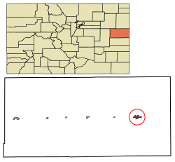
Burlington is located on the High Plains in eastern Colorado.

At the 2020 United States Census, the city had a total area of 1,378 acres (5.575 km2), all of it land. [3]

The easternmost interchange in Colorado on Interstate 70 is located at Burlington.

Climate

Burlington has a typical High Plains cool semi-arid climate with hot, dry summers punctuated by occasional heavy thunderstorm rains, and cold, very dry winters. Snowfall is occasionally heavy, with an average annual amount of 33.7 inches (86 cm) – but mostly the winter weather is very dry and extremely variable in temperatures. More than 33 afternoons (over a third) each winter can be expected to reach or exceed 50 °F (10 °C), but 4.9 mornings each year will drop to or under 0 °F (−17.8 °C) and 24.3 afternoons do not top freezing.

Climate data for Burlington, Colorado, 1991–2020 normals, extremes 1903–present
MonthJanFebMarAprMayJunJulAugSepOctNovDecYear
Record high °F (°C)79
(26)
85
(29)
93
(34)
95
(35)
100
(38)
112
(44)
109
(43)
109
(43)
104
(40)
99
(37)
87
(31)
81
(27)
112
(44)
Mean maximum °F (°C)66.6
(19.2)
69.5
(20.8)
79.8
(26.6)
85.6
(29.8)
92.0
(33.3)
99.2
(37.3)
101.3
(38.5)
98.8
(37.1)
95.6
(35.3)
88.7
(31.5)
76.5
(24.7)
67.0
(19.4)
102.2
(39.0)
Mean daily maximum °F (°C)43.8
(6.6)
46.2
(7.9)
56.5
(13.6)
64.0
(17.8)
73.6
(23.1)
85.2
(29.6)
90.5
(32.5)
87.9
(31.1)
80.5
(26.9)
67.4
(19.7)
53.8
(12.1)
44.0
(6.7)
66.1
(19.0)
Daily mean °F (°C)30.6
(−0.8)
32.6
(0.3)
41.4
(5.2)
48.8
(9.3)
59.1
(15.1)
70.3
(21.3)
75.5
(24.2)
73.3
(22.9)
65.3
(18.5)
52.0
(11.1)
40.0
(4.4)
31.1
(−0.5)
51.7
(10.9)
Mean daily minimum °F (°C)17.3
(−8.2)
19.0
(−7.2)
26.3
(−3.2)
33.7
(0.9)
44.6
(7.0)
55.4
(13.0)
60.5
(15.8)
58.7
(14.8)
50.0
(10.0)
36.7
(2.6)
26.1
(−3.3)
18.2
(−7.7)
37.2
(2.9)
Mean minimum °F (°C)−1.2
(−18.4)
1.3
(−17.1)
9.5
(−12.5)
19.5
(−6.9)
31.1
(−0.5)
45.2
(7.3)
52.8
(11.6)
50.5
(10.3)
36.9
(2.7)
20.4
(−6.4)
9.8
(−12.3)
0.8
(−17.3)
−6.3
(−21.3)
Record low °F (°C)−25
(−32)
−23
(−31)
−22
(−30)
−3
(−19)
21
(−6)
31
(−1)
36
(2)
37
(3)
20
(−7)
−1
(−18)
−8
(−22)
−22
(−30)
−25
(−32)
Average precipitation inches (mm)0.36
(9.1)
0.59
(15)
1.01
(26)
2.00
(51)
2.70
(69)
2.80
(71)
3.36
(85)
2.69
(68)
1.29
(33)
1.42
(36)
0.52
(13)
0.51
(13)
19.25
(489.1)
Average snowfall inches (cm)5.3
(13)
6.8
(17)
5.8
(15)
3.9
(9.9)
0.3
(0.76)
0.0
(0.0)
0.0
(0.0)
0.0
(0.0)
0.0
(0.0)
2.7
(6.9)
3.7
(9.4)
5.2
(13)
33.7
(84.96)
Average extreme snow depth inches (cm)3.1
(7.9)
3.5
(8.9)
2.7
(6.9)
1.8
(4.6)
0.3
(0.76)
0.0
(0.0)
0.0
(0.0)
0.0
(0.0)
0.0
(0.0)
1.9
(4.8)
2.4
(6.1)
3.0
(7.6)
7.6
(19)
Average precipitation days (≥ 0.01 in)3.13.54.26.28.77.88.37.33.95.13.23.464.7
Average snowy days (≥ 0.1 in)3.03.12.61.40.20.00.00.00.01.02.03.116.4
Source 1: NOAA [9]
Source 2: National Weather Service [10]

Demographics

Historical population
CensusPop.Note
1890 146
1900 18325.3%
1910 368101.1%
1920 991169.3%
1930 1,28029.2%
1940 1,2800.0%
1950 2,24775.5%
1960 2,090−7.0%
1970 2,82835.3%
1980 3,1079.9%
1990 2,941−5.3%
2000 3,67825.1%
2010 4,25415.7%
2020 3,172−25.4%
U.S. Decennial Census

As of the census [11] of 2010, there were 4,191 people, 1,478 households, and ? families residing in the city. The population density was 1,995.7 inhabitants per square mile (770.5/km2). There were 1,478 housing units at an average density of 703.8 per square mile (271.7/km2). The racial makeup of the city was 84.3% White, 6.2% African American, 1.2% Native American, 0.5% Asian, 0.1% Pacific Islander, 8.5% from other races, and 0.90% from two or more races. Hispanic or Latino of any race were 27.5% of the population.

There were 1,287 households, out of which 32.9% had children under the age of 18 living with them, 53.0% were married couples living together, 8.6% had a female householder with no husband present, and 34.7% were non-families. 30.3% of all households were made up of individuals, and 13.9% had someone living alone who was 65 years of age or older. The average household size was 2.47 and the average family size was 3.11.

In the city, the population was spread out, with 25.2% under the age of 18, 8.6% from 18 to 24, 32.8% from 25 to 44, 19.7% from 45 to 64, and 13.7% who were 65 years of age or older. The median age was 36 years. For every 100 females, there were 121.6 males. For every 100 females age 18 and over, there were 126.2 males.

The median income for a household in the city was $33,854, and the median income for a family was $42,500. Males had a median income of $29,167 versus $19,018 for females. The per capita income for the city was $16,054. About 12.2% of families and 14.8% of the population were below the poverty line, including 20.3% of those under age 18 and 15.8% of those age 65 or over.

Government

Burlington is a home rule municipality. [12]

Education

An AH-1 Cobra on display outside of the VFW Post in Burlington AH-1 on display in front of the VFW Post in Burlington, Colorado.JPG
An AH-1 Cobra on display outside of the VFW Post in Burlington

Burlington Public Schools are part of the Burlington Public School District RE-6J. The district has one elementary school, one middle school and one high school. Burlington also has several private schools.

Burlington Elementary School, Burlington Middle School and Burlington High School are located in Burlington. [13]

Media

Print

Burlington has a weekly newspaper, The Burlington Record. [14] A run of 3 years, 1910–1912, of the Kit Carson County Record is archived in the Colorado Historic Newspapers Collection. [15]

Radio

The following radio stations are licensed to Burlington:

AM

Frequency Callsign [16] Format [17] Notes
1140 KNAB Adult Standards/MOR

FM

Frequency Callsign [18] Format [17] Notes
88.1 K201FK Christian Translator of KAWZ, Twin Falls, Idaho
89.5 K208CH Contemporary Christian Translator of KTLF, Colorado Springs
104.1 KNAB-FM Country

National Historic Landmark

Notable people

Notable individuals who were born in or have lived in Burlington include:

See also

Related Research Articles

<span class="mw-page-title-main">Douglas County, Nevada</span> County in Nevada, United States

Douglas County is a county in the northwestern part of the U.S. state of Nevada. As of the 2020 census, the population was 49,488. Its county seat is Minden. Douglas County comprises the Gardnerville Ranchos, NV Micropolitan Statistical Area, which is also included in the Reno–Carson City–Fernley, NV Combined Statistical Area.

<span class="mw-page-title-main">Yuma County, Colorado</span> County in Colorado, United States

Yuma County is a county located in the U.S. state of Colorado. As of the 2020 census, the population was 9,988. The county seat is Wray.

<span class="mw-page-title-main">Washington County, Colorado</span> County in Colorado, United States

Washington County is a county located in the eastern side of the U.S. state of Colorado. As of the 2020 census, the population was 4,817. The county seat is Akron. The county was named in honor of the United States President George Washington.

<span class="mw-page-title-main">Kit Carson County, Colorado</span> County in Colorado, United States

Kit Carson County is a county located in the U.S. state of Colorado. As of the 2020 census, the population was 7,087. The county seat is Burlington. The county was established in 1889 and named for American frontiersman and Indian fighter Kit Carson.

<span class="mw-page-title-main">Hinsdale County, Colorado</span> County in Colorado, United States

Hinsdale County is a county located in the U.S. state of Colorado. As of the 2020 census, the population was 788, making it the second-least populous county in Colorado. With a population density of only 0.71 inhabitants per square mile (0.27/km2), it is also the least-densely populated county in Colorado. The county seat and only incorporated municipality in the county is Lake City. The county is named for George A. Hinsdale, a prominent pioneer and former Lieut. Governor of Colorado Territory.

<span class="mw-page-title-main">Elbert County, Colorado</span> County in Colorado, United States

Elbert County is a county located in the U.S. state of Colorado. As of the 2020 census, the population was 26,062. The county seat is Kiowa and the largest town is Elizabeth.

<span class="mw-page-title-main">Cheyenne County, Colorado</span> County in Colorado, United States

Cheyenne County is a county located in the U.S. state of Colorado. The county population was 1,748 at 2020 census. The county seat is Cheyenne Wells.

<span class="mw-page-title-main">Bethune, Colorado</span> Town in Kit Carson County, Colorado, United States

Bethune is a Statutory Town located in Kit Carson County, Colorado, United States. The town population was 183 at the 2020 United States Census. It is located along U.S. Highway 24 that is north of an exit on Interstate 70.

<span class="mw-page-title-main">Flagler, Colorado</span> Town in Colorado, United States

Flagler is a Statutory Town in western Kit Carson County, Colorado, United States. The town population was 567 at the 2020 United States Census. Flagler is near Exit 395 on I-70.

<span class="mw-page-title-main">Brush, Colorado</span> City in Colorado, United States

Brush is a Statutory City located in Morgan County, Colorado, United States. The city population was 5,339 at the 2020 United States Census. Brush is a part of the Fort Morgan, CO Micropolitan Statistical Area.

<span class="mw-page-title-main">Wiggins, Colorado</span> Town in Colorado, United States

Wiggins is a statutory town in Morgan County, Colorado, United States. The population was 1,401 as of the 2020 census, up from 893 at the 2010 census.

<span class="mw-page-title-main">Fort Lupton, Colorado</span> City in Colorado, United States

The City of Fort Lupton is a Statutory City located in southern Weld County, Colorado, United States. The town population was 7,955 at the 2020 United States Census. Fort Lupton is a part of the Greeley, Colorado Metropolitan Statistical Area and the Front Range Urban Corridor.

<span class="mw-page-title-main">Carson, Iowa</span> City in Iowa, United States

Carson is a city in Pottawattamie County, Iowa, United States. The population was 766 at the 2020 census. Carson has a number of interesting and historic places.

<span class="mw-page-title-main">Burlington, Kansas</span> City in Coffey County, Kansas, United States

Burlington is a city in and the county seat of Coffey County, Kansas, United States. As of the 2020 census, the population of the city was 2,634.

<span class="mw-page-title-main">Burlington Township, Lapeer County, Michigan</span> Civil township in Michigan, United States

Burlington Township is a civil township of Lapeer County in the U.S. state of Michigan. The population was 1,478 at the 2010 Census.

<span class="mw-page-title-main">Franklin, Missouri</span> City in Missouri, United States

Franklin is a city in Howard County, Missouri, United States. It is located along the Missouri River in the central part of the state. Located in a rural area, the city had a population of 70 at the 2020 census. It is part of the Columbia, Missouri Metropolitan Statistical Area.

<span class="mw-page-title-main">Gardnerville, Nevada</span> Unincorporated town in the State of Nevada, United States

Gardnerville is an unincorporated town in Douglas County, Nevada, adjacent to the county seat of Minden. The population was 6,211 at the 2020 census.

<span class="mw-page-title-main">Minden, Nevada</span> County seat in Nevada, United States

Minden is a census-designated place (CDP) in Douglas County, Nevada, United States. The population was 3,001 at the 2010 census. It is the county seat of Douglas County and is adjacent to the town of Gardnerville. The Douglas campus of the Western Nevada College is located in Minden.

<span class="mw-page-title-main">Hawthorne, Nevada</span> CDP in Nevada, United States

Hawthorne is a census-designated place (CDP) in Mineral County, Nevada, United States. At the 2010 census, the population was 3,269, a decrease since the 2000 census, when it was 3,311. It is the county seat of Mineral County. The nearby Hawthorne Army Depot is the primary economic base of the town.

<span class="mw-page-title-main">Burlington, North Dakota</span> City in North Dakota, United States

Burlington is a city in Ward County, North Dakota, United States. It was founded in 1883, the third in a series that included two earlier settlements. Despite this, Burlington is still the oldest city in Ward County, as well as north-western and north central North Dakota. On February 28, 1884, as it was the only city in the then-newly formed Imperial Ward County, it was made the county seat, a position it held until 1888. The population was 1,291 at the 2020 census. Burlington is part of the Minot Micropolitan Statistical Area.

References

  1. 1 2 3 4 "Active Colorado Municipalities". Colorado Department of Local Affairs . Retrieved October 15, 2021.
  2. 1 2 3 U.S. Geological Survey Geographic Names Information System: Burlington, Colorado
  3. 1 2 3 4 "Decennial Census P.L. 94-171 Redistricting Data". United States Census Bureau, United States Department of Commerce. August 12, 2021. Retrieved September 2, 2021.
  4. "ZIP Code Lookup". United States Postal Service. Archived from the original (JavaScript/HTML) on September 3, 2007. Retrieved September 4, 2007.
  5. "Find a County". National Association of Counties. Archived from the original on May 31, 2011. Retrieved June 7, 2011.
  6. "Local and Personal Happenings notice of a wedding at the Congregational church in the Settlement, page 1 Kit Carson County Record December 5, 1912
  7. The Birth of the German Settlement in Kit Carson County, from The German Settlement of Kit Carson County, Colorado
  8. "Using the Sundown Towns Database". History and Social Justice. Retrieved September 22, 2023.
  9. "U.S. Climate Normals Quick Access – Station: Burlington, CO". National Oceanic and Atmospheric Administration. Retrieved September 7, 2023.
  10. "NOAA Online Weather Data – NWS Goodland". National Weather Service. Retrieved September 7, 2023.
  11. "U.S. Census website". United States Census Bureau . Retrieved January 31, 2008.
  12. "Burlington". GreatSchools, Inc. Retrieved May 7, 2012.
  13. "About this Newspaper: The Burlington record". Chronicling America. Library of Congress . Retrieved September 24, 2009.
  14. Colorado Historic Newspapers Collection
  15. "AMQ AM Radio Database Query". Federal Communications Commission. Archived from the original on August 25, 2009. Retrieved September 24, 2009.
  16. 1 2 "Station Information Profile". Arbitron . Retrieved September 24, 2009.
  17. "FMQ FM Radio Database Query". Federal Communications Commission. Archived from the original on August 25, 2009. Retrieved September 24, 2009.
  18. "Robert P. Kerr". IMDb. Retrieved June 21, 2016.
  19. "Biographical Data - John M. "Mike" Lounge". NASA. Archived from the original on April 5, 2011. Retrieved June 21, 2016.
  20. "Beau McCoy's Biography". Vote Smart. Retrieved June 21, 2016.
  21. "Susan Phillips' Biography". Vote Smart. Retrieved June 21, 2016.