San Luis, Colorado

Last updated

San Luis, Colorado
San Luis de la Culebra
San Luis, Colorado.JPG
Entering San Luis from the west
Motto: 
The Oldest Town in Colorado
Costilla County Colorado Incorporated and Unincorporated areas San Luis Highlighted 0868105.svg
Location of San Luis in Costilla County, Colorado.
USA Colorado location map.svg
Red pog.svg
San Luis
Usa edcp location map.svg
Red pog.svg
San Luis
Coordinates: 37°12′09″N105°25′21″W / 37.20250°N 105.42250°W / 37.20250; -105.42250
Country Flag of the United States.svg  United States
State Flag of Colorado.svg  State of Colorado
County [1] Costilla County - seat [2]
EstablishedApril 9, 1851
Incorporated1885
Government
  Type Statutory Town [1]
Area
[3]
  Total0.57 sq mi (1.47 km2)
  Land0.57 sq mi (1.47 km2)
  Water0.00 sq mi (0.00 km2)
Elevation
[4]
7,989 ft (2,435 m)
Population
 (2020) [5]
  Total598
  Density1,000/sq mi (410/km2)
Time zone UTC-7 (MST)
  Summer (DST) UTC-6 (MDT)
ZIP code [6]
81152
Area code 719
FIPS code 08-68105
GNIS feature ID2413253 [4]
Website townofsanluisco.org

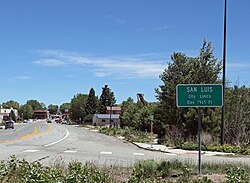
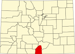
San Luis is a statutory town that is the county seat and the most populous town of Costilla County, Colorado, United States. [7] Formerly known as San Luis de la Culebra, it is the oldest continuously occupied town in Colorado. [8] The population was 598 at the 2020 census. [5]

Contents

History

La casa del senor Don Alberto Forbes, San Luis, 1909 La casa del senor Don Alberto Forbes, de San Luis, Colo. 1909.jpg
La casa del senor Don Alberto Forbes, San Luis, 1909

The Town of San Luis is centuries younger than the pueblos and villages of northern New Mexico because Hispanic settlers were wary of venturing north of the 37th parallel north for fear of Ute and Comanche raids. Armed traders traveled the Old Spanish Trail through the area in the early 19th century. In 1821, the Treaty of Córdoba recognized the independence of Mexico from the Spanish Empire. San Luis was in the Sangre de Cristo Land Grant awarded by the government of New Mexico to the Carlos Beaubien family in 1843. The Treaty of Guadalupe Hidalgo annexed northern Mexico to the United States in 1848, and the Compromise of 1850 created the U.S. Territory of New Mexico.

Hispanic settlers from the Taos Valley established several small villages along the Rio Culebra in the San Luis Valley and officially took possession of this portion of the Sangre de Cristo Land Grant on April 9, 1851. [9] The settlers built a church in the central village of La Plaza Medio. They dedicated it on the Feast of Saint Louis, June 21, 1851, renaming the village San Luis de la Culebra in honor of the saint.

The United States Army established Fort Massachusetts in 1852 and Fort Garland in 1858 to provide protection for the settlers in the valley. The village of San Luis remained part of the Territory of New Mexico until 1861 when the Territory of Colorado was established. San Luis became the seat of Costilla County in 1863, and remains so to this day. Colonel Christopher "Kit" Carson, Commander of Fort Garland, negotiated a treaty with the Ute people in 1867. Colorado became a state in 1876 and the Town of San Luis was incorporated in 1885. Today, San Luis is the oldest continuously inhabited town in the State of Colorado. [10]

A Pueblo Chieftain article dated June 8, 1872, describes the three stores of San Luis as kept by Fred Meyer & Co, Auguste Lacome and Mazers & Rich in addition to a blacksmith, butcher, beer saloon, carpenter and two hotels.

Today, the town is renowned for its Stations of the Cross ascending the local mesa. The town celebrates the Fiesta de Santiago y Santa Ana each July and the San Luis Manito Christmas celebration in December.

Geography

The town of San Luis lies in the San Luis Valley. Colorado State Highway 159 leads north 15 miles (24 km) to Fort Garland and U.S. Route 160, and south 18 miles (29 km) to the New Mexico border. Highway 142 leads west 31 miles (50 km) to Manassa.

According to the United States Census Bureau, the town has a total area of 0.54 square miles (1.4 km2), all of it land. [11]

Demographics

Historical population
CensusPop.Note
1970 781
1980 8427.8%
1990 800−5.0%
2000 739−7.6%
2010 629−14.9%
2020 598−4.9%
U.S. Decennial Census

See also

Related Research Articles

<span class="mw-page-title-main">San Luis Valley</span> High-altitude basin in Colorado and New Mexico in the United States

The San Luis Valley is a region in south-central Colorado with a small portion overlapping into New Mexico. The valley is approximately 122 miles (196 km) long and 74 miles (119 km) wide, extending from the Continental Divide on the northwest rim into New Mexico on the south. It contains 6 counties and portions of 3 others. It is an extensive high-elevation depositional basin of approximately 8,000 square miles (21,000 km2) with an average elevation of 7,664 feet (2,336 m) above sea level. The valley is a section of the Rio Grande Rift and is drained to the south by the Rio Grande, which rises in the San Juan Mountains to the west of the valley and flows south into New Mexico. The San Luis Valley has a cold desert climate but has substantial water resources from the Rio Grande and groundwater.

<span class="mw-page-title-main">Costilla County, Colorado</span> County in Colorado, United States

Costilla County is a county located in the U.S. state of Colorado. As of the 2020 census, the population was 3,499. The county seat is San Luis, the oldest continuously occupied town in Colorado.

<span class="mw-page-title-main">Manassa, Colorado</span> Town in Colorado, United States

Founded in 1851, the Town of Manassa is a Statutory Town and is the most populous municipality in Conejos County, Colorado, United States. The town's population was 947 at the 2020 United States Census.

<span class="mw-page-title-main">Fort Garland, Colorado</span> Census Designated Place in Colorado, United States

Fort Garland is an unincorporated town, a post office, and a census-designated place (CDP) located in and governed by Costilla County, Colorado, United States. The Fort Garland post office has the ZIP Code 81133. At the United States Census 2020, the population of the Fort Garland CDP was 464.

<span class="mw-page-title-main">Sangre de Cristo Mountains</span> Mountain range in Colorado and New Mexico, United States

The Sangre de Cristo Mountains are the southernmost subrange of the Rocky Mountains. They are located in southern Colorado and northern New Mexico in the United States. The mountains run from Poncha Pass in South-Central Colorado, trending southeast and south, ending at Glorieta Pass, southeast of Santa Fe, New Mexico. The mountains contain a number of fourteen thousand foot peaks in the Colorado portion, as well as several peaks in New Mexico which are over thirteen thousand feet.

<span class="mw-page-title-main">Blanca Peak</span> Mountain in Colorado, United States

Blanca Peak is the fourth highest summit of the Rocky Mountains of North America and the U.S. state of Colorado. The ultra-prominent 14,351-foot (4,374 m) peak is the highest summit of the Sierra Blanca Massif, the Sangre de Cristo Range, and the Sangre de Cristo Mountains. The fourteener is located 9.6 miles (15.5 km) north by east of the Town of Blanca, on the drainage divide separating Rio Grande National Forest and Alamosa County from the Sangre de Cristo Land Grant and Costilla County. The summit is the highest point of both counties and the entire drainage basin of the Rio Grande. Below the steep North Face of Blanca Peak two live Glaciers once developed, until extinction sometime after 1903. North & South Blanca Glaciers were located at 37° 35N.,longitude 105° 28W. Blanca Peak is higher than any point in the United States east of its longitude.

<span class="mw-page-title-main">Southern Ute Indian Reservation</span> Indian reservation in United States, Southern Ute

The Southern Ute Indian Reservation is an Indian reservation in southwestern Colorado, United States, near the northern New Mexico state line. Its territory consists of land from three counties; in descending order of surface area they are La Plata, Archuleta, and Montezuma Counties. The reservation has a land area of 1,058.785 sq mi (2,742.24 km²). Its largest communities are Ignacio and Arboles. The only other community that is recognized as a separate place by the Census Bureau is the CDP of Southern Ute, which lies just southeast of Ignacio.

<span class="mw-page-title-main">Chama, Colorado</span> Unincorporated community in State of Colorado, United States

Chama is an unincorporated community and U.S. Post Office in Costilla County, Colorado, United States. The ZIP Code of the Chama Post Office is 81126.

<span class="mw-page-title-main">San Pablo, Colorado</span> Unincorporated community in Colorado, United States

San Pablo is an unincorporated community located in Costilla County, Colorado, United States. The San Luis post office (Zip Code 81152) serves San Pablo postal addresses. San Pablo is located in the Rio Culebra valley of the Sangre de Cristo Land Grant which was awarded to the family of Carlos Beaubien in 1843.

<span class="mw-page-title-main">San Acacio, Colorado</span> Census Designated Place in Colorado, United States

San Acacio is an unincorporated community and a census-designated place (CDP) located in and governed by Costilla County, Colorado, United States. The population of the San Acacio CDP was 56 at the 2020 United States census. The Sanford post office serves San Acacio postal addresses.

<span class="mw-page-title-main">Sangre de Cristo Ranches, Colorado</span> Unincorporated community in Colorado, United States

Sangre de Cristo Ranches is an unincorporated community located near Fort Garland in Costilla County, Colorado, United States. The U.S. Post Office at Fort Garland serves Sangre de Cristo Ranches postal addresses.

<span class="mw-page-title-main">Fort Garland</span> United States historic place

Fort Garland (1858–1883), Colorado, United States, was designed to house two companies of soldiers to protect settlers in the San Luis Valley, then in the Territory of New Mexico. It was named for General John Garland, commander of the Military District of New Mexico.

<span class="mw-page-title-main">Rio Culebra (Colorado)</span> River in Colorado, United States

Rio Culebra is a river or creek in Costilla County, Colorado. The Rio Culebra rises in the Sangre de Cristo Mountains and is 48 km (30 mi) long. It empties into the Rio Grande west of the town of San Luis. The region around San Luis features extensive agriculture made possible by irrigation water from the river. Sometimes called the "Culebra Basin" this area is known for the extensive irrigation canals called acequias built by its Hispanic settlers in the 19th century and still in use in the 21st century

Hispanic and Latino Coloradans are residents of the state of Colorado who are of Hispanic or Latino ancestry. As of 2020, Hispanics and Latinos of any race made up 21% of the state's population, or 1,269,520 of the state's 5,770,545 residents.

<span class="mw-page-title-main">Fort Massachusetts (Colorado)</span>

Fort Massachusetts was a military installation built in the San Luis Valley in Southern Colorado. It was located near the western bank of Ute Creek on the base of Mount Blanca and sat at an elevation of 8,000 feet, approximately 6 miles north of present-day Fort Garland.

<span class="mw-page-title-main">Mountain Home Reservoir</span> Reservoir in Costilla County, Colorado

Mountain Home Reservoir is a reservoir and state wildlife area in Costilla County, Colorado, near Fort Garland. Frozen in winter, the reservoir lies at 2,483 meters elevation on the western slope of the Culebra Range of the Sangre de Cristo Mountains in southern Colorado.

<span class="mw-page-title-main">San Luis Hills</span>

The San Luis Hills are a group of small mountain ranges in Conejos and Costilla counties in the San Luis Valley in southern Colorado. The individual mountain ranges that make up the San Luis Hills include the Fairy Hills, the Brownie Hills, the Piñon Hills, and the South Piñon Hills. The San Luis Hills' highest point is Flat Top, elevation 9,206 feet

The Los Caminos Antiguos Scenic and Historic Byway is a 129-mile (208 km) Back Country Byway and Colorado Scenic and Historic Byway located in Alamosa, Conejos, and Costilla counties, Colorado, USA. The byway explores the historic San Luis Valley of south-central Colorado including Great Sand Dunes National Park and Preserve; the Old Spanish National Historic Trail; historic Fort Garland, San Luis (San Luis de la Culebra), the oldest town in Colorado; and the Cumbres and Toltec Scenic Railroad.

The Sangre de Cristo Land Grant in the San Luis Valley of southern Colorado and northern New Mexico consists of 1,000,000 acres (4,000 km2) of mostly arid land. It was awarded by the government of New Mexico to the Beaubien family in 1843. The land grant was originally settled by Hispanics from New Mexico. Since the incorporation of the area of the grant into the United States in 1848, legal disputes between the descendants of the Hispanic settlers and Anglo ranchers about ownership of and access to some of the land in the grant area have been frequent and continued into the 21st century.

<span class="mw-page-title-main">Rito Seco</span> River in Colorado, United States

Rito Seco is a tributary of Culebra Creek in Costilla County, Colorado. The name means dry creek in the dialect of Spanish spoken in southern Colorado and New Mexico.

References

  1. 1 2 "Active Colorado Municipalities". State of Colorado, Department of Local Affairs. Archived from the original on December 12, 2009. Retrieved September 1, 2007.
  2. "Colorado County Seats". State of Colorado, Department of Public Health and Environment. Retrieved December 31, 2007.
  3. "2019 U.S. Gazetteer Files". United States Census Bureau. Retrieved July 1, 2020.
  4. 1 2 U.S. Geological Survey Geographic Names Information System: San Luis, Colorado
  5. 1 2 United States Census Bureau. "San Luis town, Colorado" . Retrieved April 28, 2023.
  6. "ZIP Code Lookup". United States Postal Service. Archived from the original (JavaScript/HTML) on November 4, 2010. Retrieved January 1, 2008.
  7. "Find a County". National Association of Counties. Retrieved June 7, 2011.
  8. Rosso, Mike (November 1, 2010). "Lines in the sand". Colorado Central Magazine. Retrieved February 28, 2023.
  9. "The Culebra River Villages of Costilla County, Colorado" (PDF). Colorado Historical Society.
    - "Land of Contrast: A History of Southeast Colorado". U.S. Bureau of Land Management.
    - "San Luis, Colorado". Sangres.
    - "Town of San Luis". Costilla County, Colorado. Archived from the original on June 25, 2010.
    - "San Luis de la Culebra". Sangres..
  10. "Where is the Oldest Town in Colorado?". History Colorado. 2019.
  11. "Geographic Identifiers: 2010 Demographic Profile Data (G001): San Luis town, Colorado". U.S. Census Bureau, American Factfinder. Archived from the original on February 12, 2020. Retrieved June 24, 2014.