Breckenridge, Colorado | |
|---|---|
| Town of Breckenridge | |
 Main Street in Breckenridge | |
Seal | |
 Interactive map of Breckenridge, Colorado | |
| Coordinates: 39°28′54″N106°02′18″W / 39.4817°N 106.0384°W [2] | |
| Country | United States |
| State | Colorado |
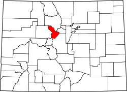
| County | Summit [3] |
| Founded | November 1859 as Breckinridge |
| Incorporated | March 3, 1880 [4] |
| Named after | Thomas E. Breckenridge |
| Government | |
| • Type | home rule town [1] |
| • Mayor | Kelly Owens |
| • Town Council | Dick Carleton Carol Saade Jay Beckerman Todd Rankin Marika Page Steve Gerard |
| Area | |
• Town | 6.041 sq mi (15.646 km2) |
| • Land | 6.041 sq mi (15.646 km2) |
| • Water | 0 sq mi (0.000 km2) 0.0% |
| Elevation | 9,728 ft (2,965 m) |
| Population | |
• Town | 5,078 |
| 4,892 | |
| • Density | 840.6/sq mi (324.6/km2) |
| • Urban | 8,725 |
| • Metro | 30,882 |
| Time zone | UTC−07:00 (MST) |
| • Summer (DST) | UTC−06:00 (MDT) |
| ZIP code [9] | 80424 |
| Area codes | 303/720/983 |
| GNIS place ID | 204681 |
| GNIS town ID | 2411722 |
| FIPS code | 08-08400 |
| Website | townofbreckenridge.com |
Breckenridge is the home rule town that is the county seat of Summit County, Colorado, United States. The population was 5,078 at the 2020 census, [6] and was estimated at 4,892 in 2024. [7]
Contents
- History
- Name
- Discovery
- Geography
- Climate
- Demographics
- 2000 census
- Events
- Winter
- Summer and fall
- Notable people
- See also
- References
- External links
Breckenridge is the principal town of the Breckenridge, CO Micropolitan Statistical Area. The town also has many part-time residents, as many people have vacation homes in the area. The town is located at the base of the Tenmile Range.
Since ski trails were first cut in 1961, Breckenridge Ski Resort has made the town a popular destination for skiers. Summer in Breckenridge attracts outdoor enthusiasts with hiking trails, wildflowers, fly fishing in the Blue River, mountain biking, nearby Lake Dillon for boating, white-water rafting, three alpine slides, a roller coaster, and many shops and restaurants up and down Main Street. The historic buildings along Main Street with their clapboard and log exteriors add to the charm of the town. Since 1981, Breckenridge has hosted the Breckenridge Festival of Film in September, while in January, the town has often been host to a screening of the Backcountry Film Festival. [10] [11] [12] Also held in December is Ullr Fest, a week of festivities celebrating snow and honoring the Norse god Ullr. [13] There are many summertime attractions to enjoy in Breckenridge, most notably the annual Fourth of July parade.