Heeney, Colorado

Last updated

Heeney, Colorado
Heeney, Colorado.JPG
Homes along the shore of Green Mountain Reservoir in Heeney.
Summit County Colorado Incorporated and Unincorporated areas Heeney Highlighted 0835400.svg
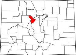
Location of the Heeney CDP in Summit County, Colorado.
Usa edcp location map.svg
Red pog.svg
Heeney
Location of the Heeney CDP in the United States.
Coordinates: 39°52′27″N106°18′28″W / 39.87417°N 106.30778°W / 39.87417; -106.30778 (Heeney CDP, Colorado) [1]
Country Flag of the United States.svg  United States
State Flag of Colorado.svg  Colorado
County Summit County
Government
[1]
  Type unincorporated community
Area
[2]
  Total0.227 sq mi (0.589 km2)
  Land0.227 sq mi (0.589 km2)
  Water0.000 sq mi (0.000 km2)
Elevation
[1]
8,019 ft (2,444 m)
Population
 (2020) [3]
  Total74
  Density330/sq mi (130/km2)
Time zone UTC-7 (MST)
  Summer (DST) UTC-6 (MDT)
ZIP Code [4]
80498
Area code 970
GNIS feature ID 2583244 [1]

Heeney is an unincorporated community and a census-designated place (CDP) located in and governed by Summit County, Colorado, United States. The CDP is a part of the Breckenridge, CO Micropolitan Statistical Area. The population of the Heeney CDP was 74 at the United States Census 2020. [3] The Silverthorne post office (Zip Code 80498) serves Heeney postal addresses. [4]

Contents

History

The Heeney post office was established in 1939, and remained in operation until 1960. [5] The community has the name of Paul Heeney, a local property owner. [6]

Geography

The Heeney CDP has an area of 146 acres (0.589 km2), all land. [2]

Climate

This climate type is dominated by the winter season, a long, bitterly cold period with short, clear days, relatively little precipitation mostly in the form of snow, and low humidity. According to the Köppen Climate Classification system, Heeney has a subarctic climate, abbreviated "Dfc" on climate maps. [7]

Demographics

The United States Census Bureau initially defined the Heeney CDP for the United States Census 2010.

Heeney CDP, Colorado
YearPop.±%
2010 76    
2020 74−2.6%
Source: United States Census Bureau

See also

Related Research Articles

<span class="mw-page-title-main">Strasburg, Colorado</span> Census Designated Place in Colorado, United States

Strasburg is an unincorporated town located just 30 minutes east of downtown Denver along the I-70 corridor. It is home to Strasburg School District 31-J, and there are several small businesses, medical clinics, and a post office. Strasburg is a census-designated place (CDP) located in and governed by Adams and Arapahoe counties, Colorado, United States. The CDP is a part of the Denver–Aurora–Lakewood, CO Metropolitan Statistical Area. The Strasburg post office has the ZIP Code 80136. At the United States Census 2020, the population of the Strasburg CDP was 3,307.

<span class="mw-page-title-main">Byers, Colorado</span> Census Designated Place in Colorado, United States

Byers is an unincorporated town, a post office, and a census-designated place (CDP) located in and governed by Arapahoe County, Colorado, United States. The CDP is a part of the Denver–Aurora–Lakewood, CO Metropolitan Statistical Area. The Byers post office has the ZIP Code 80103. At the United States Census 2020, the population of the Byers CDP was 1,322.

<span class="mw-page-title-main">Louviers, Colorado</span> Census Designated Place in Colorado, United States

Louviers is an unincorporated town, a post office, and a census-designated place (CDP) located in and governed by Douglas County, Colorado, United States. The CDP is a part of the Denver–Aurora–Lakewood, CO Metropolitan Statistical Area. The Louviers post office has the ZIP Code 80131. At the United States Census 2020, the population of the Louviers CDP was 293.

<span class="mw-page-title-main">Sedalia, Colorado</span> Census Designated Place in Colorado, United States

Sedalia is an unincorporated town, a post office, and a census-designated place (CDP) located in and governed by Douglas County, Colorado, United States. The CDP is a part of the Denver–Aurora–Lakewood, CO Metropolitan Statistical Area. The Sedalia post office has the ZIP Code 80135. At the United States Census 2020, the population of the Sedalia CDP was 177.

<span class="mw-page-title-main">Edwards, Colorado</span> Census Designated Place in Colorado, United States

Edwards is an unincorporated town, a post office, and a census-designated place (CDP) located in and governed by Eagle County, Colorado, United States. Edwards is the principal town of the Edwards, CO Micropolitan Statistical Area. The Edwards post office has the ZIP Code 81632. At the United States Census 2020, the population of the Edwards CDP was 11,246. The Edwards Metropolitan District provides services.

<span class="mw-page-title-main">El Jebel, Colorado</span> Census Designated Place in Colorado, United States

El Jebel is an unincorporated community and a census-designated place (CDP) located in and governed by Eagle County, Colorado, United States. The CDP is a part of the Edwards, CO Micropolitan Statistical Area. The population of the El Jebel CDP was 4,130 at the United States Census 2020. The Carbondale Post Office serves El Jebel postal addresses.

<span class="mw-page-title-main">Kittredge, Colorado</span> Census Designated Place in Colorado, United States

Kittredge is an unincorporated town, a post office, and a census-designated place (CDP) located in and governed by Jefferson County, Colorado, United States. The CDP is a part of the Denver–Aurora–Lakewood, CO Metropolitan Statistical Area. The Kittredge post office has the ZIP code 80457. At the United States Census 2020, the population of the Kittredge CDP was 1,308.

<span class="mw-page-title-main">Atwood, Colorado</span> Census Designated Place in Colorado, United States

Atwood is an unincorporated town, a post office, and a census-designated place (CDP) located in and governed by Logan County, Colorado, United States. The CDP is a part of the Sterling, CO Micropolitan Statistical Area. The Atwood post office has the ZIP Code 80722. At the United States Census 2020, the population of the Atwood CDP was 138.

<span class="mw-page-title-main">Padroni, Colorado</span> Census Designated Place in Colorado, United States

Padroni is an unincorporated town, a census-designated place (CDP), and a post office located in and governed by Logan County, Colorado, United States. The CDP is a part of the Sterling, CO Micropolitan Statistical Area. The Padroni post office has the ZIP Code 80745. At the United States Census 2020, the population of the Padroni CDP was 75.

<span class="mw-page-title-main">Keystone, Colorado</span> Home rule municipality in Colorado, United States

Keystone is an unincorporated community and a census-designated place (CDP) located in and governed by Summit County, Colorado, United States. The CDP is a part of the Breckenridge, CO Micropolitan Statistical Area. The population of the Keystone CDP was 1,369 at the United States Census 2020. The Dillon post office (Zip Code 80435) serves Keystone postal addresses. The Keystone CDP includes the Keystone Resort and Keystone village.

<span class="mw-page-title-main">Howard, Colorado</span> Census-designated place in Fremont County, Colorado, United States

Howard is a census-designated place (CDP) and post office in and governed by Fremont County, Colorado, United States. The CDP is a part of the Cañon City, CO Micropolitan Statistical Area. The Howard post office has the ZIP Code 81233. At the United States Census 2020, the population of the Howard CDP was 852.

<span class="mw-page-title-main">Matheson, Colorado</span> Census-designated place in Elbert County, Colorado, United States.

Matheson is a census-designated place (CDP) and post office in and governed by Elbert County, Colorado, United States. The CDP is a part of the Denver–Aurora–Lakewood, CO Metropolitan Statistical Area. The Matheson post office has the ZIP Code 80830. At the United States Census 2020, the population of the Matheson CDP was 79.

<span class="mw-page-title-main">McCoy, Colorado</span> Census Designated Place in Colorado, United States

McCoy is an unincorporated town, a census-designated place (CDP), and a post office located in and governed by Eagle County, Colorado, United States. The CDP is a part of the Edwards, CO Micropolitan Statistical Area. The McCoy post office has the ZIP Code 80463. At the United States Census 2020, the population of the McCoy CDP was 30.

<span class="mw-page-title-main">Orchard, Colorado</span> Unincorporated community in Colorado, United States

Orchard is an unincorporated town, a post office, and a census-designated place (CDP) located in and governed by Morgan County, Colorado, United States. The CDP is a part of the Fort Morgan, CO Micropolitan Statistical Area. The Orchard post office has the ZIP Code 80649. As of the 2020 census, the population of the Orchard CDP was 76.

<span class="mw-page-title-main">Phippsburg, Colorado</span> Census-designated place in Routt County, Colorado, United States

Phippsburg is a census-designated place (CDP) and a post office in and governed by Routt County, Colorado, United States. The population was 234 at the 2020 census. The CDP is a part of the Steamboat Springs, CO Micropolitan Statistical Area. The Phippsburg post office has the ZIP Code 80469.

<span class="mw-page-title-main">Snyder, Colorado</span> Census-designated place in Colorado, United States

Snyder is an unincorporated town, a post office, and a census-designated place (CDP) located in and governed by Morgan County, Colorado, United States. The CDP is a part of the Fort Morgan, CO Micropolitan Statistical Area. The Snyder post office has the ZIP Code 80750. As of the 2020 census, the population of the Snyder CDP was 136.

<span class="mw-page-title-main">Weldona, Colorado</span> Census Designated Place in Colorado, United States

Weldona is an unincorporated town, a post office, and a census-designated place (CDP) located in and governed by Morgan County, Colorado, United States. The CDP is a part of the Fort Morgan, CO Micropolitan Statistical Area. The Weldona post office has the ZIP Code 80653. At the United States Census 2020, the population of the Weldona CDP was 113.

<span class="mw-page-title-main">Wolcott, Colorado</span> Census Designated Place in Colorado, United States

Wolcott is an unincorporated town, a post office, and a census-designated place (CDP) located in and governed by Eagle County, Colorado, United States. The CDP is a part of the Edwards, CO Micropolitan Statistical Area. The Wolcott post office has the ZIP Code 81655. At the United States Census 2020, the population of the Wolcott CDP was 20.

<span class="mw-page-title-main">Copper Mountain, Colorado</span> Census-designated place in Colorado, US

Copper Mountain is an unincorporated community and a census-designated place (CDP) located in and governed by Summit County, Colorado, United States. The CDP is a part of the Breckenridge, CO Micropolitan Statistical Area. The population of the Copper Mountain CDP was 650 at the United States Census 2020. The Copper Mountain Consolidated Metropolitan District provides services. The Frisco post office (Zip Code 80443) serves the area. The Copper Mountain CDP includes the Copper Mountain Ski Resort and Copper Mountain village.

<span class="mw-page-title-main">Colona, Colorado</span> Census-designated place in Colorado, United States

Colona is a census-designated place (CDP) located in and governed by Ouray County, Colorado, United States. The CDP is a part of the Montrose, CO Micropolitan Statistical Area. The population of the Colona CDP was 36 at the United States Census 2020. The Montrose post office (Zip Code 81401) serves the area.

References

  1. 1 2 3 4 U.S. Geological Survey Geographic Names Information System: Heeney, Colorado
  2. 1 2 "State of Colorado Census Designated Places - BAS20 - Data as of January 1, 2020". United States Census Bureau . Retrieved December 27, 2020.
  3. 1 2 United States Census Bureau. "Heeney CDP, Colorado" . Retrieved April 13, 2023.
  4. 1 2 "Look Up a ZIP Code". United States Postal Service . Retrieved December 27, 2020.
  5. "Post offices". Jim Forte Postal History. Retrieved June 27, 2016.
  6. Dawson, John Frank. Place names in Colorado: why 700 communities were so named, 150 of Spanish or Indian origin. Denver, CO: The J. Frank Dawson Publishing Co. p. 26.
  7. Climate Summary for Heeney, Colorado