Dove Creek, Colorado

Last updated

Dove Creek, Colorado
Dove Creek CO.jpg
Nickname: 
Pinto Bean Capital of the World
Dolores County Colorado Incorporated and Unincorporated areas Dove Creek Highlighted 0821265.svg
Location of the Town of Dove Creek in Dolores County, Colorado.
Usa edcp location map.svg
Red pog.svg
Dove Creek
Location of the Town of Dove Creek in the United States.
Coordinates: 37°46′01″N108°54′26″W / 37.76694°N 108.90722°W / 37.76694; -108.90722 [2]
Country Flag of the United States.svg  United States
State Flag of Colorado.svg  Colorado
County Dolores County seat [1]
Incorporated June 15, 1939 [3]
Government
  Type Statutory Town [1]
  State Representative Marc Catlin [4]
Area
[5]
  Total0.573 sq mi (1.483 km2)
  Land0.573 sq mi (1.483 km2)
  Water0.000 sq mi (0.000 km2)
Elevation
[2]
6,841 ft (2,085 m)
Population
 (2020) [5]
  Total635
  Density1,109/sq mi (428/km2)
Time zone UTC−07:00 (MST)
  Summer (DST) UTC−06:00 (MDT)
ZIP code [6]
81324
Area code 970
FIPS code 08-21265
GNIS feature ID 2412446 [2]
Website townofdovecreek.colorado.gov

Dove Creek is a statutory town that is the county seat and the most populous municipality of Dolores County, Colorado, United States. [1] [7] The town population was 635 at the 2020 United States Census. [5] The community takes its name from the nearby Dove Creek. [8] Dove Creek is the self-proclaimed Pinto Bean Capital of the World.

Contents

Dolores County High School Dolores County High School 2.jpg
Dolores County High School

History

The Old Spanish Trail trade route passed through the area of Dove Creek from 1829 into the 1850s.

A post office at Dove Creek has been in operation since 1915. [9]

There are several area prehistoric and historic sites listed on the Colorado State Register of Historic Properties: [10]

Geography

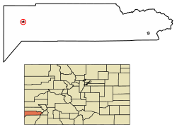
Dove Creek is located in western Dolores County on US 491 (formerly US 666) at the crossing of Dove Creek, the town's namesake. Dove Creek flows south to Cross Canyon, Montezuma Creek, Utah, and the San Juan River. The town is located on the northern portion of the Great Sage Plain, a large plateau covered in desert lands, bounded by the La Plata Mountains, Mesa Verde National Park, the La Sal Mountains, and the Abajo Mountains, and cut by dozens of deep canyons, which was and is a productive agricultural region. The plateau is dotted with numerous ruins of the Anasazi and other ancient people who took advantage of good soils and terrain, even with limited water resources.

The Dolores County Courthouse, built in 1957, replaces a temporary courthouse in the town used after voters of the county moved the county seat from Rico to Dove Creek in 1947, reflecting a shift in the original mining-oriented make-up of the county's population to the current situation in which farmers and a few ranchers outnumber the mountain-dwellers in the old mining districts of the eastern end of Dolores County. The courthouse is adjacent to Dolores County High School, and is part of the old business district located north of US 491; most business is now located on US 491 as it angles through the town from east-southeast to west-northwest. A regional landmark is the large concrete bean elevator located on the west edge of town, near the Dolores County Industrial Park. SH 141 intersects US 491 just west of town, and provides access to the Paradox Valley, Nucla-Naturita, and the uranium mining and industrial area of Montrose County, Colorado, and Grand County, Utah.

At the 2020 United States Census, the town had a total area of 366 acres (1.483 km2), all of it land. [5]

Climate

Climate data for Dove Creek, Colorado (1991–2020)
MonthJanFebMarAprMayJunJulAugSepOctNovDecYear
Mean daily maximum °F (°C)37.7
(3.2)
41.8
(5.4)
50.4
(10.2)
58.8
(14.9)
68.7
(20.4)
81.2
(27.3)
86.6
(30.3)
82.9
(28.3)
75.0
(23.9)
61.7
(16.5)
49.3
(9.6)
38.3
(3.5)
61.0
(16.1)
Daily mean °F (°C)27.5
(−2.5)
31.2
(−0.4)
39.1
(3.9)
45.5
(7.5)
55.0
(12.8)
66.3
(19.1)
72.2
(22.3)
69.6
(20.9)
62.1
(16.7)
49.6
(9.8)
38.2
(3.4)
28.4
(−2.0)
48.7
(9.3)
Mean daily minimum °F (°C)17.3
(−8.2)
20.6
(−6.3)
27.8
(−2.3)
32.1
(0.1)
41.2
(5.1)
51.5
(10.8)
57.8
(14.3)
56.2
(13.4)
49.2
(9.6)
37.5
(3.1)
27.0
(−2.8)
18.5
(−7.5)
36.4
(2.4)
Source: NOAA [11]

Demographics

Historical population
CensusPop.Note
1940 418
1950 70267.9%
1960 98640.5%
1970 619−37.2%
1980 82633.4%
1990 643−22.2%
2000 6988.6%
2010 7355.3%
2020 635−13.6%
U.S. Decennial Census

As of the census of 2000, [12] there were 698 people, 285 households, and 202 families residing in the town. The population density was 1,322.5 inhabitants per square mile (510.6/km2). There were 326 housing units at an average density of 617.7 units per square mile (238.5 units/km2). The racial makeup of the town was 96.28% White, 1.86% Native American, 0.29% from other races, and 1.58% from two or more races. Hispanic or Latino of any race were 3.87% of the population.

There were 285 households, out of which 31.2% had children under the age of 18 living with them, 54.4% were married couples living together, 13.0% had a female householder with no husband present, and 28.8% were non-families. 26.0% of all households were made up of individuals, and 14.4% had someone living alone who was 65 years of age or older. The average household size was 2.45 and the average family size was 2.93.

In the town, the population was spread out, with 26.6% under the age of 18, 7.9% from 18 to 24, 24.4% from 25 to 44, 22.3% from 45 to 64, and 18.8% who were 65 years of age or older. The median age was 39 years. For every 100 females, there were 97.2 males. For every 100 females age 18 and over, there were 91.0 males. The median income for a household in the town was $27,500, and the median income for a family was $32,813. Males had a median income of $28,333 versus $17,500 for females. The per capita income for the town was $13,015. About 8.9% of families and 12.3% of the population were below the poverty line, including 9.9% of those under age 18 and 16.0% of those age 65 or over.

Economy

Pinto bean silo to the west of Dove Creek Bean Tower 1.jpg
Pinto bean silo to the west of Dove Creek

The Dolores County Industrial Park is located west of Dove Creek and is the site of a plant which began construction in 2007, which produces food-grade vegetable oil from sunflowers, safflower, and canola grown in the Dove Creek area, and will ultimately produce biodiesel. The industrial park is home to the community's first ready-mix plant in many decades, and other businesses. New housing developments have been permitted and platted in the Dove Creek area, anticipating growth due to efforts like this. On the eastern edge of the town is the headquarters and facility of Adobe Milling, a company marketing various locally-grown beans and other traditional Southwestern foods. [13]

Major employers in the town include the county government and school district, and various other government agencies. Most businesses in town support agricultural operations; some provide transportation services for highway users.

Dove Creek Press building on Main Street Dove Creek Press building.jpg
Dove Creek Press building on Main Street

Community news

The Dove Creek Press is an 824-circulation weekly newspaper, [14] locally owned and operated by Kathleen "Kat" Keesling since January 2017. The Press office is located at 321 Main St, Dove Creek, CO 81324. [15]

According to Keesling, the Dove Creek Press was first published May 10, 1940, on eight broadsheet pages. The cost of a subscription was $2 per year. The Ladies Civic Club held a subscription drive, receiving 25¢ per subscription in return. The newspaper was printed in house. It was a broadsheet typical of that era, 21 inches tall by 14 ½ inches wide. The newspapers were frequently a sideline for printers.

See also

Related Research Articles

<span class="mw-page-title-main">San Juan County, Utah</span> County in Utah, United States

San Juan County is a county in the southeastern portion of the U.S. state of Utah. As of the 2020 United States Census, the population was 14,518. Its county seat is Monticello, while its most populous city is Blanding. The Utah State Legislature named the county for the San Juan River, itself named by Spanish explorers.

<span class="mw-page-title-main">Mohave County, Arizona</span> County in Arizona, United States

Mohave County is a county in the northwestern corner of the U.S. state of Arizona. As of the 2020 census, its population was 213,267. The county seat is Kingman, and the largest city is Lake Havasu City. It is the fifth largest county in the United States.

<span class="mw-page-title-main">Kent County, Delaware</span> County in Delaware, United States

Kent County is a county located in the central part of the U.S. state of Delaware. As of the 2020 census, the population was 181,851, making it the least populous county in Delaware. The county seat is Dover, the state capital of Delaware. It is named for Kent, an English county.

<span class="mw-page-title-main">Summit County, Colorado</span> County in Colorado, United States

Summit County is a county located in the U.S. state of Colorado. As of the 2020 census, the population was 31,055. The county seat and largest town is Breckenridge.

<span class="mw-page-title-main">Montrose County, Colorado</span> County in Colorado, United States

Montrose County is a county located in the U.S. state of Colorado. As of the 2020 census, the population was 42,679. The county seat is Montrose, for which the county is named.

<span class="mw-page-title-main">Montezuma County, Colorado</span> County in Colorado, United States

Montezuma County is a county located in the southwest corner of the U.S. state of Colorado. As of the 2020 census, the population was 25,849. The county seat is Cortez.

<span class="mw-page-title-main">Lincoln County, Colorado</span> County in Colorado, United States

Lincoln County is a county located in the U.S. state of Colorado. As of the 2020 census, the population was 5,675. The county seat is Hugo. The county obtains its name in memory of the United States President Abraham Lincoln. County was formed from portions of Bent and Elbert counties in 1889 from a restructuring of Colorado counties.

<span class="mw-page-title-main">Jefferson County, Colorado</span> County in Colorado, United States

Jefferson County is a county located in the U.S. state of Colorado. As of the 2020 census, the population was 582,910, making it the fourth-most populous county in Colorado. The county seat is Golden, and the most populous city's Lakewood.

<span class="mw-page-title-main">Dolores County, Colorado</span> County in Colorado, United States

Dolores County is a county located in the U.S. state of Colorado. As of the 2020 census, the population was 2,326. The county seat is Dove Creek.

<span class="mw-page-title-main">Cheyenne County, Colorado</span> County in Colorado, United States

Cheyenne County is a county located in the U.S. state of Colorado. The county population was 1,748 at 2020 census. The county seat is Cheyenne Wells.

<span class="mw-page-title-main">Campo, Colorado</span> Town in Colorado, United States

Campo is a Statutory Town located in Baca County, Colorado, United States. The town population was 103 at the 2020 United States Census. The town is situated on the High Plains, straddling U.S. Route 287/385.

<span class="mw-page-title-main">Jamestown, Colorado</span> Town in Colorado, United States

The historic Town of Jamestown is a Statutory Town in Boulder County, Colorado, United States. The population was 256 at the 2020 United States Census, down from 274 in 2010. It was named for James Smith, an early discoverer of gold. Jamestown was hit hard by the September 2013 Colorado floods when the town was isolated due to road damage from the rains and the flooding of James Creek. Under a mandatory evacuation order, most residents were airlifted to safety under the direction of the Colorado National Guard to nearby Boulder.

<span class="mw-page-title-main">Cortez, Colorado</span> City in Colorado, United States

Cortez is a home rule municipality that is the county seat and the most populous municipality of Montezuma County, Colorado, United States. The city population was 8,766 at the 2020 United States Census.

<span class="mw-page-title-main">Dolores, Colorado</span> Town in Montezuma County, Colorado, United States

Dolores is a Statutory Town located in Montezuma County, Colorado, United States. The town population was 885 at the 2020 United States Census.

<span class="mw-page-title-main">Mancos, Colorado</span> Town in Colorado, United States

Mancos is a statutory town in Montezuma County, Colorado, United States. The population was 1,196 at the 2020 census, down from 1,336 in 2010.

<span class="mw-page-title-main">Little Creek, Delaware</span> Town in Delaware, United States

Little Creek is a town in Kent County, Delaware, United States. It is part of the Dover metropolitan statistical area. The population was 195 in 2020.

<span class="mw-page-title-main">Canyon City, Oregon</span> City in Oregon, United States

Canyon City is a city in Grant County, Oregon, United States. It is the county seat of Grant County, and is about 2 miles (3 km) south of John Day on U.S. Highway 395. As of the 2010 census, the city had a total population of 703.

<span class="mw-page-title-main">New Berlin, Pennsylvania</span> Borough in Pennsylvania, United States

New Berlin is a borough in Union County, Pennsylvania, United States. The population was 802 at the 2020 census.

<span class="mw-page-title-main">Wayne, West Virginia</span> Town in West Virginia, United States

Wayne is a town in and the county seat of Wayne County, West Virginia, United States. The population was 1,441 at the 2020 census. It is part of the Huntington–Ashland metropolitan area.

<span class="mw-page-title-main">Coal Creek, Colorado</span> Town in Colorado, United States

The Town of Coal Creek is a Statutory Town located in Fremont County, Colorado, United States. The town population was 364 at the 2020 United States Census. Coal Creek is a part of the Cañon City, CO Micropolitan Statistical Area and the Front Range Urban Corridor.

References

  1. 1 2 3 4 "Active Colorado Municipalities". Colorado Department of Local Affairs . Retrieved October 16, 2021.
  2. 1 2 3 U.S. Geological Survey Geographic Names Information System: Dove Creek, Colorado
  3. "Colorado Municipal Incorporations". State of Colorado, Department of Personnel & Administration, Colorado State Archives. December 1, 2004. Retrieved September 2, 2007.
  4. "State Representative". State of Colorado. Retrieved January 3, 2024.
  5. 1 2 3 4 "Decennial Census P.L. 94-171 Redistricting Data". United States Census Bureau, United States Department of Commerce. August 12, 2021. Retrieved September 7, 2021.
  6. "ZIP Code Lookup". United States Postal Service. Archived from the original (JavaScript/HTML) on November 4, 2010. Retrieved September 8, 2007.
  7. "Find a County". National Association of Counties. Archived from the original on May 31, 2011. Retrieved June 7, 2011.
  8. Dawson, John Frank. Place names in Colorado: why 700 communities were so named, 150 of Spanish or Indian origin. Denver, CO: The J. Frank Dawson Publishing Co. p. 18.
  9. "Post offices". Jim Forte Postal History. Archived from the original on March 6, 2016. Retrieved June 25, 2016.
  10. National & State Registers for Dolores County, Colorado. Archived April 24, 2012, at the Wayback Machine Colorado Historical Society, Office of Archaeology and Historic Preservation. Retrieved August 10, 2011.
  11. "NOAA NCEI U.S. Climate Normals Quick Access". NOAA. Retrieved April 17, 2024.
  12. "U.S. Census website". United States Census Bureau . Retrieved January 31, 2008.
  13. Adobe Milling
  14. United States Postal Service Statement of Ownership, Management and Circulation, 2018
  15. "Dove Creek Press". Dove Creek Press. Retrieved February 19, 2019.