Julesburg, Colorado

Last updated

Julesburg, Colorado
Julesburg, Colorado.JPG
Entering Julesburg from the northeast.
Sedgwick County Colorado Incorporated and Unincorporated areas Julesburg Highlighted 0839965.svg
Location of Julesburg in Sedgwick County, Colorado.
Coordinates: 40°59′18″N102°16′0″W / 40.98833°N 102.26667°W / 40.98833; -102.26667
Country United States
State Colorado
County Sedgwick County Seat [1]
Incorporated November 18, 1886 [2]
Named for Jules Beni
Government
  Type Statutory Town [1]
Area
[3]
  Total1.51 sq mi (3.92 km2)
  Land1.51 sq mi (3.92 km2)
  Water0.00 sq mi (0.00 km2)
Elevation
[4]
3,478 ft (1,060 m)
Population
 (2020) [5]
  Total1,307
  Density870/sq mi (330/km2)
Time zone UTC-7 (MST)
  Summer (DST) UTC-6 (MDT)
ZIP code [6]
80737
Area code 970
FIPS code 08-39965
GNIS feature ID 0202892
Website Official website

Julesburg is the statutory town that is the county seat and the most populous municipality of Sedgwick County, Colorado, United States. [7] The population was 1,307 at the 2020 United States Census. [5]

Contents

History

The original trading post was named for Jules Beni. [8] Julesburg was on the Pony Express (1860–1861) route from Missouri to California.

Jack Slade

Former Union Pacific station is now a museum, 2007 Julesburg, Colorado UP Station.jpg
Former Union Pacific station is now a museum, 2007

In 1858, Joseph A. "Jack" Slade, a superintendent for the Central Overland California and Pikes Peak Express Company, was tracking down horse thieves, including Jules Beni. Slade caught up with him at Julesburg, but Beni shot him five times. Everybody thought that Slade was dead and several angry townsfolk chased Beni out of Julesburg. When they returned, they found Slade struggling to his feet, having miraculously recovered.

Beni continued to steal horses from the Pike's Peak Express Company, and Slade vowed to hunt him down. Beni attempted to ambush Slade at Slade's own ranch at Cold Springs. But Slade found out about the planned ambush and, along with some of his cowboys, captured Beni. Slade did not take Beni to authorities but instead shot him dead while he was tied to a fence post. [9] He shot off each of his fingers, and then put the gun in Beni's mouth and pulled the trigger. Afterward, he severed Beni's ears as trophies. [ citation needed ]

This account is among the Stories of the Century , a syndicated television series starring and narrated by Jim Davis, which aired on March 4, 1955. Gregg Palmer (1927-2015) played the role of Slade, and Paul Newlan (1903–1973) portrayed Beni.

Battle of Julesburg

Julesburg was a large and prominent stagecoach station and the site of Fort Rankin (later Fort Sedgwick). In revenge for the Sand Creek Massacre, one thousand Cheyenne, Arapaho, and Lakota warriors attacked Julesburg on January 7, 1865. In the battle the Indians defeated about 60 soldiers of the U.S. army and 50 armed civilians. In the following weeks the Indians raided up and down the South Platte River valley. On February 2 they returned to Julesburg and burned down all the buildings in the settlement, although not attacking the soldiers and civilians holed up in the fort. At the time, the town was said to have had over 1000 buildings. [10]

Geography

Julesburg is located at 40°59′18″N102°16′0″W / 40.98833°N 102.26667°W / 40.98833; -102.26667 (40.988422, −102.266677). [11] According to the United States Census Bureau, the town has a total area of 1.3 square miles (3.4 km2), all of it land.

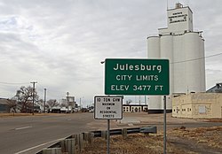
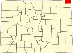
The town is located on the north side of the South Platte River, along U.S. 138 and U.S. 385 and just off of I-76. It is the northernmost town in the state, less than 0.9 mi (1.4 km) south of the Colorado−Nebraska state line.

Climate

Julesburg experiences a semi-arid climate (Köppen BSk) with cold, dry winters and hot, wetter summers.

Climate data for Julesburg, Colorado, 19912020 normals, extremes 1893present
MonthJanFebMarAprMayJunJulAugSepOctNovDecYear
Record high °F (°C)74
(23)
79
(26)
88
(31)
94
(34)
100
(38)
107
(42)
109
(43)
109
(43)
106
(41)
95
(35)
85
(29)
77
(25)
109
(43)
Mean maximum °F (°C)63.4
(17.4)
67.7
(19.8)
77.9
(25.5)
83.6
(28.7)
91.9
(33.3)
97.6
(36.4)
100.8
(38.2)
96.7
(35.9)
95.4
(35.2)
86.6
(30.3)
74.8
(23.8)
61.6
(16.4)
101.4
(38.6)
Average high °F (°C)40.5
(4.7)
44.0
(6.7)
54.5
(12.5)
61.9
(16.6)
70.7
(21.5)
81.5
(27.5)
87.6
(30.9)
85.3
(29.6)
78.3
(25.7)
64.5
(18.1)
51.2
(10.7)
40.5
(4.7)
63.4
(17.4)
Daily mean °F (°C)28.2
(−2.1)
31.1
(−0.5)
40.2
(4.6)
48.3
(9.1)
57.7
(14.3)
68.4
(20.2)
74.4
(23.6)
72.1
(22.3)
63.6
(17.6)
49.9
(9.9)
37.6
(3.1)
28.3
(−2.1)
50.0
(10.0)
Average low °F (°C)15.9
(−8.9)
18.2
(−7.7)
25.9
(−3.4)
34.6
(1.4)
44.7
(7.1)
55.3
(12.9)
61.3
(16.3)
58.9
(14.9)
48.8
(9.3)
35.3
(1.8)
24.0
(−4.4)
16.0
(−8.9)
36.6
(2.5)
Mean minimum °F (°C)−5.4
(−20.8)
−2.5
(−19.2)
8.0
(−13.3)
19.7
(−6.8)
29.2
(−1.6)
43.6
(6.4)
51.4
(10.8)
48.5
(9.2)
35.3
(1.8)
16.9
(−8.4)
5.4
(−14.8)
−4.2
(−20.1)
−12.0
(−24.4)
Record low °F (°C)−34
(−37)
−30
(−34)
−23
(−31)
−8
(−22)
19
(−7)
32
(0)
35
(2)
38
(3)
16
(−9)
−3
(−19)
−14
(−26)
−38
(−39)
−38
(−39)
Average precipitation inches (mm)0.41
(10)
0.41
(10)
1.00
(25)
1.77
(45)
3.00
(76)
3.20
(81)
2.33
(59)
2.79
(71)
1.52
(39)
1.43
(36)
0.41
(10)
0.29
(7.4)
18.56
(469.4)
Average snowfall inches (cm)3.7
(9.4)
4.0
(10)
3.3
(8.4)
2.3
(5.8)
0.1
(0.25)
0.0
(0.0)
0.0
(0.0)
0.0
(0.0)
0.0
(0.0)
2.0
(5.1)
2.8
(7.1)
3.5
(8.9)
21.7
(54.95)
Average precipitation days (≥ 0.01 in)1.52.53.95.78.17.97.06.84.74.62.31.356.3
Average snowy days (≥ 0.1 in)1.82.21.51.10.10.00.00.00.00.81.31.710.5
Source 1: NOAA [12]
Source 2: National Weather Service [13]

Demographics

Historical population
CensusPop.Note
1890 202
1900 37183.7%
1910 962159.3%
1920 1,32037.2%
1930 1,46711.1%
1940 1,61910.4%
1950 1,95120.5%
1960 1,840−5.7%
1970 1,578−14.2%
1980 1,528−3.2%
1990 1,295−15.2%
2000 1,46713.3%
2010 1,225−16.5%
2020 1,3076.7%

Education

Julesburg School District operates public schools.

In media

Julesburg was featured in the 1960 episode "The Story of Julesburg" of the syndicated television series Pony Express . [14] It was the setting of the 1959 Randolph Scott film, Westbound . "Julesburg" is the title of the second episode (1955) of the ABC western Cheyenne . [15] A 2019 YouTube video by VOA News features Julesburg as the backdrop for a short documentary about Charmaine Teodoro, a math teacher from the Philippines who is currently working at Julesburg High School. [16]

See also

Related Research Articles

<span class="mw-page-title-main">Weld County, Colorado</span> County in Colorado, United States

Weld County is a county located in the U.S. state of Colorado. As of the 2020 census, the population was 328,981. The county seat is Greeley.

<span class="mw-page-title-main">Sedgwick County, Colorado</span> County in Colorado, United States

Sedgwick County is a county located in the U.S. state of Colorado. As of the 2020 census, the population was 2,404. The county seat is Julesburg. The county was named for Fort Sedgwick, a military post along the Platte Trail, which was named for General John Sedgwick. It is located near the state border with Nebraska.

<span class="mw-page-title-main">Logan County, Colorado</span> County in Colorado, United States

Logan County is a county located in the U.S. state of Colorado. As of the 2020 census, the population was 21,528. The county seat is Sterling. The county was named for General John A. Logan.

<span class="mw-page-title-main">El Paso County, Colorado</span> County in Colorado, United States

El Paso County is a county located in the U.S. state of Colorado. The 2020 Census recorded its population as 730,395. The Census Bureau's 2020 result indicates it is the most populous county in Colorado, surpassing the City and County of Denver. The county seat is Colorado Springs, the second most populous city in Colorado. El Paso County is included in the Colorado Springs, Colorado, Metropolitan Statistical Area and is located in Colorado's 5th congressional district, except for the far eastern extremities, which are located in the 4th.

<span class="mw-page-title-main">Cheyenne County, Colorado</span> County in Colorado, United States

Cheyenne County is a county located in the U.S. state of Colorado. The county population was 1,748 at 2020 census. The county seat is Cheyenne Wells.

<span class="mw-page-title-main">Cheyenne Wells, Colorado</span> Town in Colorado, United States

Cheyenne Wells is the Statutory Town that is the county seat and the most populous municipality of Cheyenne County, Colorado, United States. The town population was 758 at the 2020 United States Census.

<span class="mw-page-title-main">Ovid, Colorado</span> Town in Colorado, United States

Ovid is a statutory town in Sedgwick County, Colorado, United States. The population was 271 at the 2020 census.

<span class="mw-page-title-main">Sedgwick, Colorado</span> Town in Colorado, United States

Sedgwick is a statutory town in Sedgwick County, Colorado, United States. The population was 172 at the 2020 census.

<span class="mw-page-title-main">Fort Lupton, Colorado</span> City in Colorado, United States

The City of Fort Lupton is a Statutory City located in southern Weld County, Colorado, United States. The town population was 7,955 at the 2020 United States Census. Fort Lupton is a part of the Greeley, Colorado Metropolitan Statistical Area and the Front Range Urban Corridor.

<span class="mw-page-title-main">Virginia Dale, Colorado</span> Unincorporated community in Colorado, United States

Virginia Dale is a tiny unincorporated community located in northwestern Larimer County, Colorado, United States. Virginia Dale is situated in the foothills of the Rocky Mountains on U.S. Highway 287, approximately 45 mi (72 km) northwest of Ft. Collins and approximately 4 mi (6 km) south of the Wyoming border. In the late 19th century, Virginia Dale was a famous stop on the Overland Trail. The stage station, the last of its kind still standing, and its associated home, the Hurzeler House, are owned and maintained by the Virginia Dale Community Club.

<span class="mw-page-title-main">Interstate 76 (Colorado–Nebraska)</span> Interstate mostly in Colorado

Interstate 76 (I-76) is an east–west Interstate Highway in the Western United States that runs from I-70 in Arvada, Colorado – near Denver – to an interchange with I-80 near Big Springs, Nebraska. The highway measures 187.29 miles (301.41 km) long, all but approximately three miles (4.8 km) of which is in Colorado. Along the route, the highway runs concurrent with US Route 6 (US 6), US 85 in the Denver metropolitan area, and US 34 from Wiggins to Fort Morgan. It has no auxiliary Interstates, but it has two business routes that are located in northeastern Colorado. This route is not connected with the other I-76 that spans from Ohio to New Jersey.

<span class="mw-page-title-main">Colorado War</span> 19th-century armed conflict of the American Indian Wars

The Colorado War was an Indian War fought in 1864 and 1865 between the Southern Cheyenne, Arapaho, and allied Brulé and Oglala Sioux peoples versus the U.S. Army, Colorado militia, and white settlers in Colorado Territory and adjacent regions. The Kiowa and the Comanche played a minor role in actions that occurred in the southern part of the Territory along the Arkansas River. The Cheyenne, Arapaho, and Sioux played the major role in actions that occurred north of the Arkansas River and along the South Platte River, the Great Platte River Road, and the eastern portion of the Overland Trail. The United States government and Colorado Territory authorities participated through the 1st Colorado Cavalry Regiment, often called the Colorado volunteers. The war was centered on the Colorado Eastern Plains, extending eastward into Kansas and Nebraska.

Colorado's 4th congressional district is a congressional district in the U.S. state of Colorado. Located in the eastern part of the state, the district encompasses most of the rural Eastern Plains as well as the larger Colorado Front Range cities of Loveland, Highlands Ranch, Castle Rock, and Parker.

<span class="mw-page-title-main">Great Platte River Road</span>

The Great Platte River Road was a major overland travel corridor approximately following the course of the Platte River in present-day Nebraska and Wyoming that was shared by several popular emigrant trails during the 19th century, including the Trapper's Trail, the Oregon Trail, the Mormon Trail, the California Trail, the Pony Express route, and the military road connecting Fort Leavenworth and Fort Laramie. The road, which extended nearly 370 miles (600 km) from the Second Fort Kearny to Fort Laramie, was utilized primarily from 1841 to 1866. In modern times it is often regarded as a sort of superhighway of its era, and has been referred to as "the grand corridor of America's westward expansion".

The Overland Trail was a stagecoach and wagon trail in the American West during the 19th century. While portions of the route had been used by explorers and trappers since the 1820s, the Overland Trail was most heavily used in the 1860s as a route alternative to the Oregon, California, and Mormon trails through central Wyoming. The Overland Trail was famously used by the Overland Stage Company owned by Ben Holladay to run mail and passengers to Salt Lake City, Utah, via stagecoaches in the early 1860s. Starting from Atchison, Kansas, the trail descended into Colorado before looping back up to southern Wyoming and rejoining the Oregon Trail at Fort Bridger. The stage line operated until 1869 when the completion of the First transcontinental railroad eliminated the need for mail service via stagecoach.

<span class="mw-page-title-main">Battle of Julesburg</span>

The Battle of Julesburg took place on January 7, 1865, near Julesburg, Colorado between 1,000 Cheyenne, Arapaho, and Lakota Indians and about 60 soldiers of the U.S. army and 40 to 50 civilians. The Indians defeated the soldiers and over the next few weeks plundered ranches and stagecoach stations up and down the South Platte River valley.

<span class="mw-page-title-main">South Platte Trail</span>

South Platte Trail was a historic trail that followed the southern side of South Platte River from Fort Kearny in Nebraska to Denver, Colorado. Plains Indians, such as the Cheyenne and the Arapaho, hunted in the lands around the South Platte River. They also traded at trading posts along the route, as did white travelers. Travelers included trappers, traders, explorers, the military, and those following the gold rush. The trail was also used by the Pony Express.

The South Platte River Trail Scenic and Historic Byway is a 19-mile (31 km) Colorado Scenic and Historic Byway located in Sedgwick County, Colorado, USA. The byway follows the historic trails used during westward expansion. The route, which includes County Road 28 (CR 28) and U.S. Highway 138 (US 138), connects Ovid and Julesburg and encircles the South Platte River. It was designated a Colorado Scenic and Historic Byway in 1991.

<span class="mw-page-title-main">Fort Sedgwick</span> U.S. military post in Colorado, United States

Fort Sedgwick, also known as Post at Julesburg, Camp Rankin, and Fort Rankin was a U.S. military post from 1864 to 1871, in Sedgwick County, Colorado. There are two historical markers for the former post. The town was named for Fort Sedgwick, which was named after John Sedgwick, who was a major general in the Union Army during the American Civil War.

<span class="mw-page-title-main">Fort Wicked</span> Civilian fort in Colorado, United States

Fort Wicked was a ranch and stage station on the Overland Trail from 1864 to 1868 in present-day Merino, Colorado. A historical marker commemorating the ranch is located at US 6 and CR-2.5. The ranch itself was located near a ford of the South Platte River, near where US-6 now crosses over the river. Fort Wicked was one of the few places along the trail to Denver that withstood an attack by Lakota, Cheyenne, and Arapaho Native Americans in the Colorado War of 1864. It was named Fort Wicked for the "bitter defence" made by Holon Godfrey, his family, and his employees.

References

  1. 1 2 "Active Colorado Municipalities". State of Colorado, Department of Local Affairs. Archived from the original on December 12, 2009. Retrieved September 1, 2007.
  2. "Colorado Municipal Incorporations". State of Colorado, Department of Personnel & Administration, Colorado State Archives. December 1, 2004. Retrieved September 2, 2007.
  3. "2019 U.S. Gazetteer Files". United States Census Bureau. Retrieved July 1, 2020.
  4. "US Board on Geographic Names". United States Geological Survey. October 25, 2007. Retrieved January 31, 2008.
  5. 1 2 United States Census Bureau. "Julesburg town; Colorado" . Retrieved April 20, 2023.
  6. "ZIP Code Lookup". United States Postal Service. Archived from the original (JavaScript/HTML) on November 4, 2010. Retrieved October 17, 2007.
  7. "Find a County". National Association of Counties. Archived from the original on May 31, 2011. Retrieved June 7, 2011.
  8. Dawson, John Frank. Place names in Colorado: why 700 communities were so named, 150 of Spanish or Indian origin. Denver, CO: The J. Frank Dawson Publishing Co. p. 28. Archived from the original on November 8, 2016.
  9. Colorado Heritage/ Autumn 2000 page 48
  10. Grinnell, George Bird. The Fighting Cheyennes. New York: Charles Scribner's Sons, 1915, pp. 181-195
  11. "US Gazetteer files: 2010, 2000, and 1990". United States Census Bureau. February 12, 2011. Retrieved April 23, 2011.
  12. "U.S. Climate Normals Quick Access". National Oceanic and Atmospheric Administration. Retrieved August 8, 2022.
  13. "NOAA Online Weather Data". National Weather Service. Retrieved August 8, 2022.
  14. "Pony Express". Classic Television Archives. Retrieved January 30, 2013.
  15. "Julesburg". Internet Movie Database. October 11, 1955. Retrieved December 2, 2014.
  16. "Foreign Teacher Lands in Rural America: 'I Was Surprised'", VOA Connect, 2019. Retrieved November 1, 2020]
Listen to this article (6 minutes)
Sound-icon.svg
This audio file was created from a revision of this article dated 6 January 2010 (2010-01-06), and does not reflect subsequent edits.