Sedgwick, Colorado | |
|---|---|
 Community signs (2017) | |
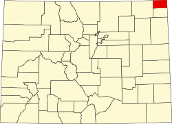
 Location within Sedgwick County and Colorado | |
| Coordinates: 40°56′9″N102°31′31″W / 40.93583°N 102.52528°W [1] | |
| Country | United States |
| State | Colorado |
| County | Sedgwick County [2] |
| Incorporated | January 28, 1918 [3] |
| Area | |
• Total | 0.35 sq mi (0.90 km2) |
| • Land | 0.35 sq mi (0.90 km2) |
| • Water | 0 sq mi (0.00 km2) |
| Elevation | 3,586 ft (1,093 m) |
| Population | |
• Total | 172 |
| • Density | 490/sq mi (190/km2) |
| Time zone | UTC−7 (MST) |
| • Summer (DST) | UTC−6 (MDT) |
| ZIP Code | |
| Area code | 970 |
| FIPS code | 08-68930 [1] |
| GNIS ID | 182694 [1] |
| Website | sedgwickcolorado.com |
Sedgwick is a statutory town in Sedgwick County, Colorado, United States. [1] The population was 172 at the 2020 census. [5]