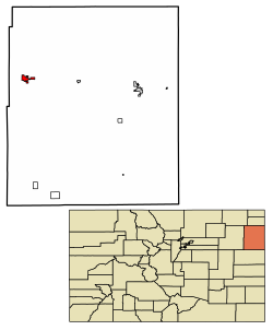
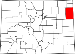
Yuma, Colorado | |
---|---|
Coordinates: 40°7′22″N102°43′30″W / 40.12278°N 102.72500°W [2] | |
Country | United States |
State | Colorado |
County | Yuma [3] |
Incorporated | March 24, 1887 [4] |
Named for | Yuma |
Area | |
• Total | 3.14 sq mi (8.13 km2) |
• Land | 3.10 sq mi (8.03 km2) |
• Water | 0.04 sq mi (0.10 km2) |
Elevation | 4,137 ft (1,261 m) |
Population | |
• Total | 3,456 |
• Density | 1,100/sq mi (430/km2) |
Time zone | UTC−7 (MST) |
• Summer (DST) | UTC−6 (MDT) |
ZIP Code | 80759 [7] |
Area code | 970 |
FIPS code | 08-86750 [2] |
GNIS ID | 202920 [2] |
Website | cityofyuma.colorado.gov |
Yuma is a home rule municipality that is the most populous municipality in Yuma County, Colorado, United States. [2] The population was 3,456 at the 2020 census. [6]
A post office in Yuma has been in operation since 1885. [8] The community was named after a Native American named Yuma who worked for the railroad, died and was buried near the town site. [9]
On August 8, 2023, a tornado touched down near the town, damaging farms. [10]
The Yuma School's mascot is the Outlaws.
According to the United States Census Bureau, the city has a total area of 1 square mile (2.6 km2), of which 1 square mile (2.6 km2) is land and 0.41% is water. Yuma is 27 miles from the nearest city, Wray.
Climate data for Yuma, Colorado (1991–2020 normals, extremes 1900–1902, 1939–present) | |||||||||||||
---|---|---|---|---|---|---|---|---|---|---|---|---|---|
Month | Jan | Feb | Mar | Apr | May | Jun | Jul | Aug | Sep | Oct | Nov | Dec | Year |
Record high °F (°C) | 77 (25) | 82 (28) | 89 (32) | 93 (34) | 100 (38) | 111 (44) | 109 (43) | 111 (44) | 103 (39) | 94 (34) | 90 (32) | 77 (25) | 111 (44) |
Mean daily maximum °F (°C) | 42.6 (5.9) | 45.2 (7.3) | 56.2 (13.4) | 63.3 (17.4) | 73.2 (22.9) | 85.8 (29.9) | 91.8 (33.2) | 88.9 (31.6) | 80.6 (27.0) | 66.3 (19.1) | 53.2 (11.8) | 42.9 (6.1) | 65.8 (18.8) |
Daily mean °F (°C) | 29.9 (−1.2) | 32.0 (0.0) | 41.7 (5.4) | 48.9 (9.4) | 59.5 (15.3) | 71.1 (21.7) | 76.9 (24.9) | 74.3 (23.5) | 65.4 (18.6) | 51.6 (10.9) | 39.6 (4.2) | 30.2 (−1.0) | 51.8 (11.0) |
Mean daily minimum °F (°C) | 17.2 (−8.2) | 18.8 (−7.3) | 27.1 (−2.7) | 34.5 (1.4) | 45.8 (7.7) | 56.4 (13.6) | 62.1 (16.7) | 59.7 (15.4) | 50.2 (10.1) | 36.9 (2.7) | 26.0 (−3.3) | 17.6 (−8.0) | 37.7 (3.2) |
Record low °F (°C) | −28 (−33) | −27 (−33) | −22 (−30) | 4 (−16) | 11 (−12) | 29 (−2) | 37 (3) | 35 (2) | 14 (−10) | 3 (−16) | −14 (−26) | −33 (−36) | −33 (−36) |
Average precipitation inches (mm) | 0.29 (7.4) | 0.44 (11) | 0.81 (21) | 1.64 (42) | 2.94 (75) | 2.49 (63) | 3.07 (78) | 2.64 (67) | 1.44 (37) | 1.25 (32) | 0.50 (13) | 0.45 (11) | 17.96 (456) |
Average snowfall inches (cm) | 3.9 (9.9) | 3.1 (7.9) | 3.7 (9.4) | 1.9 (4.8) | 0.1 (0.25) | 0.0 (0.0) | 0.0 (0.0) | 0.0 (0.0) | 0.2 (0.51) | 1.4 (3.6) | 2.8 (7.1) | 5.7 (14) | 22.8 (58) |
Average precipitation days (≥ 0.01 in) | 2.2 | 2.9 | 3.0 | 6.8 | 9.4 | 7.9 | 9.1 | 8.6 | 4.8 | 4.7 | 2.6 | 2.6 | 64.6 |
Average snowy days (≥ 0.1 in) | 1.9 | 2.3 | 1.3 | 0.9 | 0.1 | 0.0 | 0.0 | 0.0 | 0.0 | 0.5 | 1.3 | 2.2 | 10.5 |
Source: NOAA [11] [12] |
Census | Pop. | Note | %± |
---|---|---|---|
1890 | 241 | — | |
1900 | 139 | −42.3% | |
1910 | 333 | 139.6% | |
1920 | 1,177 | 253.5% | |
1930 | 1,360 | 15.5% | |
1940 | 1,606 | 18.1% | |
1950 | 1,908 | 18.8% | |
1960 | 1,919 | 0.6% | |
1970 | 2,259 | 17.7% | |
1980 | 2,824 | 25.0% | |
1990 | 2,719 | −3.7% | |
2000 | 3,285 | 20.8% | |
2010 | 3,524 | 7.3% | |
2020 | 3,456 | −1.9% |
The City of Northglenn is a home rule municipality located in Adams and Weld counties, Colorado, United States. Northglenn is a part of the Denver–Aurora–Lakewood, CO Metropolitan Statistical Area. As of the 2020 census the city's population was 38,131. It was built as a master planned community in 1959 by Jordon Perlmutter.
Walsh is a statutory town in Baca County, Colorado, United States. The population was 543 at the 2020 census.
Salida is the statutory city that is the county seat and the most populous municipality of Chaffee County, Colorado, United States. The population was 5,666 at the 2020 census.
Romeo is a Statutory Town in Conejos County, Colorado, United States. The population was 302 at the 2020 census. A post office called Romeo was established in 1901. The community derives its name from the surname Romero.
Sanford is a statutory town in Conejos County, Colorado, United States. The population was 879 at the 2020 census.
Ordway is a Statutory Town in and the county seat of Crowley County, Colorado, United States, that is also the most populous community in the county. The population was 1,066 at the 2020 census.
Sugar City is a Statutory Town in Crowley County, Colorado, United States. The population was 259 at the 2020 census.
Walden is the Statutory Town that is the county seat, the most populous community, and the only incorporated municipality in Jackson County, Colorado, United States. It is situated in the center of a large open valley called North Park. People from Walden and the surrounding area refer to themselves as "North Parkers". The town population was 606 at the 2020 census. The town sits at an elevation of 8,099 feet. It was established in 1889 and was incorporated December 2, 1890. Mark A. Walden, an early postmaster, gave the community his name.
Seibert is a statutory town in Kit Carson County, Colorado, United States. The population was 172 at the 2020 census.
Craig is a home rule municipality that is the county seat and the most populous municipality of Moffat County, Colorado, United States. The city population was 9,060 at the 2020 United States Census. Craig is the principal city of the Craig, CO Micropolitan Statistical Area.
The City of Monte Vista is the home rule municipality that is the most populous municipality in Rio Grande County, Colorado, United States. The city population was 4,247 at the 2020 Census.
Ovid is a statutory town in Sedgwick County, Colorado, United States. The population was 271 at the 2020 census.
Akron is a statutory town that is the county seat and the most populous municipality of Washington County, Colorado, United States. The town population was 1,757 at the 2020 United States Census.
The Town of LaSalle is a Statutory Town in Weld County, Colorado, United States. The town population was 2,359 at the 2020 United States Census.
Nunn is a Statutory Town in Weld County, Colorado, United States. The population was 504 at the 2020 census.
Pierce is a Statutory Town in Weld County, Colorado, United States. The population was 1,097 at the 2020 census. The town is a rural agricultural community located on the Colorado Eastern Plains along U.S. Highway 85 north of Greeley.
Wray is the home rule municipality that is the county seat of Yuma County, Colorado, United States. The population was 2,358 at the 2020 United States census. It is located 9 miles west of the Nebraska state line in the northeast Colorado Plains.
Idalia is an unincorporated town and census-designated place (CDP) in Yuma County, Colorado, United States. At the United States Census 2020, the population of the Idalia CDP was 97.
Joes is a census-designated place (CDP) in Yuma County, Colorado, United States. As of the United States Census 2020, its population was 82.
Vernon is an unincorporated town and census-designated place (CDP) in Yuma County, Colorado, United States. At the United States Census 2020, the population of the total Vernon CDP was 38.