Delta, Colorado | |
|---|---|
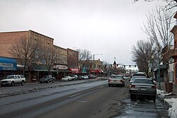 Main Street in Delta (2005) | |
| Nickname: City of Murals | |
 Location within Delta County and Colorado < | |
 Delta Location of Delta  Delta Delta (Colorado) | |
| Coordinates: 38°44′32″N108°04′08″W / 38.7422°N 108.0690°W [2] | |
| Country | United States |
| State | Colorado |
| County | Delta [3] |
| Incorporated | October 24, 1882 [4] |
| Government | |
| • Type | home rule city [1] |
| • Mayor | Kevin Carlson |
| Area | |
• Total | 13.530 sq mi (35.043 km2) |
| • Land | 13.273 sq mi (34.378 km2) |
| • Water | 0.257 sq mi (0.665 km2) |
| Elevation | 4,961 ft (1,512 m) |
| Population | |
• Total | 9,035 |
| • Density | 681/sq mi (263/km2) |
| Time zone | UTC−07:00 (MST) |
| • Summer (DST) | UTC−06:00 (MDT) |
| ZIP code [6] | 81416 |
| Area codes | 970/748 |
| GNIS place ID | 185516 |
| GNIS city ID | 2410319 |
| FIPS code | 08-19850 |
| Major highways | |
| Website | cityofdelta |
Delta is a home rule city that is the county seat of and the most populous municipality in Delta County, Colorado, United States. [1] [7] The city population was 9,035 at the 2020 United States census. [5] The United States Forest Service headquarters of the Grand Mesa, Gunnison, and Uncompahgre National Forests are located in Delta.

