Ocean City, officially the Town of Ocean City, is an Atlantic resort city in Worcester County, Maryland, along the East Coast of the United States. The population was 6,844 at the 2020 U.S. census, although during summer weekends the city hosts between 320,000 and 345,000 vacationers and up to eight million visitors annually. During the summer, Ocean City becomes the second most populated municipality in Maryland, after Baltimore.[3][2] It is part of the Salisbury metropolitan area as defined by the United States Census Bureau.
During peak vacation season, the city gains over 1000 seasonal police officers, plus extra firefighters and other workers. Numerous events take place within the town during the shoulder-season, including Sunfest, Springfest, Bike Week, Cruisin' Weekend, Winterfest of Lights, and Reach the Beach, which take place on the Boardwalk and the Roland E. Powell Convention Center. Ocean City is also home to the annual Maryland State Firefighters Convention, a week-long event in June that honors the state's firefighters.
History
Ocean City's inlet during the offseason
19th century
Before the European colonization of what is now Maryland in the 17th century, the shoreline of the Delmarva Peninsula had been populated for thousands of years by Indigenous peoples including the Algonquian-speakingAssateague and Nanticoke peoples.[4] The land on which the city was built and much of the surrounding area was obtained by Thomas Fenwick, an Englishman, from the Indigenous peoples of the region. In 1869, businessman Isaac Coffin built the first beach-front cottage to receive paying guests. During those days, guests arrived by stagecoach and ferry.
Soon after, other simple boarding houses were built on the strip of sand, with the activity attracting prominent businessmen from the Maryland Eastern Shore, Baltimore, Philadelphia, and Wilmington, Delaware. They came not so much to visit as to survey the spit. A decision was made to develop it and 250 lots were cut into it. A corporation was formed to help with the development of the land. The corporation’s stock of 4,000 shares sold for $25 each.
Before 1870, what is now Ocean City was known as "The Ladies' Resort to the Ocean".[5]
The Atlantic Hotel, the first major hotel in the town, opened July 4, 1875. The Atlantic Hotel originally was owned by the Atlantic Hotel Company, but eventually Charles W. Purnell bought it in 1923. As of 2025[update], it is still owned and operated by the Purnell family.[6] Besides the beach and ocean, it offered dancing and billiard rooms to the visitors of its more than 400 rooms, and for years it was the northernmost attraction in Ocean City. By 1878, tourists could come by the Wicomico & Pocomoke Railroad from Berlin to the shores of Sinepuxent Bay across from the town. By 1881, a line was completed from across Sinepuxent Bay to the shore, bringing rail passengers on the Baltimore, Chesapeake and Atlantic Railroad directly into the town to a train station and returning to larger city markets with locally caught fish from Ocean City.
20th century
1933 hurricane in Ocean CityOcean City, 1935
In 1930, Ocean City Beach Patrol was formed in order to better protect the bathers that frequented the shoreline. It was done in collaboration with Mayor William W. McCabe and Coast Guard Captain William Purnell.[7]
The Ocean City Inlet was formed during a significant hurricane in August 1933, which also destroyed the train tracks across the Sinepuxent Bay.[8][9] The inlet separated what is now Ocean City from Assateague Island. Another hurricane the following month widened the inlet from about 100 feet (30m) wide to over 500 feet (152m) wide.[10] The U.S. Army Corps of Engineers took advantage of nature's intervention and made the inlet permanent at the south end of Ocean City. The inlet eventually helped establish Ocean City as an important mid-Atlantic fishing port, as it offered easy access to the Atlantic Ocean fishing grounds.
In the late 1930s, the Army Corps of Engineers dredged a new channel on the bayside of Ocean City to allow larger boats to have access to Sinepuxent Bay. The dredge was pumped back onto the western shore of Ocean City allowing the creation of Chicago Avenue and St. Louis Avenue, leading to new development where previously only marshland had been.[11]
Ocean City has undergone a fairly rapid expansion that took place during the post-World War II boom. In 1952, with the completion of the Chesapeake Bay Bridge, Ocean City became easily accessible to people in the Baltimore–Washington metropolitan area.[12] In 1964, with the completion of the Chesapeake Bay Bridge-Tunnel, another pathway to the south was opened. This tunnel connects Northampton County on the Delmarva Peninsula to Southeast Virginia. These two events helped Ocean City become one of the largest vacation areas on the East Coast.
By the 1970s, big business flourished and gave birth to the construction of more than 15,000 condominium units.[13] However, throughout the 1980s and into the 1990s, the width of the beach began to shrink, prompting the first of a series of beach replenishment projects.
A fire during the annual Sunfest destroyed five boardwalk businesses in 1994.[14] There was a small water park and giant walk-through haunted house with live actors near the end of the pier and a New Orleans-style Hollywood in Wax Museum on the boardwalk side. In the mid 1990s, the wax museum closed[15] and was turned into a Photon laser tag arena[citation needed]. The building now houses the Ripley's Believe it or Not! museum.
21st century
Ocean City beach at 25th Street
In 2002, Ocean City undertook a multi-million dollar beach restoration program in an attempt to slow the westward migration of its beaches. The program pumped tons of sand from offshore and deposited it onto the beach. A dune line was also re-established in front of Ocean City's building line. Another similar project began after the 2006 tourist season closed.
In 2006, the city erected the Ocean City Firefighter's Memorial to honor local firefighters as well as firefighters who died in the September 11 attacks. In addition to a statue of a firefighter, the monument incorporates a piece of steel beam from one of the towers destroyed at the World Trade Center.[16]
The resort area was visited by approximately 8 million visitors in 2011.[17]
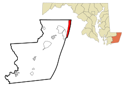
According to the U.S. Census Bureau, the town has a total area of 36.37 square miles (94.20km2), of which 4.41 square miles (11.42km2) is land and 31.96 square miles (82.78km2) is water.[19]
Ocean City is located on Fenwick Island, a barrier spit which encompasses Ocean City, as well as South Bethany and Fenwick Island, Delaware. Ocean City's southern point is an inlet formed by the 1933 Chesapeake–Potomac hurricane. Rainfall and tides swelled the rivers and bays surrounding Ocean City until the overflowing water cut a 50-foot crevasse from the bay to the ocean. Ocean City businessmen had long sought funding to create an inlet to support a harbor, so residents seized the opportunity and built jetties to ensure the city's land remained divided from what is now Assateague Island.[20]
Climate
According to the Köppen climate classification system, Ocean City, Maryland has a humid subtropical (Köppen: Cfa) or oceanic with long, warm to hot and humid summers, cool winters and year-round precipitation. Ocean City receives 2300 hours of sunshine annually (higher than the US average). Temperatures are moderate in Ocean City due to its location on the Atlantic coast. During the summer months, a cooling afternoon sea breeze is present on most days with an average of only 10 days annually reaching 90°F (32°C). However, in 2010 the temperature rose to 103°F (39°C) which was the hottest air temperature on record, and episodes of extreme heat combined with tropical humidity can occur with heat index values ≥ 100°F (37.8°C).
The geographic location of Ocean City, places it where just above where Atlantic tropical cyclones turn out to sea on the East Coast, thus direct hits from tropical storms and hurricanes are rare, although they sometimes brush the area. The Atlantic hurricane season extends from June 1 through November 30, sharply peaking from late August through September.
During the winter months, Ocean City has cool weather with an average high of 45 F (7.5 C), however periods of mild temperatures in the 50 to 60 F range are common. The air temperature fails to rise above freezing 5.8 days on average and the plant hardiness zone is 7b with an average annual extreme minimum air temperature of 9.1°F (−12.7°C).[21] On rare occasion, episodes of extreme cold and wind can occur with wind chill values under 5°F (−15°C). The coldest temperature on record was −6°F (−21°C). The average seasonal (Dec-Mar) snowfall is quite small in Ocean City, with the average being 4 to 6in (10 to 15cm), and often several years may pass with no snowfall at all.
Climate data for Ocean City Beach, MD (1981-2010 Averages)
As of the 2020 census, 6,844 (estimated at 6,900 as of 2022) people resided full-time in Ocean City, with 3,723 households. The population density was 1,510.5 inhabitants per square mile. There were 30,028 total housing units, with 3,820 occupied year-round and 26,208 vacant. The resident racial makeup of Ocean City was 90.0% White, 5.8% Hispanic, 0.8% African American, 0.2% Native American and Alaskan Native, 0.8% Asian, and 2.2% two or more races.[25]
2010 census
As of the census[26] of 2010, there were 7,102 people, 3,852 households, and 1,784 families residing in the town. The population density was 1,610.4 inhabitants per square mile (621.8/km2). There were 30,119 housing units at an average density of 6,829.7 per square mile (2,637.0/km2). The racial makeup of the town was 92.2% White, 2.7% African American, 0.2% Native American, 1.3% Asian, 2.2% from other races, and 1.4% from two or more races. Hispanic or Latino of any race were 5.9% of the population.
There were 3,852 households, of which 11.1% had children under the age of 18 living with them, 36.8% were married couples living together, 6.3% had a female householder with no husband present, 3.3% had a male householder with no wife present, and 53.7% were non-families. 42.8% of all households were made up of individuals, and 17.5% had someone living alone who was 65 years of age or older. The average household size was 1.84, and the average family size was 2.41.
The median age in the town was 54.2 years. 9.1% of residents were under the age of 18; 6.7% were between the ages of 18 and 24; 20.8% were from 25 to 44; 33.8% were from 45 to 64; and 29.6% were 65 years of age or older. The gender makeup of the town was 51.4% male and 48.6% female.
Economy
Ocean City boardwalk looking north at Worcester Street
Ocean City extends just more than 9mi (14km) from the southern inlet to the Delaware line. The strip supports hotels, motels, apartment houses, shopping centers, residential communities, and condominiums. The southern tip houses the Ocean City Boardwalk. The boardwalk is the main shopping district and entertainment area of the town. The Boardwalk has two amusement parks, Trimpers Rides and The Pier, which was recently renamed Jolly Roger at The Pier after its sister uptown local amusement park. The downtown neighborhood, Old Town, is marked by Victorian style houses and other older buildings.
Ocean City has a long history of fishing, both commercial and recreational. The town bills itself as the "White Marlin Capital of the World." During the summer, numerous charter and private boats fish for billfish, tuna, wahoo, and other game fish. In early August, the White Marlin Open, one of the larger fishing tournaments in the world, is held. Prize money for the largest white marlin, blue marlin, and tuna can range over $1 million.
Arts and culture
Boardwalk
Ocean City Boardwalk looking south
The Ocean City Boardwalk currently runs from South 2nd Street at the Ocean City Inlet in South Ocean City (by the Ocean City Life Saving Station Museum) up to 27th Street in South Ocean City. The boardwalk is home to food, shops, arcades, and amusements.[27]
Originally called the "Atlantic Avenue", the first Ocean City boardwalk was constructed in 1902. After being damaged by a storm in 1962, the boardwalk was rebuilt to stretch a total of 2.25 miles, which is its current length. In 1985, the boardwalk suffered extensive storm damage during Hurricane Gloria, which pummeled Ocean City with 89 MPH winds; however, the boardwalk was refurbished, and a concrete sea wall was soon constructed to prevent further damage. The aftermath of Hurricane Gloria led to the first phase of extensive beach replenishment projects in Ocean City.
In 2012, the Ocean City Boardwalk was damaged again as a result of Hurricane Sandy, which flooded and destroyed half the boardwalk.[28] The boardwalk has since been rebuilt to its original length and attracts many tourists.
Also located in South Ocean City is Trimper's Rides, a historic amusement park founded in 1893 as The Windsor Resort.[29] Trimper's Rides is home to one of the United States' oldest operational carousel rides. Colloquially known as "The Pride of the Boardwalk," the 1912 Herschell-Spillman carousel received the National Carousel Association's Historic Carousel Award in 1996.[30][unreliable source?]
Dining and nightlife
The Midtown section of Ocean City stretches from 28th Street to 90th Street and is home to dining along the bay and nightlife.[27] Located in Midtown are the Jolly Roger Amusement Park and the Roland E. Powell Convention Center. This area also features the Seacrets entertainment complex on 49th Street, one of the highest-grossing bars in the country, known for bringing in hundreds of coconut palms and other tropical plants in the summer.[31]
High-rise hotels and condominiums in North Ocean City
An anchor recovered from the sailboat wreck in 1870 of the commercial clam vessel Star Light.[32]
The Atlantic Hotel. After a fire destroyed the original and first hotel in Ocean City, the Atlantic Hotel was rebuilt in 1926 and is one of the oldest hotels in Ocean City.[33]
Ocean City is known for its Senior Week activities when recently graduated high school seniors from Maryland and surrounding states travel to Ocean City. Senior Week historically begins the first week after graduation, and the graduates often are referred to as "June Bugs".[36][37]
Other
The city is home to the Brine Beach Lacrosse Festival on the second week of June. The Ocean City Film Festival takes place every year in early March.
Parks and recreation
Skatepark and other attractions
First opened in June 1976, Ocean Bowl Skatepark in South Ocean City was the first skate park to open on the East Coast in the United States, and it is the longest-running municipal skatepark in the United States today. Due to time, wear and the current needs of skaters, the original bowl and steel halfpipe ramp were torn down in the Fall of 1997 and the newly constructed skatepark opened in July 1998 on the same site. The park has held the National Dew Tour for several years.[38]
Ocean City has a council-manager system of government with a mayor and seven-member city council. The mayor is elected at-large to two-year terms while the city council is elected at-large to staggered four-year terms. The city council elects a council president who presides over and sets the agenda for city council meetings. The mayor represents the town to state and local agencies. Both the mayor and city council hire a city manager who is in charge of all daily operations of the town and serves as its chief financial officer.[39] As of 2017, the mayor of Ocean City is Rick Meehan, and the members of city council are council president Matt James, council secretary Tony Deluca, Frank Knight, Carol Proctor, William Savage, John Gehrig Jr., and Peter Baus[40]
Media
Radio
Ocean City has an emergency advisory radio system broadcast on two FM frequencies.[41]
WOCM broadcasts from studios located at the popular restaurant, nightclub, distillery, and entertainment venue Seacrets. The call letters stand for "We are Ocean City Maryland".
Ocean City is mentioned in the Car Seat Headrest song “Beach Life-In-Death”.
Infrastructure
Transportation
U.S. Route 50, also known as Ocean Gateway, leaving Ocean City; the sign over the eastbound lane displays the distance to the western terminus of route in Sacramento, California as 3,073 miles.Coastal Highway Beach BusOcean City Fire Department station
Road and bridges
Ocean City has a single major north−south thoroughfare, Maryland Route 528, known as the Coastal Highway for most of its length. Two bridges connect the mainland to Ocean City:
Ocean City also has a public transportation system called Ocean City Transportation. This agency operates the Coastal Highway Beach Bus, the West Ocean City Park-N-Ride Beach Bus, the Express Beach Bus for special events, and a trackless train shuttle called the Boardwalk Tram.[43] Ocean City Transportation also offers paratransit service.[44] The Boardwalk Tram operated during the summer months along the entire length of the Ocean City Boardwalk, but was closed due an accident in 2024[45][46]
Ocean City's transit service connects with Shore Transit, which connects with other destinations.[47][48]
Delmarva Power, a subsidiary of Exelon, provides electricity to Ocean City.[51]Sandpiper Energy, a subsidiary of Chesapeake Utilities, provides natural gas to the town.[52][53] The Town of Ocean City Municipal Water Department provides water to the town, operating 25 wells, 3 treatment plants, 6 above-ground storage tanks, and an underground storage tank.[54] The Public Works department provides wastewater service to Ocean City, operating the Ocean City Wastewater Treatment Plant.[55] Trash and recycling collection in Ocean City is handled by the Public Works department, with the town's trash transported by Reworld to the Energy Resource Recovery Facility in Fairfax, Virginia, a waste-to-energy plant.[56][57]
Police and fire department
Police services in Ocean City are provided by the Ocean City Police Department, which consists of 105 full-time officers and from 100 to 110 seasonal officers.[58] Fire protection in Ocean City is provided by the Ocean City Fire Department, which consists of over 200 volunteer members and over 100 career members.[59]
↑"Museum History". Ocean City Life-Saving Station Museum. Ocean City Museum Society, Inc. 2014. Archived from the original on September 9, 2015. Retrieved November 22, 2014.
↑"Play it Safe". Ocean City Department of Tourism. Archived from the original on September 13, 2011. Retrieved September 6, 2011.
This page is based on this Wikipedia article Text is available under the CC BY-SA 4.0 license; additional terms may apply. Images, videos and audio are available under their respective licenses.