Milton, Delaware

Last updated

Milton, Delaware
326 Union Milton Sussex Co DE.JPG
House in Milton Historic District
Sussex County Delaware Incorporated and Unincorporated areas Milton Highlighted 1048330.svg
Location of Milton in Sussex County, Delaware.
USA Delaware location map.svg
Red pog.svg
Milton
Location within the state of Delaware
Usa edcp location map.svg
Red pog.svg
Milton
Milton (the United States)
Coordinates: 38°46′39″N75°18′36″W / 38.77750°N 75.31000°W / 38.77750; -75.31000
CountryFlag of the United States.svg  United States
State Flag of Delaware.svg  Delaware
County Flag of Sussex County, Delaware.gif Sussex
Founded1763
IncorporatedMarch 17, 1865
Area
[1]
  Total1.89 sq mi (4.89 km2)
  Land1.79 sq mi (4.63 km2)
  Water0.10 sq mi (0.26 km2)
Elevation
[2]
10 ft (3 m)
Population
 (2020)
  Total3,291
  Density1,842.67/sq mi (711.35/km2)
Time zone UTC−5 (Eastern (EST))
  Summer (DST) UTC−4 (EDT)
ZIP code
19968
Area code 302
FIPS code 10-48330
GNIS feature ID214325 [2]
Website www.ci.milton.de.us

Milton is a town in Sussex County, Delaware, United States, on the Delmarva Peninsula. It is located on the Broadkill River, which empties into Delaware Bay. The population was 3,291 at the 2020 census. [3]

Contents

It is part of the rapidly growing Cape Region and lies within the Salisbury, Maryland-Delaware Metropolitan Statistical Area. Delaware Route 5 passes through Milton.

History

Located at the head of the Broadkill River, which enters Delaware Bay, the Milton area was first settled in 1675 by English colonists and founded as "Head of Broadkiln" in 1763. It became important for shipbuilding. The town was known by renamed by the Delaware Legislature in 1807, in honor of the English poet John Milton. The Delaware General Assembly passed a charter on March 17, 1865, that recognized the Town of Milton as a municipality. [4]

Sussex County Library in Milton Milton Public Library.JPG
Sussex County Library in Milton

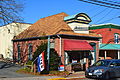
History and Milton's shipbuilding heritage remain very important to the town, which is home to some of the finest Victorian and Colonial architecture in Delaware. Many of the homes have been restored to their original form, particularly those on Union and Federal streets.

Milton has 198 contributing structures listed within its Federal Register Historic District. Significant buildings and sites are the Lydia Black Cannon Museum, the Governor James Carey home, the Chestnut Street Cemetery, and the Governor David Hazzard Mansion. The Hazzard House and Gov. James Ponder House were listed on the National Register of Historic Places in 1973. The Milton Historic District was added in 1982. [5]

Milton serves local residents and summer tourists in the Milton, Broadkill Beach and Primehook Beach areas with family-operated businesses and new office and shopping complexes. Several local businesses in the area are served by the Delmarva Central Railroad, which operates a branch that extends to Milton from Ellendale. Recreational opportunities abound with the Broadkill River, Wagamon's Pond, Diamond Pond and Lavinia Pond. Public boat docks and fishing piers are also available. It is within an easy drive to the coastal resorts of Lewes and Rehoboth Beach, Delaware.

A footpath known as the Governors Walk follows the Broadkill River in central Milton. The Nature Conservancy established a preserve along the river downstream of Milton in 1998. [6] As of 2005, an annual canoe and kayak race was being held on the river in Milton. [7] The river passes through and feeds Prime Hook National Wildlife Refuge to the east before entering Delaware Bay.

Milton is the home of the Dogfish Head Brewery, a well-known East Coast beer-maker. [8]

Transportation

DE 5 northbound entering Milton 2022-07-15 12 51 58 View north along Delaware State Route 5 (Federal Street) at Park Street in Milton, Sussex County, Delaware.jpg
DE 5 northbound entering Milton

Roads are the main means of transport to and from Milton. Delaware Route 5 is the main highway serving Milton, running on a north-south alignment through the center of town. Trucks are served by a bypass route, Delaware Route 5 Alternate, which bypasses downtown to the west. Delaware Route 16 also passes through Milton, skimming the north side of town on an east-west alignment. Delaware Route 30 passes just outside the town to the west, following a similar north-south alignment to parallel DE 5. DART First State provides bus service to Milton along Route 303, which runs north to Dover and south to Georgetown. [9] The Delmarva Central Railroad's Milton Industrial Track line runs from Milton west to a junction with the Indian River Subdivision in Ellendale. [10]

Geography

Milton is located along the Broadkill River. [11]

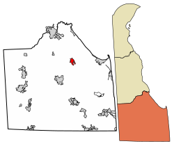
According to the United States Census Bureau, the town has a total area of 1.2 square miles (3.1 km2), of which 1.1 square miles (2.8 km2) is land and 0.1 square miles (0.26 km2) (8.62%) is water.

Demographics

Historical population
CensusPop.Note
1860 780
1870 8245.6%
1880 1,02624.5%
1890 1,0744.7%
1900 948−11.7%
1910 1,0389.5%
1920 898−13.5%
1930 1,13025.8%
1940 1,1986.0%
1950 1,32110.3%
1960 1,61722.4%
1970 1,490−7.9%
1980 1,359−8.8%
1990 1,4174.3%
2000 1,65716.9%
2010 2,57655.5%
2020 3,29127.8%
U.S. Decennial Census [12]

As of the census [13] of 2000, there were 1,657 people, 700 households, and 438 families residing in the town. The population density was 1,568.5 inhabitants per square mile (605.6/km2). There were 804 housing units at an average density of 761.1 per square mile (293.9/km2). The racial makeup of the town was 67.11% White, 24.32% Black, 0.24% Native American, 0.48% Asian, 0.12% Pacific Islander, 6.04% from other races, and 1.69% from two or more races. Hispanic or Latino of any race were 8.93% of the population.

There were 700 households, out of which 31.4% had children under the age of 18 living with them, 37.3% were married couples living together, 20.1% had a female householder with no husband present, and 37.4% were non-families. 31.3% of all households were made up of individuals, and 17.4% had someone living alone who was 65 years of age or older. The average household size was 2.33 and the average family size was 2.90.

In the town, the population was spread out, with 24.6% under the age of 18, 10.2% from 18 to 24, 26.4% from 25 to 44, 22.0% from 45 to 64, and 16.8% who were 65 years of age or older. The median age was 37 years. For every 100 females, there were 78.7 males. For every 100 females age 18 and over, there were 71.8 males.

The median income for a household in the town was $32,368, and the median income for a family was $40,313. Males had a median income of $26,065 versus $23,269 for females. The per capita income for the town was $17,016. About 12.8% of families and 18.0% of the population were below the poverty line, including 28.6% of those under age 18 and 14.0% of those age 65 or over.

Notable people

Education

It is in the Cape Henlopen School District. [15] The Milton School District was consolidated into the Cape Henlopen district in 1969. [16]

Two elementary schools, Milton Elementary School and H. O. Brittingham Elementary School, serve sections of Milton. [17]

Cape Henlopen High School is the sole comprehensive high school of the district.

Climate

In Milton, the summers are warm and muggy; the winters are very cold, wet, and windy; and it is partly cloudy year round. Over the course of the year, the temperature typically varies from 28 °F to 86 °F and is rarely below 15 °F or above 93 °F. Based on the tourism score, the best times of year to visit Milton for warm-weather activities are for the entire month of June and from mid August to early October.

The hot season lasts for 3.5 months, from June 1 to September 17, with an average daily high temperature above 77 °F. The hottest month of the year in Milton is July, with an average high of 86 °F and low of 70 °F. The cold season lasts for 3.2 months, from December 5 to March 10, with an average daily high temperature below 52 °F. The coldest month of the year in Milton is January, with an average low of 29 °F and high of 44 °F.

Rain falls throughout the year in Milton. The month with the most rain in Milton is August, with an average rainfall of 3.6 inches. The month with the least rain in Milton is February, with an average rainfall of 2.6 inches.

The snowy period of the year lasts for 3.2 months, from December 7 to March 15, with a sliding 31-day snowfall of at least 1.0 inches. The month with the most snow in Milton is February, with an average snowfall of 3.6 inches.

The growing season in Milton typically lasts for 7.3 months (223 days), from around March 31 to around November 9, rarely starting before March 13 or after April 18, and rarely ending before October 23 or after November 28.

Related Research Articles

<span class="mw-page-title-main">Sussex County, Delaware</span> County in Delaware, United States

Sussex County is located in the southern part of the U.S. state of Delaware, on the Delmarva Peninsula. As of the 2020 census, the population was 237,378, making it the state's second most populated county only behind New Castle and ahead of Kent. The county seat is Georgetown.

<span class="mw-page-title-main">Lewes, Delaware</span> City in Delaware, United States

Lewes is an incorporated city on the Delaware Bay in eastern Sussex County, Delaware, United States. According to the 2020 census, its population was 3,303. Along with neighboring Rehoboth Beach, Lewes is one of the principal cities of Delaware's rapidly growing Cape Region. The city lies within the Salisbury, Maryland–Delaware Metropolitan Statistical Area. Lewes proudly claims to be "The First Town in The First State."

<span class="mw-page-title-main">Bowers, Delaware</span> Town in Delaware, United States

Bowers is a town in Kent County, Delaware, United States. It is part of the Dover, Delaware Metropolitan Statistical Area. According to the 2020 census, its population was 278.

<span class="mw-page-title-main">Cheswold, Delaware</span> Town in Delaware, United States

Cheswold is a town in Kent County in the U.S. state of Delaware. It is part of the Dover, Delaware Metropolitan Statistical Area. The population was 1,923 in 2020.

<span class="mw-page-title-main">Farmington, Delaware</span> Town in Delaware, United States

Farmington is a town in Kent County, Delaware, United States. It is part of the Dover, Delaware Metropolitan Statistical Area. The population was 92 in 2020.

<span class="mw-page-title-main">Felton, Delaware</span> Town in Delaware, United States

Felton is a town in Kent County, Delaware, United States. It is part of the Dover metropolitan statistical area. The population was 1,568 in 2020.

<span class="mw-page-title-main">Hartly, Delaware</span> Town in Delaware, United States

Hartly is a town in Kent County, Delaware, United States. It is part of the Dover, Delaware Metropolitan Statistical Area. The population was 73 in 2020, making it the least populous municipality in Delaware.

<span class="mw-page-title-main">Leipsic, Delaware</span> Town in Delaware, United States

Leipsic is a town in Kent County, Delaware, United States. It is part of the Dover, Delaware Metropolitan Statistical Area. The population was 178 in 2020.

<span class="mw-page-title-main">Woodside, Delaware</span> Town in Delaware, United States

Woodside is a town in Kent County, Delaware, United States. It is part of the Dover, Delaware Metropolitan Statistical Area. The population was 190 in 2020.

<span class="mw-page-title-main">Delaware City, Delaware</span> City in Delaware, United States

Delaware City is a city in New Castle County, Delaware, United States. The population was 1,885 as of 2020. It is a small port town on the eastern terminus of the Chesapeake and Delaware Canal and is the location of the Forts Ferry Crossing to Fort Delaware on Pea Patch Island.

<span class="mw-page-title-main">Blades, Delaware</span> Town in Delaware, United States

Blades is a town in Sussex County, Delaware, United States. As of the 2010 census, the town population was 1,241, a 29.8% increase over the previous decade. It is part of the Salisbury, Maryland-Delaware Metropolitan Statistical Area.

<span class="mw-page-title-main">Bridgeville, Delaware</span> Town in Delaware, United States

Bridgeville is a town in Sussex County, Delaware, United States. According to the 2020 census, the population is 2,568. It is part of the Salisbury, Maryland-Delaware Metropolitan Statistical Area.

<span class="mw-page-title-main">Dewey Beach, Delaware</span> Town in Delaware, United States

Dewey Beach is an incorporated coastal town in eastern Sussex County, Delaware, United States. According to the 2010 census, the population of the town is 341, an increase of 13.3% over the previous decade. It is part of the rapidly growing Cape Region and lies within the Salisbury, Maryland-Delaware Metropolitan Statistical Area. In 2011, the NRDC awarded Dewey Beach with a 5-Star rating in water quality. This award was given only to 12 other locations, one being neighboring Rehoboth Beach. Out of the 30 states with coastline, the Delaware Beaches ranked number 1 in water quality in 2011.

<span class="mw-page-title-main">Henlopen Acres, Delaware</span> Town in Delaware, United States

Henlopen Acres is a municipality north of Rehoboth Beach in Sussex County, Delaware, United States, and is the third smallest incorporated town in Delaware. According to 2010 census figures, the population of the town is 122, a 12.2% decrease from the 2000 census. It is part of the Salisbury, Maryland-Delaware Metropolitan Statistical Area.

<span class="mw-page-title-main">Laurel, Delaware</span> Town in Delaware, United States

Laurel is a town in Sussex County, Delaware, United States. The population was 3,708 at the time of the 2010 census. Laurel is part of the Salisbury, Maryland-Delaware Metropolitan Statistical Area. It once hosted the Laurel Blue Hens of the Eastern Shore Baseball League.

<span class="mw-page-title-main">Rehoboth Beach, Delaware</span> City in Delaware, United States

Rehoboth Beach is a city on the Atlantic Ocean along the Delaware Beaches in eastern Sussex County, Delaware. As of 2020, its population was 1,108. Along with the neighboring coastal town of Lewes, Rehoboth Beach is one of the principal cities of Delaware's rapidly growing Cape Region. Rehoboth Beach lies within the Salisbury metropolitan area.

<span class="mw-page-title-main">Seaford, Delaware</span> City in Delaware, United States

Seaford is a city located along the Nanticoke River in Sussex County, Delaware, United States. According to the 2010 Census Bureau figures, the population of the city is 6,928, an increase of 3.4% from the 2000 census. It is part of the Salisbury, Maryland-Delaware Metropolitan Statistical Area.

<span class="mw-page-title-main">Slaughter Beach, Delaware</span> Town in Delaware, United States

Slaughter Beach is a town in Sussex County, Delaware, United States, located on the southwest shore of Delaware Bay. The population was 207 at the 2010 census, an increase of 4.5% over the past decade. It is part of the Salisbury, Maryland-Delaware Metropolitan Statistical Area.

<span class="mw-page-title-main">Delaware Route 16</span> State highway in Kent and Sussex counties in Delaware, United States

Delaware Route 16 (DE 16) is an east-west state highway in Delaware, mainly across northern Sussex County, with a small portion near the Maryland border in extreme southwestern Kent County. It runs from Maryland Route 16 (MD 16) at the Maryland border in Hickman east to the Delaware Bay at Broadkill Beach. The route passes through rural areas along with the towns of Greenwood, Ellendale, and Milton. DE 16 intersects DE 36 and U.S. Route 13 (US 13) in Greenwood, US 113 in Ellendale, DE 30 and DE 5 in the Milton area, and DE 1 between Milton and Broadkill Beach. West of DE 1, the route serves as part of a connection between the Baltimore–Washington Metropolitan Area and the Delaware Beaches. DE 16 was built as a state highway during the 1920s and 1930s. By 1936, the route was designated onto its current alignment.

<span class="mw-page-title-main">Cape Region (Delaware)</span> Region in Delaware, United States

The Cape Henlopen Region, or the Cape Region, is a region in Sussex County, in southern Delaware, on the Delmarva Peninsula. The region is part of the Salisbury, Maryland-Delaware Metropolitan Statistical Area. The region takes its name from Cape Henlopen, as does the Cape Henlopen School District and Cape Henlopen State Park. Much of the region's populated areas are found along the Delaware Bay, Rehoboth Bay and the Atlantic Ocean. Northern and western parts of the Cape Region are rural areas dominated by farmland and wetlands. The area is often referred to as the Delaware Beaches.

References

  1. "2020 U.S. Gazetteer Files". United States Census Bureau. Retrieved October 31, 2021.
  2. 1 2 U.S. Geological Survey Geographic Names Information System: Milton, Delaware
  3. "The Delaware Census State Data Center". THe State of Delaware. Archived from the original on December 31, 2016. Retrieved December 30, 2015.
  4. "History of Milton - Town of Milton - Sussex County Delaware". December 16, 2014. Retrieved April 23, 2021.
  5. "National Register Information System". National Register of Historic Places . National Park Service. July 9, 2010.
  6. State of Delaware Department of Natural Resources and Environmental Control. Division of Parks and Recreation. "Greenways & Trails". Archived from the original on October 28, 2007. Retrieved February 4, 2007.
  7. "Milton Fairs and Festivals" . Retrieved February 4, 2007.
  8. "Dogfish Head Brewery Frequently Asked Questions". Archived from the original on November 29, 2014. Retrieved December 30, 2014.
  9. "Routes and Schedules". DART First State. Retrieved August 16, 2013.
  10. "Delmarva Central Railroad". Carload Express. November 8, 2016. Retrieved March 27, 2017.
  11. DeLorme (2004). Maryland Delaware Atlas & Gazetteer. p. 45. Yarmouth, Maine: DeLorme. ISBN   0-89933-279-X.
  12. "Census of Population and Housing". Census.gov. Retrieved June 4, 2016.
  13. "U.S. Census website". United States Census Bureau . Retrieved January 31, 2008.
  14. "Wyoming Governor Joseph Maull Carey". National Governors Association. Retrieved October 13, 2013.
  15. "2020 CENSUS - SCHOOL DISTRICT REFERENCE MAP: Sussex County, DE" (PDF). U.S. Census Bureau . Retrieved June 15, 2021.
  16. MacArthur, Ron (November 11, 2010). "Cape Henlopen High school bridges past to present with dedication of cornerstone". Cape Gazette . Retrieved June 17, 2021.
  17. Elementary school zoning: "Boundary Descriptions". Cape Henlopen School District . Retrieved June 15, 2021. and "ES_Feeder_Patterns_21-22.pdf" (PDF). Cape Henlopen School District . Retrieved June 15, 2021.