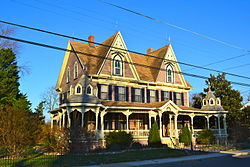
Frankford, Delaware

Last updated

Frankford, Delaware
Capt Ebe frankford SusCo DE.JPG
Sussex County Delaware Incorporated and Unincorporated areas Frankford Highlighted 1028310.svg
Location of Frankford in Sussex County, Delaware.
USA Delaware location map.svg
Red pog.svg
Frankford
Location within the state of Delaware
Usa edcp location map.svg
Red pog.svg
Frankford
Frankford (the United States)
Coordinates: 38°31′02″N75°14′06″W / 38.51722°N 75.23500°W / 38.51722; -75.23500
CountryFlag of the United States.svg  United States
State Flag of Delaware.svg  Delaware
County Flag of Sussex County, Delaware.gif Sussex
Area
[1]
  Total0.73 sq mi (1.89 km2)
  Land0.73 sq mi (1.89 km2)
  Water0.00 sq mi (0.00 km2)
Elevation
[2]
36 ft (11 m)
Population
 (2020)
  Total790
  Density1,083.68/sq mi (418.47/km2)
Time zone UTC−5 (Eastern (EST))
  Summer (DST) UTC−4 (EDT)
ZIP code
19945
Area code 302
FIPS code 10-28310
GNIS feature ID213980 [2]
Website frankford.delaware.gov

Frankford is a town in Sussex County, Delaware, United States. The population was 847 at the 2010 census, an increase of 18.6% over the previous decade. [3] It is part of the Salisbury, Maryland-Delaware Metropolitan Statistical Area.

Contents

History

Located on U.S. Route 113, Frankford, was founded in 1808 and incorporated in 1937. The town was named Frankford Village in 1848 upon the acquisition of a post office. The establishment of the Pennsylvania Railroad brought a hotel, commercial establishments and an opera house to make Frankford a thriving commercial and cultural center.

The Capt. Ebe Chandler House (1880) was added to the National Register of Historic Places in 1979. [4]

Transportation

US 113 southbound in Frankford 2022-07-08 10 47 04 View south along U.S. Route 113 (DuPont Boulevard) just south of Blueberry Lane in Frankford, Sussex County, Delaware.jpg
US 113 southbound in Frankford

Road is the primary method of travel to and from Frankford. U.S. Route 113 is the only significant highway serving the town, extending north toward Georgetown and south into Maryland. Frankford is the location of an interchange between the Delmarva Central Railroad and the Maryland and Delaware Railroad. [5]

Demographics

Historical population
CensusPop.Note
1880 380
1890 51936.6%
1900 424−18.3%
1910 395−6.8%
1920 44312.2%
1930 4501.6%
1940 56325.1%
1950 6159.2%
1960 558−9.3%
1970 63513.8%
1980 82830.4%
1990 591−28.6%
2000 71420.8%
2010 84718.6%
2020 790−6.7%
U.S. Decennial Census [6]

At the 2000 census there were 714 people, 227 households, and 172 families living in the town. The population density was 1,012.7 inhabitants per square mile (391.0/km2). There were 258 housing units at an average density of 365.9 per square mile (141.3/km2). The racial makeup of the town was 45.24% White, 35.01% African American, 2.94% Native American, 0.42% Asian, 10.92% from other races, and 5.46% from two or more races. Hispanic or Latino of any race were 20.73%. [7]

Of the 227 households 37.4% had children under the age of 18 living with them, 52.0% were married couples living together, 16.7% had a female householder with no husband present, and 24.2% were non-families. 18.9% of households were one person and 11.0% were one person aged 65 or older. The average household size was 3.15 and the average family size was 3.62.

The age distribution was 32.5% under the age of 18, 9.5% from 18 to 24, 25.4% from 25 to 44, 19.3% from 45 to 64, and 13.3% 65 or older. The median age was 31 years. For every 100 females, there were 88.9 males. For every 100 females age 18 and over, there were 88.3 males.

The median household income was $35,333 and the median family income was $35,729. Males had a median income of $24,375 versus $20,875 for females. The per capita income for the town was $13,711. About 9.5% of families and 14.5% of the population were below the poverty line, including 21.5% of those under age 18 and 16.4% of those age 65 or over.

Climate

Frankford experiences a Humid subtropical climate (cfa) with all year precipitation, warm to hot summers and snowy, wet winters.

Education

Frankford is in the Indian River School District. [8]

Related Research Articles

<span class="mw-page-title-main">Clayton, Delaware</span> Town in Delaware, United States

Clayton is a town in Kent and New Castle counties in the U.S. state of Delaware. Located almost entirely in Kent County, it is part of the Dover, Delaware Metropolitan Statistical Area. The population was 2,918 at the 2010 census.

<span class="mw-page-title-main">Farmington, Delaware</span> Town in Delaware, United States

Farmington is a town in Kent County, Delaware, United States. It is part of the Dover, Delaware Metropolitan Statistical Area. The population was 92 in 2020.

<span class="mw-page-title-main">Felton, Delaware</span> Town in Delaware, United States

Felton is a town in Kent County, Delaware, United States. It is part of the Dover metropolitan statistical area. The population was 1,568 in 2020.

<span class="mw-page-title-main">Harrington, Delaware</span> City in Delaware, United States

Harrington is a city in Kent County, Delaware, United States. It is part of the Dover metropolitan statistical area. Harrington hosts the annual Delaware State Fair each July. The population was 3,774 in 2020.

<span class="mw-page-title-main">Houston, Delaware</span> Town in Delaware, United States

Houston is a town in Kent County, Delaware, United States. It is part of the Dover metropolitan area. The population was 381 in 2020. It was named for John W. Houston.

<span class="mw-page-title-main">Kenton, Delaware</span> Town in Delaware, United States

Kenton is a town in Kent County, Delaware, United States. It is part of the Dover metropolitan statistical area. The population was 215 in 2020.

<span class="mw-page-title-main">Leipsic, Delaware</span> Town in Delaware, United States

Leipsic is a town in Kent County, Delaware, United States. It is part of the Dover, Delaware Metropolitan Statistical Area. The population was 178 in 2020.

<span class="mw-page-title-main">Woodside, Delaware</span> Town in Delaware, United States

Woodside is a town in Kent County, Delaware, United States. It is part of the Dover, Delaware Metropolitan Statistical Area. The population was 190 in 2020.

<span class="mw-page-title-main">Wyoming, Delaware</span> Town in Delaware, United States

Wyoming is a town in Kent County, Delaware, United States. It was named after the Wyoming Valley in Pennsylvania. It is part of the Dover, Delaware, Metropolitan Statistical Area. The population was 1,680 in 2020.

<span class="mw-page-title-main">Odessa, Delaware</span> Town in Delaware, United States

Odessa is a town in New Castle County, Delaware, United States. The population was 364 at the 2010 census. Founded as Cantwell's Bridge in the 18th century, the name was changed in the 19th century, after the Ukrainian port city of the same name. Today a significant part of the town is a historic district list on the National Register of Historic Places.

<span class="mw-page-title-main">Townsend, Delaware</span> Town in Delaware, United States

Townsend is a town in New Castle County, Delaware, United States. The population was 2,049 at the 2010 census, an increase of 492.2% from 2000. The center of population of Delaware is located in Townsend.

<span class="mw-page-title-main">Blades, Delaware</span> Town in Delaware, United States

Blades is a town in Sussex County, Delaware, United States. As of the 2010 census, the town population was 1,241, a 29.8% increase over the previous decade. It is part of the Salisbury, Maryland-Delaware Metropolitan Statistical Area.

<span class="mw-page-title-main">Bridgeville, Delaware</span> Town in Delaware, United States

Bridgeville is a town in Sussex County, Delaware, United States. According to the 2010 census, the population is 2,048, an increase of 42.6% from the previous decade. It is part of the Salisbury, Maryland-Delaware Metropolitan Statistical Area.

<span class="mw-page-title-main">Dagsboro, Delaware</span> Town in Delaware, United States

Dagsboro is a town in Sussex County, Delaware, United States. The population was 805 at the 2010 census. It is part of the Salisbury, Maryland-Delaware Metropolitan Statistical Area.

<span class="mw-page-title-main">Delmar, Delaware</span> Town in Delaware, United States

Delmar is a town in Sussex County, Delaware, United States, on the Maryland border along the Transpeninsular Line. Its motto is "The Little Town Too Big for One State." The population was 1,597 at the 2010 census, an increase of 13.5% over the previous decade. It is part of the Salisbury, Maryland-Delaware Metropolitan Statistical Area and a suburb of Salisbury, MD. When added with Delmar, Maryland, the total population of the town was 4,600 at the 2010 Census.

<span class="mw-page-title-main">Fenwick Island, Delaware</span> Town in Delaware, United States

Fenwick Island is a coastal resort town in Sussex County, Delaware, United States. According to 2020 census figures, the population of the town is 355, a 2.6% decrease over the last decade. It is part of the Salisbury, Maryland–Delaware Metropolitan Statistical Area. The town is located on Fenwick Island, a barrier spit.

<span class="mw-page-title-main">Greenwood, Delaware</span> Town in Delaware, United States

Greenwood is a town in Sussex County, Delaware, United States. The population was 973 at the 2010 census, an increase of 16.2% over the previous decade. It is part of the Salisbury, Maryland-Delaware Metropolitan Statistical Area.

<span class="mw-page-title-main">Laurel, Delaware</span> Town in Delaware, United States

Laurel is a town in Sussex County, Delaware, United States. The population was 3,708 at the time of the 2010 census. Laurel is part of the Salisbury, Maryland-Delaware Metropolitan Statistical Area. It once hosted the Laurel Blue Hens of the Eastern Shore Baseball League.

<span class="mw-page-title-main">Milton, Delaware</span> Town in Delaware, United States

Milton is a town in Sussex County, Delaware, United States, on the Delmarva Peninsula. It is located on the Broadkill River, which empties into Delaware Bay. The population was 2,576 at the 2010 census, an increase of 55.5% over the previous decade.

<span class="mw-page-title-main">Delmar, Maryland</span> Town in Maryland, United States

Delmar is a town in Wicomico County, Maryland, United States. The population was 3,003 at the 2010 census. It is included in the Salisbury, Maryland-Delaware Metropolitan Statistical Area. When the population is added to Delmar, Delaware, the town's total population is 4,600.

References

  1. "2020 U.S. Gazetteer Files". United States Census Bureau. Retrieved October 31, 2021.
  2. 1 2 U.S. Geological Survey Geographic Names Information System: Frankford, Delaware
  3. "The Delaware Census State Data Center". Archived from the original on December 31, 2016. Retrieved April 29, 2013.
  4. "National Register Information System". National Register of Historic Places . National Park Service. July 9, 2010.
  5. "Delmarva Central Railroad". Carload Express. November 8, 2016. Retrieved March 27, 2017.
  6. "Census of Population and Housing". Census.gov. Retrieved June 4, 2016.
  7. "U.S. Census website". United States Census Bureau . Retrieved January 31, 2008.
  8. "2020 CENSUS - SCHOOL DISTRICT REFERENCE MAP: Sussex County, DE" (PDF). U.S. Census Bureau . Retrieved June 15, 2021.