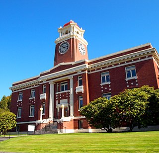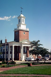
Clallam County is a county in the U.S. state of Washington. As of the 2010 census, the population was 71,404. The county seat and largest city is Port Angeles. The name is a Klallam word for "the strong people". The county was formed on April 26, 1854. Located on the Olympic Peninsula, it is south from the Strait of Juan de Fuca, which forms the Canada–US border, as British Columbia's Vancouver Island is across the strait.

Scott County is a county located in the U.S. state of Tennessee. As of the 2010 census, the population was 22,228. Its county seat is Huntsville. Scott County is known for having seceded from Tennessee in protest of the state's decision to join the Confederacy during the Civil War, and subsequently forming The Free and Independent State of Scott.

Forsyth County is a county located in the U.S. state of North Carolina. As of the 2010 census, the population was 350,670, making it the fourth-most populous county in North Carolina. Its county seat is Winston-Salem.

Cheyenne County is the sixth-least densely populated of the 64 counties of the U.S. state of Colorado. The county population was 1,836 at 2010 census. The county seat is Cheyenne Wells.

Roaring Fork River is a tributary of the Colorado River, approximately 70 miles (110 km) long, in west central Colorado in the United States. The river drains a populated and economically vital area of the Colorado Western Slope called the Roaring Fork Valley or Roaring Fork Watershed, which includes the resort city of Aspen and the resorts of Aspen/Snowmass.

The Cumberland River is a major waterway of the Southern United States. The 688-mile-long (1,107 km) river drains almost 18,000 square miles (47,000 km2) of southern Kentucky and north-central Tennessee. The river flows generally west from a source in the Appalachian Mountains to its confluence with the Ohio River near Paducah, Kentucky, and the mouth of the Tennessee River. Major tributaries include the Obey, Caney Fork, Stones, and Red rivers.

The Tug Fork is a tributary of the Big Sandy River, 159 miles (256 km) long, in southwestern West Virginia, southwestern Virginia, and eastern Kentucky in the United States. Via the Big Sandy and Ohio rivers, it is part of the watershed of the Mississippi River.

The Clark Fork, or the Clark Fork of the Columbia River, is a river in the U.S. states of Montana and Idaho, approximately 310 miles (500 km) long. The largest river by volume in Montana, it drains an extensive region of the Rocky Mountains in western Montana and northern Idaho in the watershed of the Columbia River. The river flows northwest through a long valley at the base of the Cabinet Mountains and empties into Lake Pend Oreille in the Idaho Panhandle. The Pend Oreille River in Idaho, Washington, and British Columbia, Canada which drains the lake to the Columbia in Washington, is sometimes included as part of the Clark Fork, giving it a total length of 479 miles (771 km), with a drainage area of 25,820 square miles (66,900 km2). In its upper 20 miles (32 km) in Montana near Butte, it is known as Silver Bow Creek. Interstate 90 follows much of the upper course of the river from Butte to northwest of Missoula. The highest point within the river's watershed is Mount Evans at 10,641 feet (3,243 m) in Deer Lodge County, Montana along the Continental Divide.

The Stillaguamish River is a river in northwest Washington in the United States. It is mainly composed of two forks, the longer North Fork Stillaguamish and the South Fork Stillaguamish. The two forks join near Arlington. From there the Stillaguamish River proper flows for 22 miles (35 km) to Puget Sound. The river's watershed drains part of the Cascade Range north of Seattle.

The Roaring Fork Valley is a geographical region in western Colorado in the United States. The Roaring Fork Valley is one of the most affluent regions in Colorado and the U.S. as well as one of the most populous and economically vital areas of the Colorado Western Slope. The Valley is defined by the valley of the Roaring Fork River and its tributaries, including the Crystal and Fryingpan River. It includes the communities of Aspen, Snowmass Village, Basalt, Carbondale, and Glenwood Springs. Mount Sopris and the Roaring Fork River serve as symbols of the Roaring Fork Valley.

The One Hundred and Two River is a tributary of the Platte River of Missouri that is approximately 80 miles (130 km) long, in northwestern Missouri in the United States, with its source tributaries rising in southwestern Iowa.

Grassy Fork Township is one of twelve townships in Jackson County, Indiana, United States. As of the 2010 census, its population was 668 and it contained 288 housing units. It was named from the Grassy Fork Creek.

Seaford Hundred is a hundred in Sussex County, Delaware, United States. Seaford Hundred was formed in 1869 from Northwest Fork Hundred. Its primary community is Seaford.

The Clearwater River is in the northwestern United States, in north central Idaho. Its length is 74.8 miles (120.4 km), it flows westward from the Bitterroot Mountains along the Idaho-Montana border, and joins the Snake River at Lewiston. In October 1805, the Lewis and Clark Expedition descended the Clearwater River in dugout canoes, putting in at "Canoe Camp," five miles (8 km) downstream from Orofino; they reached the Columbia Bar and the Pacific Ocean about six weeks later.

Antler is an unincorporated community in McDowell County, West Virginia, United States. Antler is located along the Tug Fork 2.5 miles (4.0 km) northwest of Welch.

The Double Mountain Fork Brazos River is an ephemeral, sandy-braided stream about 170 mi (280 km) long, heading on the Llano Estacado of West Texas about 11.5 mi (18.5 km) southeast of Tahoka, Texas, flowing east-northeast across the western Rolling Plains to join the Salt Fork, forming the Brazos River about 17 mi (27 km) west-northwest of Haskell, Texas.

Brush Fork is a census-designated place (CDP) in Mercer County, West Virginia, United States. Brush Fork is 2 miles (3.2 km) northwest of Bluefield. As of the 2010 census, its population was 1,197.

Tomkins Mountain is a mountain in the North Carolina High Country, near the community of Deep Gap. The majority of the mountain is within the Blue Ridge Parkway. Its elevation reaches 4,075 feet (1,242 m) and it also marks the corner between Ashe, Watauga, and Wilkes counties.

Pomroy is an unincorporated community in Pomroy Township, Itasca County, Minnesota, United States.

West Fork is a rural unincorporated community in northwest Allen County, Kentucky, United States.


