
Millville is a town in Sussex County, Delaware, United States. The population in 2020 was 1,825, It is part of the Salisbury, Maryland-Delaware Metropolitan Statistical Area and lies within Baltimore Hundred.

Milton is a town in Sussex County, Delaware, United States, on the Delmarva Peninsula. It is located on the Broadkill River, which empties into Delaware Bay. The population was 2,576 at the 2010 census, an increase of 55.5% over the previous decade.

Slaughter Beach is a town in Sussex County, Delaware, United States. The population was 207 at the 2010 census, an increase of 4.5% over the past decade. It is part of the Salisbury, Maryland-Delaware Metropolitan Statistical Area.

Delaware Bay is the estuary outlet of the Delaware River on the northeast seaboard of the United States. Approximately 782 square miles (2,030 km2) in area, the bay's fresh water mixes for many miles with the salt water of the Atlantic Ocean.

The Broadkill River is a river flowing to Delaware Bay in southern Delaware in the United States. It is 13.3 miles (21.4 km) long and drains an area of 110 square miles (280 km2) on the Atlantic Coastal Plain.
Brandywine Hundred is an unincorporated subdivision of New Castle County, Delaware, United States. It is located to the north and northeast of the city of Wilmington. Hundreds were once used as a basis for representation in the Delaware General Assembly. Brandywine Hundred and North Wilmington are commonly used colloquial names for this area. However, while their names still appear on all real estate transactions, all other hundreds in Delaware presently have no meaningful use or purpose except as a geographical point of reference. In the 2010 census, Brandywine had 77,182 people.

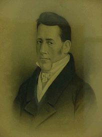
David Hazzard was an American merchant and politician from Milton, in Sussex County, Delaware. He was a member of the Democratic-Republican Party, then the National Republican Party, and finally the Whig Party. He served in the Delaware General Assembly, as Governor of Delaware, and as an associate justice of the Delaware Superior Court.
Samuel Paynter was an American merchant and politician from Drawbridge, in Broadkill Hundred, Sussex County, Delaware. He was a member of the Federalist Party, who served in the Delaware General Assembly and as Governor of Delaware.
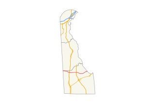
Delaware Route 16 (DE 16) is an east-west state highway in Delaware, mainly across northern Sussex County, with a small portion near the Maryland border in extreme southwestern Kent County. It runs from Maryland Route 16 (MD 16) at the Maryland border in Hickman to the Delaware Bay at Broadkill Beach. The route runs through rural areas, passing through the towns of Greenwood, Ellendale, and Milton. DE 16 intersects DE 36 and U.S. Route 13 (US 13) in Greenwood, US 113 in Ellendale, DE 30 and DE 5 in the Milton area, and DE 1 between Milton and Broadkill Beach. West of DE 1, the route serves as part of a connection between the Baltimore–Washington Metropolitan Area and the Delaware Beaches. DE 16 was built as a state highway during the 1920s and 1930s. By 1936, the route was designated onto its current alignment.

Broadkill Beach is an unincorporated beach community in Sussex County, in the U.S. state of Delaware, located on the Delaware Bay north of the mouth of the Broadkill River. It is part of the Salisbury, Maryland-Delaware Metropolitan Statistical Area. The word kill is from the Dutch word kil.
Georgetown Hundred is a hundred in Sussex County, Delaware, United States. Georgetown Hundred was formed in 1863 from Broadkill Hundred. Its primary community is Georgetown.
Indian River Hundred is a hundred in Sussex County, Delaware, United States. Indian River Hundred was formed in 1706 from Lewes & Rehoboth Hundred. Its primary community is now Angola on Delaware Route 24, but maritime transportation dominated during the colonial and early federal era. Thus settlers as early as 1794 built a nearby chapel St. George's to serve their spiritual needs and as a community gathering place. By 1821 they paid to share a pastor with St. Peter's Church in Lewes, Delaware, as well as Old Christ Church, Prince George's Chapel in Dagsboro, Delaware and St. Pauls' Church in Georgetown, Delaware. By the late 20th century, fishing and farming had declined but tourism had increased, so the parish was linked to All Saints' Church in Rehoboth Beach.
Taylors Bridge is an unincorporated community in Appoquinimink Hundred and Blackbird Hundred, New Castle County, Delaware, United States. Taylors Bridge is located on Delaware Route 9, 7.4 miles (11.9 km) east-southeast of Middletown. It is named for the bridge that carries Route 9 over the Blackbird Creek, the boundary between the two hundreds.

The Cape Henlopen Region, or the Cape Region, is a region in Sussex County, in southern Delaware, on the Delmarva Peninsula. The region is part of the Salisbury, Maryland-Delaware Metropolitan Statistical Area. The region takes its name from Cape Henlopen, as does the Cape Henlopen School District and Cape Henlopen State Park. Much of the region's populated areas are found along the Delaware Bay, Rehoboth Bay and the Atlantic Ocean. Northern and western parts of the Cape Region are rural areas dominated by farmland and wetlands. The area is often referred to as the Delaware Beaches.
The 1780 Black Camp Rebellion was a brief Loyalist uprising in Sussex County, Delaware, that occurred during the American Revolutionary War. It was a local reaction to the American War of Independence by Loyalists who opposed the independence movement and intended to secure Sussex County for the British.

Fort Saulsbury was a United States Army coastal defense fort near Slaughter Beach and Milford, Delaware. From 1924 to 1943 it was the primary heavy gun defense in the Harbor Defenses of the Delaware. In 1943 it was itself superseded by the longer-range 16-inch guns of Fort Miles at Cape Henlopen, Delaware, to which two of Fort Saulsbury's four guns were relocated. Fort Saulsbury was named for Willard Saulsbury Sr., a former US Senator from Delaware.
Overbrook is an unincorporated community and former village in Sussex County, Delaware, United States.

