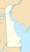
Delaware is one of the 50 states of the United States, in the South-Atlantic or Southern region. It is bordered to the south and west by Maryland, north by Pennsylvania, and east by New Jersey and the Atlantic Ocean. The state takes its name from Thomas West, 3rd Baron De La Warr, an English nobleman and Virginia's first colonial governor.

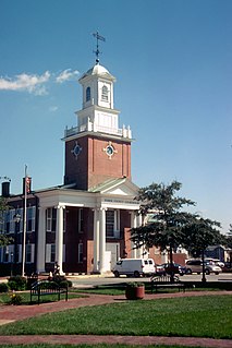
Kent County is a county located in the central part of the U.S. state of Delaware. As of the 2010 census, the population was 162,310, making it the least populous county in Delaware. The county seat is Dover, the state capital of Delaware. It is named for Kent, an English county.
Sussex County is a county located in the southern part of the U.S. state of Delaware, on the Delmarva Peninsula. As of the 2010 census, the population was 197,145. The county seat is Georgetown.

The historic counties of England are areas that were established for administration by the Normans, in many cases based on earlier kingdoms and shires created by the Anglo-Saxons and others. They are alternatively known as ancient counties, traditional counties, former counties or simply as counties. In the centuries that followed their establishment, as well as their administrative function, the counties also helped define local culture and identity. This role continued even after the counties ceased to be used for administration after the creation of administrative counties in 1889, which were themselves amended by further local government reforms in the years following.
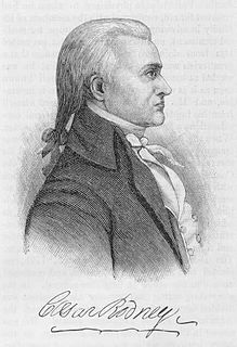
Caesar Rodney was an American lawyer and politician from St. Jones Neck in Dover Hundred, Kent County, Delaware, east of Dover. He was an officer of the Delaware militia during the French and Indian War and the American Revolution, a Continental Congressman from Delaware, a signer of the Declaration of Independence, and President of Delaware during most of the American Revolution.
A hundred is an administrative division that is geographically part of a larger region. It was formerly used in England, Wales, some parts of the United States, Denmark, Southern Schleswig, Sweden, Finland, Estonia, and Norway. It is still used in other places, including South Australia and the Northern Territory.

The Eastern Shore of Maryland is a part of the U.S. state of Maryland that lies predominantly on the east side of the Chesapeake Bay and consists of nine counties, seven of which have Chesapeake Bay coastlines. The region also contains Maryland's only coast on the Atlantic Ocean. As of the 2010 census, its population was 449,226, with just under 8 percent of Marylanders living in the region. The term "Eastern Shore" distinguishes a territorial part of the state of Maryland from the Western Shore of Maryland, land west of the Chesapeake Bay. The Eastern Shore is part of the larger Delmarva Peninsula that Maryland shares with Delaware and Virginia.
Brandywine Hundred is an unincorporated subdivision of New Castle County, Delaware, United States. It is located to the north and northeast of the city of Wilmington. Hundreds were once used as a basis for representation in the Delaware General Assembly. Brandywine Hundred and North Wilmington are commonly used colloquial names for this area. However, while their names still appear on all real estate transactions, all other hundreds in Delaware presently have no meaningful use or purpose except as a geographical point of reference. In the 2010 census, Brandywine had 77,182 people. In recent decades it has become a major edge city of Philadelphia due in part to Delaware General Corporation Law.

Charles Polk Jr. was an American farmer and politician from Big Stone Beach, in Milford Hundred, Kent County, Delaware. He was a member of the Federalist Party, and later the Whig Party, who served in the Delaware General Assembly and twice as Governor of Delaware.
Blackbird Hundred is an unincorporated subdivision of New Castle County, Delaware. Hundreds were once used as a basis for representation in the Delaware General Assembly, and while their names still appear on all real estate transactions, they now have no purpose except as a geographical point of reference.
Appoquinimink Hundred is an unincorporated subdivision of New Castle County, Delaware. Hundreds were once used as a basis for representation in the Delaware General Assembly, and while their names still appear on all real estate transactions, they presently have no meaningful use or purpose except as a geographical point of reference.
White Clay Creek Hundred is an unincorporated subdivision of New Castle County, Delaware. Hundreds were once used as a basis for representation in the Delaware General Assembly, and while their names still appear on all real estate transactions, they presently have no meaningful use or purpose except as a geographical point of reference.
Daniel Rogers was an American miller and politician from Milford, in Sussex County, Delaware. He was a member of the Federalist Party, who served in the Delaware General Assembly and as Governor of Delaware.
Joseph Haslet was an American planter and politician from Cedar Creek Village in Cedar Creek Hundred, Sussex County, Delaware. He was a member of the Democratic-Republican Party, who served twice as Governor of Delaware.
John Clark was an American farmer and politician from Blackbird Hundred in New Castle County, Delaware, near Smyrna. He was a member of the Federalist Party, who served in the Delaware General Assembly and as Governor of Delaware.
A tithing or tything was a historic English legal, administrative or territorial unit, originally ten hides. Tithings later came to be seen as subdivisions of a manor or civil parish. The tithing's leader or spokesman was known as a tithingman.

Cedar Creek is a 16.09 mi (25.89 km) long 4th order tributary to Delaware Bay in Sussex and Kent Counties, Delaware.

Banning, Delaware, USA was a stop in Cedar Creek Hundred on the now defunct Queen Anne's Railroad line between Ellendale and Greenwood positioned at the NE corner of what now is Road 44/Blacksmith Shop Road and Delaware Route 16/Beach Highway. After the railroad closed down and the tracks were removed, all Banning, Delaware property owned by the railroad was returned to Mark L. Banning, its previous landowner. A small town built around the Banning, Delaware stop disappeared.
A tenth was a geographic division used in the former American Province of West Jersey, to divide a larger region into smaller administrative divisions. Despite seemingly related names, tenths are not directly related to hundreds, other than both being administrative divisions.