Kent County, Delaware

Last updated

Kent County
Kent County Courthouse Dover.jpg
The Kent County Courthouse in Dover in 2006
Kent County, DE Flag.gif
Seal of Kent County, Delaware.jpg
Map of Delaware highlighting Kent County.svg
Location within the U.S. state of Delaware
Delaware in United States.svg
Delaware's location within the U.S.
Coordinates: 39°06′N75°30′W / 39.1°N 75.5°W / 39.1; -75.5
CountryFlag of the United States.svg United States
StateFlag of Delaware.svg  Delaware
FoundedAugust 8, 1683
Named for Kent, England
Seat Dover
Largest cityDover
Area
  Total798 sq mi (2,070 km2)
  Land586 sq mi (1,520 km2)
  Water212 sq mi (550 km2)  26.6%
Population
 (2020)
  Total181,851
  Density310.33/sq mi (119.82/km2)
Time zone UTC−5 (Eastern)
  Summer (DST) UTC−4 (EDT)
Congressional district At-large
Website www.co.kent.de.us

Kent County is a county located in the central part of the U.S. state of Delaware. As of the 2020 census, the population was 181,851, making it the least populous county in Delaware. [1] The county seat is Dover, [2] the state capital of Delaware. It is named for Kent, an English county. [3]

Contents

Kent County comprises the Dover metropolitan area, which is included in the Philadelphia-Reading-Camden, PA-NJ-DE-MD combined statistical area. [4]

History

1683 Seal of Kent County Seal of Kent County Delaware 1683.jpg
1683 Seal of Kent County

In about 1670 the English began to settle in the valley of the St. Jones River, earlier known as Wolf Creek. On June 21, 1680, the Duke of York chartered St. Jones County, which was carved out of New Amstel/New Castle and Hoarkill/Sussex counties. St. Jones County was transferred to William Penn on August 24, 1682, and became part of Penn's newly chartered Delaware Colony. [5]

Penn ordered a court town to be laid out, and the courthouse was built in 1697. The town of Dover, named after the town of Dover in England's Kent, was finally laid out in 1717, in what was then known as the Lower Counties. It was designated as the capital of Delaware in 1777. In 1787 Delaware was first state to ratify the U.S. Constitution, and became "the First State." Through much of the late 18th century, the economy of Kent County was based on small grain farms. As a result, farmers did not need as many slaves as did owners of tobacco plantations. Delaware had a high proportion of free blacks among its African-American population by the early 19th century.
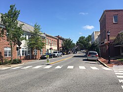
The new courthouse NEW KENT COUNTY COURTHOUSE, DOVER, DELAWARE.jpg
The new courthouse

In the 1960s, Dover was a center of manufacturing of spacesuits worn by NASA astronauts in the Apollo moon flights by ILC Dover, now based in the small town of Frederica. The suits, dubbed the "A7L," was first flown on the Apollo 7 mission in October 1967, and was the suit worn by Neil Armstrong and Buzz Aldrin on the Apollo 11 mission. The company still manufactures spacesuits to this day—the present-day Space Shuttle "soft" suit components (the arms and legs of the suit).

Geography

According to the U.S. Census Bureau, the county has a total area of 798 square miles (2,070 km2), of which 586 square miles (1,520 km2) is land and 212 square miles (550 km2) (26.6%) is water. [6]

Kent County, like all of Delaware's counties, is subdivided into Hundreds. There are several explanations given for how the Hundreds were arrived at, either being an area containing 100 families, an area containing 100 people, or an area that could raise 100 militiamen. [7] [8] Kent County was originally apportioned into six Hundreds: Duck Creek, Little Creek, Dover, Murderkill, Milford and Mispillion. In 1867, the Delaware legislature split Murderkill Hundred into North Murderkill Hundred and South Murderkill Hundred. In 1869, the legislature formed Kenton Hundred from parts of Little Creek and Duck Creek Hundred. Today the county contains eight Hundreds.

Adjacent counties

Bombay Hook National Wildlife Refuge Bombay Hook NWR wetlands.jpg
Bombay Hook National Wildlife Refuge

National protected area

Climate

Kent County has a humid subtropical climate (Cfa) according to the Köppen climate classification. The Trewartha climate classification considers the climate oceanic (Do) because only seven months average above 50 °F (above 10 °C.) All months average above freezing and Dover has three months averaging above 22 °C (72 °F).) The hardiness zone is 7b.

Climate data for Dover, Delaware (1991−2020 normals, extremes 1893–present)
MonthJanFebMarAprMayJunJulAugSepOctNovDecYear
Record high °F (°C)77
(25)
80
(27)
88
(31)
97
(36)
98
(37)
101
(38)
104
(40)
102
(39)
99
(37)
95
(35)
85
(29)
75
(24)
104
(40)
Mean maximum °F (°C)65.7
(18.7)
65.4
(18.6)
73.5
(23.1)
83.0
(28.3)
88.1
(31.2)
93.1
(33.9)
95.4
(35.2)
93.1
(33.9)
89.0
(31.7)
82.8
(28.2)
73.9
(23.3)
66.1
(18.9)
96.1
(35.6)
Mean daily maximum °F (°C)44.4
(6.9)
47.4
(8.6)
54.5
(12.5)
66.0
(18.9)
74.4
(23.6)
82.7
(28.2)
86.9
(30.5)
85.1
(29.5)
79.2
(26.2)
68.9
(20.5)
58.0
(14.4)
48.6
(9.2)
66.3
(19.1)
Daily mean °F (°C)36.0
(2.2)
38.2
(3.4)
45.0
(7.2)
55.5
(13.1)
64.4
(18.0)
73.2
(22.9)
77.9
(25.5)
76.2
(24.6)
70.1
(21.2)
59.2
(15.1)
48.7
(9.3)
40.3
(4.6)
57.1
(13.9)
Mean daily minimum °F (°C)27.6
(−2.4)
29.0
(−1.7)
35.4
(1.9)
44.9
(7.2)
54.4
(12.4)
63.8
(17.7)
69.0
(20.6)
67.3
(19.6)
61.0
(16.1)
49.5
(9.7)
39.3
(4.1)
32.1
(0.1)
47.8
(8.8)
Mean minimum °F (°C)10.8
(−11.8)
13.3
(−10.4)
20.5
(−6.4)
31.1
(−0.5)
40.7
(4.8)
51.0
(10.6)
59.5
(15.3)
58.4
(14.7)
47.7
(8.7)
34.4
(1.3)
24.0
(−4.4)
17.8
(−7.9)
8.8
(−12.9)
Record low °F (°C)−7
(−22)
−11
(−24)
7
(−14)
14
(−10)
28
(−2)
41
(5)
45
(7)
35
(2)
30
(−1)
25
(−4)
11
(−12)
−3
(−19)
−11
(−24)
Average precipitation inches (mm)3.43
(87)
3.08
(78)
4.21
(107)
3.72
(94)
3.89
(99)
4.56
(116)
4.14
(105)
4.92
(125)
4.25
(108)
4.06
(103)
3.36
(85)
3.99
(101)
47.61
(1,209)
Average snowfall inches (cm)4.1
(10)
5.9
(15)
0.6
(1.5)
0.0
(0.0)
0.0
(0.0)
0.0
(0.0)
0.0
(0.0)
0.0
(0.0)
0.0
(0.0)
0.0
(0.0)
0.0
(0.0)
2.6
(6.6)
13.2
(34)
Average precipitation days (≥ 0.01 in)9.79.29.810.310.59.29.08.28.28.07.410.2109.7
Average snowy days (≥ 0.1 in)1.81.90.40.00.00.00.00.00.00.00.00.84.9
Average ultraviolet index 2356899874225
Source 1: NOAA [9] [10]
Source 2: Weather Atlas (UV) [11]

Transportation

Major highways

The DE 1 toll road in Smyrna, northern Kent County 2022-07-18 11 42 42 View north along Delaware State Route 1 (Korean War Veterans Memorial Highway) from the overpass for Smyrna-Leipsic Road in Smyrna, Kent County, Delaware.jpg
The DE 1 toll road in Smyrna, northern Kent County

The following state highways are located in Kent County: [12]

Railroads

The Delmarva Central Railroad operates two freight lines through Kent County. The Delmarva Subdivision runs north–south along the US 13 corridor through Farmington, Harrington, Felton, Wyoming, Dover, Cheswold, and Clayton and the Indian River Subdivision branches from the Delmarva Subdivision at Harrington and runs east to Houston and Milford along the DE 14 corridor. There is no passenger rail service in the county. [13]

Public transportation

DART First State operates bus service within Kent County. There are several local bus routes that serve the Dover area. In addition, DART First State operates inter-county service to Wilmington, Newark, Georgetown, and Lewes, along with seasonal service to Lewes and Rehoboth Beach. [14]

Airports

Kent County contains the following public-use and military airports:

Government and politics

United States presidential election results for Kent County, Delaware [15]
Year Republican Democratic Third party
No.%No.%No.%
2020 41,00947.12%44,55251.19%1,4641.68%
2016 36,99149.50%33,35144.63%4,3875.87%
2012 32,13546.79%35,52751.73%1,0181.48%
2008 29,82744.57%36,39254.38%7061.05%
2004 31,57856.40%23,87542.64%5380.96%
2000 24,08149.90%22,79047.23%1,3832.87%
1996 15,93240.59%18,32746.69%4,99312.72%
1992 15,56238.67%15,36438.18%9,31223.14%
1988 19,92360.17%12,99639.25%1940.59%
1984 21,53164.46%11,78935.29%830.25%
1980 14,88249.84%12,88443.15%2,0967.02%
1976 12,60442.83%16,52356.15%3011.02%
1972 17,71262.03%10,46336.64%3811.33%
1968 11,08244.53%9,05536.38%4,75119.09%
1964 9,00640.84%12,98158.86%670.30%
1960 10,69749.49%10,75449.75%1650.76%
1956 10,30352.18%9,31947.20%1230.62%
1952 10,14450.45%9,87449.10%900.45%
1948 8,50150.63%8,17448.68%1150.68%
1944 7,06947.05%7,90052.58%570.38%
1940 8,07946.69%9,22653.31%00.00%
1936 7,38943.45%9,58856.38%280.16%
1932 6,59742.59%8,82957.00%640.41%
1928 8,33559.16%5,72740.65%270.19%
1924 6,89449.17%6,93649.47%1921.37%
1920 6,51146.88%7,21151.92%1671.20%
1916 3,81347.14%4,21052.05%660.82%
1912 3,19240.22%4,07151.30%6738.48%

Kent County is governed by the Kent County Levy Court, which consists of seven members, six of whom are elected by district and the seventh who is elected at-large. The current members of the Kent County Levy Court are: [16]

The county row offices are held by: [16]

Politically, Kent County is a swing county in local, state, and federal elections. The county is often used in state politics to determine a party or candidate's strength in statewide elections and is often considered a bellwether county, having voting for the winner of the national presidential election in 17 out of the last 18 presidential elections.

In the 2016 general elections, Republican Presidential Nominee Donald Trump won Kent County with 49.81% of the vote compared to Democratic Nominee Hillary Clinton's 44.91% out of 74,260 votes cast. [17] In the 2016 Delaware Gubernatorial Election, Democratic nominee John Carney won 49.68% of the vote compared to Republican Colin Bonini's 48.05%.

In the 2020 presidential election, however, Democratic Nominee and Delaware native Joe Biden was able to flip Kent County with 51.19% of the vote compared to Trump's 47.12%, out of 87,025 votes cast. In fact, Biden previously carried the county in his vice presidential bids in 2008 and 2012, as well as six of his seven runs to the Senate, only losing the county in 2002 by a narrow margin of 2 points.

In the Delaware General Assembly, 8 of the 41 seats in the Delaware State House of Representatives. As of March 2020, Democrats held 4 seats and Republicans held 4 seats. In the Delaware State Senate, 5 senate districts represent parts of Kent County. As of March 2020 there were 3 Republican seats and 2 Democratic seats.

Kent County Voter Registration and Party Affiliations as of March 30, 2020 [18]
Political PartyTotal VotersPercentage
Democratic 55,27043.34%
Republican 38,07329.85%
No Party31,76324.91%
Third Parties2,4111.90%
Total127,517100.00%

Demographics

Historical population
CensusPop.Note
1790 18,920
1800 19,5543.4%
1810 20,4954.8%
1820 20,7931.5%
1830 19,913−4.2%
1840 19,872−0.2%
1850 22,81614.8%
1860 27,80421.9%
1870 29,8047.2%
1880 32,87410.3%
1890 32,664−0.6%
1900 32,7620.3%
1910 32,721−0.1%
1920 31,023−5.2%
1930 31,8412.6%
1940 34,4418.2%
1950 37,87010.0%
1960 65,65173.4%
1970 81,89224.7%
1980 98,21919.9%
1990 110,99313.0%
2000 126,69714.1%
2010 162,31028.1%
2020 181,85112.0%
2023 (est.)189,789 [19] 4.4%
U.S. Decennial Census [20]
1790-1960 [21] 1900-1990 [22]
1990-2000 [23] 2010-2020 [24]

2000 census

As of the census of 2000, there were 126,697 people, 47,224 households, and 33,623 families living in the county. The population density was 215 people per square mile (83 people/km2). There were 50,481 housing units at an average density of 86 per square mile (33/km2). The racial makeup of the county was 73.49% White, 20.66% Black or African American, 0.64% Native American, 1.69% Asian, 0.04% Pacific Islander, 1.27% from other races, and 2.22% from two or more races. 3.21% of the population were Hispanic or Latino of any race. 13.3% were of German, 11.3% United States or American, 10.9% Irish, 10.0% English and 5.4% Italian ancestry. 92.5% spoke English and 3.3% Spanish as their first language.

There were 47,224 households, out of which 35.50% had children under the age of 18 living with them, 52.90% were married couples living together, 13.80% had a female householder with no husband present, and 28.80% were non-families. 23.00% of all households were made up of individuals, and 8.40% had someone living alone who was 65 years of age or older. The average household size was 2.61 and the average family size was 3.06.

In the county, the population was spread out, with 27.30% under the age of 18, 10.10% from 18 to 24, 29.80% from 25 to 44, 21.20% from 45 to 64, and 11.70% who were 65 years of age or older. The median age was 34 years. For every 100 females there were 93.10 males. For every 100 females age 18 and over, there were 89.60 males.

The median income for a household in the county was $40,950, and the median income for a family was $46,504. Males had a median income of $32,660 versus $24,706 for females. The per capita income for the county was $18,662. About 8.10% of families and 10.70% of the population were below the poverty line, including 14.80% of those under age 18 and 8.80% of those age 65 or over.

2010 census

As of the 2010 census, there were 162,310 people, 60,278 households, and 42,290 families living in the county. [25] The population density was 276.9 inhabitants per square mile (106.9/km2). There were 65,338 housing units at an average density of 111.5 per square mile (43.1/km2). [26] The racial makeup of the county was 67.8% white, 24.0% black or African American, 2.0% Asian, 0.6% American Indian, 0.1% Pacific islander, 2.0% from other races, and 3.5% from two or more races. Those of Hispanic or Latino origin made up 5.8% of the population. [25] In terms of ancestry, 17.5% were German, 15.4% were Irish, 11.5% were English, 7.2% were Italian, and 5.9% were American. [27]

Of the 60,278 households, 35.6% had children under the age of 18 living with them, 50.1% were married couples living together, 14.9% had a female householder with no husband present, 29.8% were non-families, and 23.6% of all households were made up of individuals. The average household size was 2.62 and the average family size was 3.09. The median age was 36.6 years. [25]

The median income for a household in the county was $53,183 and the median income for a family was $60,949. Males had a median income of $43,418 versus $35,603 for females. The per capita income for the county was $24,194. About 9.3% of families and 12.5% of the population were below the poverty line, including 21.0% of those under age 18 and 7.7% of those age 65 or over. [28]

2020 census and 2021 census estimates

As of the 2020 census, there were 181,851 people living in the county; according to the 2021 American Community Survey, its racial makeup was 58.8% non-Hispanic white, 28.4% Black or African American, 0.8% Native American, 2.4% Asian, 0.1% Pacific Islander, 4.1% multiracial, and 7.8% Hispanic or Latino of any race. [1]

In 2021, there were 66,720 households and an average of 2.63 people per household. Among its population, 88.2% were living in the same residency one year ago. The median household income for the county was $63,715; the county had a per capita income of $30,804. An estimated 12.2% of the population lived at or below the poverty line.

Amish community

Kent County is home to an Amish community residing to the west of Dover, consisting of 9 church districts and about 1,650 people. The Amish first settled in Kent County in 1915 after migrations from Wisconsin, Montana, Alabama, and Ohio. [29] The area is home to several Amish businesses selling items such as Amish food, furniture, quilts, and handmade crafts. Every September, the Amish Country Bike Tour, one of the largest cycling events in Delaware, takes place in the area. In recent years, increasing development has led to the decline in the number of Amish living in the community. [30] [31] [29]

Communities

Cities

Dover Dover Delaware.jpg
Dover
Milford Walnut Street NB at Park Avenue Milford DE.jpeg
Milford

Towns

Smyrna Main Street NB approaching Commerce Street Smyrna DE.jpeg
Smyrna

Census-designated places

Unincorporated localities

Education

School districts include: [32]

Tertiary institutions:

Wesley College merged into DSU in 2021. [33]

See also

Related Research Articles

<span class="mw-page-title-main">Dover, Delaware</span> Capital city of Delaware, United States

Dover is the capital and second-most populous city of the U.S. state of Delaware. It is also the county seat of Kent County and the principal city of the Dover metropolitan statistical area, which encompasses all of Kent County and is part of the Philadelphia–Wilmington–Camden, PA–NJ–DE–MD, combined statistical area. It is located on the St. Jones River in the Delaware River coastal plain. It was named by William Penn for Dover in Kent, England. As of 2020, its population was 39,403.

<span class="mw-page-title-main">Tuscarawas County, Ohio</span> County in Ohio, United States

Tuscarawas County is a county located in the northeastern part of the U.S. state of Ohio. As of the 2020 census, the population was 93,263. Its county seat is New Philadelphia. Its name is a Delaware Indian word variously translated as "old town" or "open mouth". Tuscarawas County comprises the New Philadelphia–Dover, OH Micropolitan Statistical Area, which is also included in the Cleveland–Akron–Canton, OH Combined Statistical Area.

<span class="mw-page-title-main">Buchanan County, Iowa</span> County in Iowa, United States

Buchanan County is a county located in the U.S. state of Iowa. As of the 2020 census, the population was 20,565. Its county seat is Independence. The county was created in 1837 and was named in honor of Senator James Buchanan, the 15th President of the United States.

<span class="mw-page-title-main">Bowers, Delaware</span> Town in Delaware, United States

Bowers is a town in Kent County, Delaware, United States. It is part of the Dover, Delaware Metropolitan Statistical Area. According to the 2020 census, its population was 278.

<span class="mw-page-title-main">Camden, Delaware</span> Town in Delaware, United States

Camden is a town in Kent County, Delaware, United States. It is part of the Dover, Delaware Metropolitan Statistical Area. The population was 3,715 in 2020.

<span class="mw-page-title-main">Cheswold, Delaware</span> Town in Delaware, United States

Cheswold is a town in Kent County in the U.S. state of Delaware. It is part of the Dover, Delaware Metropolitan Statistical Area. The population was 1,923 in 2020.

<span class="mw-page-title-main">Clayton, Delaware</span> Town in Delaware, United States

Clayton is a town in Kent and New Castle counties in the U.S. state of Delaware. Located almost entirely in Kent County, it is part of the Dover, Delaware Metropolitan Statistical Area. The population was 2,918 at the 2010 census.

<span class="mw-page-title-main">Farmington, Delaware</span> Town in Delaware, United States

Farmington is a town in Kent County, Delaware, United States. It is part of the Dover, Delaware Metropolitan Statistical Area. The population was 92 in 2020.

<span class="mw-page-title-main">Felton, Delaware</span> Town in Delaware, United States

Felton is a town in Kent County, Delaware, United States. It is part of the Dover metropolitan statistical area. The population was 1,568 in 2020.

<span class="mw-page-title-main">Frederica, Delaware</span> Town in Delaware, United States

Frederica is a town in Kent County, Delaware, United States. It is part of the Dover, Delaware Metropolitan Statistical Area. The population was 1,073 in 2020. ILC Dover, the company which manufactured the spacesuits for the Apollo and Skylab astronauts of the 1960s and 1970s, along with fabricating the suit component of the Space Shuttle's Extravehicular Mobility Unit (EMU), is located nearby.

<span class="mw-page-title-main">Hartly, Delaware</span> Town in Delaware, United States

Hartly is a town in Kent County, Delaware, United States. It is part of the Dover, Delaware Metropolitan Statistical Area. The population was 73 in 2020, making it the least populous municipality in Delaware.

<span class="mw-page-title-main">Highland Acres, Delaware</span> CDP in Delaware, United States

Highland Acres is a census-designated place (CDP) in Kent County, Delaware, United States. It is part of the Dover, Delaware Metropolitan Statistical Area. The population was 3,459 at the 2010 census.

<span class="mw-page-title-main">Houston, Delaware</span> Town in Delaware, United States

Houston is a town in Kent County, Delaware, United States. It is part of the Dover metropolitan area. The population was 381 in 2020. It was named for John W. Houston.

<span class="mw-page-title-main">Kent Acres, Delaware</span> CDP in Delaware, United States

Kent Acres is a census-designated place (CDP) in Kent County, Delaware, United States. It is part of the Dover, Delaware Metropolitan Statistical Area. The population was 1,890 at the 2010 census.

<span class="mw-page-title-main">Leipsic, Delaware</span> Town in Delaware, United States

Leipsic is a town in Kent County, Delaware, United States. It is part of the Dover, Delaware Metropolitan Statistical Area. The population was 178 in 2020.

<span class="mw-page-title-main">Little Creek, Delaware</span> Town in Delaware, United States

Little Creek is a town in Kent County, Delaware, United States. It is part of the Dover metropolitan statistical area. The population was 195 in 2020.

<span class="mw-page-title-main">Magnolia, Delaware</span> Town in Delaware, United States

Magnolia is a town in Kent County, Delaware, United States. It is part of the Dover, Delaware Metropolitan Statistical Area. Recent estimates put the population at around 235, however, the population was 277 at the 2020 census.

<span class="mw-page-title-main">Viola, Delaware</span> Town in Delaware, United States

Viola is a town in Kent County, Delaware, United States. It is part of the Dover, Delaware Metropolitan Statistical Area. The population was 140 in 2020.

<span class="mw-page-title-main">Woodside, Delaware</span> Town in Delaware, United States

Woodside is a town in Kent County, Delaware, United States. It is part of the Dover, Delaware Metropolitan Statistical Area. The population was 190 in 2020.

<span class="mw-page-title-main">Wyoming, Delaware</span> Town in Delaware, United States

Wyoming is a town in Kent County, Delaware, United States. It was named after the Wyoming Valley in Pennsylvania. It is part of the Dover, Delaware, Metropolitan Statistical Area. The population was 1,680 in 2020.

References

  1. 1 2 "Census - Geography Profile: Kent County, Delaware". United States Census Bureau . Retrieved December 18, 2022.
  2. "Find a County". National Association of Counties. Archived from the original on May 31, 2011. Retrieved June 7, 2011.
  3. Gannett, Henry (1905). The Origin of Certain Place Names in the United States. Govt. Print. Off. pp.  173.
  4. "Archived copy" (PDF). Office of Management and Budget . Archived (PDF) from the original on January 21, 2017. Retrieved April 27, 2014 via National Archives.{{cite web}}: CS1 maint: archived copy as title (link)
  5. NEW YORK: Atlas of Historical County Boundaries by John H. Long and Kathryn Ford Thorne
  6. "US Gazetteer files: 2010, 2000, and 1990". United States Census Bureau. February 12, 2011. Retrieved April 23, 2011.
  7. Delaware History Online - Geography - Hundreds Archived July 16, 2012, at the Wayback Machine . Hsd.org. Retrieved on 2013-08-17.
  8. Delaware Hundreds Archived July 16, 2012, at the Wayback Machine . Delgensoc.org (July 16, 2010). Retrieved on August 17, 2013.
  9. "NowData - NOAA Online Weather Data". National Oceanic and Atmospheric Administration. Retrieved June 18, 2021.
  10. "Station: Dover, DE". U.S. Climate Normals 2020: U.S. Monthly Climate Normals (1991-2020). National Oceanic and Atmospheric Administration. Archived from the original on August 6, 2023. Retrieved June 18, 2021.
  11. "Dover, Delaware, USA – Monthly weather forecast and Climate data". Weather Atlas. Archived from the original on June 29, 2019. Retrieved July 4, 2019.
  12. Delaware Department of Transportation (2008). Delaware Official Transportation Map (PDF) (Map). Dover: Delaware Department of Transportation.
  13. "Delmarva Central Railroad". Carload Express. Retrieved March 27, 2017.
  14. "Routes and Schedules". DART First State. Retrieved August 16, 2013.
  15. "Dave Leip's Atlas of United States Presidential Elections" . Retrieved June 11, 2011.
  16. 1 2 "Levy Court". Kent County. Retrieved January 6, 2020.
  17. "State of Delaware - Department of Elections · Office of the State Election Commissioner". elections.delaware.gov. Retrieved March 30, 2020.
  18. "State of Delaware - Department of Elections · Office of the State Election Commissioner". elections.delaware.gov. Retrieved March 30, 2020.
  19. "Annual Estimates of the Resident Population for Counties: April 1, 2020 to July 1, 2023". United States Census Bureau. Retrieved March 31, 2024.
  20. "U.S. Decennial Census". United States Census Bureau. Retrieved June 12, 2014.
  21. "Historical Census Browser". University of Virginia Library. Retrieved June 12, 2014.
  22. "Population of Counties by Decennial Census: 1900 to 1990". United States Census Bureau. Retrieved June 12, 2014.
  23. "Census 2000 PHC-T-4. Ranking Tables for Counties: 1990 and 2000" (PDF). United States Census Bureau. Archived (PDF) from the original on October 9, 2022. Retrieved June 12, 2014.
  24. "State & County QuickFacts". United States Census Bureau. Archived from the original on December 28, 2015. Retrieved June 12, 2014.
  25. 1 2 3 "DP-1 Profile of General Population and Housing Characteristics: 2010 Demographic Profile Data". United States Census Bureau. Archived from the original on February 13, 2020. Retrieved January 12, 2016.
  26. "Population, Housing Units, Area, and Density: 2010 - County". United States Census Bureau. Archived from the original on February 13, 2020. Retrieved January 12, 2016.
  27. "DP02 SELECTED SOCIAL CHARACTERISTICS IN THE UNITED STATES – 2006-2010 American Community Survey 5-Year Estimates". United States Census Bureau. Archived from the original on February 13, 2020. Retrieved January 12, 2016.
  28. "DP03 SELECTED ECONOMIC CHARACTERISTICS – 2006-2010 American Community Survey 5-Year Estimates". United States Census Bureau. Archived from the original on February 13, 2020. Retrieved January 12, 2016.
  29. 1 2 "Delaware Amish". Amish America. Archived from the original on October 7, 2017. Retrieved October 6, 2017.
  30. "Amish Population, 2018". Elizabethtown College, the Young Center for Anabaptist and Pietist Studies. Archived from the original on February 5, 2019. Retrieved January 29, 2019.
  31. "Amish Countryside". Kent County & Greater Dover, Delaware Convention and Visitors Bureau. Archived from the original on November 23, 2016. Retrieved November 22, 2016.
  32. "2020 CENSUS - SCHOOL DISTRICT REFERENCE MAP: Kent County, DE" (PDF). U.S. Census Bureau. Archived (PDF) from the original on October 9, 2022. Retrieved July 20, 2022. - Text list - It only includes geographical districts and does not have county-wide overlay districts.
  33. "Delaware State University will acquire Wesley College, a first for HBCUs". insidehighered.com. Retrieved July 20, 2020. The acquisition will be finalized by the end of June next year.

39°06′N75°30′W / 39.10°N 75.50°W / 39.10; -75.50