Upper Darby Township, Pennsylvania

Last updated

Upper Darby, Pennsylvania
TowerTheaterUpperDarby69thStreet2007.jpg
Tower Theater in Upper Darby Township
Nickname: 
UD
Motto: 
"The World in One Place" [1]
Upper Darby Township, Pennsylvania
Interactive map of Upper Darby
USA Pennsylvania relief location map.svg
Red pog.svg
Upper Darby
Usa edcp relief location map.png
Red pog.svg
Upper Darby
Coordinates: 39°57′30″N75°18′29″W / 39.95833°N 75.30806°W / 39.95833; -75.30806
CountryFlag of the United States.svg  United States
StateFlag of Pennsylvania.svg  Pennsylvania
County Delaware
Settled1653
Government
  Type Mayor–council
  MayorEd Brown (D)
Area
[2]
  Total7.83 sq mi (20.27 km2)
  Land7.83 sq mi (20.27 km2)
  Water0.00 sq mi (0.00 km2)
Elevation
230 ft (70 m)
Population
 (2020)
  Total85,681
  Density10,559.62/sq mi (4,076.89/km2)
Time zone UTC-5 (EST)
  Summer (DST) UTC-4 (EDT)
ZIP Code
19082
Area code(s) 610 and 484
FIPS code 42-045-79000
Website www.upperdarby.org

Upper Darby Township, often shortened to Upper Darby, is a home rule township [3] in Delaware County, Pennsylvania, United States. As of the 2020 census, the township had a total population of 85,681, making it the state's sixth-most populated municipality after Philadelphia, Pittsburgh, Allentown, Reading, and Erie. [4] Upper Darby borders Philadelphia, the nation's sixth-most populous city, and constitutes part of the Delaware Valley, also known as the Philadelphia metropolitan area, the nation's seventh-largest metropolitan area.

Contents

Upper Darby is home to the Tower Theater, a historic music venue on 69th Street built in the 1920s, and to several Underground Railroad sites. [5] In August 2019, the radio tower on top of the theater was removed due to structural concerns.

History

Settlement and 17th century

Row houses on Richfield Road Locust St Upper Darby.jpg
Row houses on Richfield Road
Charles Willson Peale's portrait Landscape Looking Toward Sellers Hall from Mill Bank in Upper Darby Charles Willson Peale - Landscape Looking Toward Sellers Hall from Mill Bank - B.98.12 - Museum of Fine Arts.jpg
Charles Willson Peale's portrait Landscape Looking Toward Sellers Hall from Mill Bank in Upper Darby

In 1650, the area that eventually became Upper Darby had been inhabited by the Lenape tribe of Native Americans for thousands of years. The Lenape were part of the larger late Woodland culture, living in longhouses and birch bark homes, and engaging in the type of agriculture featuring companion planting of the Three Sisters (winter squash, maize, and beans).[ citation needed ]

The first permanent Europeans settlers arrived in late 1653 with a group from New Sweden. Soon after, in 1655, New Sweden was taken over by the Dutch, and then came under English rule in October 1664 as part of England's overall conquest of New Amsterdam. The region was controlled as a possession of the English king until it was included in a large land grant to William Penn in 1681.

Upon Penn's founding of the colony of Pennsylvania the next year, the area was designated as part of the municipality of Darby Township, in Chester County. It was subsequently part of the eastern section of that county which was split off on September 26, 1789, to form Delaware County. [6]

The Lower Swedish Cabin, thought to have been built in 1654, is located on Creek Road along the Darby Creek and is believed by many to be a remnant of the early Swedes, who introduced the log cabin to this area. Today the "Swedish Cabin" is designated with a Pennsylvania Historical Marker. The Cabin is also on the National Register of Historic Places. [7]

18th century

Darby Township originally occupied the area between the current border of Upper Darby to the north, Cobbs Creek and then Darby Creek to the east and south, and Ridley and Springfield townships to the west. This continued until 1747, when, for the convenience of the inhabitants, it was decided at a town meeting to separate the upper part from the lower "in all matters save the levies made for the support of the poor," with the northern part thereafter to be called Upper Darby Township. The exact boundary was not established until 1786, when a petition was presented to the court. The following is an excerpt from this petition:

Beginning at Cobb's Creek on the Northwest side of a tract of land belonging to the heirs of Joshua Ash and in the line of said land, thence along said line and the line of land late Enoch Bonsall's & Joshua Bonsall's to Darby Creek thence down the said Creek to the northwest line of John Ash's land, thence along said line and the line of Samuel Ash and Nathaniel Smith to the line of Ridley Township, and that the lower part may be called Darby and the other part Upper Darby. [8]

The abundance of creeks and streams in the area favored the development of mills, and it was in Upper Darby that some of the first mills in Delaware County could be found. Some notable examples were the Cardington Mills in the Cardington section of the township and the Kent Mills in the Kellyville section. The site of the former Kent Mills is now a recreation area and dog park known as Kent Park. One local mill owner was the Garrett family, who owned mills along the Darby Creek.

19th century

Collen Brook Farm CollenbrookFarm.JPG
Collen Brook Farm
The Abe Pennock House was a stop on the Underground Railroad Abe Pennock House old Sellers Library Upper Darby DelCo PA.jpg
The Abe Pennock House was a stop on the Underground Railroad

In addition to mills, the township was part of a region that was home to rock quarries, factories, and other various industrial concerns. Industrialization greatly increased the township's population from just over 800 in 1800 to almost 5,000 by 1890 and spurred residential and commercial development that attracted an influx of European immigrants. To serve this influx, churches were founded across the township.

The township's population explosion turned out to be a double-edged sword as beginning in 1885, the township lost large sections of territory as the citizens of more populated neighborhoods petitioned the state to be recognized as separate municipalities. The first of these was the borough of Clifton Heights (incorporated on June 1, 1885), followed by the boroughs of Lansdowne (July 6, 1893), Aldan (September 22, 1893), Millbourne (October 12, 1909), and East Lansdowne (June 3, 1911). Part of the territory of Aldan was also taken from Darby Township.

Reflecting the Quaker background of its earliest English settlers, Upper Darby was active in the antislavery movement. At least one abolition society existed prior to 1830, and sent a committee of twelve prominent citizens to the 1830 meeting of the Pennsylvania Anti-Slavery Society in Philadelphia. [9]

Many homes in the area were stops on the Underground Railroad, including Hoodland, the home of abolitionist Abraham L. Pennock and Thomas Pennock, which was eventually bequeathed to the township's public library and which currently houses the children's library, connected to a much larger modern annex which houses the Main Branch. Another prominent abolitionist, Thomas Garrett, grew up in Upper Darby and Thornfield, his home until the age of 32, still stands at Garrett Road and Maple Avenue in the Drexel Hill neighborhood.

The influx of immigrants drawn to the township by industrialization caused the township's population to explode, and also gave Upper Darby a role in the Civil War. Two regiments from Upper Darby took part in the American Civil War, including the 106th Pennsylvania Infantry Regiment, which was involved in the Battle of Antietam and Battle of Gettysburg.

In addition to mills, the township was part of a region that was home to rock quarries, factories, and other various industrial concerns. Industrialization greatly increased the township's population from just over 800 in 1800 to almost 5,000 by 1890 and spurred residential and commercial development that attracted an influx of European immigrants. To serve this influx, churches were founded across the township.

The township's population explosion turned out to be a double-edged sword as beginning in 1885, the township lost large sections of territory as the citizens of more populated neighborhoods petitioned the state to be recognized as separate municipalities. The first of these was the borough of Clifton Heights (incorporated on June 1, 1885), followed by the boroughs of Lansdowne (July 6, 1893), Aldan (September 22, 1893), Millbourne (October 12, 1909), and East Lansdowne (June 3, 1911). Part of the territory of Aldan was also taken from Darby Township.

20th century

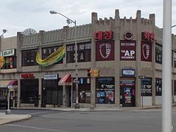
In 1907, the Philadelphia Rapid Transit Company recognized the potential for growth in the township and extended the Market-Frankford elevated train line, or the "El", from just west of the Schuylkill River in Philadelphia to 69th and Market Streets in Upper Darby. The El terminus at 69th Street Station became a busy terminal serving several trolley and light rail lines into the suburbs, as well as numerous city and suburban bus routes. Commuter traffic spurred the development of the 69th St. shopping district in the 1920s by John McClatchy, and made Upper Darby the second-busiest shopping area in the region after Center City Philadelphia. The business district is noted for many fine examples of Art Deco style buildings. A population explosion in the township followed; by the 1960s, Upper Darby was the seventh-most populous municipality in Pennsylvania. [10]

In the early 1970s, students from Highland Park Elementary School began a campaign to have the Pennsylvania Firefly declared the official state insect of Pennsylvania. With advice and support from state legislators, the students began a campaign that included letter writing, the circulation of petitions, and the distribution of bumper stickers. On April 10, 1974, Governor Milton J. Shapp signed their bill making the Pennsylvania Firefly their state's official insect. A couple of years later, Highland Park Elementary School was presented with a bronze plaque in honor of the students' achievement. [11] [12]

21st century

In the wake of the 2020 racial uprising in response to the murder of George Floyd, several protests and actions took place in Upper Darby, including a die-in at 69th and Market Streets. [13]

In 2020 the community voted on a motto for Upper Darby, "The World in One Place," reflecting the multicultural community of the present day.

Upper Darby has seen a rise in LGBTQ activism of late, and Upper Darby Pride, a non-profit organization planned the first Upper Darby Pride Fest for June 2020. It was cancelled due to the pandemic but held a year later by U.D.T.J. on the grounds of Upper Darby High School and accompanied by other Pride events in the township. [14]

In 2023 the Pride celebration in Upper Darby grew into what is now Delaware County Pride. Delaware County Pride hosted its inaugural festival in Downtown Upper Darby June 10, 2023. [15]

Geography

According to the U.S. Census Bureau, the township has a total area of 7.9 square miles (20.4 km2), all land. The township lies on the edge of the Piedmont slightly above the City of Philadelphia (60 to 260 ft or 18 to 79 m above sea level). The area is crossed by several small creeks. The borough of East Lansdowne, Pennsylvania is an enclave completely surrounded by Upper Darby Township; additionally, an exclave of Upper Darby Township is separated from the rest of the township.

Upper Darby neighborhoods include Aronimink, Beverly Hills, Bywood, Drexel Hill, Drexel Park, Fernwood, Highland Park, Llanerch Hills, Kellyville, Kirklyn, Oakview, Primos, Secane, Stonehurst, Terminal Square, and Westbrook Park.

Cobbs Creek runs along the border of Upper Darby and connects with Darby Creek. Cobbs Creek Park and the Philadelphia public golf course abut the Highland Park Neighborhood of Upper Darby along the border of Philadelphia's Overbrook Park neighborhood.

Neighborhoods

Adjacent municipalities and communities

Climate

Upper Darby Township, Cheltenham Township, and West Philadelphia, are areas in the Philadelphia region with significant Korean populations From-upper-darby-koreatown-3.jpg
Upper Darby Township, Cheltenham Township, and West Philadelphia, are areas in the Philadelphia region with significant Korean populations

Upper Darby has a humid subtropical climate (Cfa) and the hardiness zone is 7a bordering 7b. Average monthly temperatures in the vicinity of Garrett Road and Lansdowne Avenue range from 32.9 °F in January to 77.7 °F in July. [16]

Demographics

Historical population
CensusPop.Note
1900 3,821
1910 5,38540.9%
1920 8,95666.3%
1930 47,145426.4%
1940 56,88320.7%
1950 84,95149.3%
1960 93,1589.7%
1970 95,9103.0%
1980 84,054−12.4%
1990 81,777−2.7%
2000 81,8210.1%
2010 82,7951.2%
2020 85,6813.5%
U.S. Decennial Census [17]

Upper Darby is one of Pennsylvania's most diverse communities. [18]

2020 census

Upper Darby Township, Pennsylvania – Racial and ethnic composition
Note: the US Census treats Hispanic/Latino as an ethnic category. This table excludes Latinos from the racial categories and assigns them to a separate category. Hispanics/Latinos may be of any race.
Race / Ethnicity (NH = Non-Hispanic)Pop 2000 [19] Pop 2010 [20] Pop 2020 [21] % 2000% 2010% 2020
White alone (NH)62,52545,34133,96176.42%54.76%39.64%
Black or African American alone (NH)9,12422,34130,29111.15%26.98%35.35%
Native American or Alaska Native alone (NH)751191250.09%0.14%0.15%
Asian alone (NH)7,2279,18210,8788.83%11.09%12.70%
Pacific Islander alone (NH)2029240.02%0.04%0.03%
Other race alone (NH)1031785560.13%0.21%0.65%
Mixed race or Multiracial (NH)1,4041,8503,1081.72%2.23%3.63%
Hispanic or Latino (any race)1,3433,7556,7381.64%4.54%7.86%
Total81,82182,79585,681100.00%100.00%100.00%

In 2019, three out members of the LGBTQ community were elected to the Upper Darby School Board. [22]

As of the census [23] of 2000, there were 85,038 people, 32,551 households, and 20,474 families residing in the township. The population density was 14,658.7 people per square mile. There were 34,322 housing units at an average density of 4,361.6 per square mile (1,684.0/km2). The racial makeup of Upper Darby was 59.1% White; 20.5% African American; 15.3% Asian; 0.1% Native American; <0.1% Pacific Islander; 0.5% from other races and 2.3% from two or more races. Hispanics or Latinos of any race were 2.4% of the population

There were 32,551 households, out of which 31.0% had children under the age of 18 living with them, 45.0% were married couples living together, 13.4% had a female householder with no husband present, and 37.1% were non-families. 31.6% of all households were made up of individuals, and 11.5% had someone living alone who was 65 years of age or older. The average household size was 2.50 and the average family size was 3.23.

25.2% of the population was under the age of 18, 8.4% from 18 to 24, 32.8% from 25 to 44, 19.9% from 45 to 64 and 13.7% who were 65 years of age or older. The median age was 35 years. For every 100 females, there were 91.6 males. For every 100 females age 18 and over, there were 88.2 males. The median income for a household in the township was $41,489, and median income for a family was $52,500. Males had a median income of $38,090 versus $30,416 for females. The per capita income for the township was $20,770. About 7.3% of families and 9.1% of the population were below the poverty line, including 11.1% of those under age 18 and 6.9% of those age 65 or over. [24]

Religion

The Roman Catholic Archdiocese of Philadelphia operates several Catholic churches in Upper Darby:

Soji Zen Center is a Buddhist Temple in the Drexel Hill section of Upper Darby.

Masjid Al-Madinah Islamic Center is a mosque and cultural center located on 69th Street. Masjid Omar and AL-Quran Center are in the Stonehurst and Bywood neighborhoods.

Sree Sree Sanatan Shangho and Sree Narayana Guru Deva Temple are Hindu Temples located in Bywood.

St Demetrios Greek Orthodox Church is located in the Stonehurst neighborhood.

Protestant denominations in Upper Darby include Presbyterian, Baptist, United Methodist, Lutheran, and non-denominational.

Crime

In 1991, five Upper Darby policemen were convicted in federal court and sentenced to prison for violating the civil rights of two residents, a father and son. Each was found guilty on several counts involving assault, false arrest, and prosecution. [25]

On January 30, 2002, Upper Darby police officer Dennis McNamara was shot and killed in the line of duty by Thomas Campbell. McNamara was investigating a suspicious parked vehicle around 9:30 PM when Campbell came up behind him and shot him in the side of the head with a .32 caliber revolver. McNamara had a section of Lansdowne Avenue renamed in his honor; Campbell pled guilty to his murder in 2003 and was sentenced to life in prison plus ten years. He died in Graterford Prison in 2015. [26]

Arts and culture

The Upper Darby Township Building Upper Darby Township Building.jpg
The Upper Darby Township Building

Tower Theater, located in Terminal Square at the intersection of 69th and Ludlow Streets, opened as a movie and vaudeville theater in 1927. After closing briefly, the Tower reopened as a concert venue in 1972, and has hosted acts including the first American tours of David Bowie and Genesis. In addition to musical acts, the Tower has hosted comedians such as Trevor Noah and Jim Norton. In 2018, Rolling Stone listed the Tower as one of the ten best live music venues in the United States. [27]

Upper Darby Summer Stage is one of the nation's oldest youth theater programs. [28]

The annual Music Man Festival is held at Greenhorn Gardens in Arlington Cemetery and features live music, food, beer gardens, and a 5k fundraiser for arts programs.

The Upper Darby International Festival is an annual event held in September on 69th Street. The festival features performances, artwork, and food reflecting the diverse cultural backgrounds of the Upper Darby community. [29]

Opened in 2018, the Upper Darby Art Gallery in the Highland Park neighborhood features local, national and international artists and works, as well as art classes.

Centered in Terminal Square and the West Chester Pike business districts, Upper Darby restaurants feature a diverse range of cuisines including Vietnamese, Thai, Japanese, Liberian, Indian, Italian, Korean, Mexican, and Colombian. The community is also known for its Irish pubs, and the Llanerch Diner was the setting for a pivotal scene in the film Silver Linings Playbook.

The Philadelphia Museum of Art opened the first branch museum in the United States, modeled on the Carnegie Library branch system, on 69th Street. The 69th Street Branch of the PMA operated from 1930 to 1933. [30]

The University of Pennsylvania operated the Flower and Clark Observatory in the Highland Park neighborhood from 1897 to 1956, the site is now known as Observatory Park. [31]

Historic sites

Libraries

Upper Darby Public Library's Municipal Branch, one of three public libraries in the township Upper Darby Public Library DelCo PA.jpg
Upper Darby Public Library's Municipal Branch, one of three public libraries in the township

Upper Darby Township has three public library branches as part of the Delaware County Library System:

Cemeteries

Government and politics

In the 2020 presidential election, Democrat Joe Biden received 71.1% of the vote in Upper Darby with Republican Donald Trump receiving 28.9%. [35] In the 2016 presidential election, Democrat Hillary Clinton received 25,475 votes (66.3%), Republican Donald Trump received 11,967 (31.1%) votes, with independent candidates receiving just over 1,000 votes in Upper Darby. [36]

In the 2016 U.S. Senate race, Democrat Katie McGinty received 23,294 votes over Republican Pat Toomey, who received 13,539 votes in Upper Darby. [36] Upper Darby is in Pennsylvania's 5th Congressional district, currently represented by Democrat Mary Gay Scanlon.

In the Pennsylvania legislature, Upper Darby is represented by Democrat Gina Curry in the 164th District and Democrat Heather Boyd is in the 163rd House District. Upper Darby is in the 26th Pennsylvania Senate District, represented by Democrat Tim Kearney.

In local politics, Democrats hold an 6-5 majority of the town council seats as well as the mayor's office; all nine seats on the school board are held by Democrats.

On January 2, 2024, Democrat Ed Brown was sworn in as Upper Darby's first black mayor. [37]

Education

Public schools

Upper Darby Township's public education is provided by the Upper Darby School District. In all, the 12 public schools plus the Kindergarten Center serve nearly 12,000 students. The district has one high school, Upper Darby High School, two middle schools, Beverly Hills Middle School and Drexel Hill Middle School, and 10 public elementary schools. In addition to Upper Darby, Secane, Clifton Heights, and Millbourne students attend the Upper Darby School District. Established in 1895, Upper Darby High School is one of the largest brick and mortar high schools in Pennsylvania with almost 4,000 students. [38]

Private schools

In addition to the public school district, Upper Darby is home to several parochial and private schools. Monsignor Bonner High School (for boys) and Archbishop Prendergast High School (for girls), both Roman Catholic, are the largest private schools in the Township. Both schools offer grades 9–12 with a combined enrollment close to 5,500 students. In addition to the two high schools, there are nine parochial primary and middle schools located in the Township, with a combined enrollment of 2,867.[ citation needed ]

Catholic K-8 schools include:

Almost all of the private academic schools in the Township are administered by the Archdiocese of Philadelphia except for the Holy Child Academy, which is a Catholic academy run by the Society of the Holy Child Jesus. Former schools included St. Alice School, closed in 2006, [39] and St. Charles Borromeo School, closed in 2007. [39]

Tertiary and adult education

Also available to residents of Upper Darby and surrounding areas is the Upper Darby Adult Evening Program (UDAEP). UDAEP offers professional development and general education classes to township residents. UDAEP is an independent non-profit entity separate from the Upper Darby School District. [40]

Delaware County Community College's Upper Darby Center holds day and evening classes serving 600 students. [41]

Infrastructure

Transportation

Footbridge at 69th Street Transportation Center SEPTA69thStreetTerminalExterior2007.jpg
Footbridge at 69th Street Transportation Center
PA Route 3 eastbound at 69th Street in Upper Darby Township 2022-10-08 14 41 14 View east along Pennsylvania State Route 3 (Market Street) from the pedestrian overpass at 69th Street in Upper Darby Township, Delaware County, Pennsylvania.jpg
PA Route 3 eastbound at 69th Street in Upper Darby Township

SEPTA's 69th Street Transportation Center is located in Terminal Square on 69th Street. It serves as the western terminal stop of the Market–Frankford Line, the eastern terminal stop of the Norristown High Speed Line (formerly Route 100) and SEPTA trolley routes 101 and 102, as well as SEPTA Bus Routes 21 , 30 , 65 , 68 , 103 , 104 , 105 , 106 , 107 , 108 , 109 , 110 , 111 , 112 , 113 , 120 , 123, and 126. The Norristown High Speed Line has stops in Upper Darby at 69th Street and Parkview station. Upper Darby Township is also served by SEPTA Bus Routes 42 and 115. SEPTA Regional Rail's Media/Wawa Line passes through the southern portion of Upper Darby Township, with stations at Secane and Primos. [42]

As of 2022, there were 152.99 miles (246.21 km) of public roads in Upper Darby Township, of which 24.83 miles (39.96 km) were maintained by Pennsylvania Department of Transportation (PennDOT) and 128.16 miles (206.25 km) were maintained by the township. [43]

Pennsylvania Route 3, which links Philadelphia and West Chester passes through the northern portion of Upper Darby Township as Market Street and the West Chester Pike. U.S. Route 1 follows Township Line Road along the northwestern edge of the township. U.S. Route 13 follows Church Lane and Baltimore Avenue through the far southeastern corner of the township.

Emergency services

Upper Darby Township is served by the 133-member Upper Darby Police Department, the Crozer-Keystone North Division Paramedics (based out of Delaware County Memorial Hospital), and the Upper Darby Township Fire Department, a combination paid/volunteer department which consists of a headquarters building and 5 stations:

Notable people

Related Research Articles

<span class="mw-page-title-main">Delaware County, Pennsylvania</span> County in Pennsylvania, United States

Delaware County, colloquially referred to as Delco, is a county in the Commonwealth of Pennsylvania. With a population of 576,830 as of the 2020 census, it is the fifth-most populous county in Pennsylvania and the third-smallest in area. The county was created on September 26, 1789, from part of Chester County and named for the Delaware River.

<span class="mw-page-title-main">Drexel Hill, Pennsylvania</span> Neighborhood in Delaware County, Pennsylvania, United States

Drexel Hill is a neighborhood and census-designated place (CDP) located in Upper Darby Township, Pennsylvania, United States. The population was 29,181 at the 2020 census, an increase over 28,043 in 2010, and accounting for over one-third of Upper Darby Township's population.

<span class="mw-page-title-main">East Lansdowne, Pennsylvania</span> Borough in Pennsylvania, United States

East Lansdowne is a borough in Delaware County, Pennsylvania, United States. The population was 2,668 at the 2010 census.

<span class="mw-page-title-main">Lansdowne, Pennsylvania</span> Borough in Pennsylvania, United States

Lansdowne is a borough in Delaware County, Pennsylvania, United States, located 6 miles (10 km) southwest of Center City Philadelphia. It was named for the Marquess of Lansdowne. As of the 2010 census, the borough had a population of 10,620.

<span class="mw-page-title-main">Millbourne, Pennsylvania</span> A borough located in Delaware County, Pennsylvania, United States

MillbourneBorough is a self-governing municipal borough in Delaware County, Pennsylvania, United States. As of the 2020 census, the population is 1,212. Millbourne borders Philadelphia along Cobbs Creek. The name "Millbourne" comes from the word Mill and "bourne" meaning creek. Millbourne, at over 17,000 people per square mile, is the most densely populated incorporated place in Pennsylvania, and 24th in the entire United States.

<span class="mw-page-title-main">Ridley Township, Pennsylvania</span> Township in Pennsylvania, United States

Ridley Township is a township in Delaware County, Pennsylvania, United States. The population was 30,768 at the 2010 census. Ridley Township contains the (CDPs) of Folsom and Woodlyn, along with the unincorporated communities of Crum Lynne and Holmes and a portion of Secane.

<span class="mw-page-title-main">Darby Township, Pennsylvania</span> First Class Township in Pennsylvania, United States

Darby Township is a township in Delaware County, Pennsylvania, United States. The population was 9,264 as of the 2010 census. It is home to both residential areas and expansive industrial districts. Darby Township is home to a diverse population and its industrial districts are popular among shipping companies for their proximity to Philadelphia International Airport. It also is known for being made up of two non-contiguous geographical areas, requiring one to pass through at least two neighboring municipalities to make it from one end of Darby Township to the other. Darby Township is a distinct municipality from the nearby and similarly named Darby Borough and Upper Darby Township.

<span class="mw-page-title-main">Tinicum Township, Delaware County, Pennsylvania</span> Township in Pennsylvania, United States

Tinicum Township, also known as Tinicum Island or The Island, is a township in Delaware County, Pennsylvania, United States. The population was 4,091 at the 2010 census, down from 4,353 at the 2000 census. Included within the township's boundaries are the communities of Essington and Lester.

<span class="mw-page-title-main">SEPTA Routes 101 and 102</span> Light rail lines in Delaware County, Pennsylvania

SEPTA Routes 101 and 102 are light rail lines operated by the Suburban Transit Division of the Southeastern Pennsylvania Transportation Authority, serving portions of Delaware County. The routes' eastern terminus is 69th Street Transportation Center in Upper Darby Township, Pennsylvania. Route 101 runs to Media, while Route 102 goes to Sharon Hill. Altogether, the two lines operate on approximately 11.9 miles (19.2 km) of route. The lines are one of the few remaining interurban systems in the United States, along with the South Shore Line in Indiana, the River Line in New Jersey, and the Norristown High Speed Line, also in the Philadelphia area.

<span class="mw-page-title-main">69th Street Transportation Center</span> Rapid transit station in Philadelphia

The 69th Street Transportation Center is a SEPTA terminal in the Terminal Square section of Upper Darby Township, Pennsylvania. It serves the Market–Frankford Line, Norristown High Speed Line, and SEPTA Routes 101 and 102 trolleys, and multiple bus routes. It is located at the end of 69th Street, a major retail corridor in Upper Darby Township across Market Street from the Tower Theater. Until 2011, the station was primarily known as 69th Street Terminal.

<span class="mw-page-title-main">Upper Darby School District</span> School district in Pennsylvania

Upper Darby School District (UDSD) is a large public school district of approximately 12,000 students in Upper Darby Township, Delaware County, Pennsylvania. It consists of an 8.3-square-mile (21 km2) area including Upper Darby Township, Clifton Heights borough, and Millbourne borough. According to 2009 local census data, it serves a resident population of 90,000. In 2009, the district residents’ per capita income was $20,699, while the median family income was $51,965. In the Commonwealth, the median family income was $49,501 and the United States median family income was $49,445, in 2010.

Secane is an unincorporated community in Ridley Township and Upper Darby Township, Delaware County, Pennsylvania, United States. At its center is retail shopping and a commuter rail station. Immediately surrounding the center are four large garden apartment complexes surrounded by single-family homes. The neighborhood has a curvilinear/cul-de-sac street pattern typical of post-World War II residential development. It is located in two school districts, Upper Darby and Ridley.

The Baltimore Pike was an auto trail connecting Baltimore, Maryland, with Philadelphia, Pennsylvania.

<span class="mw-page-title-main">Pennsylvania Route 3</span> State highway in Chester, Delaware, and Philadelphia counties in Pennsylvania, US

Pennsylvania Route 3 is a 24.3-mile (39.1 km) state highway located in the southeastern portion of Pennsylvania. The route runs from U.S. Route 322 Business in West Chester east to PA 611 in Philadelphia.

<span class="mw-page-title-main">U.S. Route 1 in Pennsylvania</span> Highway in Pennsylvania

U.S. Route 1 (US 1) is a major north–south U.S. Route, extending from Key West, Florida, in the south to Fort Kent, Maine, at the Canada–United States border in the north. In the U.S. state of Pennsylvania, US 1 runs for 81 miles (130 km) from the Maryland state line near Nottingham northeast to the New Jersey state line at the Delaware River in Morrisville, through the southeastern portion of the state. The route runs southwest to northeast and serves as a major arterial road through the city of Philadelphia and for many of the suburbs in the Delaware Valley metropolitan area. South of Philadelphia, the road mostly follows the alignment of the Baltimore Pike. Within Philadelphia, it mostly follows Roosevelt Boulevard. North of Philadelphia, US 1 parallels the route of the Lincoln Highway. Several portions of US 1 in Pennsylvania are freeways, including from near the Maryland state line to Kennett Square, the bypass of Media, the concurrency with Interstate 76 and the Roosevelt Expressway in Philadelphia, and between Bensalem Township and the New Jersey state line.

<span class="mw-page-title-main">U.S. Route 13 in Pennsylvania</span> Highway in Pennsylvania

U.S. Route 13 (US 13) is a United States Numbered Highway running from Fayetteville, North Carolina, north to Morrisville, Pennsylvania. The route runs for 49.359 miles (79.436 km) through the Delaware Valley in the U.S. state of Pennsylvania. The route enters the state from Delaware in Marcus Hook, Delaware County. It continues northeast through Delaware County, passing through the city of Chester before heading through suburban areas along Chester Pike to Darby. US 13 enters the city of Philadelphia on Baltimore Avenue and runs through West Philadelphia to University City, where it turns north along several city streets before heading east across the Schuylkill River along Girard Avenue. The route turns north and heads to North Philadelphia, where it runs northeast along Hunting Park Avenue. US 13 becomes concurrent with US 1 on Roosevelt Boulevard, continuing into Northeast Philadelphia. US 13 splits southeast on a one-way pair of streets before heading northeast out of the city on Frankford Avenue. The route continues into Bucks County as Bristol Pike, heading northeast to Bristol, where it turns into a divided highway. US 13 becomes a freeway in Tullytown and continues north to its terminus at US 1 in Falls Township, near Morrisville. US 13 roughly parallels Interstate 95 (I-95) through its course in Pennsylvania.

<span class="mw-page-title-main">Scenic Road station</span> Light-rail station in Pennsylvania, US

Scenic Road station is a SEPTA Route 101 trolley stop in Springfield Township, Delaware County, Pennsylvania. It is officially located near Scenic and Rolling Roads.

<span class="mw-page-title-main">Drexel Park station</span>

Drexel Park station is a SEPTA Media-Sharon Hill Trolley Line stop in Drexel Hill, Pennsylvania. It is located on Fairfax Road between Hillcrest and Garrett Roads and serves both Routes 101 and 102. Only local service is provided on both lines.

<span class="mw-page-title-main">Creek Road station</span>

Creek Road station is a SEPTA Route 102 trolley stop in Drexel Hill, Pennsylvania. It is located at the end of Station Road north of Creek Road within Indian Rock Park, a 21.9-acre (89,000 m2) Natural Environmental Park in Drexel Hill, containing picnic tables, playground equipment, basketball courts, and Darby Creek.

<span class="mw-page-title-main">Newtown Square Branch</span> Former railroad in Pennsylvania, United States

The Newtown Square Branch was a branch line of the Pennsylvania Railroad (PRR) that diverged from the West Chester Branch in Yeadon, Pennsylvania, and ended in Newtown Square, Pennsylvania. The rail line is mostly overgrown and few bridges remain, with the bridge over Baltimore Avenue located at the Upper Darby/East Lansdowne border having been removed in 2003. The only known presence of rails is at the junction just west of the SEPTA's Fernwood-Yeadon station. Through Upper Darby Township the former right-of-way follows PECO's high tension power lines from Fernwood to the Upper Darby/Haverford border at Lansdowne Avenue and Township Line Road.

References

  1. "Upper Darby Virtual International Fest 2020". YouTube .
  2. "2016 U.S. Gazetteer Files". United States Census Bureau. Retrieved August 13, 2017.
  3. "Archived copy" (PDF). Archived from the original (PDF) on May 27, 2011. Retrieved June 5, 2009.{{cite web}}: CS1 maint: archived copy as title (link)
  4. Bureau, U.S. Census. "U.S. Census website" . Retrieved February 25, 2017.
  5. 1 2 "New Tour Highlights Underground Railroad Sites in Upper Darby". Hidden City Philadelphia. February 23, 2021. Retrieved May 2, 2021.
  6. "Historically Speaking" (PDF). Udhistory.org. Upper Darby Historical Society. 2007. Archived from the original (PDF) on January 5, 2009. Retrieved February 26, 2017.
  7. "Upper Darby Township - Community". Archived from the original on May 5, 2009. Retrieved May 7, 2009.
  8. Ashmead, Henry Graham (1884). "History of Delaware County, Pennsylvania (1884)". Internet Archive. Philadelphia, L. H. Everts & co. Retrieved February 24, 2014.
  9. A History of Delaware County, Pennsylvania. Ed. John W. Jordan. NY: Lewis Historical Publishing, 1914. quoted in A History of Upper Darby; History.rays-place.com
  10. "Upper Darby Township - Community". Archived from the original on May 5, 2009. Retrieved May 7, 2009.
  11. "Text Only Version". Burger.com. Retrieved February 26, 2017.
  12. "Pennsylvania State Insect | Firefly". Statesymbolsusa.org. April 10, 1974. Retrieved February 26, 2017.
  13. "Protesters take a knee on West Chester Pike in Upper Darby". June 13, 2020.
  14. "'Everybody has a home here': Upper Darby having its first Pride festival".
  15. "'Delaware County holds its first-ever LGBTQ Pride parade". June 3, 2023.
  16. "PRISM Climate Group at Oregon State University". Prism.oregonstate.edu. Retrieved September 3, 2022.
  17. "Census of Population and Housing". Census.gov. Retrieved August 30, 2021.
  18. "2018 Most Diverse ZIP Codes in Pennsylvania". Niche. Retrieved August 16, 2018.
  19. "P004: Hispanic or Latino, and Not Hispanic or Latino by Race – 2000: DEC Summary File 1 – Upper Darby Township, Pennsylvania". United States Census Bureau . Retrieved January 26, 2024.
  20. "P2: Hispanic or Latino, and Not Hispanic or Latino by Race – 2010: DEC Redistricting Data (PL 94-171) – Upper Darby Township, Pennsylvania". United States Census Bureau . Retrieved January 26, 2024.
  21. "P2: Hispanic or Latino, and Not Hispanic or Latino by Race – 2020: DEC Redistricting Data (PL 94-171) – Upper Darby Township, Pennsylvania". United States Census Bureau . Retrieved January 26, 2024.
  22. Smythe, Laura (November 15, 2019). "3 LGBTQ candidates elected to Upper Darby school board". Philadelphia Gay News. Retrieved May 2, 2021.
  23. "U.S. Census website". United States Census Bureau . Retrieved January 31, 2008.
  24. Delaware County Today/Almanac: 81st Edition
  25. "5 U. Darby Officers Convicted Jury: Violated Civil Rights Of 2". Philly.com. The Philadelphia Inquirer. May 29, 1991. Retrieved September 25, 2016.
  26. Sullivan, Vince (July 8, 2015). "Biker who killed Upper Darby officer dies in Graterford Prison". Daily Times. Retrieved March 18, 2022.
  27. "10 Best Live Music Venues in America". Rolling Stone . December 13, 2018.
  28. "Upper Darby Summer Stage – Upper Darby Performing Arts Center". August 11, 2011. Retrieved August 16, 2018.
  29. "Upper Darby International Festival - Philly". Archived from the original on September 22, 2018. Retrieved December 12, 2018.
  30. says, Janes (January 31, 2020). "Have Art, Will Travel: Uncovering the 69th Street Branch of PMA". Hidden City Philadelphia. Retrieved May 2, 2021.
  31. "History of Flower and Cook Observatory". www.physics.upenn.edu. Retrieved May 2, 2021.
  32. "National Register Information System". National Register of Historic Places . National Park Service. July 9, 2010.
  33. "Friends of Sellers Hall". sellershall.org. Retrieved August 16, 2018.
  34. "Imagining a Route to Freedom Aboard the Underground Railroad". Hidden City Philadelphia. February 25, 2021. Retrieved May 2, 2021.
  35. "The Philadelphia suburbs were the key to Joe Biden's Pennsylvania victory. Here are the numbers". November 30, 2020.
  36. 1 2 "2016 Official General Election Results". election.co.delaware.pa.us.
  37. Ed Brown Becomes First Black Mayor Of Upper Darby, PA
  38. "2021 Largest High Schools in Pennsylvania". Niche. Retrieved May 2, 2021.
  39. 1 2 "St. Cyril plans appeal". Delco Times . January 12, 2012. Retrieved May 3, 2020.
  40. "GIS & Information Services". Delaware County, Pennsylvania. Archived from the original on November 28, 2006. Retrieved January 31, 2007.
  41. "Delaware County Community College – Find yourself here. – 1". www.dccc.edu. Retrieved August 16, 2018.
  42. SEPTA Official Transit & Street Map Suburban (PDF) (Map). SEPTA. Retrieved May 2, 2016.
  43. "Upper Darby Township map" (PDF). PennDOT. Retrieved March 12, 2023.
  44. "Indie comedy spotlights lessons learned growing up in Upper Darby".
  45. Gotrich, Lars (December 6, 2018). "Steve Gunn's 'Stonehurst Cowboy' Pays Tribute to His Late Father". NPR .
  46. "The Llanerch to JLaw's House, Silver Linings Playbook Mapped". October 7, 2014. Retrieved August 16, 2018.
  47. "Celebrating the works of Lloyd Alexander". Archived from the original on August 16, 2018. Retrieved August 16, 2018.
  48. "Broadway Baritone Keith Andes, of Wildcat, Dead at 85 – Playbill". Playbill. November 28, 2005.
  49. "Five for Friday: Girls Auto Clinic's Patrice Banks". February 19, 2016. Retrieved August 16, 2018.
  50. "Joe Burke – Songwriters Hall of Fame". www.songhall.org.
  51. "Farewell, Dick Clark". April 18, 2012.
  52. "ROBERT J. CLENDENING". www.legis.state.pa.us. Retrieved November 23, 2018.
  53. "History's People: Legendary musician Jim Croce called Chester County home | Chester County Historical Society". Archived from the original on October 16, 2018. Retrieved December 12, 2018.
  54. Dalzell, Tom (January 13, 2020). "How Quirky was Berkeley: R. Crumb, the underground comix artist, was here". Berkeleyside. Retrieved May 2, 2021.
  55. WRITER, Tirdad Derakhshani, STAFF (September 21, 2016). "'Blair Witch Project' star: From Upper Darby to pot farmer back to Hollywood".{{cite web}}: CS1 maint: multiple names: authors list (link)
  56. "Tina Fey Returns Home, Talks Pizza & Mean Girls". August 18, 2014. Retrieved August 16, 2018.
  57. "D'or Fischer Player Profile, West Virginia, News, Rumors, NCAA Stats, International Stats, Events Stats, Game Logs, Bests, Awards – RealGM". basketball.realgm.com.
  58. "Quakers & Slavery : Thomas Garrett". web.tricolib.brynmawr.edu. Retrieved May 2, 2021.
  59. "For Monica Horan, success is giving back".
  60. "Gallery: Jamie Kennedy's Quirky Ranch House – Philadelphia Magazine". January 10, 2014.
  61. "Football / Royals in College and Pros". www.upperdarbysd.org.
  62. "Senate Floor Leaders since 1950". The Pennsylvania Manual. Vol. 118. Harrisburg, PA: Pennsylvania Department of General Services. 2007. pp. 3–265. Archived from the original on October 1, 2011. Retrieved January 1, 2018.
  63. Center, Legislativate Data Processing. "F Joseph Loeper". The official website for the Pennsylvania General Assembly. Retrieved August 16, 2018.
  64. "Alumni Wall of Fame / David MacAdam".
  65. "Resume". Mike Manley. Retrieved May 2, 2021.
  66. "The Broadcast Pioneers of Philadelphia". www.broadcastpioneers.com.
  67. "Upper Darby soldier lauded for service". Archived from the original on August 16, 2018. Retrieved August 16, 2018.
  68. "The Ripple Effect: The impact of Upper Darby Summer Stage radiates far beyond the walls of the UD Performing Arts Center. – Upper Darby Performing Arts Center". June 29, 2015. Retrieved August 16, 2018.
  69. Rhonda Glenn (July 22, 2012). "Five-Time USGA Champion Dorothy Porter Dies". United States Golf Association. Archived from the original on October 16, 2018. Retrieved December 12, 2018.
  70. Vadala, Nick (October 10, 2018). "Upper Darby's Todd Rundgren nominated for Rock and Roll Hall of Fame's Class of 2019".
  71. "Top 10 Winningest Head Coaches in Sixers History". October 27, 2020.
  72. Jackson, Vincent (August 6, 2003). "Article Archives". Nl.newsbank.com. Retrieved March 18, 2021.
  73. "Portraits of Delaware County: Alvin Sargent – Award Winning Screenwriter" . Retrieved August 16, 2018.
  74. Martin, Douglas (May 7, 2005). "Herb Sargent, TV Writer, Is Dead at 81". The New York Times.
  75. "Coleman Sellers, Powelton Village, and The Gilded Age" (Part I) – PhillyHistory Blog". blog.phillyhistory.org. Retrieved May 2, 2021.
  76. "Sellers Hall Historical Marker" . Retrieved January 25, 2024.
  77. "Alumni Wall of Fame / Marty Stern".
  78. "Seoul Idol". Archived from the original on March 22, 2019. Retrieved March 22, 2019.
  79. "From FBI reject to private warlord: the rise of George Wackenhut". January 10, 2017. Retrieved August 16, 2018.
  80. "La Salle College Basketball Handbook 1972-1973". Archived from the original on March 13, 2015. Retrieved January 25, 2024.
  81. "Alumni Wall of Fame / William Wharton".
Preceded by Bordering communities
of Philadelphia

With: Millbourne
Succeeded by