Clinton County is a county located in the U.S. state of Pennsylvania. As of the 2020 census, the population was 37,450. Its county seat is Lock Haven. The county was created on June 21, 1839, from parts of Centre and Lycoming Counties. Its name is in honor of the seventh Governor of New York, DeWitt Clinton. Some alternate sources suggest the namesake is Henry Clinton. Clinton County comprises the Lock Haven, PA Micropolitan Statistical Area, which is also included in the Williamsport-Lock Haven, PA Combined Statistical Area.

Union County is a county located in the U.S. state of Pennsylvania. As of the 2010 census, the population was 44,947. Its county seat is Lewisburg. The county was created on March 22, 1813, from part of Northumberland County. Its name is an allusion to the federal Union. Mifflinburg was established by legislation as the first county seat until it was moved to New Berlin in 1815. Lewisburg became county seat in 1855 and has remained so since. Union County comprises the Lewisburg, PA Micropolitan Statistical Area, which is also included in the Bloomsburg-Berwick-Sunbury, PA Combined Statistical Area.

Northumberland County is a county located in the U.S. state of Pennsylvania. As of the 2020 census, the population was 91,647. Its county seat is Sunbury.

Lycoming County is a county in the U.S. Commonwealth of Pennsylvania. As of the 2010 census, the population was 116,111. Its county seat is Williamsport.

Columbia County is a county located in Northeast Pennsylvania. As of the 2020 census, the population was 64,727. Its county seat is Bloomsburg. The county was created on March 22, 1813, from part of Northumberland County. It was named Columbia, alluding to the United States and Christopher Columbus.

South Renovo is a borough in Clinton County, Pennsylvania, United States, located on the West Branch Susquehanna River, directly across from Renovo. The population was 439 at the 2010 census, down from 557 in 2000.

Loyalsock Township is a township in Lycoming County, Pennsylvania, United States. The population was 11,561 at the 2020 census. It is part of the Williamsport Metropolitan Statistical Area. It is the second largest municipality in Lycoming County, in terms of population, behind the county seat, Williamsport.

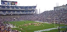
South Williamsport is a borough in Lycoming County, Pennsylvania, United States. It is famous for hosting the Little League World Series. The population was 6,259 at the 2020 census. It is part of the Williamsport, Pennsylvania Metropolitan Statistical Area.

Washington Township is a township in Lycoming County, Pennsylvania, United States. The population was 1,769 at the 2020 census. It is part of the Williamsport Metropolitan Statistical Area.

Williamsport is a city in, and the county seat of, Lycoming County, Pennsylvania. It recorded a population of 27,754 at the 2020 Census. It is the principal city of the Williamsport Metropolitan Statistical Area, which has a population of about 114,000. Williamsport is the larger principal city of the Williamsport-Lock Haven, PA Combined Statistical Area, which includes Lycoming and Clinton Counties.

The Susquehanna Valley is a region of low-lying land that borders the Susquehanna River in the U.S. states of New York, Pennsylvania, and Maryland. The valley consists of areas that lie along the main branch of the river, which flows from Upstate New York through Pennsylvania and Maryland into the Chesapeake Bay, as well as areas that lie along the shorter West Branch in Pennsylvania.

Lycoming Creek is a 37.5-mile-long (60.4 km) tributary of the West Branch Susquehanna River located in Tioga and Lycoming counties in Pennsylvania in the United States.

The Lycoming Valley Railroad is a short line that operates 38 miles (61 km) of track in Lycoming and Clinton counties in Pennsylvania in the United States. It is part of the North Shore Railroad System.

Susquehanna State Park is a Pennsylvania state park on 20 acres (8.1 ha) in Williamsport in Lycoming County, Pennsylvania in the United States. The park is on the West Branch Susquehanna River in the western part of Williamsport, and is operated by the Williamsport / Lycoming Chamber of Commerce in cooperation with the Bureau of State Parks of the Pennsylvania Department of Conservation and Natural Resources. Susquehanna State Park offers cruises on a paddlewheeler, boating, fishing, and picnicking.

Ravensburg State Park is a Pennsylvania state park in Crawford Township in Clinton County, Pennsylvania in the United States. It is in a gorge carved by Rauchtown Run through the side of Nippenose Mountain. Ravensburg State Park is 78 acres (32 ha) of wooded land that is almost entirely surrounded by Tiadaghton State Forest. This state park is on Pennsylvania Route 880, 8 miles (13 km) north of Carroll and 8 miles (13 km) south-east of Jersey Shore. The nearest city is Williamsport.

McCalls Dam State Park is a Pennsylvania state park on 8 acres (3.2 ha) in Miles Township, Centre County, Pennsylvania in the United States. The park is in the easternmost tip of Centre County, south of Clinton County and north of Union County. McCalls Dam State Park is in a remote location on a gravel road between R. B. Winter State Park on Pennsylvania Route 192 and Eastville on Pennsylvania Route 880. The park can only be accessed in the winter months by snowmobiling or cross-country skiing.

This article details a history of Lycoming County, Pennsylvania.

Plunketts Creek is an approximately 6.2-mile-long (10 km) tributary of Loyalsock Creek in Lycoming and Sullivan counties in the U.S. state of Pennsylvania. Two unincorporated villages and a hamlet are on the creek, and its watershed drains 23.6 square miles (61 km2) in parts of five townships. The creek is a part of the Chesapeake Bay drainage basin via Loyalsock Creek and the West Branch Susquehanna and Susquehanna Rivers.

The Pennsylvania Wilds, or the Pennsylvania Wilds Conservation Landscape, is a predominantly rural and forested region in northern central Pennsylvania, mostly within the Allegheny Plateau. It covers about a quarter of the state's territory, but is home to only 4% of its population. It is one of 11 Pennsylvania's tourist regions designated by the state.