The Lenape, also called the Lenni Lenape and Delaware people, are an Indigenous people of the Northeastern Woodlands, who live in the United States and Canada.

The Susquehanna River is a major river located in the Mid-Atlantic region of the United States, crossing three lower Northeast states. At 444 miles (715 km) long, it is the longest river on the East Coast of the United States. By watershed area, it is the 16th-largest river in the United States, and also the longest river in the early 21st-century continental United States without commercial boat traffic.
Lenapehoking is widely translated as 'homelands of the Lenape', which in the 16th and 17th centuries, ranged along the Eastern seaboard from western Connecticut to Delaware, and encompassed the territory adjacent to the Delaware and lower Hudson river valleys, and the territory between them.

The Allegheny Mountain Range — also spelled Alleghany or Allegany, less formally the Alleghenies — is part of the vast Appalachian Mountain Range of the Eastern United States and Canada. Historically it represented a significant barrier to westward land travel and development. The Alleghenies have a northeast–southwest orientation, running for about 300 miles (480 km) from north-central Pennsylvania southward, through western Maryland and eastern West Virginia.

The Cumberland Plateau is the southern part of the Appalachian Plateau in the Appalachian Mountains of the United States. It includes much of eastern Kentucky and Tennessee, and portions of northern Alabama and northwest Georgia. The terms "Allegheny Plateau" and the "Cumberland Plateau" both refer to the dissected plateau lands lying west of the main Appalachian Mountains. The terms stem from historical usage rather than geological difference, so there is no strict dividing line between the two. Two major rivers share the names of the plateaus, with the Allegheny River rising in the Allegheny Plateau and the Cumberland River rising in the Cumberland Plateau in Harlan County, Kentucky.

The Allegheny Plateau is a large dissected plateau area of the Appalachian Mountains in western and central New York, northern and western Pennsylvania, northern and western West Virginia, and eastern Ohio. It is divided into the unglaciated Allegheny Plateau and the glaciated Allegheny Plateau.

The Kittanning Path was a major east-west Native American trail that crossed the Allegheny Mountains barrier ridge connecting the Susquehanna River valleys in the center of Pennsylvania to the highlands of the Appalachian Plateau and thence to the western lands beyond drained by the Ohio River. Kittanning Village was the first major Delaware (Lenape) Indian settlement along the descent from the Allegheny Plateau.

The West Branch Susquehanna River is one of the two principal branches, along with the North Branch, of the Susquehanna River in the Northeastern United States. The North Branch, which rises in upstate New York, is generally regarded as the extension of the main branch, with the shorter West Branch being its principal tributary.

A dissected plateau is a plateau area that has been severely eroded such that the relief is sharp. Such an area may be referred to as mountainous, but dissected plateaus are distinguishable from orogenic mountain belts by the lack of folding, metamorphism, extensive faulting, or magmatic activity that accompanies orogeny.

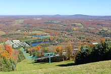
The Wyoming Valley is a historic industrialized region of Northeastern Pennsylvania. The region is historically notable for its influence in helping fuel the American Industrial Revolution with its many anthracite coal mines. As a metropolitan area, it is known as the Scranton–Wilkes-Barre metropolitan area, after its principal cities, Scranton and Wilkes-Barre. With a population of 567,559 as of the 2020 United States census, it is the fifth-largest metropolitan area in Pennsylvania, after the Delaware Valley, Greater Pittsburgh, the Lehigh Valley, and the Harrisburg–Carlisle metropolitan statistical areas.

Tunkhannock Creek is a 42.3-mile-long (68.1 km) tributary of the Susquehanna River in Northeastern Pennsylvania.
Regions of Pennsylvania in the United States include:

The West Branch Susquehanna Valley of central Pennsylvania, United States, in the Ridge-and-valley Appalachians, is the low-lying area draining into the West Branch Susquehanna River southeast of the Allegheny Front, northeast of the Bald Eagle Valley, southwest of the Wyoming Valley and north of the water gap formed between Shamokin Mountain and Montour Ridge.

The Geology of Pennsylvania consists of six distinct physiographic provinces, three of which are subdivided into different sections. Each province has its own economic advantages and geologic hazards and plays an important role in shaping everyday life in the state. From the southeast corner to the northwest corner of the state, they include: the Atlantic Plain Province, the Piedmont Province, the New England Province, the Ridge and Valley Province, the Appalachain Province, and the Central Lowlands Province.

The Blue Mountains ecoregion is a Level III ecoregion designated by the United States Environmental Protection Agency (EPA) in the Pacific Northwest, mainly in the state of Oregon, with small areas over the state border in Idaho and southeastern Washington. It is also contiguous with the World Wildlife Fund's Blue Mountain forests ecoregion.

Teedyuscung was known as "King of the Delawares". He worked to establish a permanent Lenape (Delaware) home in eastern Pennsylvania in the Lehigh, Susquehanna, and Delaware River valleys. Teedyuscung participated in the Treaty of Easton, which resulted in the surrender of Lenape claims to all lands in Pennsylvania. Following the treaty, the Lenape were forced to live under the control of the Iroquois in the Wyoming Valley near modern-day Wilkes-Barre. Teedyuscung was murdered by arsonists in the night of April 19, 1763. This marked the beginning of the end of the Lenape presence in Pennsylvania. Teedyuscung's son Chief Bull conducted a raid on the Wyoming Valley that was part of a greater Indian uprising. As a result, the Lenape were forced to move west of the Appalachian Mountains by the Royal Proclamation of 1763.

The Minisink or Minisink Valley is a loosely defined geographic region of the Upper Delaware River valley in northwestern New Jersey, northeastern Pennsylvania and New York.
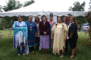
The Munsee are a subtribe and one of the three divisions of the Lenape. Historically, they lived along the upper portion of the Delaware River, the Minisink, and the adjacent country in New York, New Jersey, and Pennsylvania. They were prominent in the early history of New York and New Jersey, being among the first Indigenous peoples of that region to encounter European colonizers.

The Penn's Creek massacre was an October 16, 1755, raid by Lenape (Delaware) Native Americans on a settlement along Penn's Creek, a tributary of the Susquehanna River in central Pennsylvania. It was the first of a series of deadly raids on Pennsylvania settlements by Native Americans allied with the French in the French and Indian War.

The gaps of the Allegheny, meaning gaps in the Allegheny Ridge in west-central Pennsylvania, is a series of escarpment eroding water gaps along the saddle between two higher barrier ridge-lines in the eastern face atop the Allegheny Ridge or Allegheny Front escarpment. The front extends south through Western Maryland and forms much of the border between Virginia and West Virginia, in part explaining the difference in cultures between those two post-Civil War states. While not totally impenetrable to daring and energetic travelers on foot, passing the front outside of the water gaps with even sure footed mules was nearly impossible without navigating terrain where climbing was necessary on slopes even burros would find extremely difficult.