Herrick Township, Susquehanna County, Pennsylvania | |
---|---|
![]() | |
Map of Susquehanna County, Pennsylvania highlighting Herrick Township | |
![]() | |
Country | United States |
State | Pennsylvania |
County | Susquehanna |
Settled | 1789 |
Incorporated | 1825 |
Area | |
• Total | 24.86 sq mi (64.40 km2) |
• Land | 24.65 sq mi (63.84 km2) |
• Water | 0.21 sq mi (0.56 km2) |
Population | |
• Total | 711 ![]() |
714 | |
• Density | 27.91/sq mi (10.78/km2) |
Time zone | UTC-5 (Eastern (EST)) |
• Summer (DST) | UTC-4 (EDT) |
Area code | 570 |
FIPS code | 42-115-34096 |
Herrick Township is a township in Susquehanna County, Pennsylvania. The population was 711 at the 2020 census. [2]
Herrick Township was formed from parts of Gibson and Clifford Townships on April 20, 1825. [3]
The following villages are located in Herrick Township:
According to the U.S. Census Bureau, the township has a total area of 24.85 square miles (64.4 km2), of which 24.65 square miles (63.8 km2) is land and 0.2 square miles (0.52 km2) (1.24%) is water.
Census | Pop. | Note | %± |
---|---|---|---|
2010 | 713 | — | |
2020 | 711 | −0.3% | |
2021 (est.) | 714 | [2] | 0.4% |
U.S. Decennial Census [9] |
At the 2010 census there were 713 people, 308 households, and 217 families living in the township. The population density was 28.9 people per square mile (11.2 people/km2). There were 749 housing units at an average density of 30.4 per square mile (11.7/km2). The racial makeup of the township was 97.3% White, 0.6% African American, 0.3% Native American, 0.3% Asian, 0.7% from some other race, and 0.8% from two or more races. Hispanic or Latino of any race were 1.4%. [10]
Of the 308 households 25% had children under the age of 18 living with them, 58.4% were married couples living together, 5.8% had a female householder with no husband present, and 29.5% were non-families. 25% of households were one person and 8.7% were one person aged 65 or older. The average household size was 2.31 and the average family size was 2.71.
The age distribution was 18% under the age of 18, 61.7% from 18 to 64, and 20.3% 65 or older. The median age was 49 years. The median household income was $58,125 and the median family income was $60,069. Males had a median income of $53,500 versus $37,250 for females. The per capita income for the township was $32,337. About 3% of families and 4.5% of the population were below the poverty line, including 21.1% of those under age 18 and none of those age 65 or over.
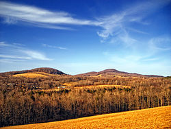
Forest City Regional School District is a Preschool-12th grade public school district serving residents of Herrick Township.
Pike Township is a township in Bradford County, Pennsylvania, United States. It is part of Northeastern Pennsylvania. The population was 671 at the 2010 census.
Standing Stone Township is a township in Bradford County, Pennsylvania, United States. The population was 642 at the 2010 census.
Stevens Township is a township in Bradford County, Pennsylvania, United States. The population was 437 at the 2010 census.
Wyalusing Township is a township in Bradford County, Pennsylvania. It is part of Northeastern Pennsylvania. The population was 1,242 at the 2010 census.
Wysox Township is a township in Bradford County, Pennsylvania. It is part of Northeastern Pennsylvania. The population was 1,721 at the 2010 census.
Franklin Township is a township in Columbia County, Pennsylvania. It is part of Northeastern Pennsylvania. The population was 552 at the 2020 census.
Beale Township is a township in Juniata County, Pennsylvania, United States. The population was 769 at the 2020 census, a decline from the figure of 830 tabulated in 2010.
Susquehanna Township is a township in Lycoming County, Pennsylvania, United States. The population was 972 at the 2020 census. It is part of the Williamsport Metropolitan Statistical Area.
Ulysses Township is a township in Potter County, Pennsylvania, United States. As of the 2020 census, the township population was 647. There are two Pennsylvania state parks in Ulysses Township. Denton Hill State Park is a ski resort along U.S. Route 6. Lyman Run State Park is in the southern part of the township and is partially in neighboring West Branch Township. Its population includes extreme white supremacy groups, and has done so for about 100 years.
Blythe Township is a township in Schuylkill County, Pennsylvania. Formed in 1846 from part of Schuylkill Township, it is named for State Legislator Calvin Blythe.
Washington Township is a township in Snyder County, Pennsylvania, United States. The population was 1,759 at the 2020 census.
Elk Lick Township is a township in Somerset County, Pennsylvania, United States. The population was 2,264 at the 2020 census. Mount Davis, the highest point in Pennsylvania, is located within the township.
Ararat Township is a township in Susquehanna County, Pennsylvania, United States. The population was 526 at the 2020 census.
Dimock Township is a township in Susquehanna County, Pennsylvania, United States. The population was 1,232 at the 2020 census. It is the home of former U.S. Congressman Chris Carney, a Democrat who represented Pennsylvania's 10th congressional district from 2007 to 2011. The school building for the Elk Lake School District is located near the village of Elk Lake in Dimock township.
Gibson Township is a township in Susquehanna County, Pennsylvania, United States. The population was 1,011 at the 2020 census.
Union Dale is a borough in Susquehanna County, Pennsylvania, United States. The borough was incorporated in 1885. Union Dale's population was 267 at the 2010 census.
Covington Township is a township in Tioga County, Pennsylvania, United States. The population was 1,031 at the 2020 census.
Loyalhanna Township is a township in Westmoreland County, Pennsylvania, United States. As of the 2020 census, the township's total population was 2,093.
Salem Township is a township in Westmoreland County, Pennsylvania, United States. The population was 6,083 at the 2020 census.
Peach Bottom Township is a township in York County, Pennsylvania, 60 miles (97 km) south of Harrisburg. The population was 4,961 at the 2020 census.